
The Storm Prediction Center has moved the Slight (2 out of 5) risk further east for most of Mississippi as well as the eastern portions of Louisiana and Arkansas. Looking at a few of the severe parameters and the Skew-T’s, it looks like most of the tornadic threat will be closer to central and north Mississippi. However, with the developing squall line into the evening, southwestern Mississippi could also see a few tornadoes possible.
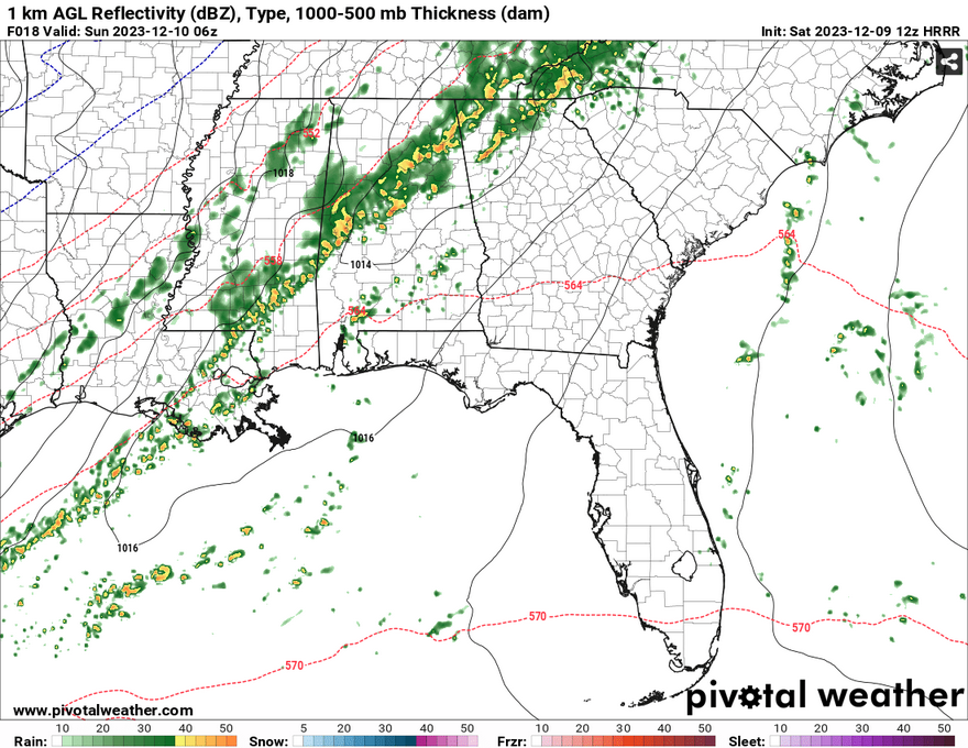
For our neck of the woods, the main concern will be wind. The Skew-T’s show an in-line column of wind which is conducive to straightline winds. Winds 40+ mph will be possible as the line moves in. Rainfall amounts around 0.5″ to 2″ are possible overnight. A few tornadoes could be possible with these storms, so please keep an eye on your phone before going to bed or leaving work.
The cold front will be directly behind this storm, so expect temperatures to be a lot cooler compared to Saturday. Winds will be quite gusty from the north and the clouds will clear out by the morning. Temperatures will reach the low 50s during the day and will likely hit the freezing point overnight into Monday. Wear a windbreaker tomorrow as it’ll be pretty chilly!
[wpcode id=”41179″]
Regional Day-to-Day Forecast
Today – A 40 percent chance of showers and thunderstorms in the afternoon. Mostly cloudy, with a high near 77. South southwest wind around 10 mph, with gusts as high as 20 mph.
Tonight – Showers and thunderstorms overnight. Low around 47. South wind 5 to 15 mph becoming north northwest after midnight. Winds could gust as high as 25 mph. Chance of precipitation is 80%. New rainfall amounts between a half and three quarters of an inch possible.
SundayA chance of showers and thunderstorms in the morning. Cloudy through mid morning, then gradual clearing, with a high near 52. North northwest wind 10 to 15 mph, with gusts as high as 25 mph. Chance of precipitation is 40%.
Sunday Night – Widespread frost, mainly after midnight. Otherwise, clear, with a low around 31. North northwest wind 5 to 10 mph, with gusts as high as 20 mph.
Monday – Sunny, with a high near 56. North wind around 5 mph becoming east northeast in the afternoon.
Monday Night – Partly cloudy, with a low around 32. East northeast wind around 5 mph.
Tuesday – Mostly sunny, with a high near 59. East wind around 5 mph.
Tuesday Night – Partly cloudy, with a low around 35. East northeast wind around 5 mph.
Wednesday – Partly sunny, with a high near 60. Northeast wind 5 to 10 mph.
Wednesday Night – Mostly cloudy, with a low around 41.
Thursday – Mostly sunny, with a high near 61.
Thursday Night – Mostly cloudy, with a low around 41.
Friday – A 20 percent chance of showers. Mostly sunny, with a high near 63.
[wpcode id=”41149″]


