Just a quick look at the forecast today, as I’m pulling another double-duty shift at work.
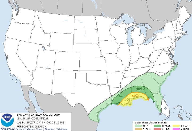
The SPC has introduced a Marginal and Slight Risk for severe weather on Friday close to the coast. Then next week we will get into another shot for some rain – with no real threat for severe weather.
REGIONAL DAY-TO-DAY FORECAST
Today
Sunny. Highs in the mid 60s. Northeast winds 5 to 10 mph.
Tonight
Mostly clear. Lows in the lower 40s. Southeast winds around 5 mph.
Thursday
Sunny. Highs in the mid 70s. Southeast winds 5 to 10 mph, becoming south 10 to 15 mph in the afternoon.
Thursday Night
Mostly cloudy with a few storms possible. Lows in the lower 60s. South winds 10 to 15 mph with gusts up to 25 mph. Chance of rain 40 percent.
Friday
Cloudy with storms possible. Temperatures will be a bit upside down with highs in the lower 70s in the morning and temps falling into the lower 60s in the afternoon. South winds around 15 mph, becoming west in the afternoon. Chance of rain near 100 percent.
Friday Night
Mostly cloudy. Much cooler with lows in the upper 30s.
Saturday
Mostly sunny. Cooler with highs in the upper 50s.
Saturday Night
Partly cloudy in the evening, then becoming mostly cloudy. Lows around 40.
Sunday
Partly sunny. Highs in the mid 50s.
Sunday Night
Partly cloudy. Lows in the upper 30s.
Monday
Partly sunny. Highs around 60.
Monday Night
Mostly cloudy with a 40 percent chance of showers. Lows in the mid 40s.
Tuesday
Mostly cloudy with showers possible. Highs in the lower 60s. Chance of rain 30 percent.


