Hot temperatures possible through the next few days with a chance for storms nearly every day. So far, it looks like Friday offers the best bet for rain.
Today, a few storms may fire along a lingering boundary that is stretched across the region. The threat for rain today is around 20- to 30-percent. Tomorrow is a different story.
Taking a look at the NAM computer weather model, it shows a small cluster of storms passing through the region as we move through Friday afternoon.
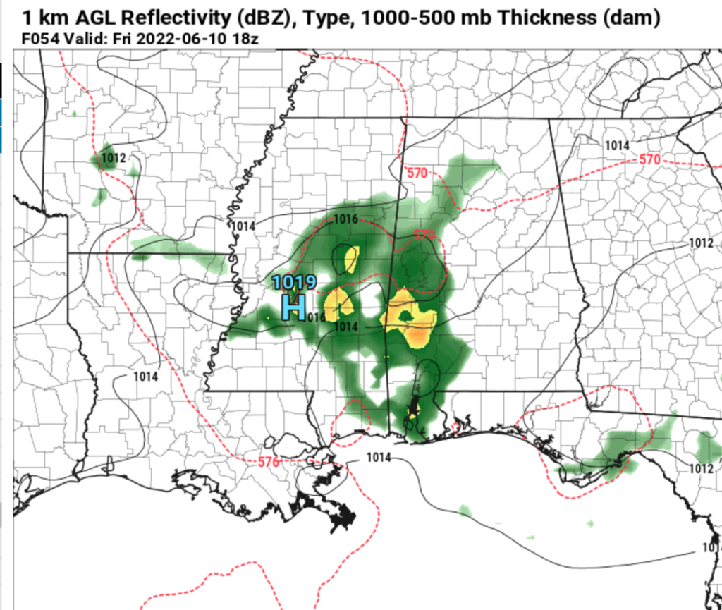
The Storm Prediction Center has highlighted the area with the potential for severe weather as the storms pass through.

Teh SPC is mostly concerned about wind, but there is also the potential for some hail, too. The tornado threat is on the very low end of the scale. Wind and hail are the main concern because the atmosphere can build those given the parameters that will be in place. But the tornado threat is nearly zero for the southern MS/AL/LA region because we will lack a lot of the needed ingredients.

For example, the forecast Skew-T above shows that the greatest forcing isn’t at the surface, but up around 850mb to 700mb. That is above the cloud deck that is, itself, too high for tornadoes. And the shear is all unidirectional shear (speed shear is the meteorological term) and it will be moving in the same direction as the storms will be moving, too.
What you will see is some pretty ominous-looking clouds on Friday.
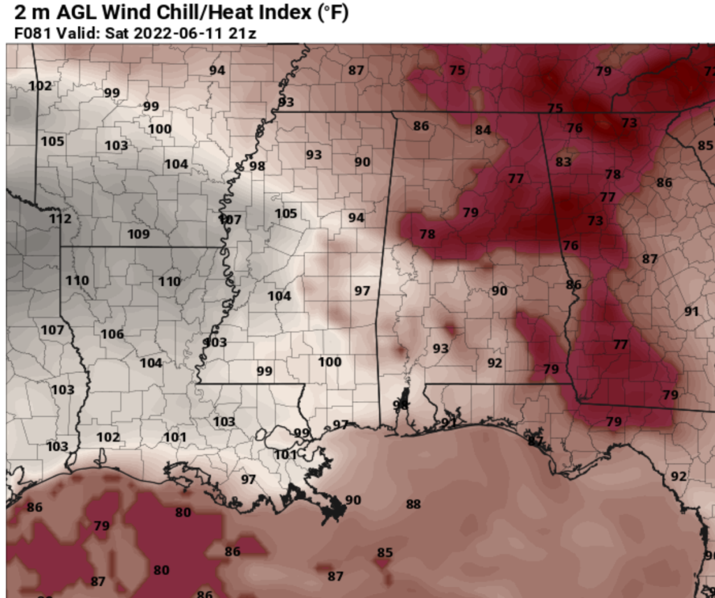
After this cluster of storms, it looks like more summertime variety storms will be possible as we move through the weekend with plenty of heat. Model estimates show Heat Index values around 100F to 110F as we move through the weekend and into next week.
With only a few storms here and there as we move through next week, it will definitely be a time where you’ll need plenty of breaks if you work outside. By Wednesday and Thursday, there looks to be a slightly better chance for storms as a little cluster may swing around the eastern edge and move from east to west across the area.
Day to Day Forecast
Thursday
Passing clouds with a 30-percent chance for an afternoon storm. Highs in the mid 90s. Heat Index values around 100.
Tonight
Partly cloudy. Lows in the lower 70s.
Friday
Mostly sunny with a 70-percent chance for storms. Some storms may be strong to severe. Highs in the lower 90s.
Friday Night
Mostly cloudy. Lows in the lower 70s.
Saturday
Partly sunny with a 30-percent chance for storms. Highs in the lower 90s.
Saturday Night
Mostly cloudy. Lows in the lower 70s.
Sunday
Mostly sunny. Highs in the mid 90s. Heat index values up to 105.
Sunday Night
Partly cloudy. Lows in the mid 70s.
Monday
Sunny. Highs in the mid 90s. Heat index values up to 105.
Monday Night
Mostly clear. Lows in the mid 70s.
Tuesday
Sunny. Highs in the mid 90s. Heat index values up to 105.
Tuesday Night
Mostly clear. Lows in the mid 70s.
Wednesday
A few clouds with a 20-percent chance for storms. Highs in the mid 90s. Heat index values up to 105.


