It still looks like there is a chance for showers and storms on Wednesday evening and into the overnight hours. The good news is that it also looks like the storms themselves are going to out-run the cold front. That should reduce the potency of the storms a bit and may even limit some of the storms from becoming surface-based (this lowers the tornado threat).
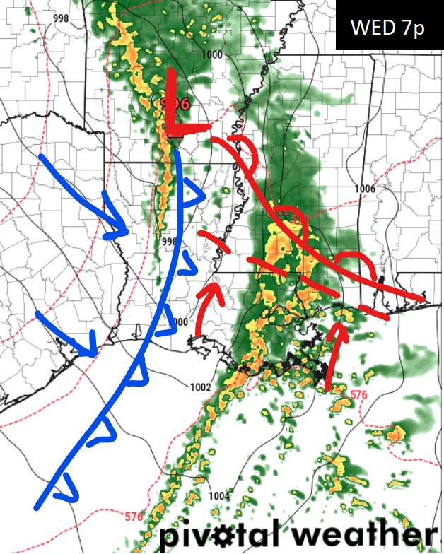
There also looks to be a secondary warm front that will hug the coast. Anything north of that secondary warm front will likely struggle to produce any tornadoes. Anything south of that warm front will have a better chance of having the low-level moisture needed to promote the development of tornadoes.
More evidence for that is in the Updraft Helicity streaks. Recall this is where we ask the computer to find where the strongest storms may be by looking at the areas with the most spin.
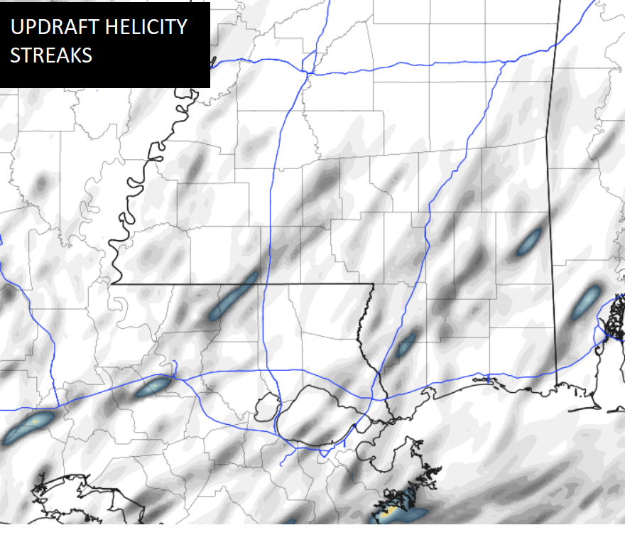
Most of those areas are south of that secondary warm front and closer to the coast.
All of that said, it looks like the threat for tornadoes isn’t terribly high to begin with in this particular setup. There aren’t many brighter colors on the UH Streaks map above and the upper-level parameters aren’t as supportive for tornado development.
The threat isn’t zero. But it also isn’t very high. And thte threat for large, violent, devastating tornadoes is very, very, very low.
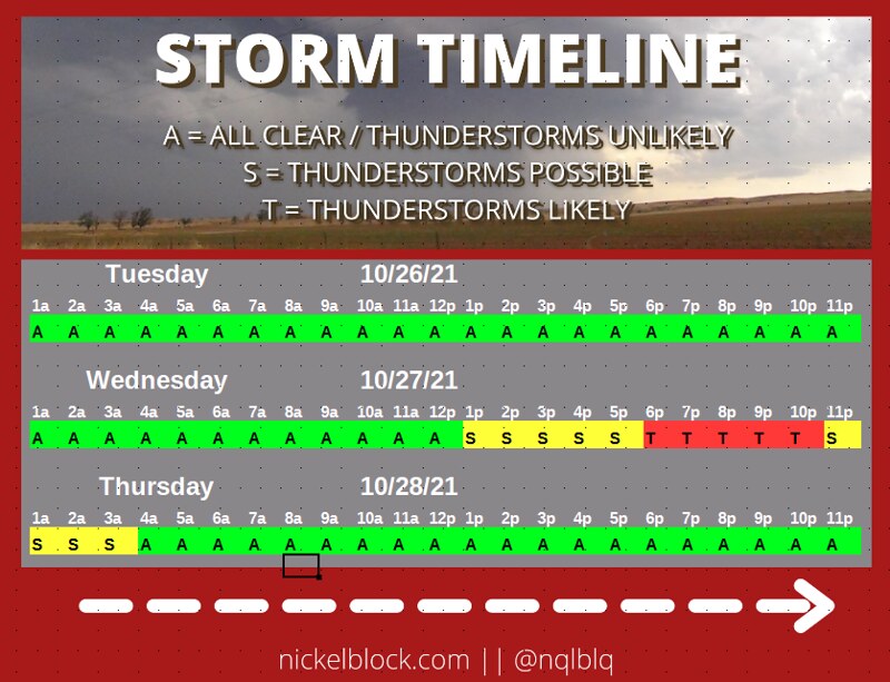
The timeline for the highest risk for the strongest storms is between 6p and 9p.
The front will actually move through overnight with a few more storms along the front, but these storms would likely be non-severe. That said, the wind may wake you up with gusts as high as 30mph possible overnight.
Once the front clears, the weather looks much nicer during the rest of the week and into and through the weekend. It may be a bit breezy on Thursday, but the wind should ease back on Friday.
Storm Timeline
Today
Sunny in the morning then becoming partly cloudy. Highs in the upper 70s.
Tonight
Partly cloudy. Lows in the mid 50s.
Wednesday
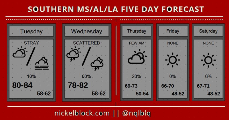
Showers and thunderstorms likely in the afternoon. Mostly sunny in the morning then becoming partly cloudy. Highs in the upper 70s. The chance of rain 40 percent.
Wednesday Night
Storms passing through. Temperatures dropping from around 75 to around 60. Lows in the upper 50s. The chance of rain 80 percent.
Thursday
Lingering AM showers possible. Mostly sunny. Highs in the upper 60s. West winds 10 to 15 mph. Gusts up to 25 mph in the afternoon.
Thursday Night
Partly cloudy. Lows in the lower 50s.
Friday
Partly cloudy. Highs in the upper 60s.
Friday Night
Partly cloudy. Lows in the lower 50s.
Saturday
Sunny. Highs in the upper 60s.
Saturday Night
Clear. Lows around 50.
Sunday
Sunny. Highs in the lower 70s
Sunday Night
Mostly clear. Lows around 50.
Monday
Sunny. Highs in the mid 70s.
Graphical Forecast