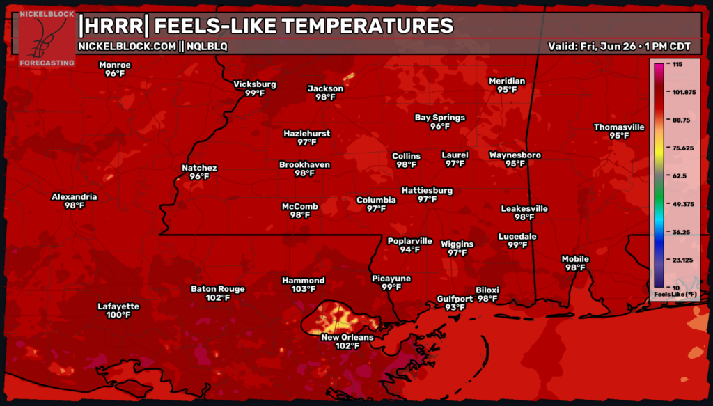
The big news for today will be the summer heat for our local MS/AL/LA area. With a so-called “heat dome” moving in across the Eastern US, storm chances will be low, but the heat will be high this Friday afternoon.

Today
For our Friday afternoon/evening outlook, expect warm temperatures with a low chance for rain. Enjoy the more comfortable temperatures tonight with lows in the high 60s to low 70s, before next week, when lows will be in the upper 70s and nights will feel noticeably muggier.

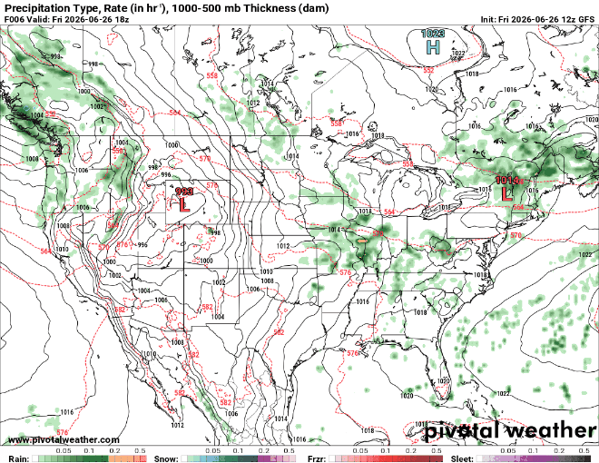
The above image, courtesy of NOAA, shows our 12-hr short-range radar including pressure patterns, fronts, and precipitation type. A small area of potential showers over Eastern Alabama is about all we have to worry about in terms of precipitation for the next 12 hours.
Tomorrow
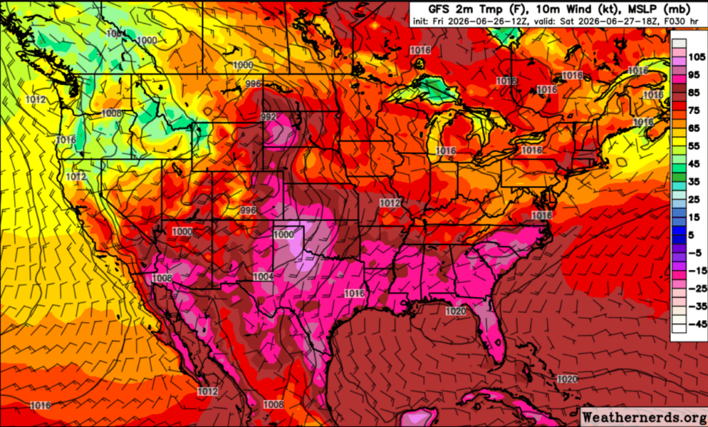
Starting off our weekend, expect relatively clear skies and high temperatures. The graphic below shows 2m temperature, 10m wind, and Mean Sea Level Pressure at 1 pm CT tomorrow. Notice the areas in pink where temperatures will exceed 90 degrees at 6.5 feet above the ground, and take precautions in those areas. We measure at 2m (6.5 ft) above the ground because it represents the conditions that humans naturally experience at head-level, while avoiding radiant heat or cooling from the earth’s surface.
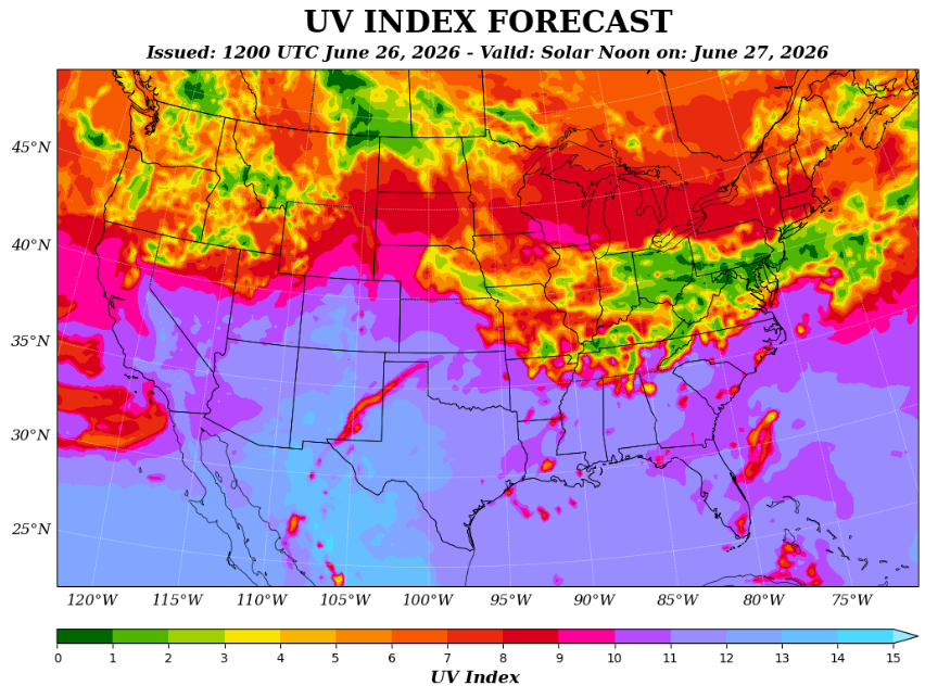
Talking about high temperatures, lets take a look at the UV index for tomorrow:
The UV graph below shows the anticipated strength of the Ultraviolet (UV) radiation from the Sun at solar noon on Saturday. The index is influenced by factors like the Sun’s elevation angle, atmospheric ozone concentration, cloud cover, altitude, and surface reflectivity. Higher UV Index values indicate a greater potential for harmful exposure and a shorter time required for skin damage to occur. With this being said, it is recommended to use sun protection if you will be outside for long periods during the summer, and on a UV 11 day like tomorrow.

Sunday
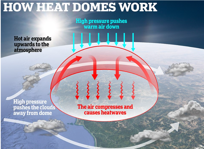
A strong, upper-level ridge of high pressure, sometimes called a heat dome, is moving in across the Eastern United States late this weekend. This system traps warm, sinking air and suppresses afternoon thunderstorm development, shooting our temperatures up above average for this time of year.
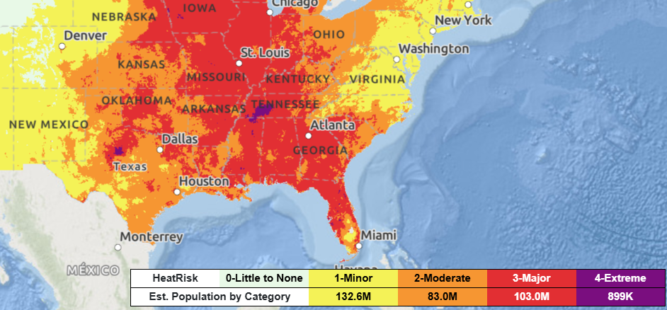
Heat is the deadliest type of weather in the United States, with death tolls greater than that of tornadoes, hurricanes, and lightning combined. The National Weather Service has issued a major heat risk for much of our Southern MS/AL/LA region, so make sure to drink lots of water and keep yourself cool out there these next few days.
Concerning precipitation, our weekend forecast, courtesy of Pivotal Weather, shows that there is nothing to be worried about over the weekend. Of course, scattered showers are typical this time of year, but with the high-pressure/heat dome moving in towards the beginning of next week our daily rain chances will plummet.
Extended Outlook
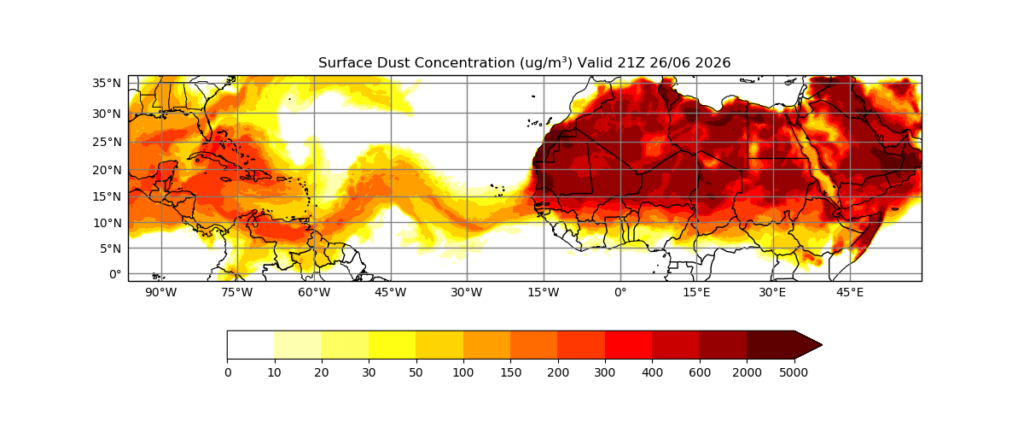
Hazy skies are something a little more unusual heading into next week as Saharan dust travels across the Atlantic and pushes into the Gulf. This is a good thing to keep track of if you suffer from allergies or are in a sensitive group that is susceptible to respiratory issues, as this dust can cause respiratory irritation. On the flip side, the SAL (Saharan Air Layer) creates beautiful sunrises and sunsets as the dust gets caught in the atmosphere and scatters the light particles. The dry, warm air and high vertical wind shear make it difficult for tropical waves to organize which inhibits hurricane development, while also limiting rainfall on land since the air is extremely dry, about 50% less moist than normal tropical air.
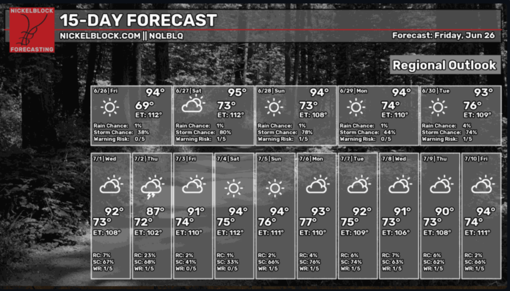
For our 15-day regional forecast, we see above-average temperatures hanging upwards of 90 degrees for the upcoming future.
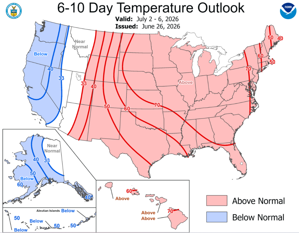
Looking at NOAA’s 6-10 day temperature outlook, it’s easy to tell that it is going to be HOT this next week. Take this as a warning that outdoor activities and events will be hot and steamy. Make sure you stay hydrated and take breaks in the shade or indoors. Have a hot and happy weekend!