Hello everyone, there will be a dry line boundary will slowly be approaching deeper in the southeast against the less dense and high amount of moisture to develop some thunderstorm activity in the afternoon. In the morning, it will be mostly cloudy with a low temperature in the 70s and a high temperature in the upper 80s.
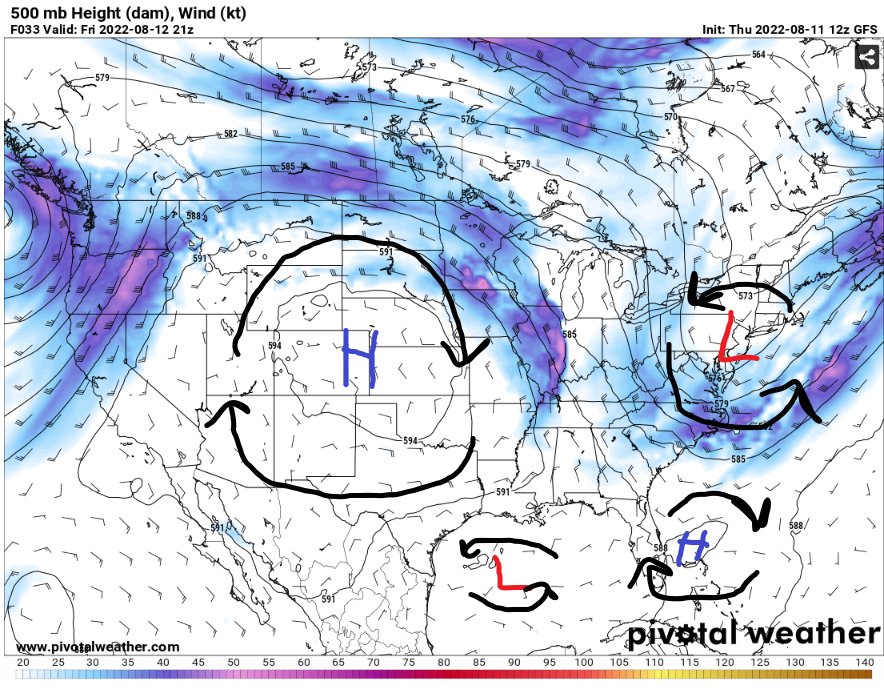
The high-pressure system in the Great Plains will bring in drier air to the southeast to change the SW MS weather pattern for next week. The low-pressure system in the Gulf of Mexico will not bring anymore stormy weather in SW MS as it will move to the Texas and Mexico coast in the next few days. The trough from the Midwest will dive deeper to bring in a stationary cold front throughout the day.
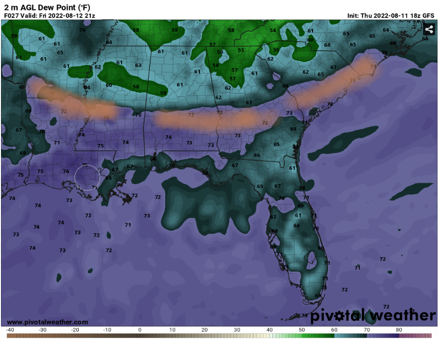
Around 4pm CDT, the dry line boundry has passed through the northern Mississippi then slowly going to the south to bring in comfortable dew points temperatures in SW MS in the next few days. For today, the dew points will remain in the mid 70s. This dry line boundary will have the potential to develop thunderstorms as the less dense moist air will have some convection above the dense dry air that is coming through the southeast.
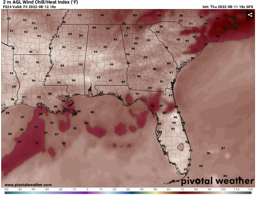
Even though the temperatures for today will be in the upper 80s, there will be a high dew point temperature in the mid 70s. This will allow the SW MS area to have low 90s up to mid 90s heat index temperature. Don’t forget to stay hydrated and safe in the hotter weather.
Day to Day Forecast
Friday
Partly cloudy, with a 50% chance of scattered showers and thunderstorms in the afternoon. With a high temp in the upper 80s to low 90s and a low temp in the low 70s. Calm wind up to 5 mph throughout the day.
Saturday
Mostly sunny, with a 30% chance for stray shower or thunderstorm in the afternoon. With a high temp in the low 90s and a low temp in the low 70s. Calm wind up to 5 mph throughout the day.
Sunday
Sunny, with a 20% chance for stray shower or thunderstorm in the afternoon. With a high temp in the low 90s and a low temp in the low 70s. Calm wind up to 5 mph throughout the day.
Monday
Mostly sunny with a 20% chance for stray shower or thunderstorm in the afternoon. With a high temp in the low 90s and a low temp in the low 70s. Calm wind up to 5 mph to the west throughout the day.
Tuesday
Mostly sunny with a 40% chance for stray shower or thunderstorm in the afternoon. With a high temp in the low 90s and a low temp in the low 70s. Calm wind up to 5 mph to the west in the morning.
Wednesday
Mostly sunny to party cloudy with a 60% chance for scattered showers or thunderstorms in the afternoon. With a high temp in the upper 80s and a low temp in the low 70s. Calm wind up to 5 mph to the west throughout the day.
Thursday
Partly sunny with a 60% chance for scattered showers or thunderstorms in the afternoon. With a high temp in the low 80s up to mid 80s and a low temp in the upper 60s. Calm wind up to 5 mph throughout the day.


