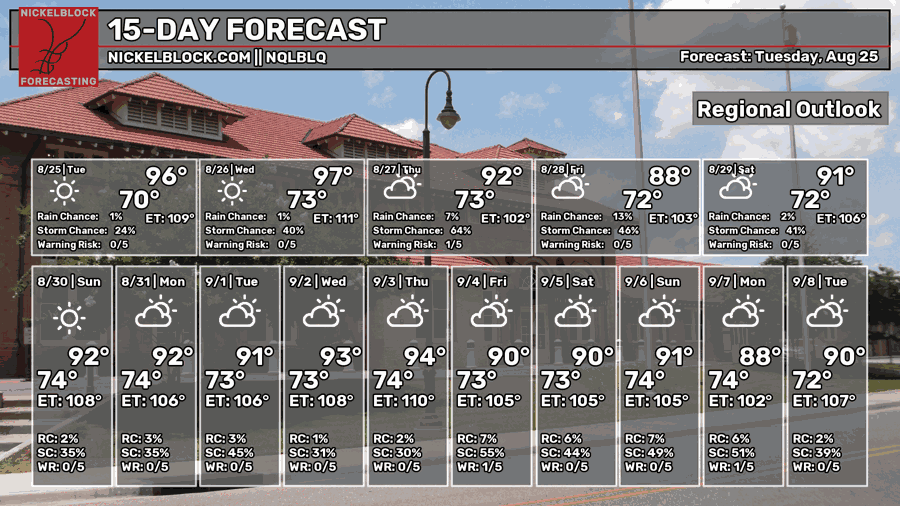
After a bit of a disappointing forecast on Monday, I’m hoping for a little bit of rain this time, and it looks like we have a better chance overnight tonight! The rain even keeps the temperatures down in the morning on Thursday, but we go back to our usual summer heat. Afterwards, the heat is back on!

Tonight
We’ve already had a few showers and thunderstorms develop around the US-98 corridor this afternoon, and a few are raining themselves out just north of Hattiesburg. A gust front is moving northwest which may induce a few more storms afterwards. Before midnight, we can expect a few more storms to develop from our north and rain in the Pine Belt. Lows will reach the low 70s overnight with rainfall expected towards the early morning.

Tomorrow
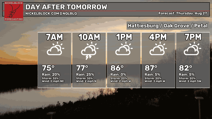
We’ll start off our morning pretty damp with more rain and thunderstorms passing through and heading south. The MCS will begin to gyrate a bit as it rains itself out and spreads itself across Louisiana and northern Mississippi. The cloud cover should help with keeping temperatures down to the upper 80s and low 90s further north. Overnight, the clouds will begin to move out and we’ll be left with another warm evening with lows in the low 70s.
Friday
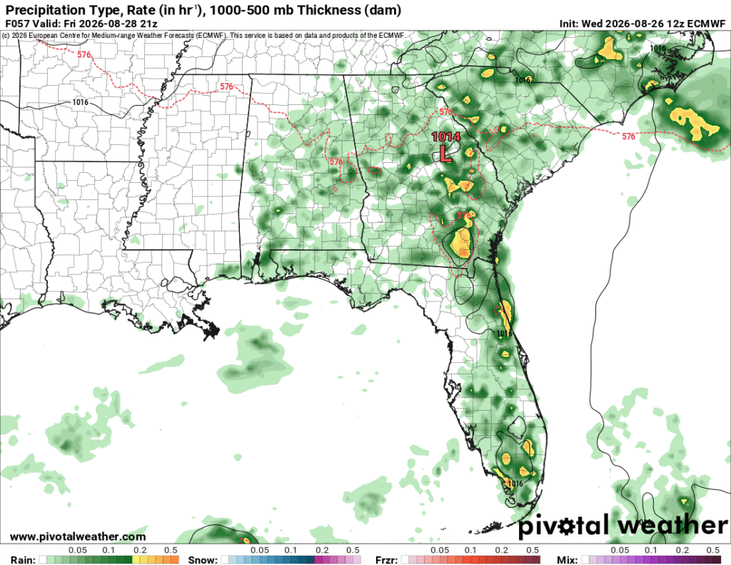
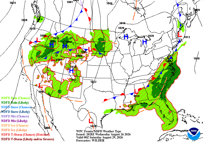
The front is moving further south as a Midwestern high evolves and moves further into the mid-South. This will also choke out most of the convective potential for most of us in Mississippi. Areas in Alabama and Georgia will see rain and thunderstorms, but we’ll be fairly dry. Highs will reach the low to mid 90s and lows in the low 70s.
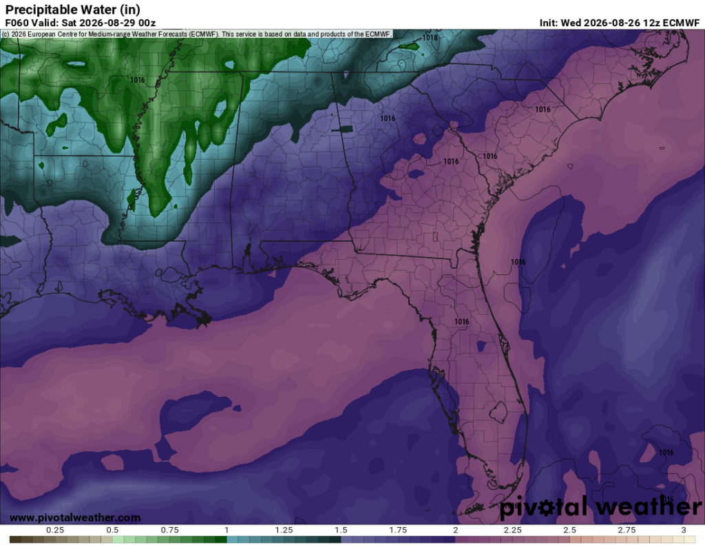
It’s the Weekend!
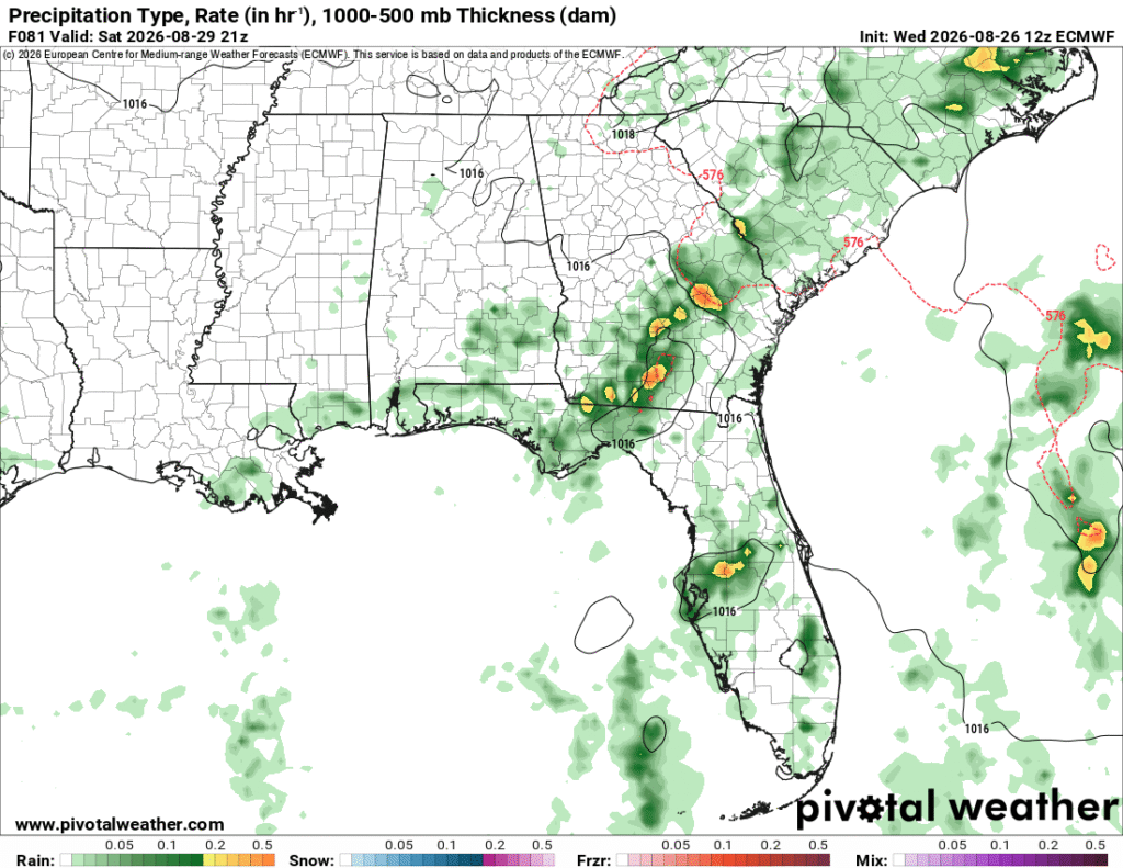
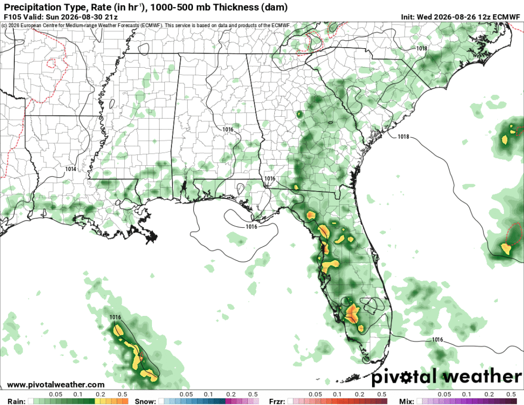
We’re back! For those of you going back to school, it’ll be a good one to head to the pool again as it’ll be a little drier, but not by much. The heat index will be down a hair and reach the low 100s, so not as miserable as the past few weekends. Still wear some sunscreen and drink plenty of electrolytes, though! Highs will be in the mid 90s. A few stray thunderstorms are possible Saturday and Sunday, too, but nothing severe as of yet.