Hey everyone! We had a nice soaker early this morning, with rain for pretty much everybody. While it may not be enough to take us out of the drought we’re in, anything counts!
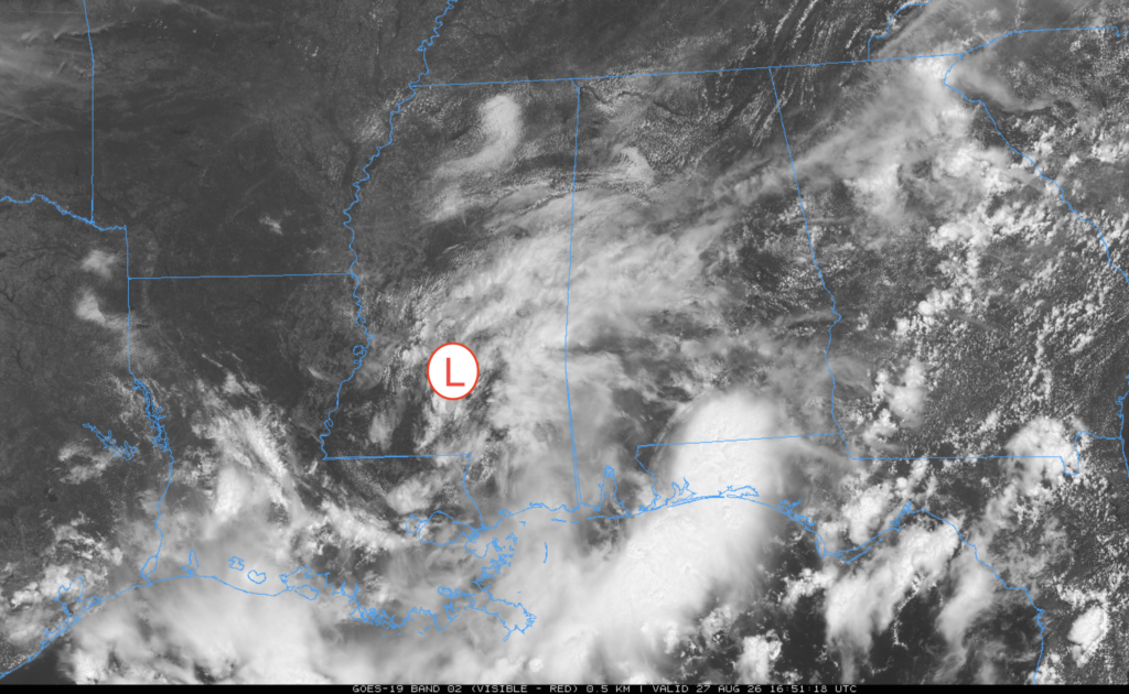
You can see on the satellite view that a low-pressure system is swirling over our area, which brought in the batch of rain earlier and all the cloud cover for today. Dry air has infiltrated the low, which is why there isn’t much rain in the area anymore.
The Setup
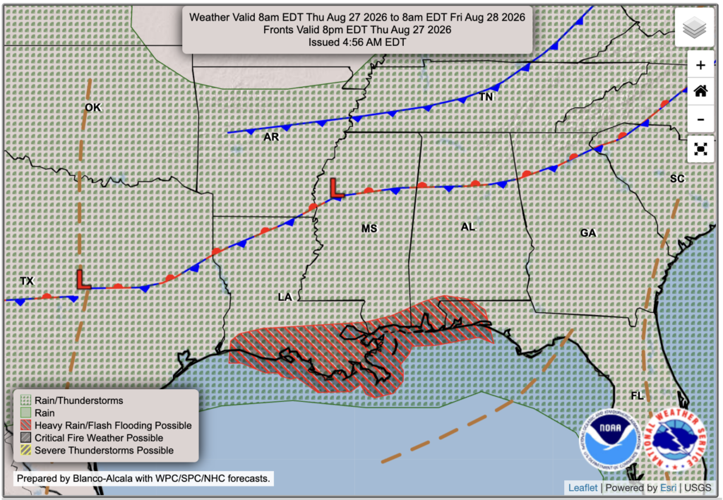
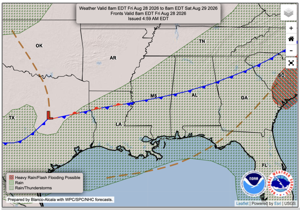
We’re in an unsettled pattern, with a stationary front stretched across northern Mississippi, Alabama, and Louisiana. Today’s WPC outlook shows a flash-flooding threat along the Gulf Coast. Most of that threat likely came from this morning’s rain, but any storms this afternoon could still produce heavy downpours. Precipitable water values this afternoon are 2 to 3 inches, which doesn’t mean 2 to 3 inches will fall, but it shows that there is plenty of moisture available for storms to produce heavy rainfall. The pattern continues Friday, but with more sunshine and fewer showers and thunderstorms.

Today’s Forecast
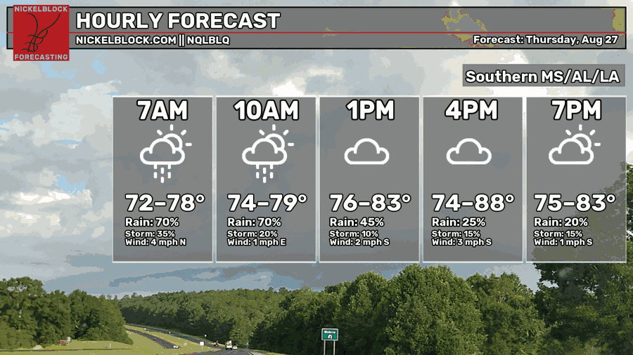
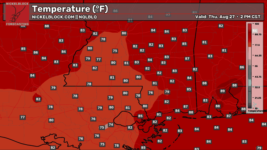
The clouds are doing us a favor today by keeping temperatures in the 80s, a nice change from the recent heat. Most of the rain moved through this morning, but keep an eye out for a few showers or thunderstorms that may pop up later this afternoon or early this evening. Otherwise, expect plenty of clouds through the rest of the day.

Tomorrow’s Forecast: Friday, August 28th
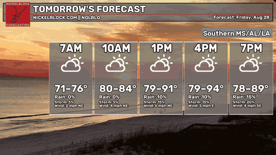
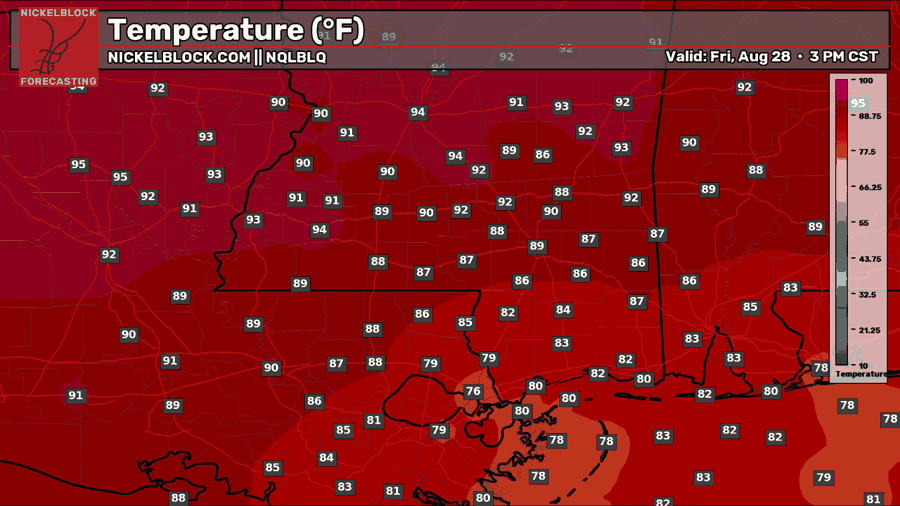
Friday will be a much brighter and warmer day, with more sunshine helping temperatures climb back into the upper 80s and lower 90s for most areas. It should stay dry through much of the day, although an isolated shower or thunderstorm can’t be ruled out during the afternoon or early evening. Overall, rain coverage will be much lower than today.
Saturday’s Forecast
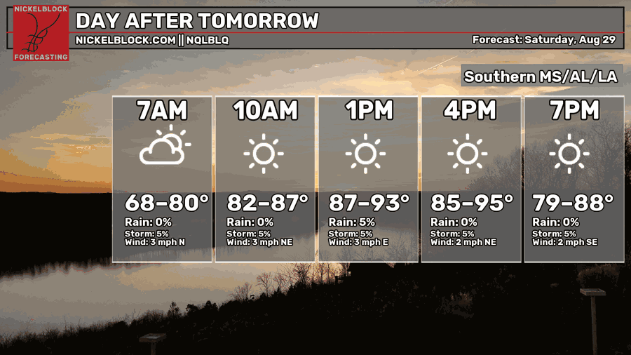
Saturday is a bit of a wild card since the stationary front will still be nearby. Right now, much of the day looks hot and mostly sunny, with highs climbing into the lower to middle 90s. However, the front could provide just enough lift for a few pop-up storms, so rain chances may need to be adjusted depending on where it settles. We’ll have a clearer picture by tomorrow.
Extended Local Outlook
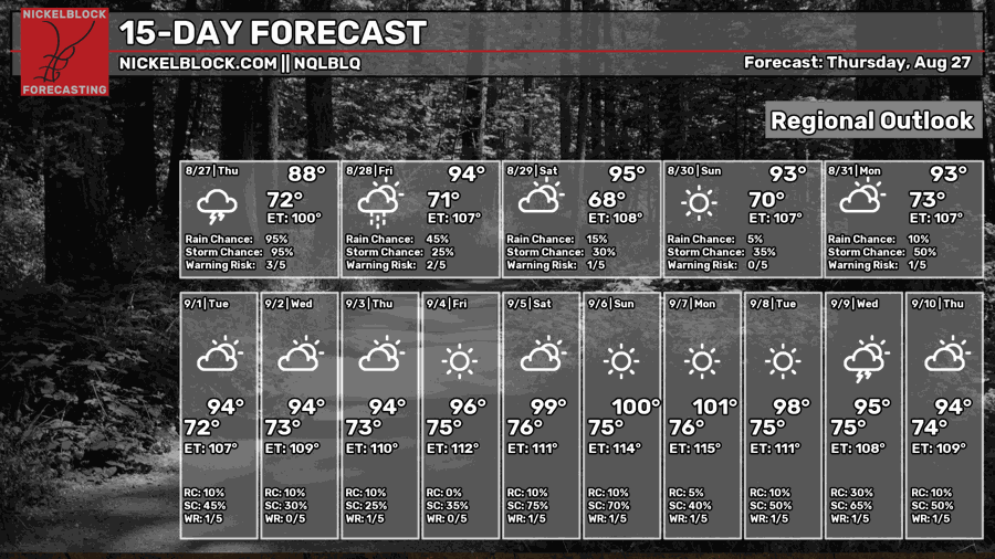
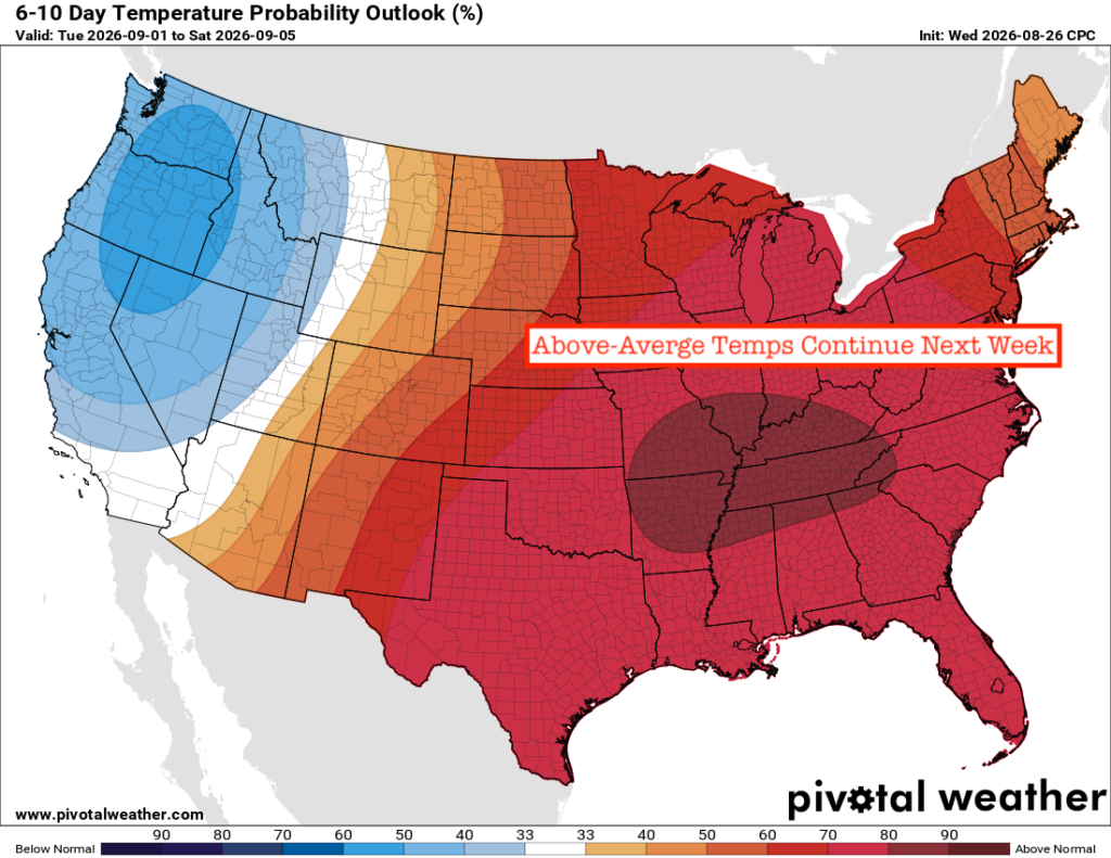
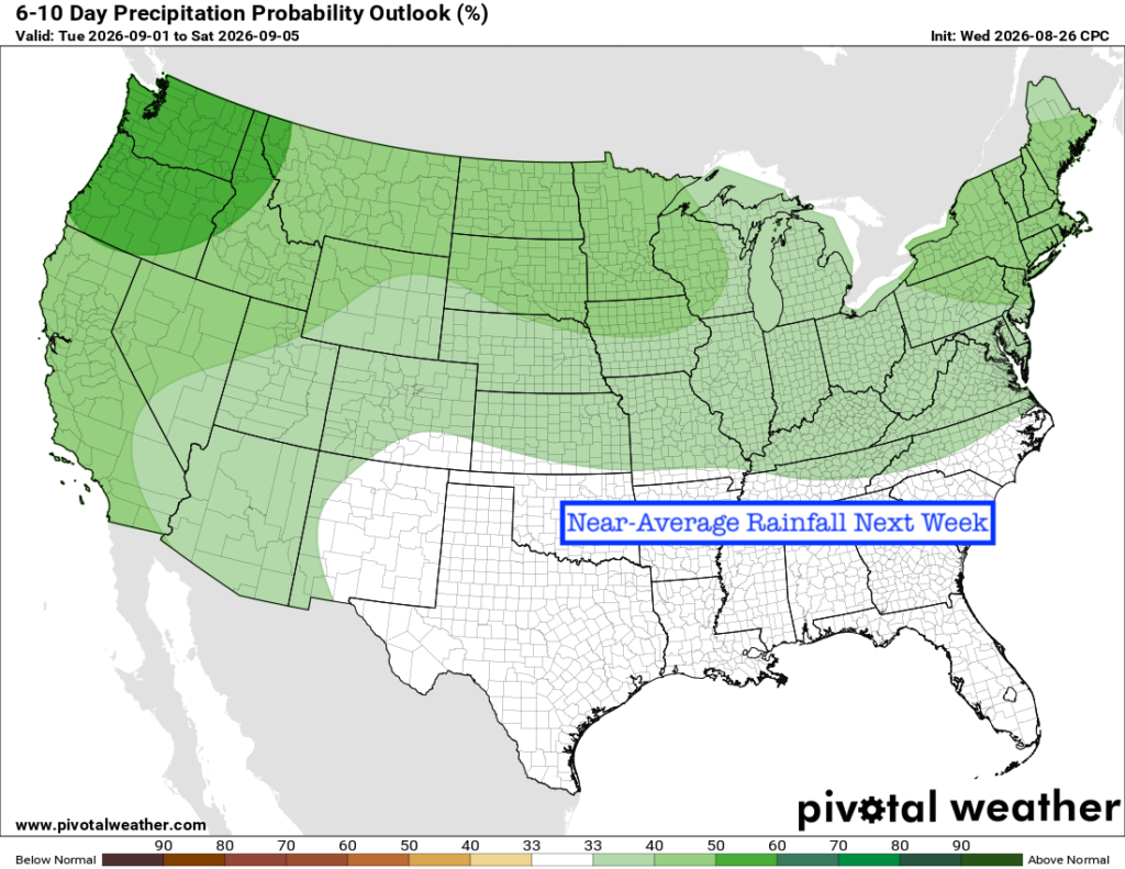
Looking ahead, the heat will quickly take over again, with highs climbing through the 90s this weekend and possibly approaching 100 degrees by next weekend. The Climate Prediction Center also favors above-average temperatures into early September, so there doesn’t appear to be much relief from the heat anytime soon. Rainfall should stay near average overall, meaning we’ll still have occasional opportunities for pop-up storms, but widespread rain is not expected.
Quick Tropics Update
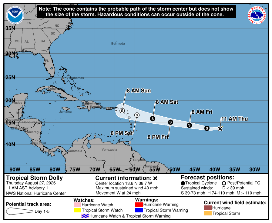
New this morning, Tropical Storm Dolly has formed in the Atlantic. An especially bittersweet storm name following the passing of Dolly Parton earlier this week. Dolly is expected to remain a tropical storm as it approaches the Leeward Islands on Saturday, followed by Puerto Rico later in the weekend. Beyond that, the forecast becomes less certain. Most guidance eventually turns the storm northward over the Atlantic, but we’ll need a little more time before we know exactly where Dolly goes next.