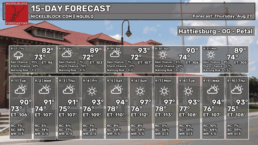
It’s been a fairly pleasant end to the week so far. Temperatures have been lower than average and rain chances were down during the day. It felt more like an early summer day! It looks like we have one more chance of that before we gear up for more heat by the beginning of next week. We’re at the mercy of the sea breeze for thunderstorm development in the afternoon, but the southerly winds will help a bit with that.

Tonight
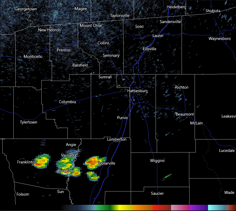
A few showers are moving through the Pearl River Valley/western I-59 corridor. They’ll eventually rain themselves out by tonight as the gust front passes further south. Otherwise, we’ll have partly cloudy skies during the evening and lows in the low 70s. Overall, not a terrible night if you’re out watching the football game or heading out on the town.

Tomorrow
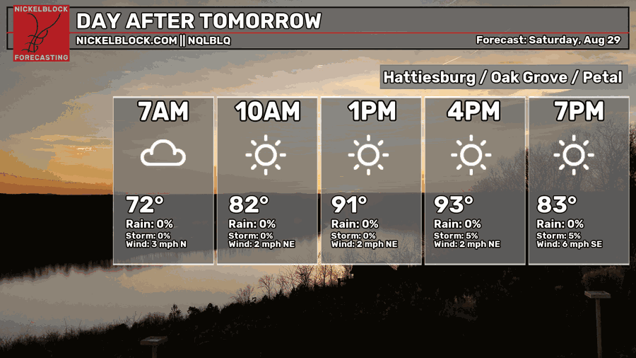
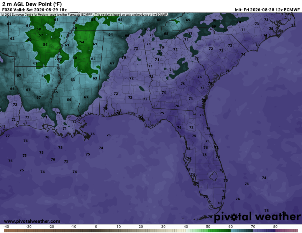
A mostly sunny day is ahead tomorrow with a high in the low 90s. The dewpoint will be in the mid 60s, so it won’t be near as humid as we’re used to. Hooray! A stray thunderstorm or two may pop up, but otherwise it looks like another hot but not as humid summer day. Pretty good for late August! Overnight, the clouds will clear out, but eventually some high clouds will move in around sunrise on Sunday.
Sunday
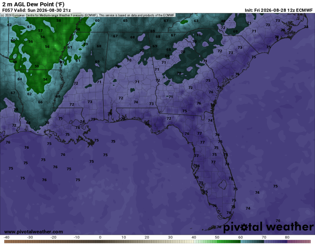
We’ll return back to our late summer type of weather by Sunday. The southerly winds are back kicking more humid air from the Gulf. At this point, too, the winds will help bring in more afternoon thunderstorms, which is a good thing since it’ll cool us off by the evening! Highs will be in the low to mid 90s with the experienced temperature in the low 100s. Back to drinking water, electrolytes and staying out of the sun for a long time! Lows will be in the low to mid 70s with some high clouds closer to the coast.
Next Week
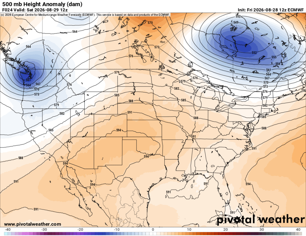
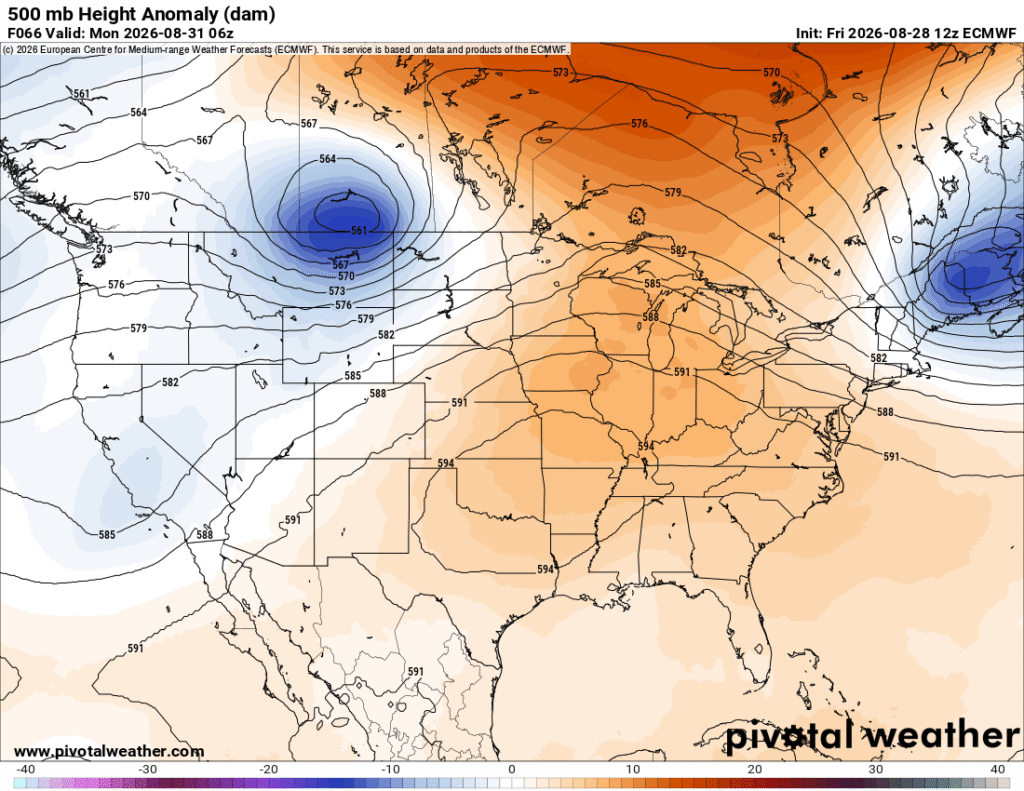
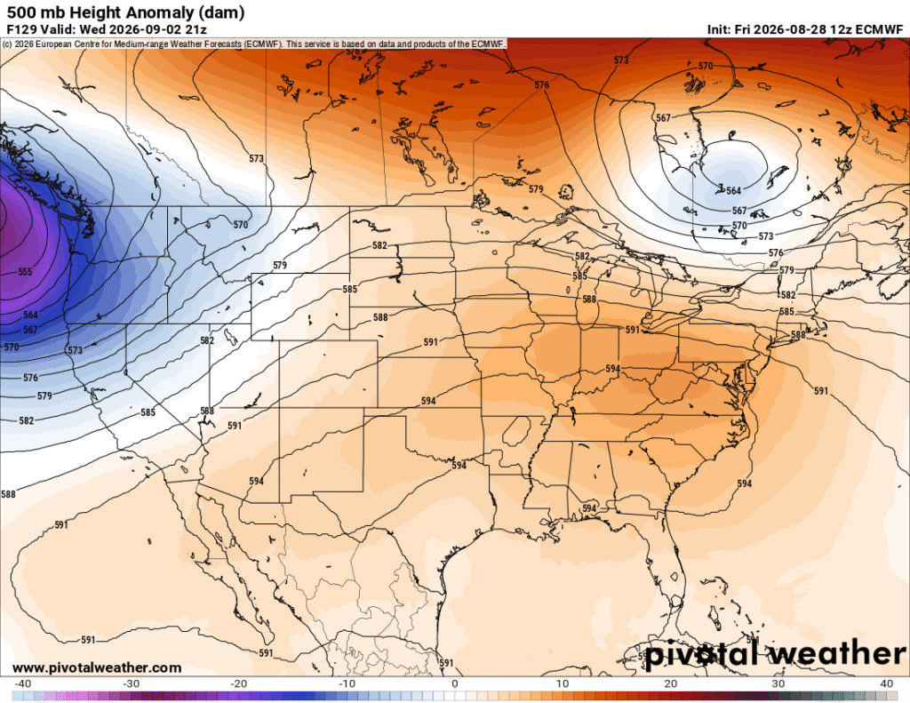
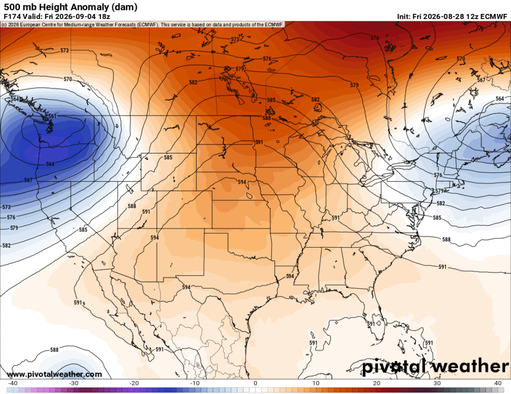
Looking at the 500mb height anomaly maps above, there is some push/pull with the large ridge over the Central US. Much of this is due to the growing troughs moving from the Pacific Northwest into Canada. They’re riding the swell of the ridge and moving around it towards the Atlantic, essentially morphing the ridge a bit, but not really putting a dent into it. The ridge moves further east, expands across the Southwest and Southeast, then contracts and balls up as the trough in Canada grows as it moves towards the northern Atlantic. Really, this ridge is going nowhere anytime soon, and we’ll be stuck in the heat dome for a while longer.
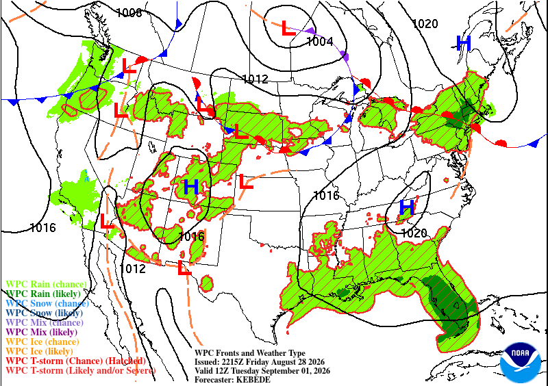
The surface high has a stranglehold on us, too. It’s a pretty broad anti-cyclone that will contribute to some southerly winds. The front I mentioned at the beginning of the blog will hang out in the Gulf for a while and spin, helping to drive a bit of convection to the coastal areas, and in some cases, further inland. Overall, we’re going to be stuck in another hot and humid pattern thanks to all these factors. Dewpoints will average in the low to mid 70s and highs will eventually climb into the mid to upper 90s again. Expect a few days with heat advisories and possibly an excessive heat warning.
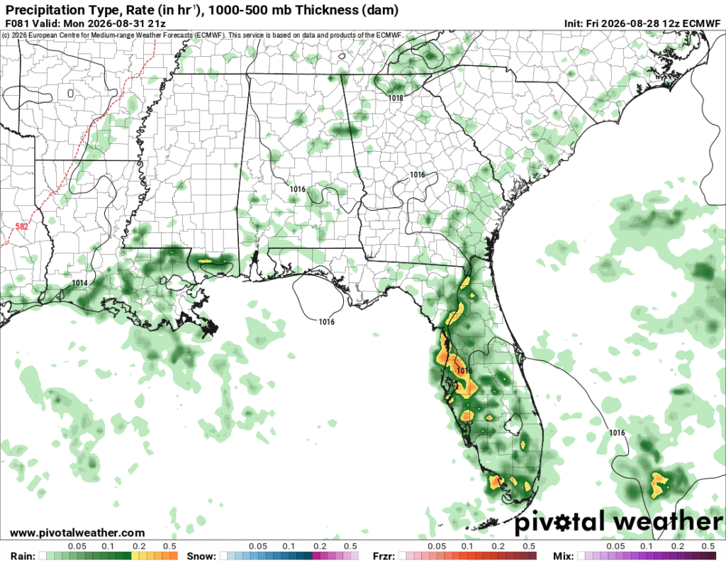
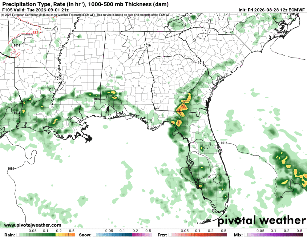
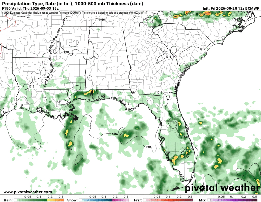
It’s a bit hard to see, but there’s a broad area of rotation in Tuesday’s model guidance (middle). That’ll be the driver for the afternoon thunderstorm pattern next week, and they will be limited to any sort of preemptive convection like the sea breeze or air parcels with enough energy to develop.
The Tropics
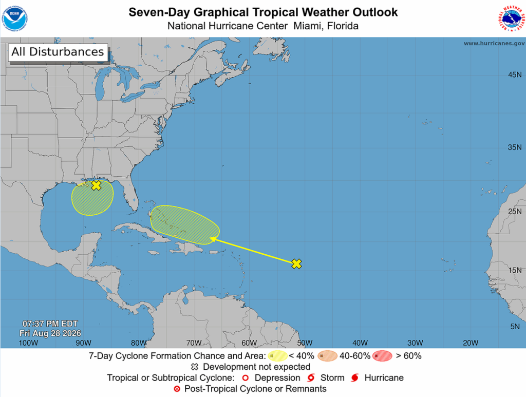
The Tropics are looking fairly unimpressive for this time of year, not that it’s a bad thing, per se. Dolly has some storms wrapped around it, but it’s a pretty broad area of rotation that hasn’t closed in, and it likely won’t. There aren’t a lot of factors to help. Sea surface temperatures are somewhat warm, but it will likely develop too late for it to become a threat. The storm in the Gulf is the front I mentioned earlier. It has plenty of warm water to sprinkle out some afternoon thunderstorms, but it’s not much of a threat either.