**If you are looking for updates on the remnants of tropical storm Arthur, scroll down**
Earlier today, tropical storm Arthur was downgraded from a a post-tropical cyclone to just a tropical invest, where its center is currently situated over Mississippi. Later tonight, it will move over into Alabama.
Over the next few days, the remnants of Arthur will make its way eastward until Friday where it is likely to exit off the coast of North Carolina, possibly reforming back into a named tropical cyclone. Until then, it will continue to drop copious rain, causing many flooding issues. These issues have only been made worse due to the fact that we’ve gotten so much rain over the past month.
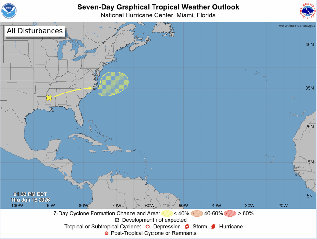
As of now, there is only a 10% chance of tropical development with the remnants of Arthur, but this chance could increase as time goes on.
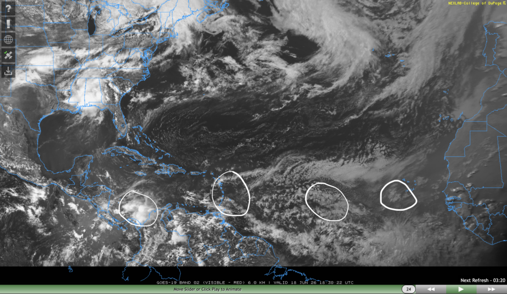
The NHC has also mentioned a few tropical waves in the Atlantic ocean and Caribbean sea, two in the eastern Atlantic, one in the eastern Caribbean sea, and one in the western Caribbean sea. It’s worth noting that none of these tropical waves have been classified as tropical invests by the NHC yet, so there is likely nothing to worry about.
Furthermore, tropical waves that develop in the eastern Atlantic ocean usually develop into stronger hurricanes in August and September, the peak of the Atlantic hurricane season.
Remnants of Tropical Storm Arthur
As I mentioned before, the remnants of tropical storm Arthur has dropped tons of rain on our area and will continue to do so until tonight.
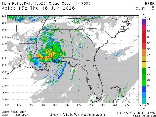
The heavy rain band today from Gulfport to Montgomery is moving towards the northeast, meaning that the areas under the band are going to pick up truly excessive rainfall, which is partly why the flooding risk with this system is so severe.
If you don’t have to travel today, don’t. Driving conditions, particularly where the heaviest rain is going to set up, will be extremely dangerous. Turn around and don’t drown.
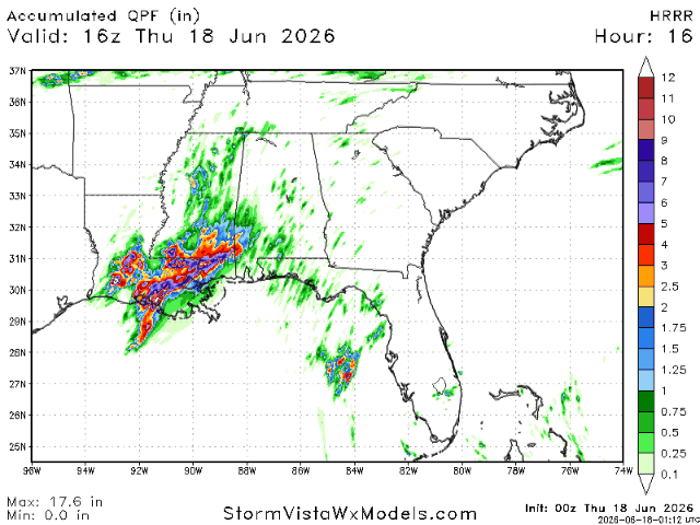
The same model is also suggesting a widespread 4-8″ of rain from now until tomorrow, with an area between Hattiesburg and Gulfport that could pick up over a foot of rain. Unreal.
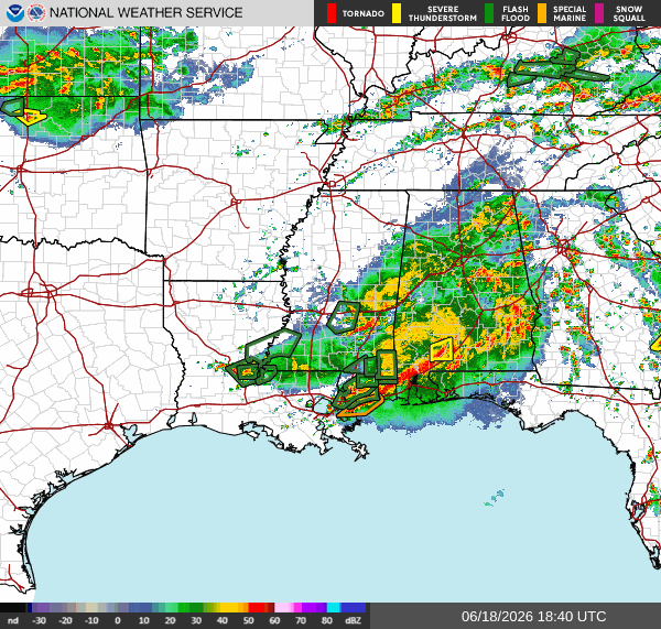
Right now, the heaviest rain band is set up from Gulfport to south of Montgomery near Greenville, AL. There are numerous flash flood warnings in southern Mississippi. Expect more in southwestern Alabama as the system moves eastward. Pay close attention to your local weather warnings issued by the NWS.


