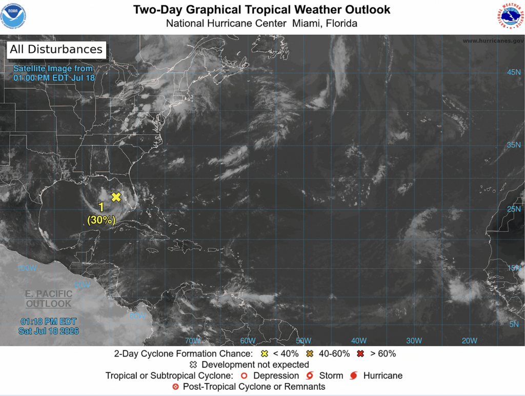
Good afternoon! Today, we actually have a tropical disturbance to talk about in the Gulf of Mexico.
Invest 91L is currently situated off the west coast of central Florida, and will continue to slowly move to the northwest over the next couple of days. Over the next 2 days, it has a 30% chance of tropical cyclone development, and over the next 7 days it has a 40% chance. According to the NHC, a hurricane hunter aircraft will fly into the invest tomorrow if necessary.
Even if a tropical storm does form, it is very unlikely to become anything strong. There simply isn’t very much space for 91L to strengthen before it moves over land, and it’s still early in the hurricane season.
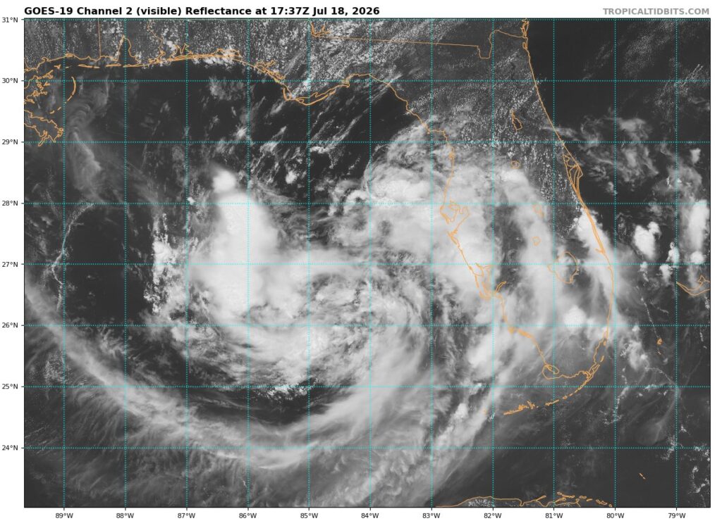
Here’s a satellite image of the invest this afternoon.
Let’s take a look at some of the surrounding atmospheric conditions.
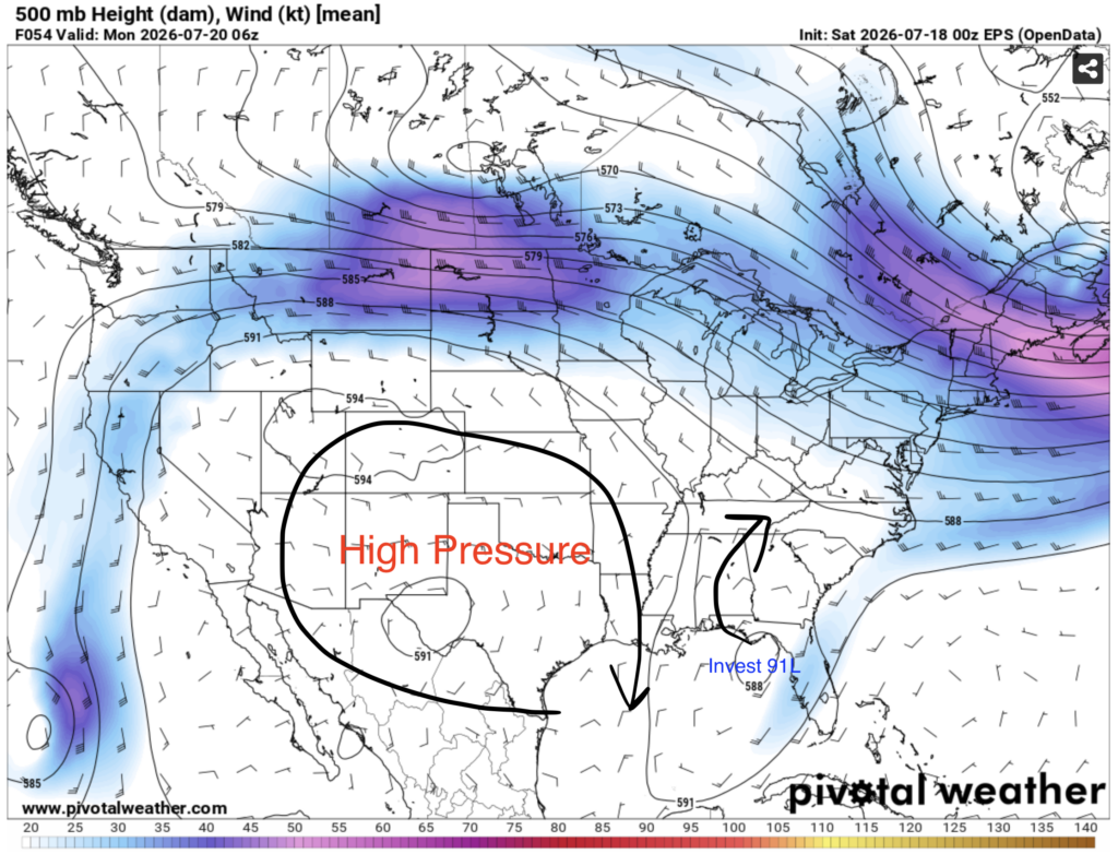
If invest 91L survives long enough to come ashore in the next few days, it is likely to be between New Orleans and Tallahassee. It is unlikely to be anywhere to the west of New Orleans as an area of high pressure centered over western Texas will steer the storm away to the east.
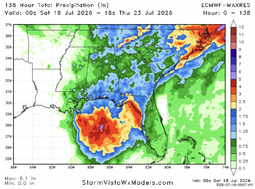
As for rainfall, amounts aren’t likely to be too crazy, with the ECMWF model showing the highest totals well off shore in the Gulf of Mexico. Rainfall totals between 1-2 inches are common stretching from Mobile to east of Tallahassee.
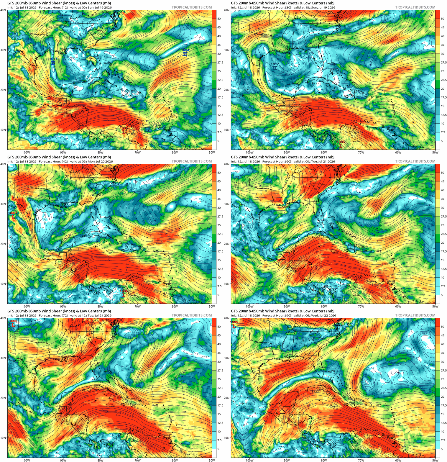
I suspect that late this weekend and early next week, on Monday and Tuesday, 91L is going to be torn apart by strong wind shear making its way south. 91L is likely to be gone by Tuesday.
The NHC has not mentioned any other tropical invests over the next 2 or 7 days. Overall, high wind shear will continue to be present over the Atlantic ocean and Caribbean sea, so tropical activity looks to be quiet over the next week.


