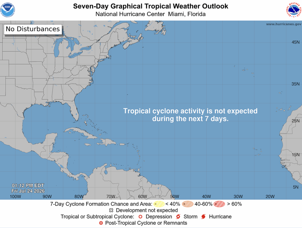
Good news! Now that tropical storm Bertha has moved over Texas and dissipated, the NHC is no longer monitoring any active tropical systems or invests.
However, as we get closer to August, the closer we get to the peak of hurricane season which is when the vast majority of damaging hurricanes make landfall. This is why it’s important to get ahead of the game and start preparing early on.
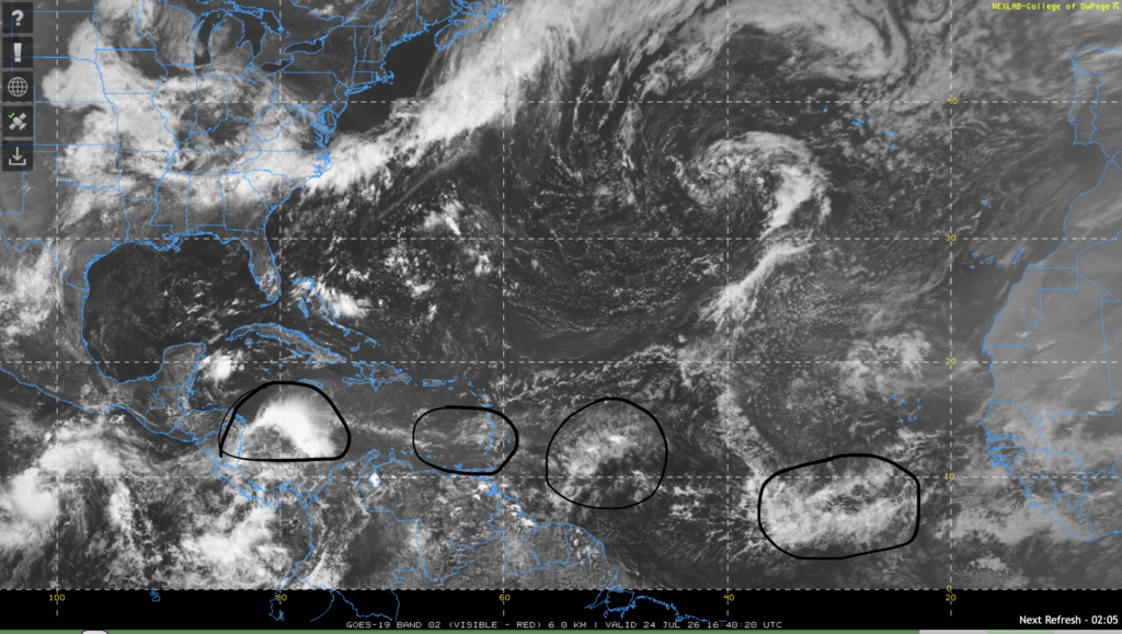
The NHC has pointed our 4 tropical waves in their discussion. One is in the eastern Atlantic southwest of Cape Verde moving west at 15 kts. One is east of the Lesser Antilles moving west at 10-15 kts. One is right near the Lesser Antilles north of Venezuela moving west at 15 kts, but little to no convection is occurring. Finally, there is one in the western Caribbean sea moving west at 10-15 kts with strong convection.
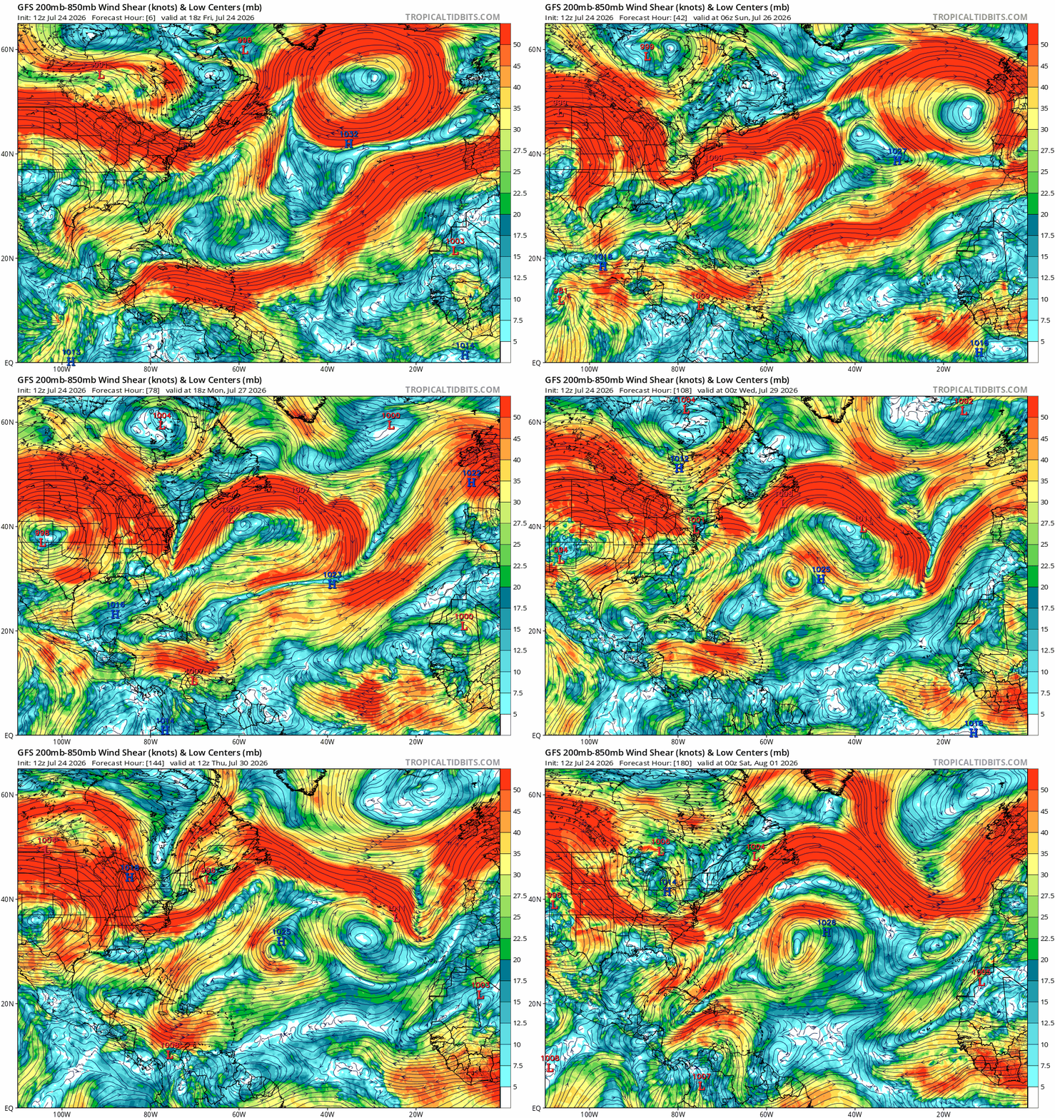
Development for these 4 tropical waves looks unlikely, the NHC hasn’t even designated them as tropical invests. Part of the reason for this is because of high wind shear, which looks likely over the Caribbean sea and eastern Atlantic ocean over the next week.
Wind shear is also higher than normal due to the near record breaking El Niño event happening in the eastern Pacific ocean. However, it is still early in the season, most tropical activity takes place between August and October.
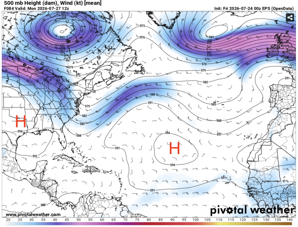
Overall, conditions for development look unfavorable over the next week. An area of high pressure is likely to set up over the eastern Atlantic as well as near the Gulf of Mexico. This will prevent most convection and will also prevent low pressure systems from moving towards them. In areas where there isn’t high pressure, there’s high wind shear, so there really isn’t anywhere in the Atlantic basin where conditions look favorable for development.


