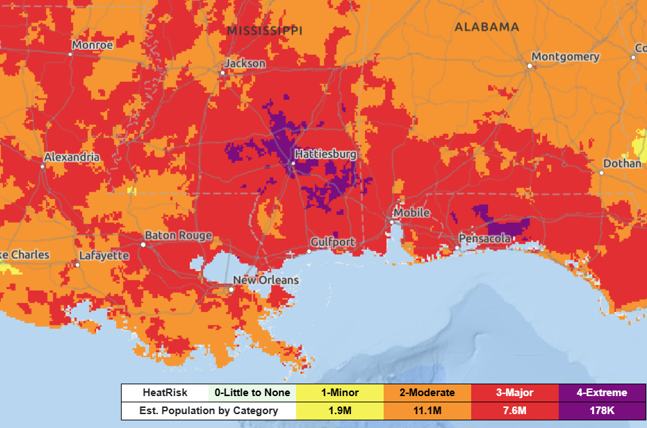
What’s summer without a heatwave? Heading into the weekend, temperatures start to heat up before taking a turn for the worse early next week. Daily high temperatures in the triple digits could threaten records, and heat indices up to 112 degrees are possible during the Monday-Wednesday timeframe.
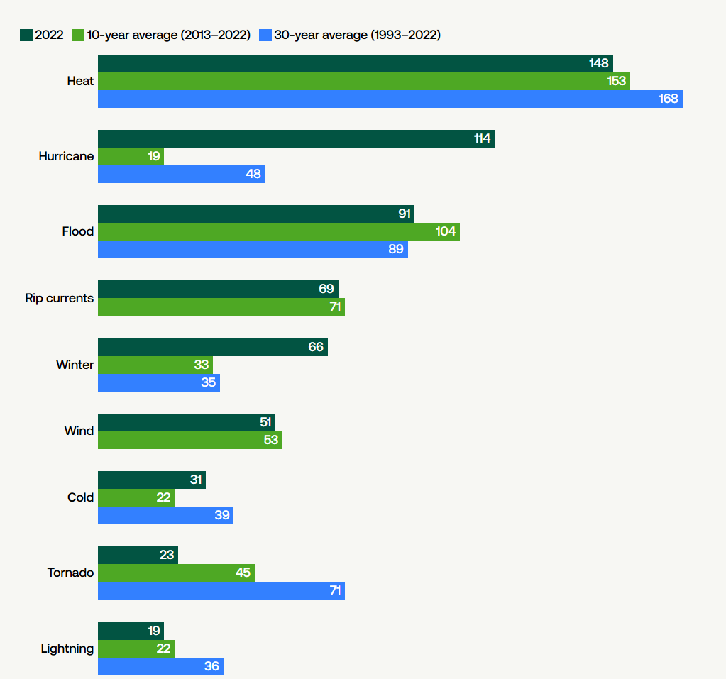
Heat is the leading cause of all weather-related deaths, claiming more lives on average over the past 30 years than hurricanes and tornadoes combined.
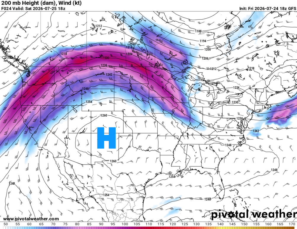
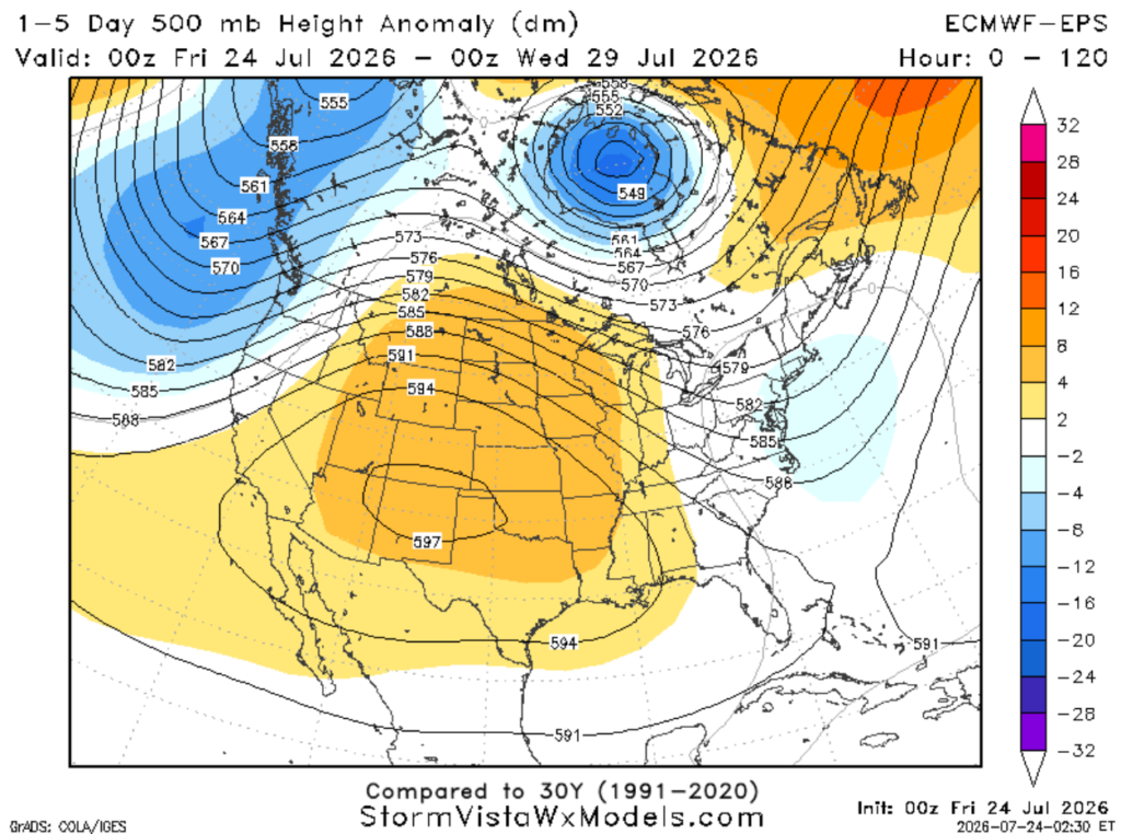
An upper ridge over the central/western U.S. is in place, and the heat is expected to worsen beneath it. Dry air flowing in from the northwest will suppress storm development, so there won’t be much rain around to provide relief from the heat.
Also, dewpoints are expected to remain in the 70s, leading to potentially dangerous heat index values.

TONIGHT
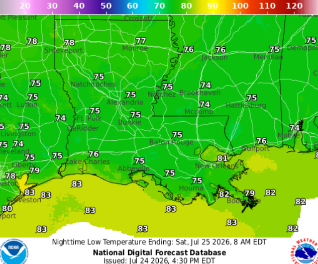
Quiet tonight with mostly cloudy skies and lows in the mid-70s. Light winds from the south.
TOMORROW
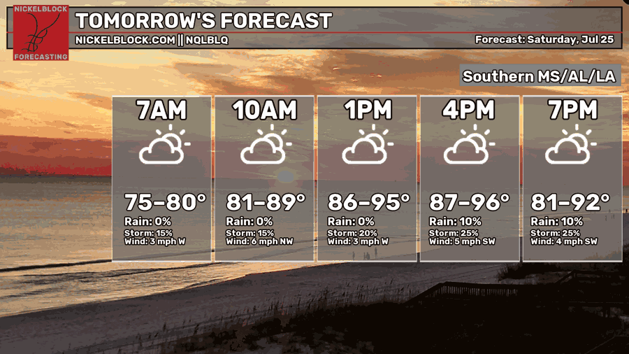
This weekend, high pressure will settle over the Gulf. Combined with the upper ridge, this will keep the chance for rain low Saturday and Sunday, with only a stray afternoon shower or thunderstorm possible, mainly along the coast.
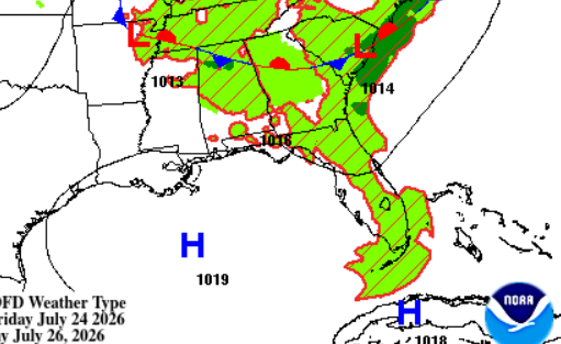
Saturday, a mix of sun and clouds. Highs ranging from 98 in Hattiesburg to 92 in Houma.

DAY AFTER TOMORROW
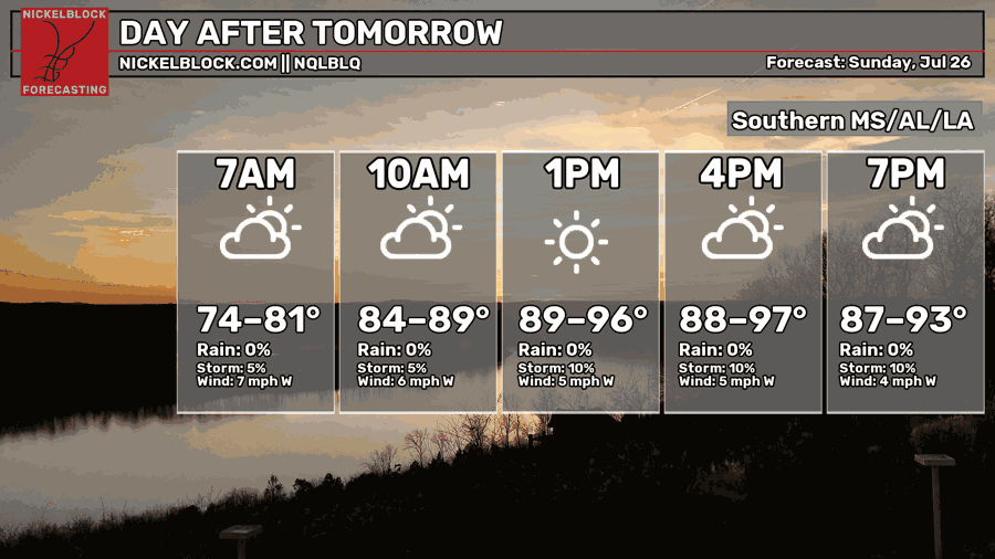
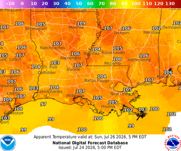
Starts to warm up on Sunday as a precursor to the extreme heat in the days following. Highs in the upper 90s will become more common across the region, with apparent temperatures reaching the triple digits.
Similar look to Saturday, with mostly sunny skies and a few stray afternoon storms possible, but mainly confined along the coast.

EXTENDED OUTLOOK
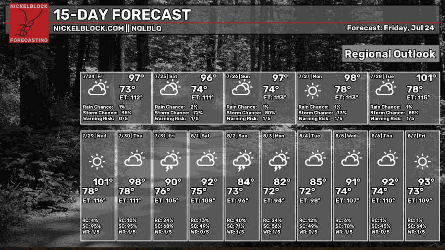
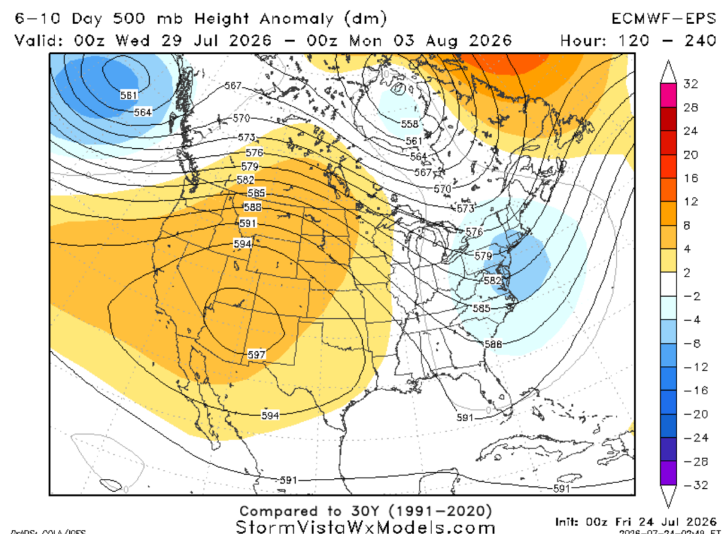
Looking ahead, extreme heat and abundant sunshine are in store for us to start the week! As the ridge continues to amplify over the central U.S., it will delay and limit storm development, allowing heat indices to potentially peak between 110-115.
Wednesday, a trough will deepen along the east coast (shown from left to right, light blue to darker blues). This could help bring some relief, as we have a better chance of rain during the Wed-Fri timeframe.
DAY-BY-DAY FORECAST
Tonight – Quiet tonight with mostly cloudy skies and temperatures in the mid-70s. Light breeze from the south.
Saturday –Mix of sun and clouds. Daily highs climbing to the mid to upper 90s. Cannot rule out a stray afternoon storm. Light breeze from the west.
Saturday Night – Partly cloudy, with a low around 75. Southwest wind around 5 mph
Sunday– Skies look to be mostly sunny and temps rising to 97, but humidity could make it feel closer to 105. Light breeze from the west at 5-10mph.
Sunday Night – Clear and calm night. Lows around 74 with calm winds.
Monday– Beautiful hot summer day, emphasis on the hot. Highs approaching 100, may feel closer to 110. Sunny, west wind around 5 mph.
Monday Night – Warm night under mostly clear skies. Lows around 78. Calm wind.
Tuesday – Sunny and -very- hot. Highs near 101 but it will feel closer to 113. West wind around 5 mph.
Tuesday Night – Little overnight relief with a low of 78. Mostly calm with a light breeze from the west.
Wednesday – Extreme heat continues with highs easily reaching 101, feeling closer to 111. Sunny and winds blowing from the west at 5-10mph. Can’t rule out an isolated afternoon storm. Rain chance: 15%
Wednesday Night – Little heat relief expected, with lows only dropping to around 78. Mostly clear conditions with a light breeze from the west.
Thursday – Mostly sunny skies. A few afternoon thunderstorms may pop up after 1pm, but much of the day stays dry. Light westerly winds. Highs around 98, may feel closer to 105. Rain chance: 20%
Thursday Night – A stray evening shower remains possible before skies settle into a partly cloudy night. Low around 78. Rain chance: 15%


