

Hi, everyone; I hope you are all having a great week. There is quite a lot of action in the tropical waters, so let us get into it. Looking at the Atlantic Basin, we are looking at two potential systems. One is far north and has little to no chance of development. The other system is much further south and has a chance of developing in the next couple of days. Looking at the Pacific, one system has little chance of development; however, another storm has already developed, named tropical storm Dora.
The Atlantic Basin
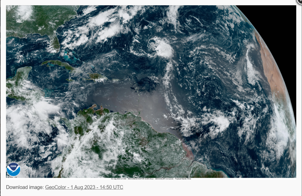
Looking at the Atlantic Basin, there are no formed tropical cyclones, but there are two possible development areas. The first area is located off the coast of Nova Scotia, but due to cool waters and the system merging with a frontal system, no development is expected at this time. The other area of development is located about 700 miles east of the Northern Leeward Islands. This area of development is expected to move in a northwest direction. Environmental conditions could be favorable for development, but dryer air and moderate wind shear (especially near the coast) is forecasted for the Southern Atlantic, which could hinder development.

The Pacific Basin
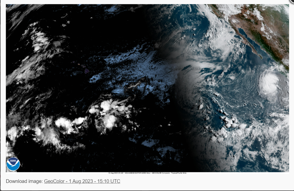
Looking at the Pacific Basin, there is more action, with a possible area of development and a fully formed tropical storm. The area of development is located over 1,000 miles off the coast of Baja, California, moving west at 5 to 10 mph. No development is expected due to wind shear and dry air aloft.

The other storm is named Tropical Strom Dora. Dora is located at latitude 16.1 north, longitude 108.1 west, and is moving west at 14 knots (16 mph). Current winds are 60 mph (50 knots), and the minimum central pressure is 1000 MB (29.53 inHG). Current forecasts expect this system to intensify into a major hurricane by Thursday morning. The system is expected to continue westerly towards the Central Pacific. The Hawaiian Islands may see impacts from Dora; however, winds shear to the north may cause this system to move south of the Islands. If you live or are planning to travel to Hawaii in the Next week, please keep an eye on tropical storm Dora.
Extended Outlook
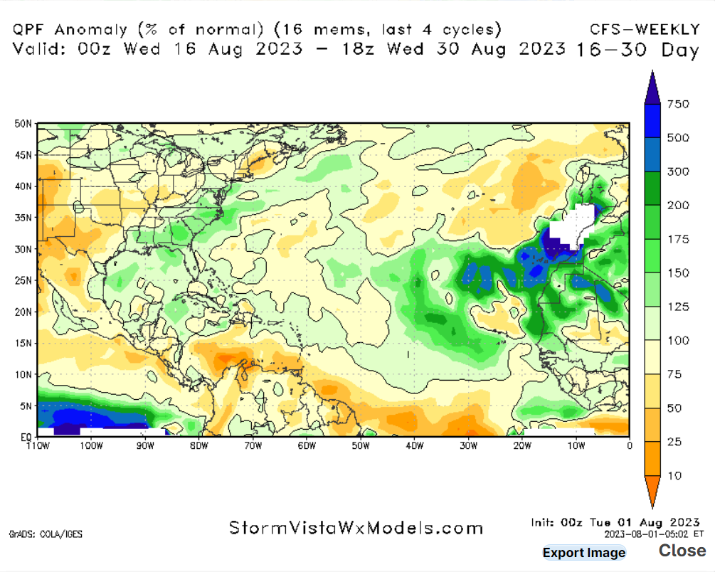
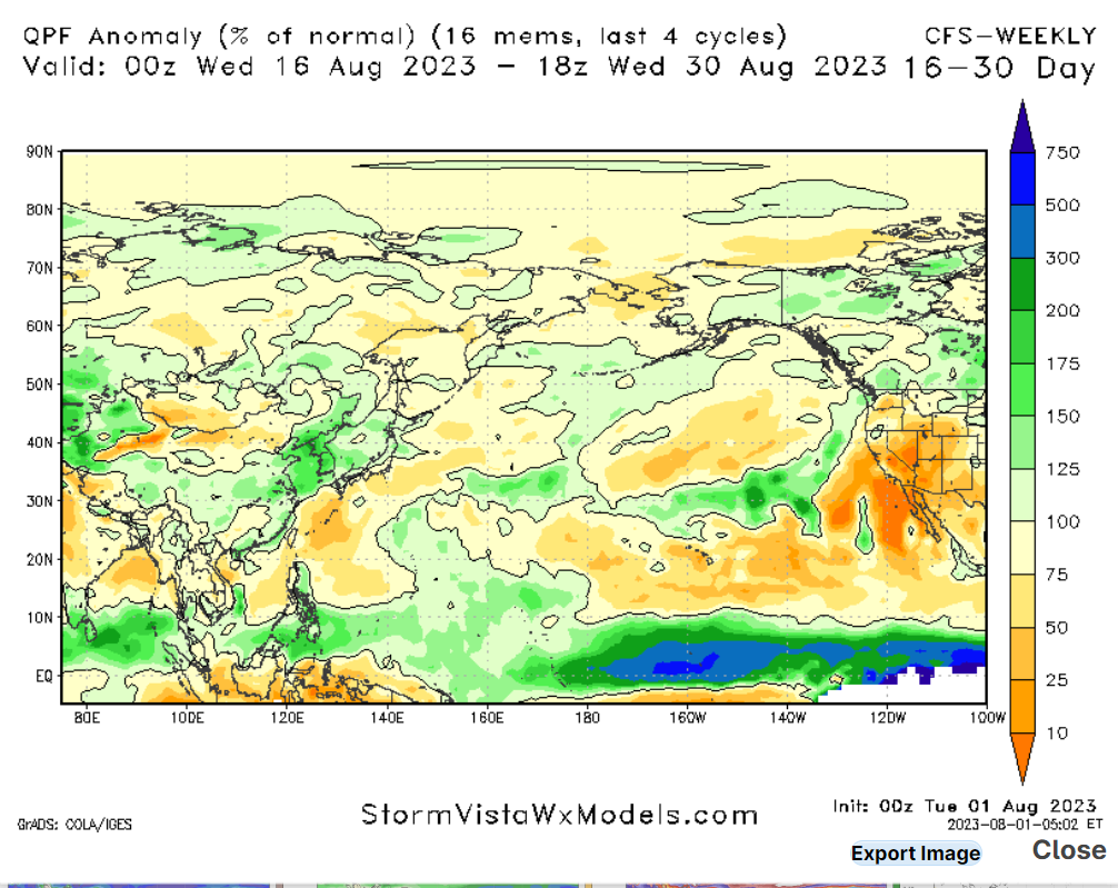
Looking at our extended outlook, one thing to keep an eye on is the above-average precipitation forecasted in both the Atlantic and Pacific Oceans. Since ocean temperatures are already above-average, seeing above-average rainfall means that we could see more tropical systems develop in the next few weeks. Some areas of disturbances are expected to move off the coast of Africa, which could develop in the Atlantic. As the month of August continues, hurricane activity will only increase before peaking in mid-September.
Conclusion
Overall, much more action is expected in the Pacific this week, with the Atlantic seeing less action. The area of disturbance in the Atlantic will have difficulty developing due to the dryer air and wind shear. Tropical Storm Dora will quickly intensify into a major hurricane in the next few days and move westward, possibly toward the Hawaiian Islands.


‘Desterbences’??
It has been corrected and spell-checked. Looks like this one got posted before the editor (me) could take a look at it.