Yes, there is still the potential for severe weather. However, what may end up causing problems for a wider number of people is the regular ‘ole wind. But more on the wind in a second…
The Storm Prediction Center has increased parts of the area to an Enhanced Risk for severe weather, leaving the Slight and Marginal Risk mostly as-is. The Enhanced Risk ( a “3” on the 1-to-5 scale where “1” is the lowest risk and “5” is the highest risk for the most significant severe weather), includes southeastern Louisiana, southern Mississippi and southwestern Alabama and a portion of the Florida panhandle.
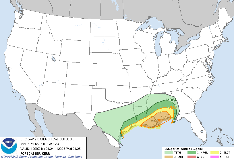
That comes with a 10-percent tornado risk with a hatched area suggesting that EF-2 or stronger tornadoes may be possible.

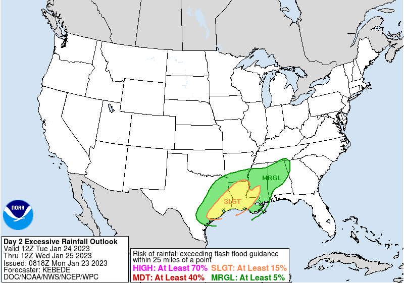
The Weather Prediction Center has also highlighted part of the region with a Slight Risk for flash flooding during the same window.
So it will be quite the active weather day on Tuesday night and into Wednesday morning.
And before the storms arrive and then after they leave, it will be rather windy. Not wind in the thunderstorms, just regular wind.
Take a look at what some of the model guidance is showing for peak wind gusts possible across the area starting Tuesday night at 6p (first, below), 9p (second, below), midnight (third, below), and 3a (fourth, below).


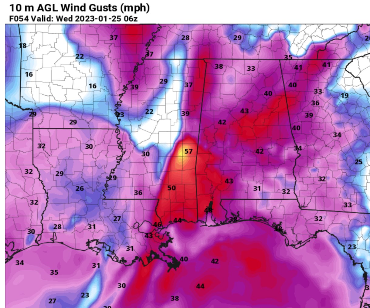

That is peak wind gusts of 50mph to 60mph possible. That is Tropical Storm-force wind. And this is on top of the chance for storms and the potential for storms to have their own wind gusts up to 70mph.
In short, power outages will be possible and if your power goes out, there is a higher than normal likelihood that it lasts a longer period of time (up to 12 hours).
So, to recap, a chance for storms and the potential for severe weather Tuesday night and into Wednesday morning. Outside of that, regular wind will be blowing between 20mph and 40mph with gusts up to 60mph possible between Tuesday midday and Wednesday midday.

Then things calm down through the afternoon and Wednesday and into Thursday.
REGIONAL DAY TO DAY FORECAST
Today
Mostly sunny. Highs in the upper 50s. North winds 10 to 15 mph.
Tonight
Mostly clear. Lows in the mid 30s. Northeast winds 5 to 10 mph.
Tuesday
Increasing clouds with a chance for afternoon and evening storms. Highs in the upper 60s. East winds 15 to 20 mph with gusts up to 30 mph. Chance of rain 40 percent.
Tuesday Night
Showers with a chance of thunderstorms. Very windy. Lows around 50. Southeast winds 25 to 35 mph, becoming southwest after midnight. Gusts up to 50 mph. Chance of rain 90 percent.
Wednesday
Partly sunny. Cooler with highs in the upper 50s. West winds 15 to 20 mph with gusts up to 30 mph.
Wednesday Night
Mostly cloudy. Cooler with lows in the mid 30s.
Thursday
Sunny. Highs in the mid 50s.
Thursday Night
Mostly clear. Cold with lows in the lower 30s.
Friday
Sunny. Highs in the mid 50s.
Friday Night
Mostly clear. Lows in the mid 30s.
Saturday
Mostly sunny. Highs in the lower 60s.
Saturday Night
Mostly cloudy. A slight chance of showers after midnight. Lows in the upper 40s. Chance of rain 20 percent.
Sunday
Cloudy with a 40 percent chance of showers. Highs in the upper 60s.


