Current Conditions
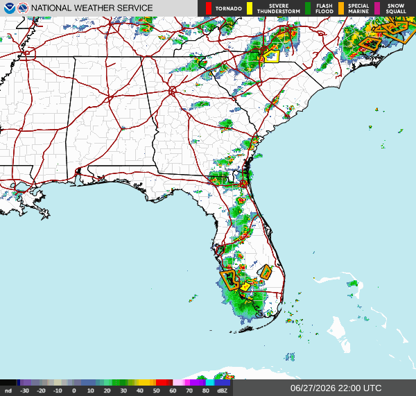
As this is being written, there are scattered showers and thunderstorms in Central TN, GA, and FL moving east-southeast. There is a special marine warning in Palm Beach, FL, and a severe thunderstorm warning in Duval, FL.

Tonight
Very brief isolated showers in most of our region. Quiet and clear night for Eastern TX, LA, AR, MS, AL, and GA. Scattered showers and thunderstorms stretch throughout FL. Will start to clear out around 10 pm. Showers and thunderstorms rolling into Northern TN around 8 pm, moving southeast. Will remain during the nighttime and morning hours.
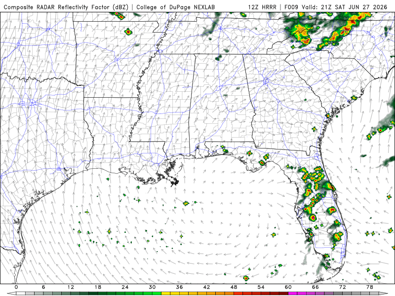
The showers and thunderstorms will bring up to 4 inches of rain or more in some areas. Majority of TN is under a slight risk for excessive rainfall, meaning scattered flash flooding is possible.
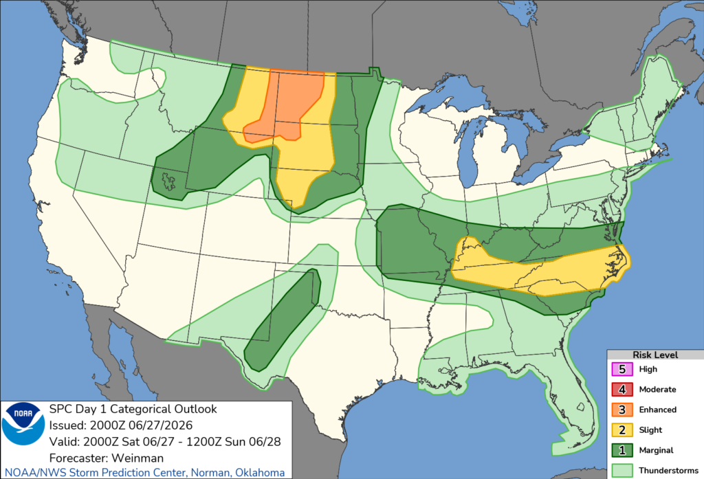
Most of TN and part of Northeastern GA is under a slight risk for severe weather, meaning scattered, short-lived thunderstorms with strong, damaging winds possible. Could also see 1 or 2 tornadoes.
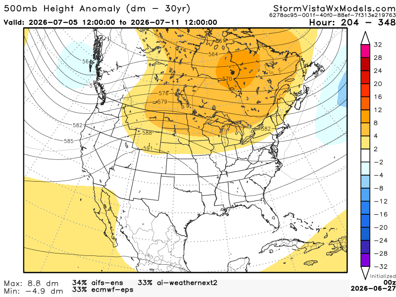
Extended Regional Outlook
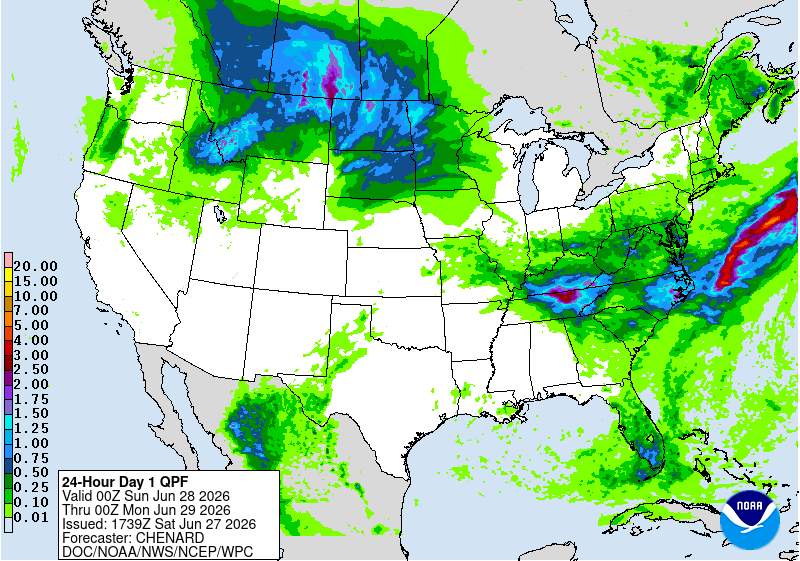
The CPC outlook has our region experiencing above-average temperatures and precipitation from July 5th to July 11th.


Below, we have 3 of the most accurate models blended into one model. This model gives us an idea of the possible outcome from July 5th to July 11th (7 am). Based on this blend of models, the Southern region will see above normal temperatures. Gulf moisture remains, so humidity will continue. Precipitation will be near normal or slightly above. Afternoon sea breeze thunderstorms are going to be the typical setup.
3 Day Traveling Forecast
KHOU – Houston: No weather is anticipated for the next 3 days!
KSHV – Shreveport: No weather is anticipated for the next 3 days!
KBTR – Baton Rouge: No weather is anticipated for the next 3 days!
KMSY – New Orleans: Slight chance for thunderstorms this afternoon. Possible delays at the airport due to lightning. No weather is anticipated for the next 2 days!
KJAN – Jackson: No weather is anticipated for the next 3 days!
KBHM – Birmingham: No weather is anticipated for the next 3 days!
KMOB – Mobile: No weather is anticipated for the next 3 days!
KATL – Atlanta: Slight chance for thunderstorms all 3 days. Possible delays at the airport due to lightning.
KTLH – Tallahassee: Slight chance for thunderstorms today and Monday. Possible delays at the airport due to lightning.
Today’s Interstate Forecast
I-10: Mostly clear. Isolated showers and thunderstorms are possible in Central FL around the evening till 10 pm.
I-20: Clear.
I-49: Clear.
I-55: Scattered showers and thunderstorms around the evening near the TN/ KY border. Should clear up around 10 pm. Isolated shower near the MS/ LA border around 7 pm. Will last only about an hour.
I-59: Clear.
I-65: Severe thunderstorm near Northern TN around 10 pm. Will remain throughout the night into the morning.
I-75: Scattered showers and thunderstorms stretching through FL. Will start to clear up around 10 pm.
3 Day City Forecast
Houston, TX: Sunny with highs in the mid-90s. Mostly clear nights with lows in the upper 70s to lower 80s. Windy. Gusts near 20 mph.
Shreveport, LA: Hot with highs in the mid-90s. Mostly clear nights with lows in the upper 70s. Breezy. Gusts near 20 mph tonight.
Baton Rouge, LA: Hot with highs in the mid-90s. Mostly clear nights with lows in the mid-70s. Relatively calm winds.
New Orleans, LA: Mostly cloudy today. Sunny the next 2 days. Currently under a heat advisory. Highs in the mid-90s. Mostly clear nights with lows in the upper 70s. Relatively calm winds.
Jackson, MS: Mostly sunny with highs in the mid-90s. Mostly clear nights with lows in the mid-70s. Relatively calm winds.
Birmingham, AL: Mostly sunny with highs in the mid-90s. Mostly clear nights with lows in the mid to upper 70s. Relatively calm winds.
Mobile, AL: Sunny with highs in the mid-90s. Mostly clear nights with lows in the mid-70s. Relatively calm winds.
Atlanta, GA: Slight chance for thunderstorms all 3 days. Highs in the lower to mid-90s. Mostly clear nights tonight and Sunday. Slight chance for thunderstorms Monday night. Lows in the mid to upper 70s. Relatively calm wind. Gusts near 20 mph today and Sunday.
Tallahassee, FL: Slight chance for thunderstorms today and Monday. Mostly sunny Sunday. Highs in the mid to upper 90s. Mostly clear tonight and Sunday. Slight chance for thunderstorms Monday night. Lows in the mid-70s. Relatively calm wind.


