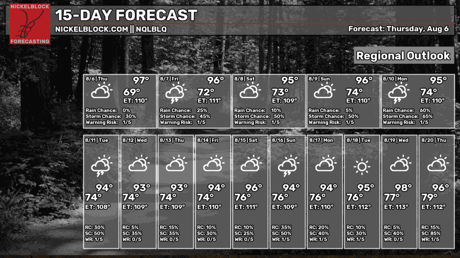
With the summer coming to a close, how will the weather treat our final few weeks? Over the next few days, we will see mid-to-upper 90s with chances of showers and thunderstorms every day. How about mid-August? Well, we may be trapped in a heat dome and experience less rainfall.


Today
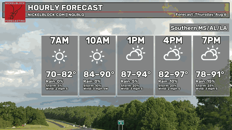
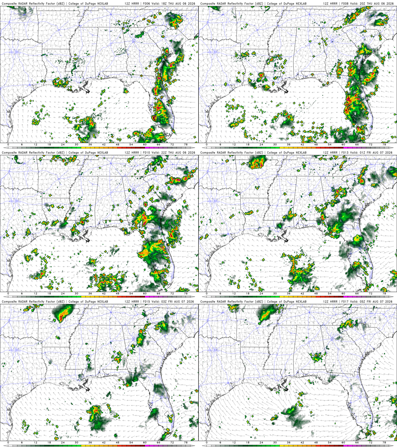
Last week, there was a short lived relief of temperatures in the upper 80s after a cold front passed through the Deep South. Now, we are back to warm and sticky conditions. The high will be in the upper 90s around late afternoon. The chance for rain and showers will increase as the day progresses. Calm winds are coming out of the south-southwest at around 3 mph.
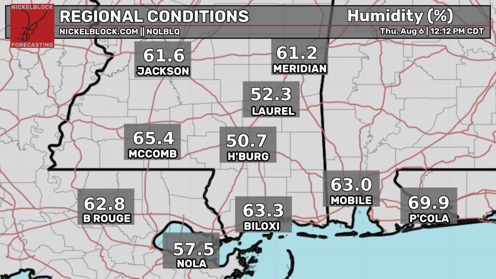
The humidity is in the 60% range in some areas, higher in localized areas.
During the afternoon into the early evening, scattered showers and thunderstorms will be prevalent in LA and southern MS. Possible isolated late afternoon storms in southern AL as an area of high pressure just offshore the FL Panhandle feeds Gulf moisture onto the coast.
Tomorrow
Seeing a similar pattern to today, with warm, muggy conditions. Tomorrow, calm winds are coming out of the south-southeast.
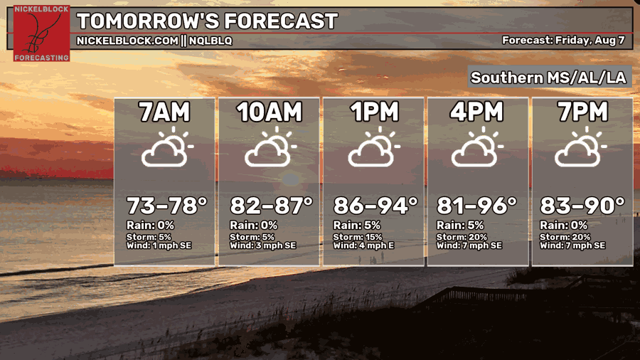
Scattered showers and thunderstorms could be seen tomorrow around the afternoon into the early evening, the typical summertime setup here in the south.
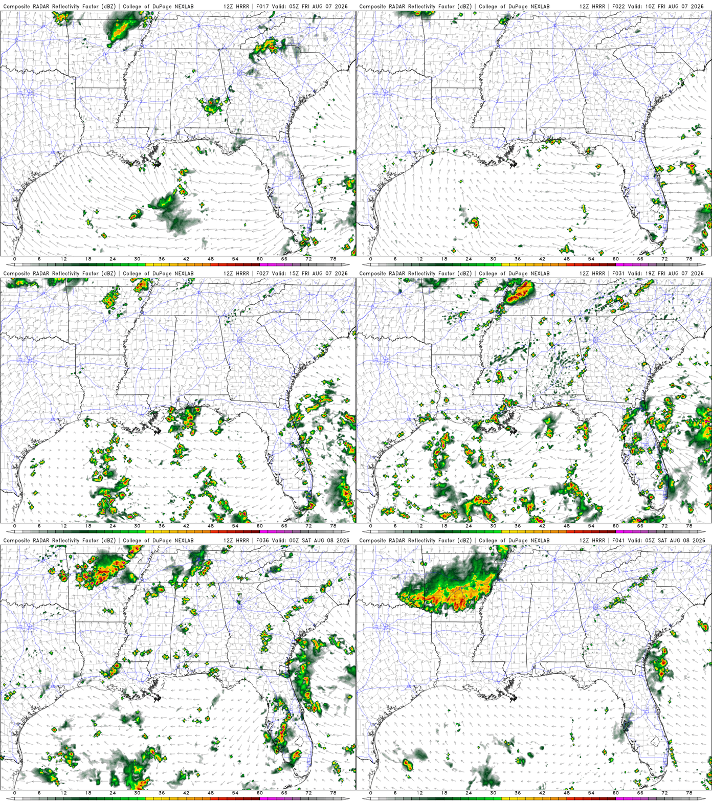
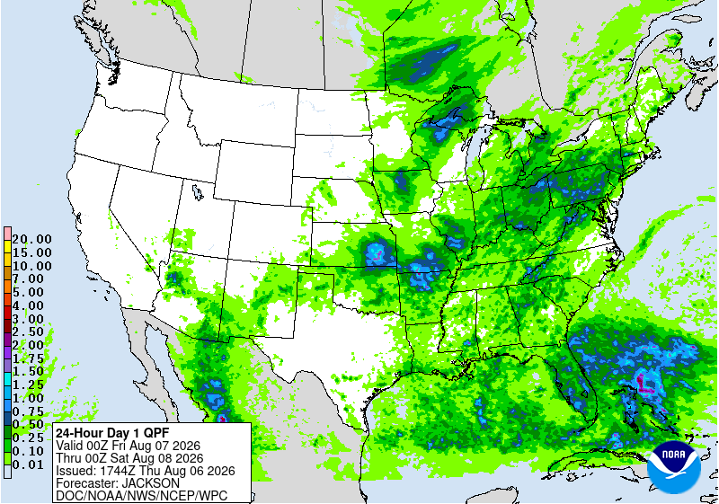
Heavier rainfall looks to be just off the coast of the FL Panhandle and coastal LA. There is also a small hotspot near Hattiesburg, MS.

Saturday
Another day of warm weather. The high will be around the mid-90s, with the highest chances of rain and showers during the late afternoon. The start of the day will feel slightly cooler since that NW wind will pull cooler, drier air into our area, so less humidity. By the afternoon, the wind will shift and begin pulling warm, moist air onshore. This is why the highest chances of rain and showers will be around late afternoon.
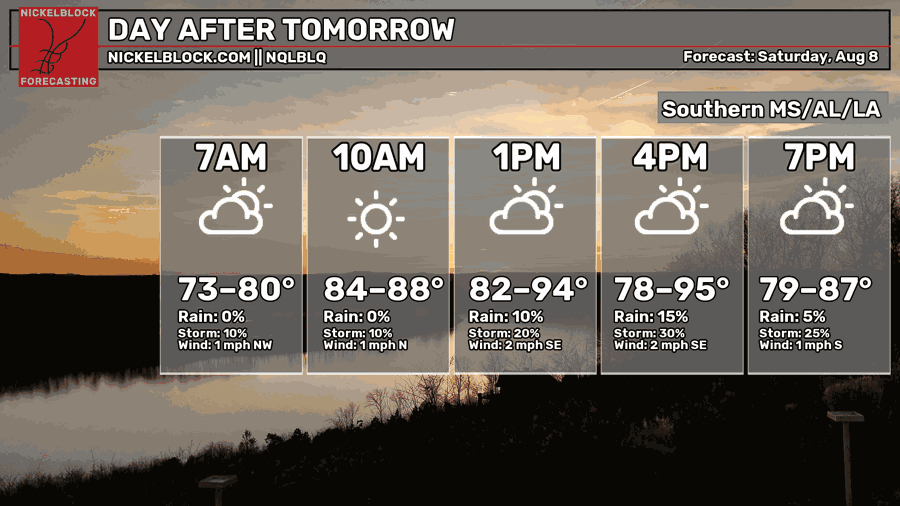
The rain and storms will possibly be more isolated or scattered around the coastal areas. No concerns for localized flooding or heavy rainfall as of now.

Extended Forecast
The CPC outlook indicated that our area would experience above-average temperatures and slightly below-average precipitation.


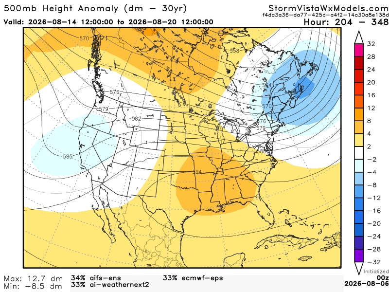
This 500mb height anomaly model is a blend of the 3 most accurate models over the past 7 days. The model runs from August 14, 7 am to August 20, 7 am. Based on the blend, I would agree with CPC. Our area has a strong positive anomaly, meaning warmer temperatures and less precipitation. A positive anomaly is associated with sinking air, making it unfavorable for precipitation and creating a heat dome over the area.