Weak cold front to bring rain in South, spotty rain and snow in New Mexico and Northwest, central US to warm up later in the weekend: CONUS Friday-Sunday forecast – 11/9/2023

Temperature estimate 3 PM CST Friday according to HRRR model // Courtesy: Pivotal Weather

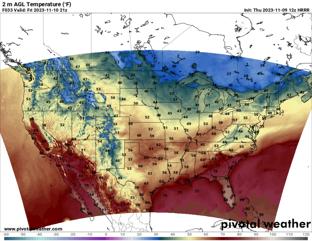
Heading into the weekend, a weak cold front will make its way across the southern states over the next day or two. Much of the South will experience precipitation over the weekend as the front moves through.

Radar reflectivity estimate 8 AM CST Friday according to HRRR model // Courtesy: Pivotal Weather

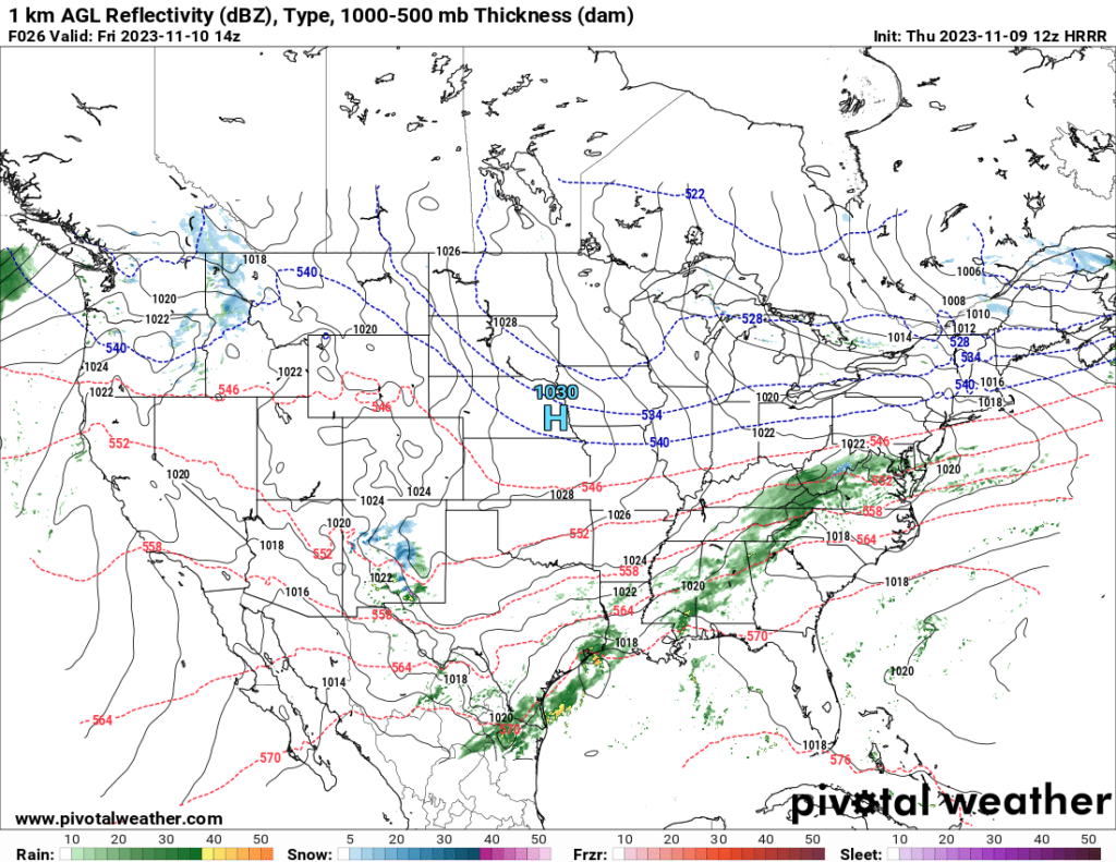
Precipitation is also likely over the Northwest this weekend, with scattered rain or snow showers depending on elevation. Some areas in New Mexico will also see snow on Friday. Meanwhile, southern Texas will see frequent precipitation throughout the weekend as the front stalls around the Gulf Coast.

500 mb height and wind estimate 6 PM CST Sunday according to NAM model // Courtesy: Pivotal Weather
Temperature estimate 3 PM CST Sunday according to NAM model // Courtesy: Pivotal Weather

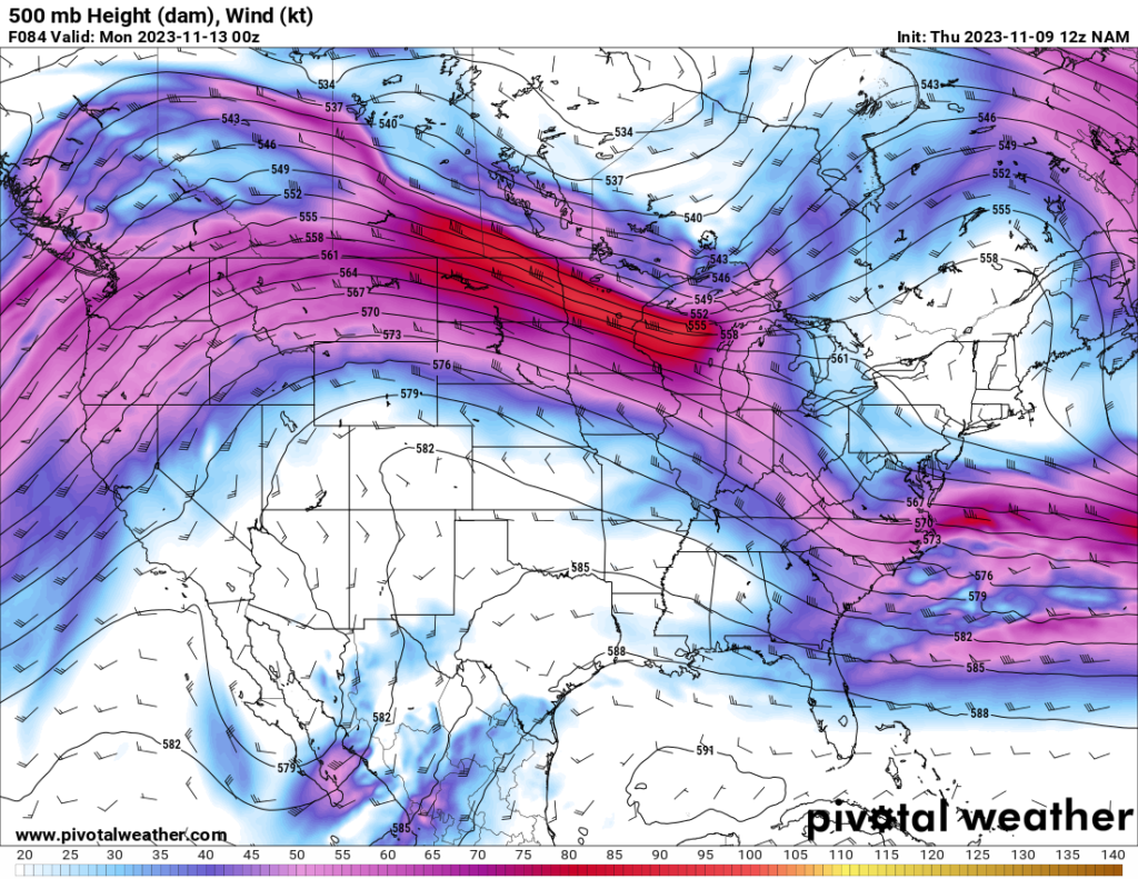
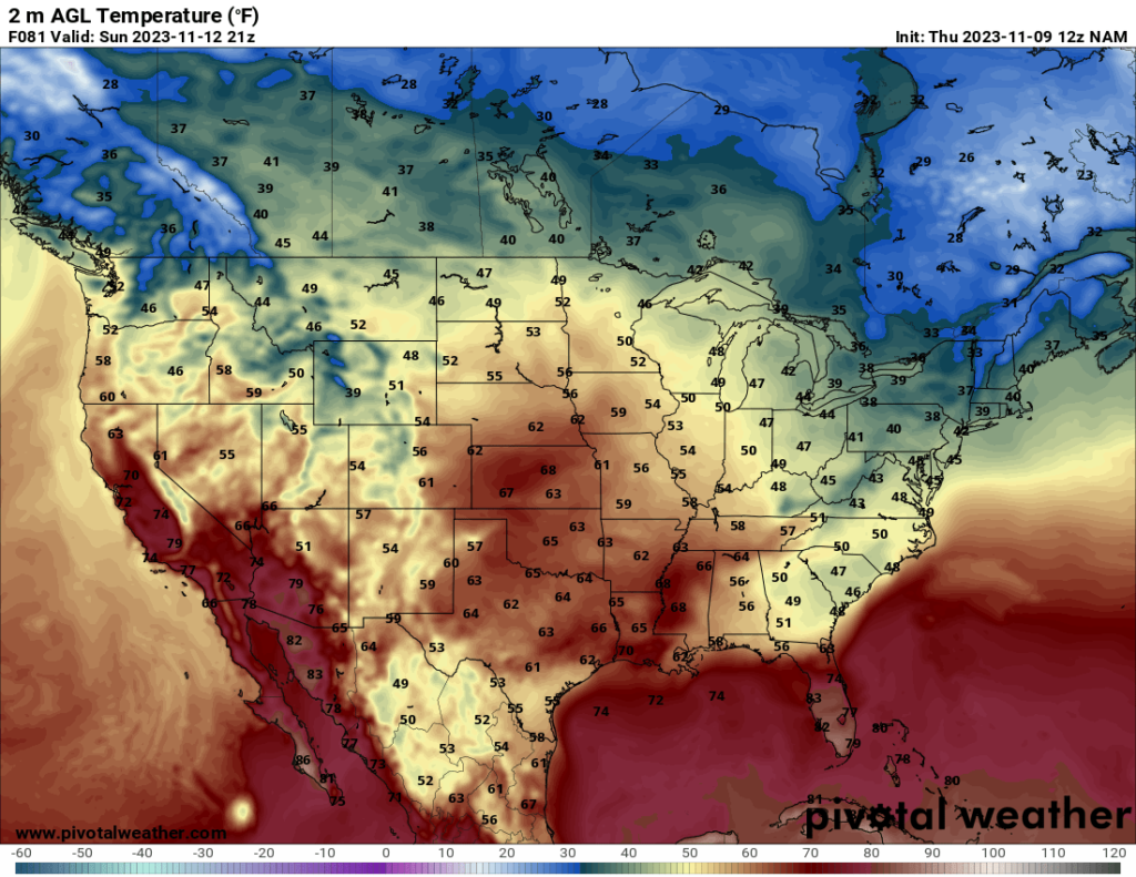
Towards the end of the weekend, the Plains will start to warm up as a ridge moves across the middle of the country. Sunday in particular will have pleasant temperatures for much of the central US along with mostly sunny skies.


Author of the article:


Patrick Kulynych

I am a recent graduate from the University of Alabama in Huntsville with a Bachelor's Degree in atmospheric science. My focus is on forecasting, especially for severe weather events. It is my dream to one day live out in the Great Plains, where I can not only forecast as a career but also go out and chase storms as a hobby!