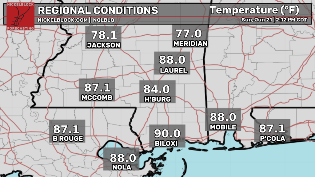
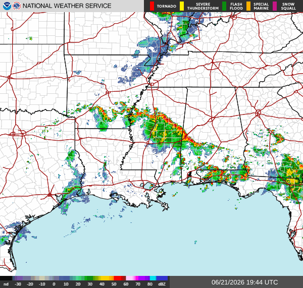
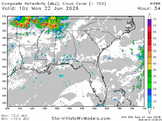
Good afternoon! Happy Father’s Day and happy first day of astronomical summer! As I’m writing this at 3p CDT, temperatures are generally in the upper 80s and lower 90s along the coast, with cooler temperatures up north near Jackson and Meridian due to a line of storms headed northeast.
There are also some scattered storms in the Florida panhandle and the FL/AL border, near Andalusia, AL, currently.

Tonight
These storms will continue to head northeast this afternoon and evening, reaching the Birmingham area by 6 tonight. After 6, these storms will begin to weaken, and should be mostly fizzled out by 8. The storms in the Florida panhandle should also be mostly gone by 8 tonight. Thunderstorms will bring heavy rain, gusty winds, and lightning.
Rainfall totals will be light for most people, however isolated areas could receive up to 3″ of rain.
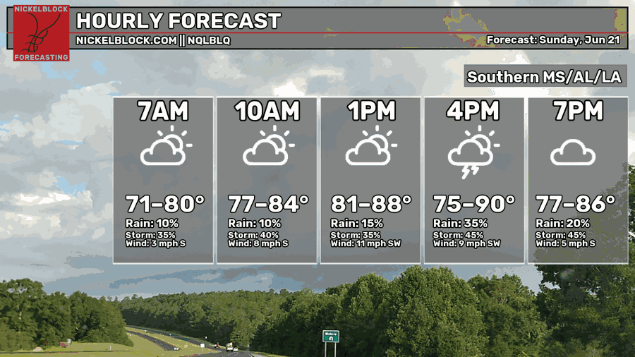
Like usual, temperatures will fall this evening going into tonight. Generally temperatures will be in the mid to upper 70s, depending on where you are. Areas closer to the coast will only drop into the upper 70s, while the area north of Meridian and most of Alabama except for Mobile, will drop into the mid 70s.
Tomorrow
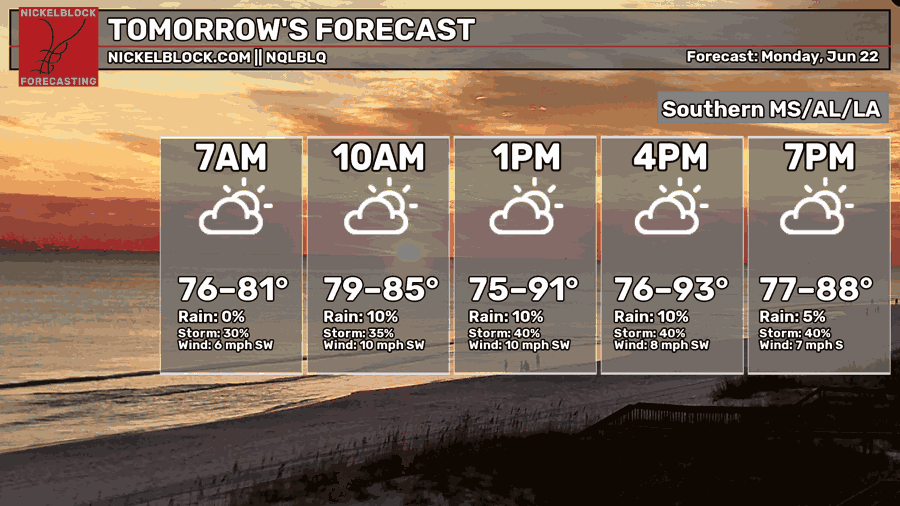
Moving into tomorrow, we’re expected to see high temperatures that will range from the mid 70s to the low 90s. This is due to a line of storms from the north which will pass through the area during the day tomorrow. Highs further south near the coast will be able to get hotter into the 90s, while areas further north may not get as hot.
This line of convection will cross into northern Mississippi from Tennessee tomorrow. By the early afternoon, they’ll be in the area between Monroe, Jackson, Meridian, and Birmingham. They’ll continue to move south, reaching the coast after dark, but by then they will have weakened significantly.
These storms will bring heavy rain, gusty winds, and lightning. Rainfall totals will generally be in the half an inch to an inch range, but localized areas may receive 2-3″ of rain.
Tuesday
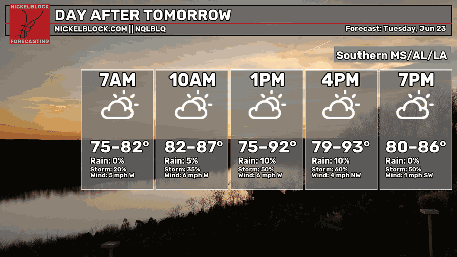
Heading into Tuesday, you can expect high temperatures that will range from the low 80s to the low-mid 90s. Morning low temperatures will generally be in the mid-upper 70s, with warmer temperatures closer to the coast.
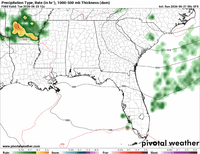
On Tuesday, there is again a chance of scattered showers and storms. The GFS model is suggesting thunderstorms will develop in the afternoon and evening throughout the area. The GFS is also hinting at a line of storms that will move into Mississippi from Arkansas on Tuesday morning, with the line persisting throughout the day, eventually exiting off the coast of Florida by night.

Extended Outlook
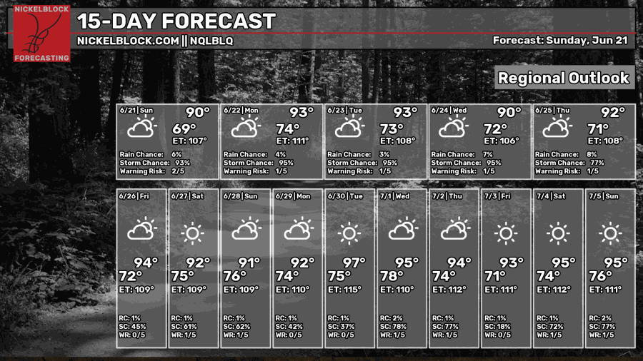
For the remainder of this week, temperatures will reach the lower-mid 90s in most places pretty much everyday. There is also a chance of thunderstorm each day, as is typical for summers in the deep south. After that, things look to get even hotter, with many days at the end of June and beginning of July being forecasted (right now) to see highs in the mid and even upper 90s.
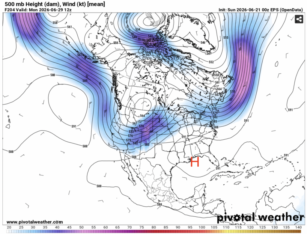
If you look at the mid-level atmospheric wind, this makes a bit more sense. At the end of June, an area of high pressure will be anchored directly over our area, with a trough of low pressure situated over the rocky mountains. While we have experienced our fair share of hot days this summer so far, the weather pattern forecasted to set up in late June and early July is much different than what we’ve experienced so far.
For that time period, the ridge of high pressure will be anchored directly over our area, with a trough of low pressure being anchored over the rocky mountains. The common pattern that we’ve seen early in the summer has been a ridge situated over the southwestern U.S., with the southeast getting in on only some of that heat. The upcoming pattern is much more conducive for excessive heat in our area.
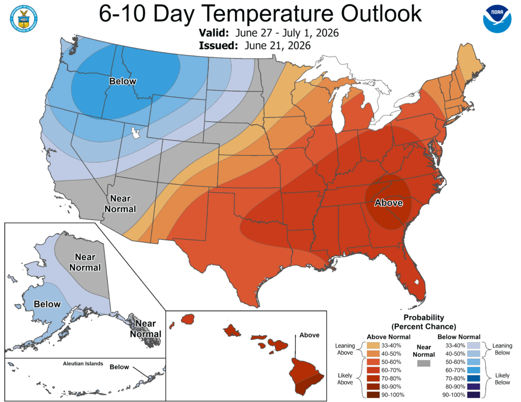
This is closely reflected in the climate prediction center’s forecast, which gives the southeast a high chance of seeing above normal temperatures from June 27-July 1.


