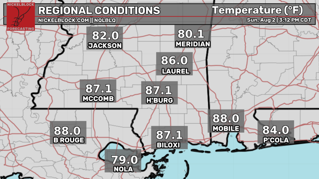
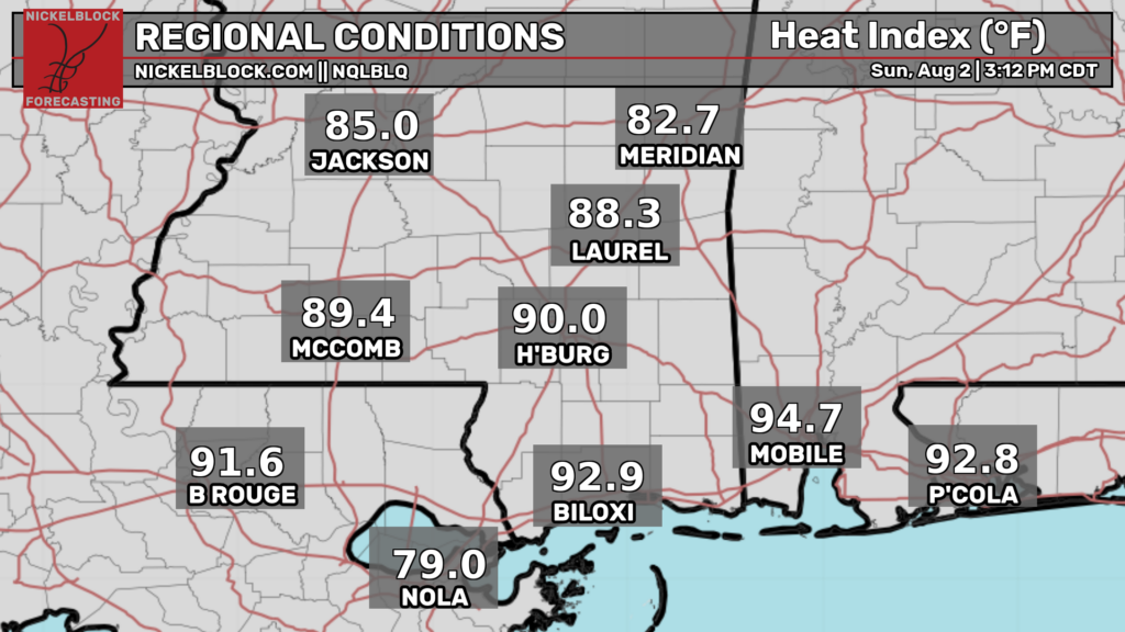
Good afternoon! As I’m writing this at 3:30p CDT, temperatures are actually pretty comfortable, in the mid-upper 80s for most places, decently below average for this time of year. Heat indices are a bit higher, but are in the tolerable upper 80s to lower 90s for most.
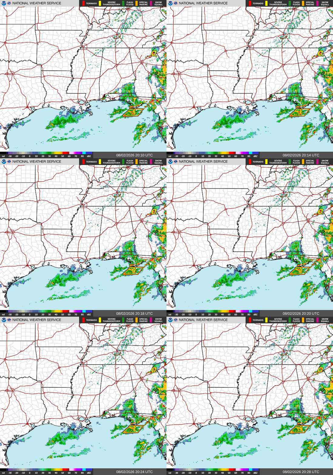
On our radar, things are relatively quiet to the west of the Florida panhandle, with pretty much nothing for Louisiana, Mississippi, and Alabama except in the extreme southeast corner. Over in the panhandle and the Tallahassee area, there are some northeast moving scattered storms and showers which have been in the area since yesterday. Be aware of flash flooding, gusty winds, and lightning.
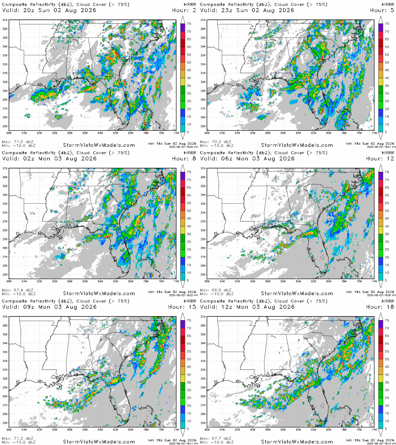
These storms will likely linger until the early morning hours of tomorrow in the FL panhandle, southern Georgia, and southern Alabama. Weather conditions further west in Louisiana, Mississippi, and in Alabama north of Mobile will be pretty nice tonight. Temperatures will drop into the 70s by night, and humidity won’t be too unbearable.

Tomorrow
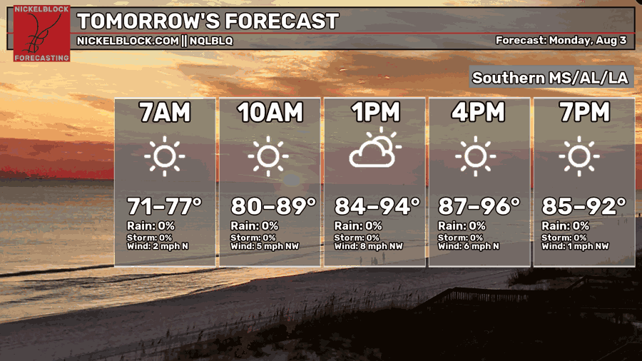
Moving into tomorrow, we’re forecasted to see afternoon high temperatures ranging from the mid 80s to the mid 90s, although I personally believe they will be cooler than that. Expect hotter high temperatures further to the west, in western Louisiana and eastern Texas, while high temperatures in the upper 80s will be more common in southeast Louisiana, Mississippi, Alabama, and the FL panhandle.
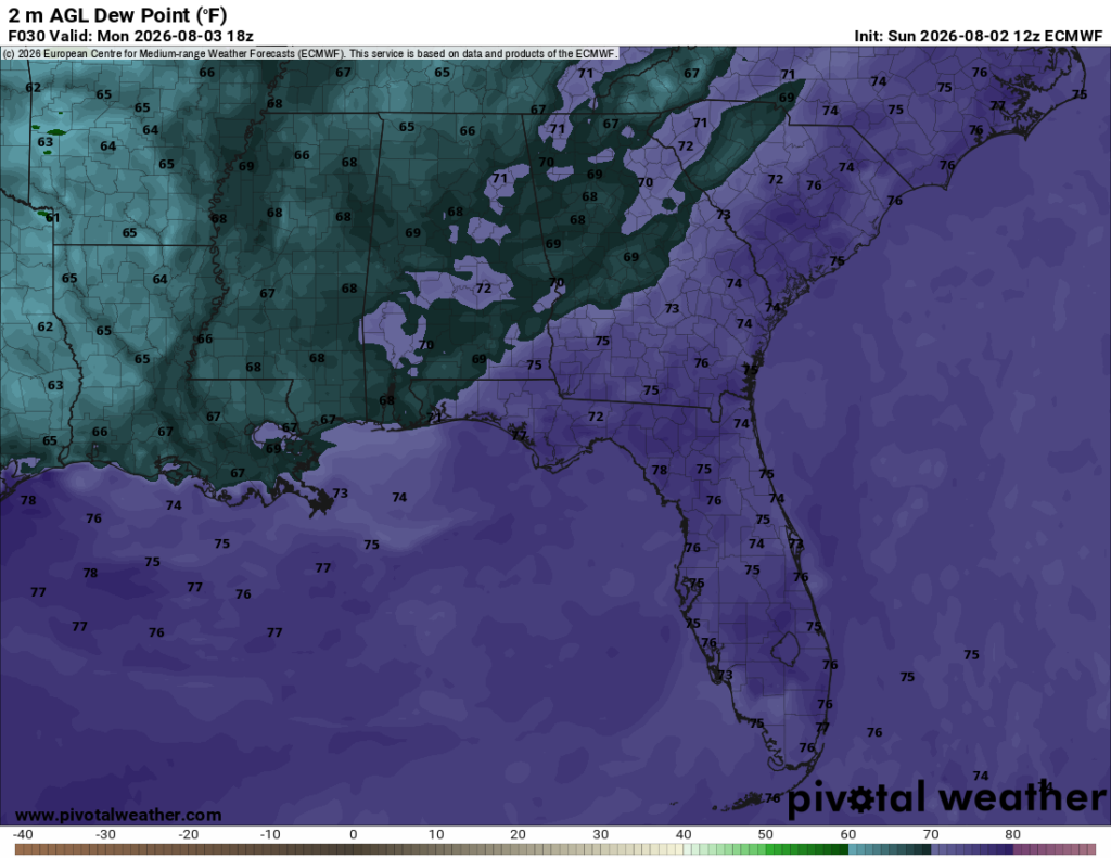
Dew point temperatures will also be a bit lower than normal tomorrow during the day. Dew points in the upper 60s can be expected, with lower dew points the further west you go, and higher ones the further east you go.
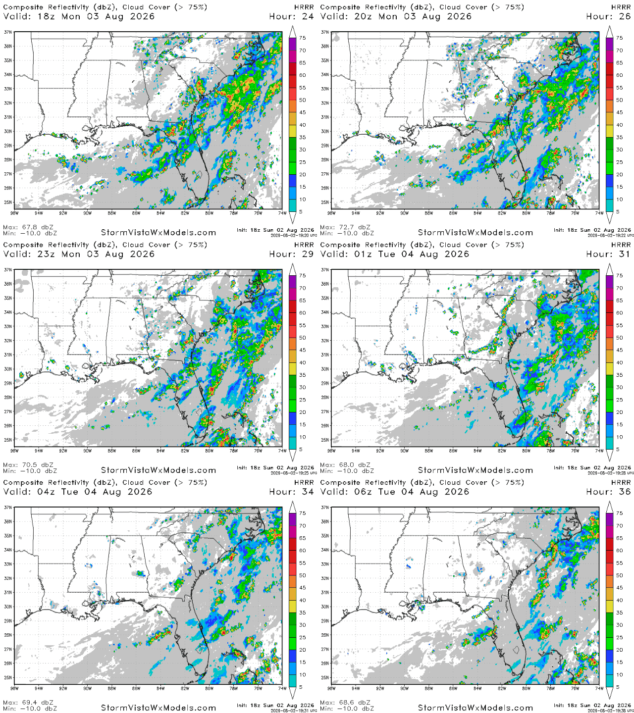
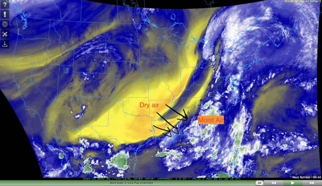
By tomorrow, a significant portion of our region will be behind the cold front passing through the area at the moment. This will allow for dry mid-level air currently situated over the southern great plains to make its way into our region.
As a result, little to no storms are expected to pop-up tomorrow evening in our area, a rarity for summer in the deep south.
Nerd Section:
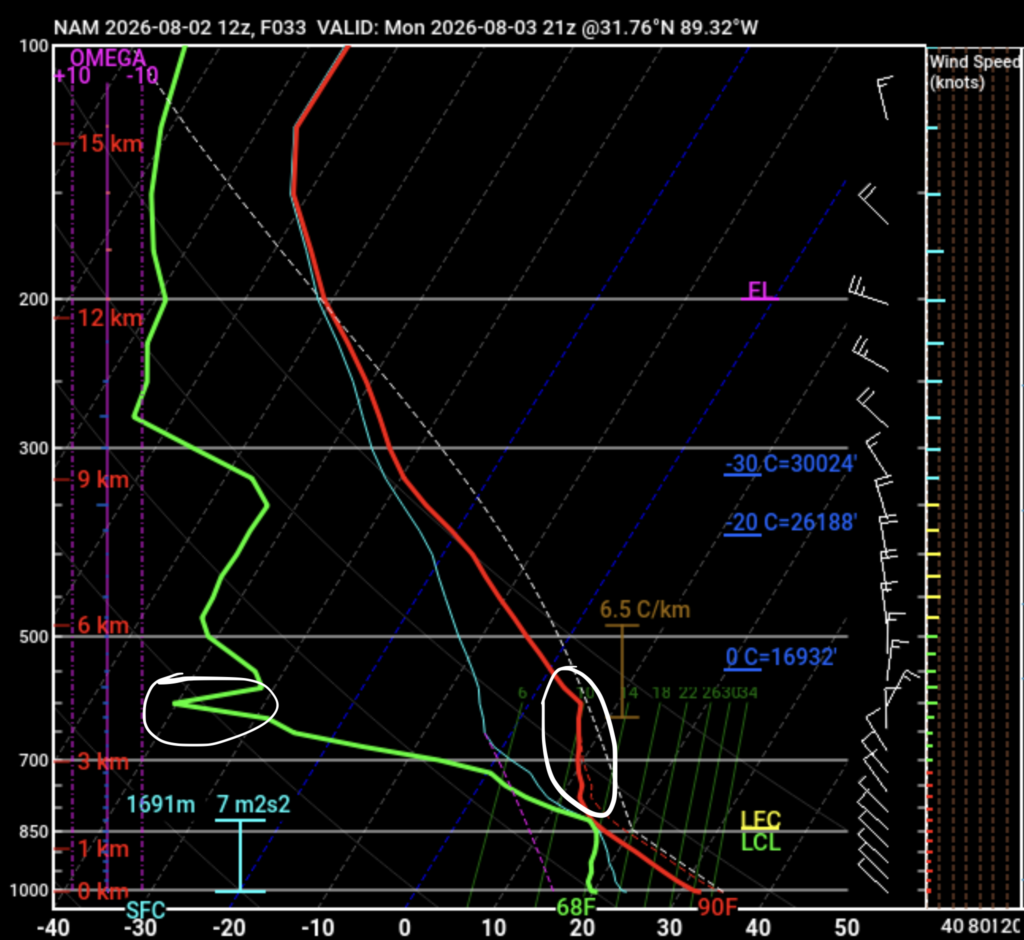
Let’s take a closer look at the vertical profile of the atmosphere tomorrow. In short, a strong inversion layer tomorrow evening will almost completely suppress thunderstorm development.
If you look between the 800 and 600 mb pressure level (numbers on y-axis on the left), you’ll see that the temperature (red line) does not change hardly at all. You’ll also see that the dew point (light green line) decreases significantly between those same two pressure levels. Both of these things mean that there is a layer of warm and very dry air between the 600 and 800 mb pressure levels.
Since warm and dry air is more dense than moist air, this means air in the mid-level atmosphere will be sinking, preventing moist air at the surface from rising, condensing, and turning into thunderstorms.
Tuesday
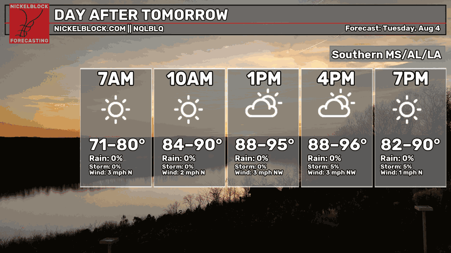
On Tuesday, we’ll probably see a slight rebound in afternoon high temperatures compared to today and tomorrow. Afternoon high temperatures will range from the upper 80s to the mid 90s on Tuesday, with morning lows bottoming out in the low-mid 70s.
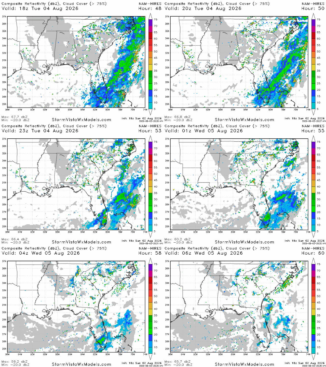
The dry air set to move into the region tomorrow will remain in place on Tuesday. Little to no storms are expected for our area on Tuesday afternoon and evening, making for nice outdoor weather. There may be a few light scattered showers throughout Georgia and eastern Alabama, but they certainly will not lead to significant rain accumulation or other impacts.
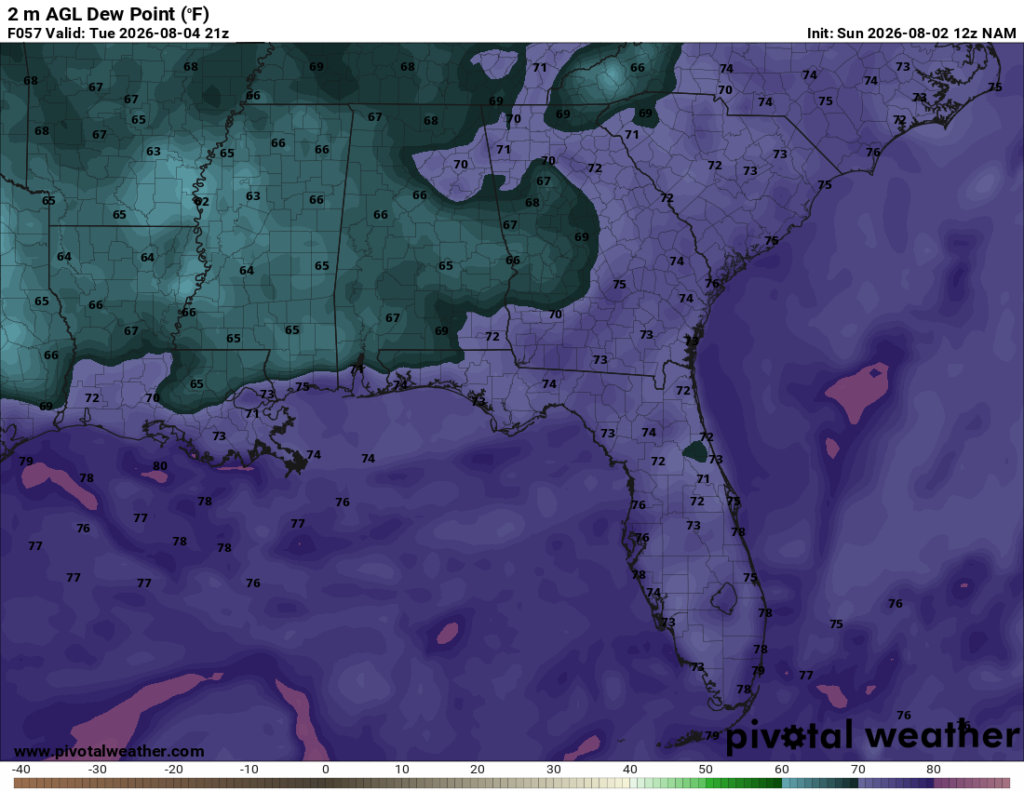
Similar to tomorrow, dew point temperatures will again be below normal during the afternoon for this time of year. Dew points in the low-mid 60s can be expected throughout Mississippi, northern Louisiana, as well as central Alabama.

Extended Outlook
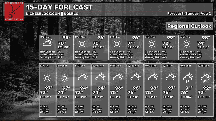
Throughout the next 2 weeks, temperatures are likely to remain very hot nearly everyday, in the mid and upper 90s. The humidity is also likely to increase again. One way you can tell is by looking at the daily low temperature. Days with higher humidity are likely to see warmer overnight low temperatures as moist air can store daytime heat much more effectively than dry air.
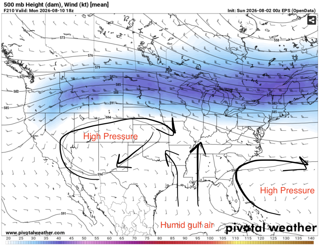
The cutoff low originally over Illinois that has made its way south bringing us dry and cooler air is not here to stay, sadly. Within the next week, a new pattern where our area is stuck between two ridges will emerge. A ridge situated over the subtropical Atlantic ocean will steer humid Gulf air into our region, while a ridge situated over the southwest will prevent any intrusions of cooler air from up north.
Expect more hot and humid conditions as well as daily thunderstorms.
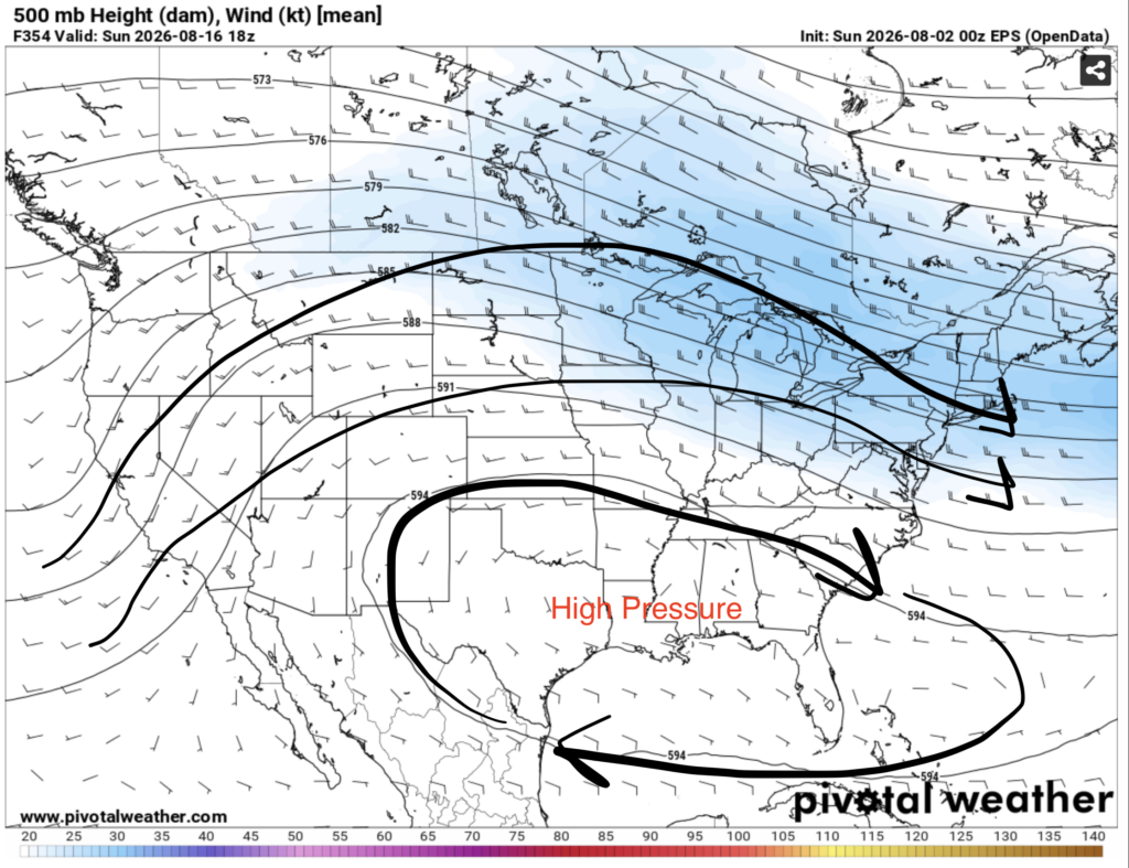
Fast forward a few days and the pattern changes again. In the mid-August period, ridging shifts to the east, and the ridge is now centered directly over the deep south. Patterns like this usually lead to above normal but not terribly hot temperatures, and precipitation that’s well below average.
While mid August is still around 2 weeks away, and the accuracy of the models is more questionable, it’s still a tool we can use to try and predict large-scale weather patterns that will occur.
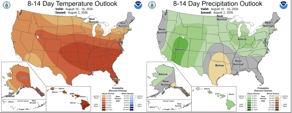
The NOAA CPC is currently giving us a very decent chance of seeing above normal temperatures in the August 10-16 period. They’re also forecasting that our area will see near normal precipitation during the same time period.


