The SPC currently has areas north of I-20 under an enhanced risk (3 out of 5) and areas south of I-20 under a slight risk (2 out of 5) for severe weather.
A series of shortwaves are developing over the Ozarks this evening which will bring us a chance for severe weather after sunset. The system will be moving into northern Mississippi near 7 o’clock and will reach I-20 by midnight. The Pinebelt will be affected around midnight until 3-4 am. A second system developing further west towards the Louisiana/Mississippi border in southwest Mississippi will arrive closer to sunrise and remain until mid-morning with some leftover rain.

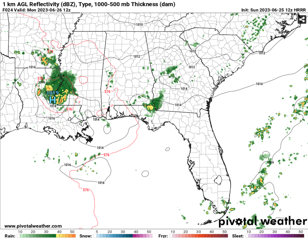
Our main concerns for tonight and tomorrow will be high winds and hail. Both rounds of storms contain these parameters. Areas further north with the first round will see the higher chance of the severe weather, however, the Pinebelt will also see some chances of severe storms with this system with some of the leading edge storms.
Looking at the Skew-T’s, it definitely looks possible for straightline winds to be a problem. There is enough mixing between the surface and the mid-levels to allow for strong winds. Some of the other Skew-T’s do support some hail formation, although I think this will be more limited compared to the high wind potential.
Keep in mind for the next few days there will be more chances for storms especially in the overnight hours, but the dangerous heat will be our main concern.
[wpcode id=”41179″]Regional Day-to-Day Forecast
This Afternoon – Sunny and hot, with a high near 97. Heat index values as high as 108. West southwest wind around 5 mph.
Tonight – A 50 percent chance of showers and thunderstorms before midnight into the early morning. Some of the storms could be severe. Increasing clouds, with a low around 76. South southwest wind around 5 mph becoming calm in the evening. Winds could gust as high as 25 mph. New rainfall amounts between a quarter and half of an inch possible.
Monday – A 30 percent chance of showers and thunderstorms after 7am. Mostly sunny and hot, with a high near 97. Heat index values as high as 110. Light west wind becoming west northwest 5 to 10 mph in the morning. Winds could gust as high as 20 mph.
Monday Night – A 20 percent chance of showers and thunderstorms. Mostly clear, with a low around 76. West northwest wind around 5 mph becoming calm in the evening.
Tuesday – A 30 percent chance of showers and thunderstorms after 1pm. Mostly sunny and hot, with a high near 98. Calm wind becoming west northwest around 5 mph in the morning.
Tuesday Night – Mostly clear, with a low around 77. West northwest wind around 5 mph becoming calm in the evening.
Wednesday – A 20 percent chance of showers and thunderstorms after 1pm. Mostly sunny and hot, with a high near 100. Light and variable wind becoming north northwest 5 to 10 mph in the morning.
Wednesday Night – Mostly clear, with a low around 76. South wind around 5 mph becoming calm in the evening.
Thursday – Sunny and hot, with a high near 102. Calm wind becoming west around 5 mph in the morning.
Thursday Night – Mostly clear, with a low around 79.
Friday – Sunny and hot, with a high near 103.
Friday Night – Partly cloudy, with a low around 76.
Saturday – A 20 percent chance of showers and thunderstorms. Mostly sunny and hot, with a high near 101.
[wpcode id=”41149″]


