Okay, okay, that’s enough April Fools for y’all. Here’s the real forecast!

Today
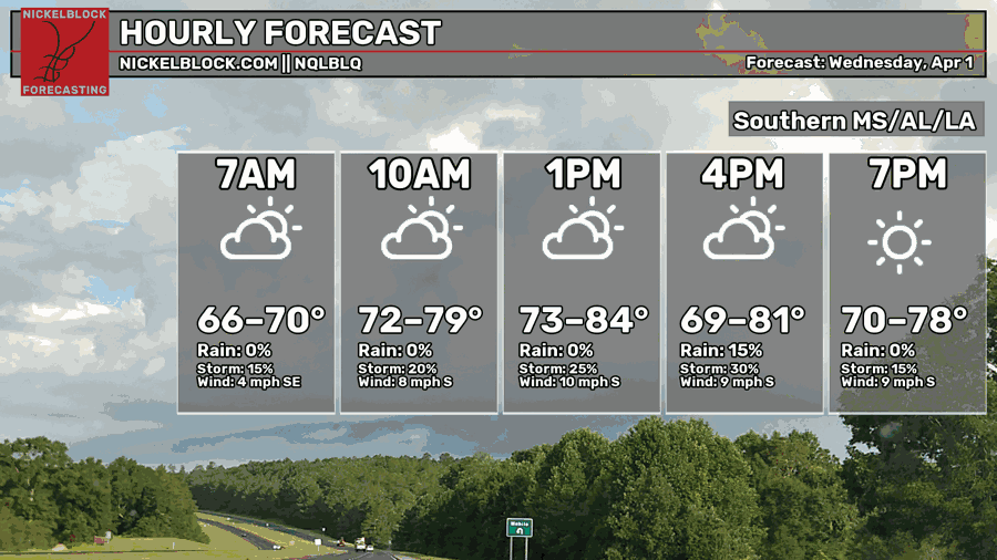
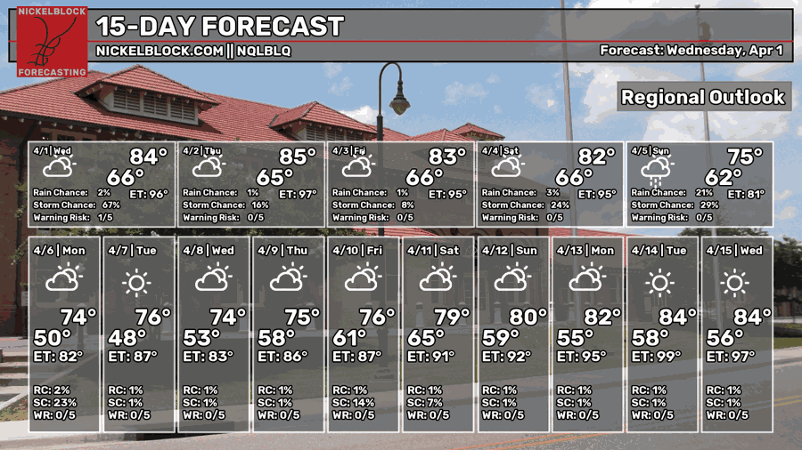
We started off pretty warm this morning with a low in the mid 60s and it’s going to stay warm and humid for the rest of the day. We’ll reach the low to mid 80s with winds out of the south and rain possible in the afternoon. A few scattered cells are likely across the Pine Belt, so keep your umbrella or your rain jacket with you! Lightning and heavy rain are possible.

Tomorrow
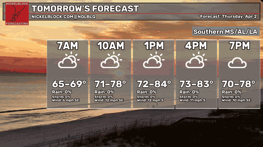
We’ll have another mix of clouds and sun tomorrow with temperatures in the low to mid 80s. Winds are pulling out of the south around 5-15mph. Rain chances are more limited compared to today as they retreat towards the west with an incoming cold front moving further north and pulling moisture with it. Areas of southwestern Mississippi can still expect some scattered rain and thunderstorms. That doesn’t mean we won’t see rain at all, but it’ll likely be more isolated. Overnight, we’ll go back into the mid 60s for the low.
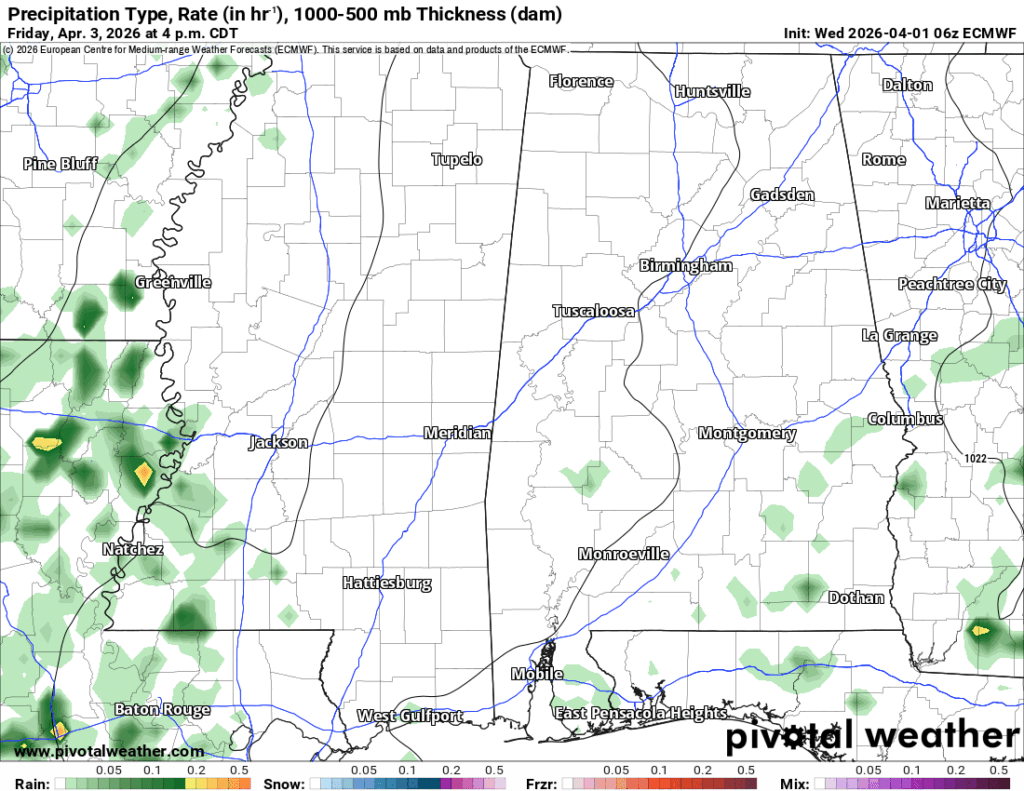
Friday
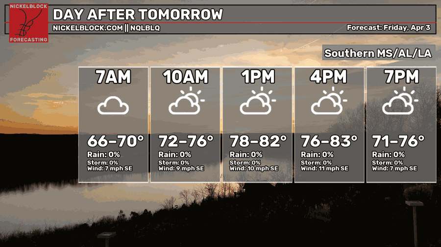
Friday is a similar setup to Thursday as the front I mentioned earlier begins to stretch thin as it moves into Ontario. This means that moisture will likely be relegated to the west near the Mississippi River with a few isolated storms in southeastern Mississippi. Otherwise, expect another partly to mostly cloudy day with temperatures in the low to mid 80s and a low in the mid 60s.
Easter Weekend
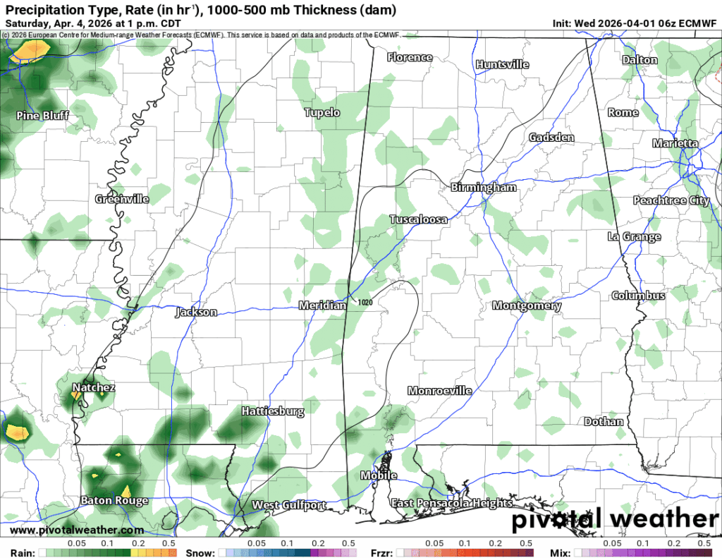
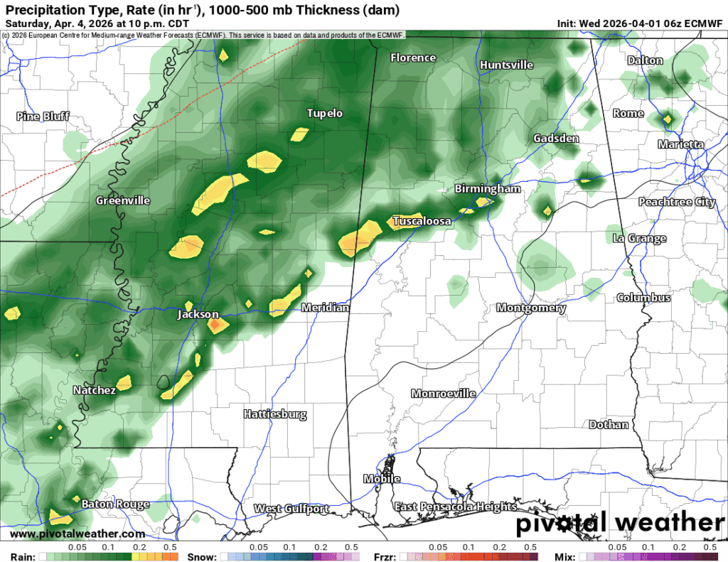
If you’re having an Easter Egg hunt, my recommended times would be Saturday morning or late Sunday afternoon. That’s not to say Saturday afternoon is a complete washout but expect some scattered thunderstorms in the afternoon. Afterwards, the main line is moving in during the overnight hours. So far, the Storm Prediction Center hasn’t placed any pre-emptive outlooks on this system, and looking at the Skew-T’s, it looks like it’s a limited convective event. Good news for us! It’ll likely be rain and a few thunderstorms.
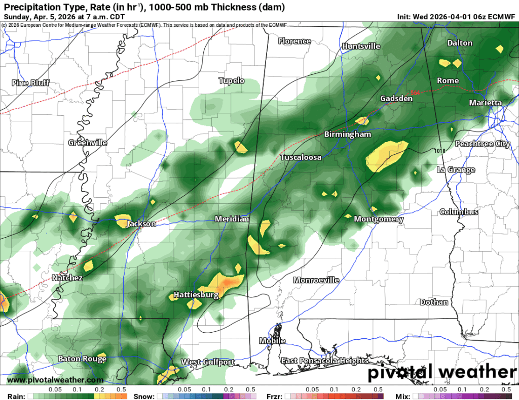
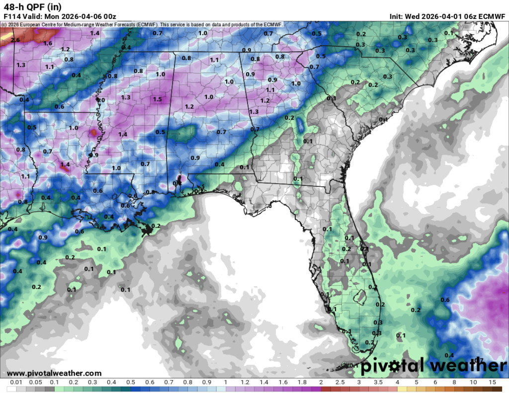
I will say that church will be a bit of a washout, however. Even if you’re dressed up in Spring colors, bring your jacket as it’s going to be raining for the next several hours, so grilling outdoors is possibly off the table too. The late afternoon will be a nice change as the high clouds exit with the front. Just keep that in mind if you have outdoor plans for this Easter!