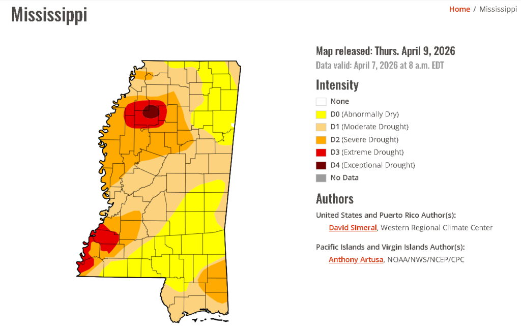
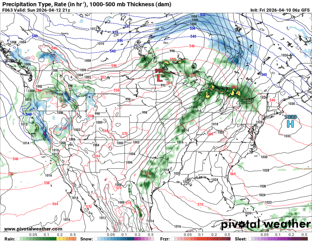
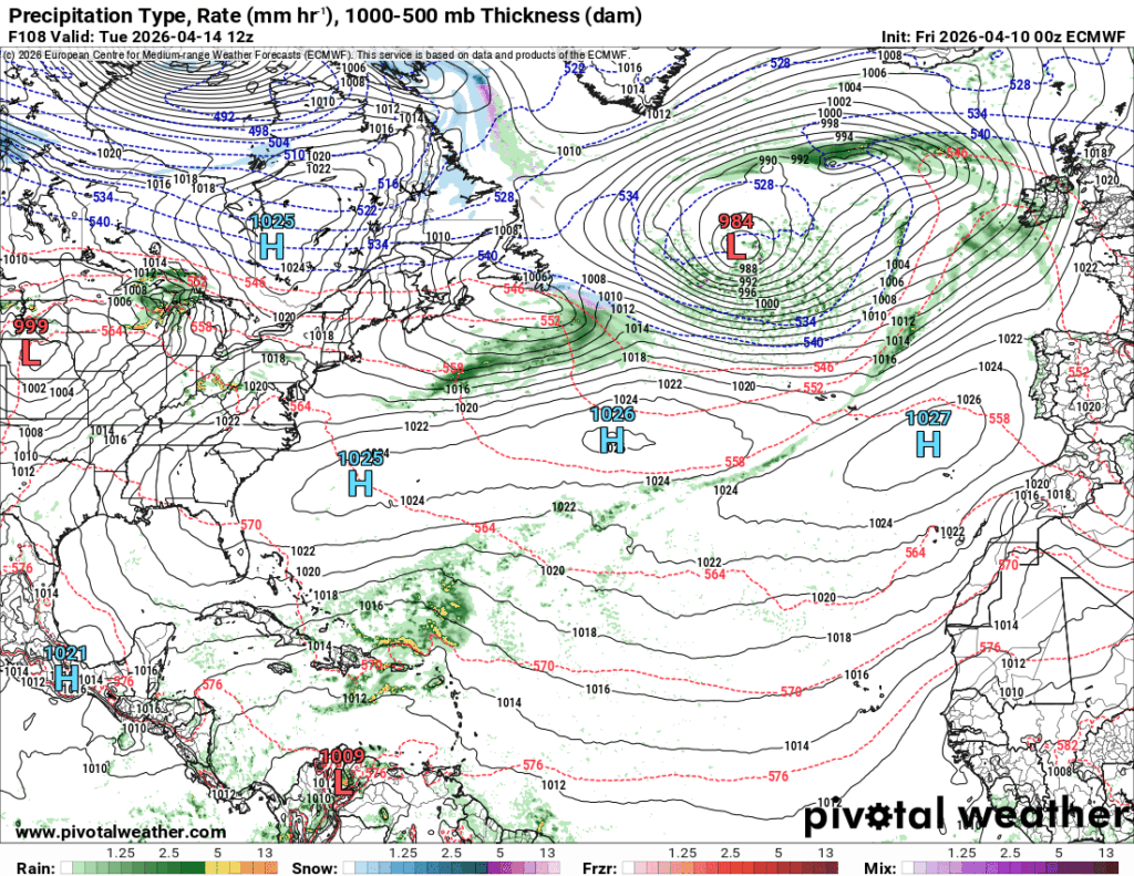
It’s still dry out there with no rain in sight! It looks like it’s going to stay that way for quite a while longer as a high pressure system keeps evolving and squashing our chances for rain. This system is quite large as it spans the entire Atlantic Ocean and later stretches across the ocean as one combined system. Otherwise, we’re going to warm up more next week with temperatures in the mid 80s and lows in the 60s.
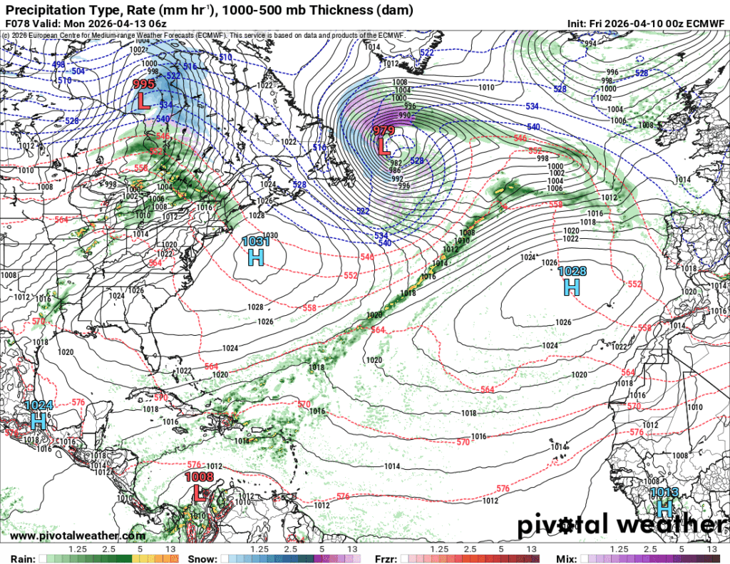
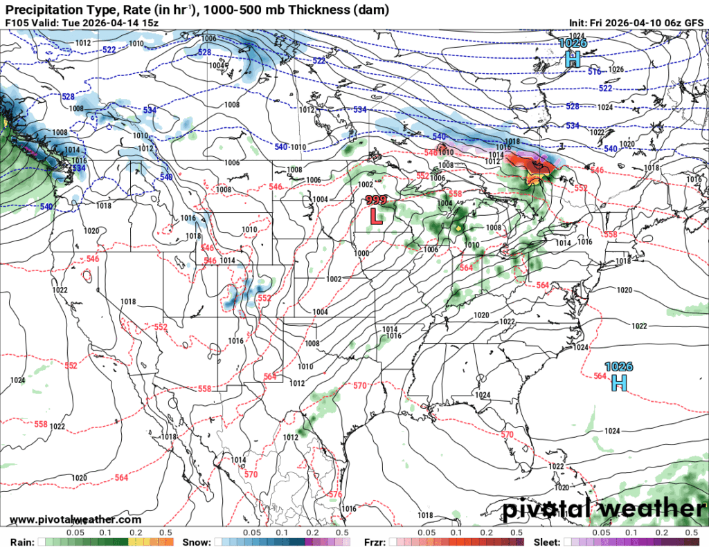
//Courtesy: Pivotal Weather

Today
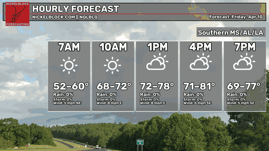
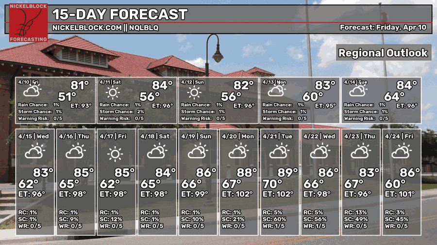
Starting off today, we reached the mid 50s with a cooler morning feel, however we’ll warm up to the low 80s. Winds will be calmer than yesterday out of the east and some upper level clouds will move in by this afternoon. Overnight, we’ll reach the mid 50s again, so tomorrow morning will feel somewhat cool.

Tomorrow
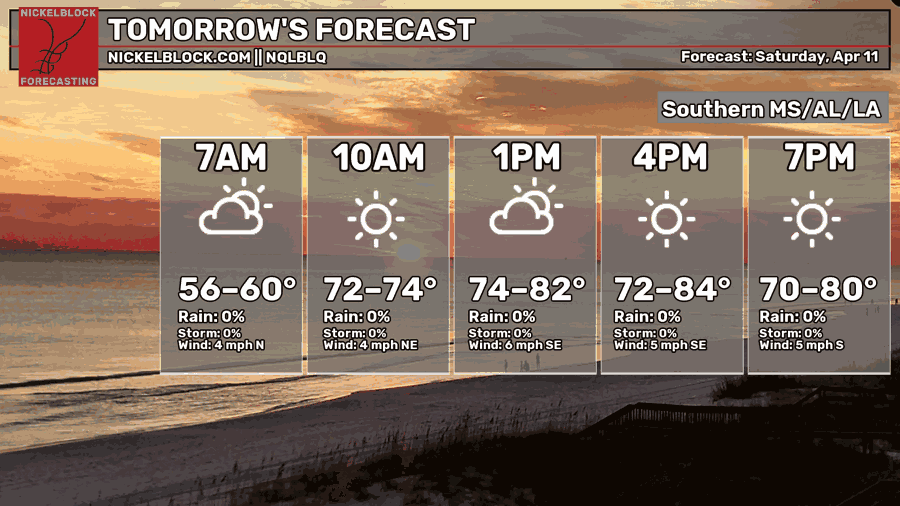
It’ll be another partly cloudy day tomorrow with a high in the low to mid 80s. If you’re out early in the morning for the Hattiesburg 5K like me (I’m only walking, my knees and ankles are destroyed), it’ll start off pleasant for a brisk walk or run! By the middle of the day, it’ll be pretty warm. Otherwise, a beautiful Saturday! Temperatures will fall into the mid 50s overnight.
Sunday
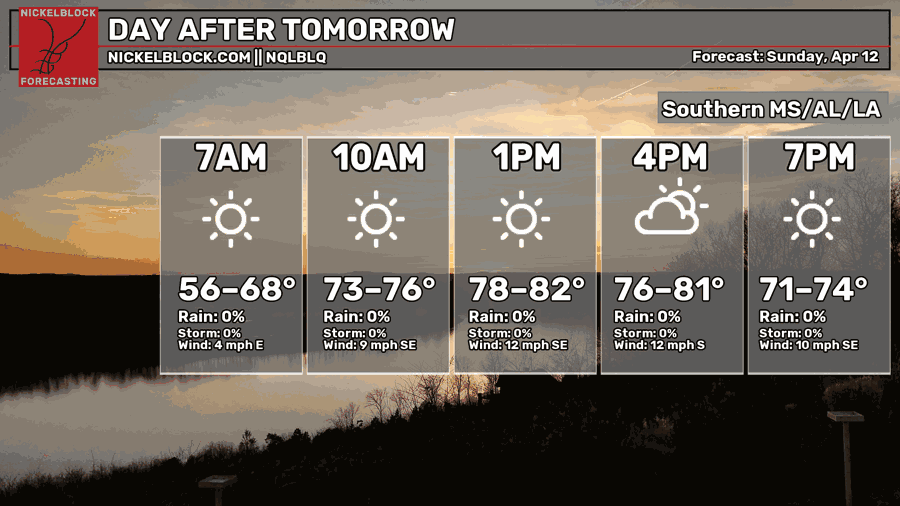
Sunday will be another beautiful day with a high in the low 80s and a few clouds in the sky. Winds will pick back up from the south and southeast around 5-15mph. Overnight, we’ll reach the mid 50s.
Next Week
We’ll plateau out during the week with temperatures hovering around the mid 80s for the average high. Low temperatures will increase from the low 60s to the mid 60s and remain there. We’ll have a few sunny and partly cloudy days during the week; however, rain chances will be very low as the high will basically suppress convection potential for most of the week. The next chance by the end of the week is still looking slim.
Extended Look
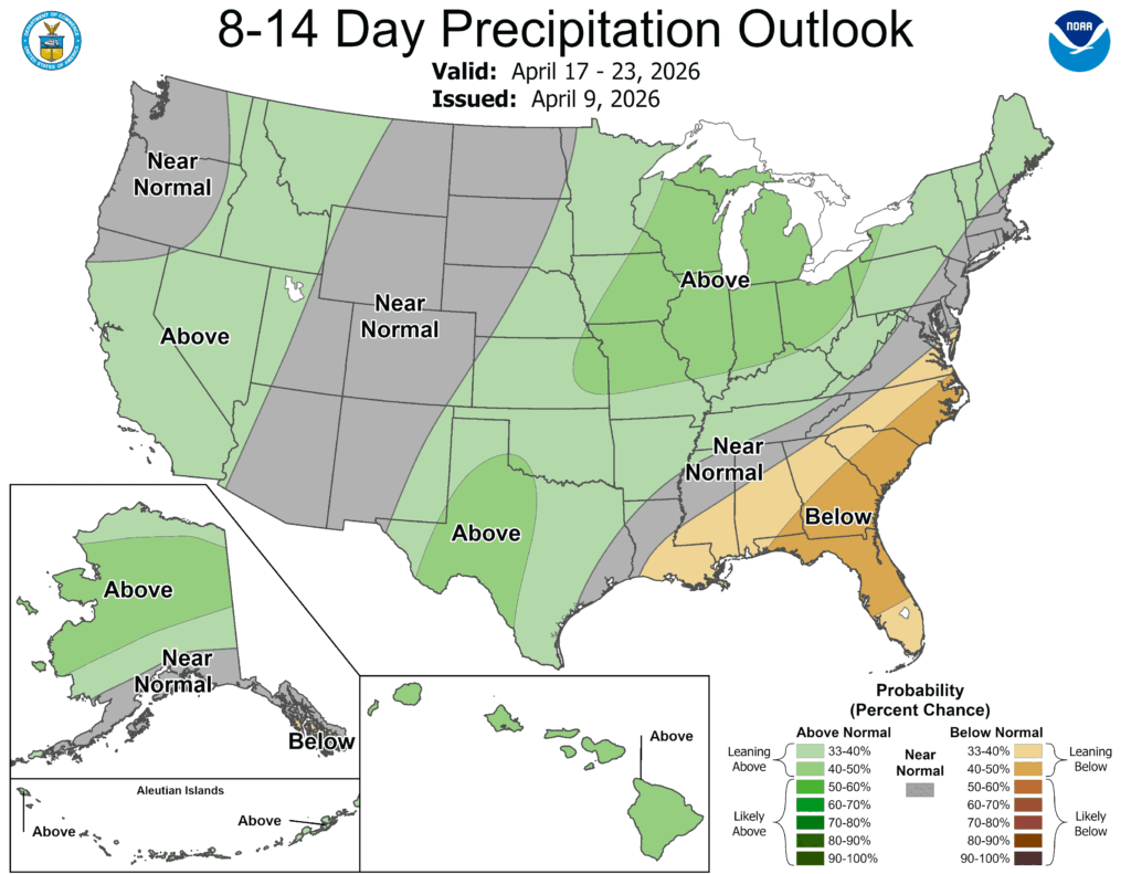
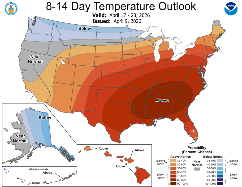
Keeping with the continuing below average precipitation/above average temperature trend, there’s not much of a surprise here. We’re stuck with the high pressure system in the Atlantic that’s still going to squash our rain chances. It doesn’t look like we have much of a chance until another 2 weeks from now as the high begins to squash and retreat, but it’s going to take several low pressure systems to move that Atlantic high back towards Greenland to bring us back to an equilibrium.