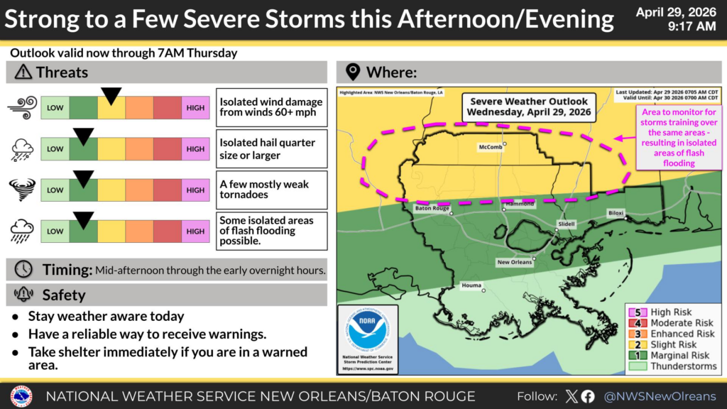
The cold front is moving in this evening, and with it, quite a few storms! While some of the storms in the Pine Belt may not be severe, areas north and west of us will see a band of severe cells develop. Afterwards, it cools down quite a bit! Rain is still likely for the next few days as the front moves slowly towards the Gulf.

Today
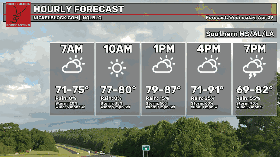
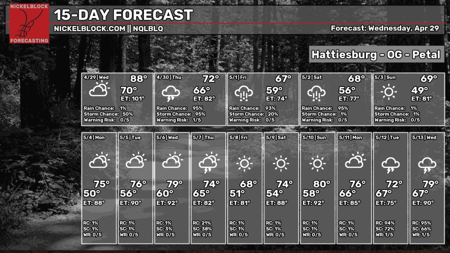
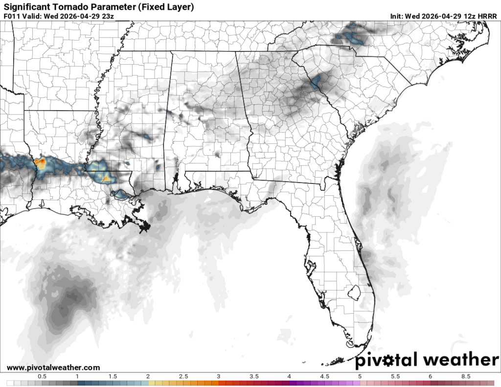
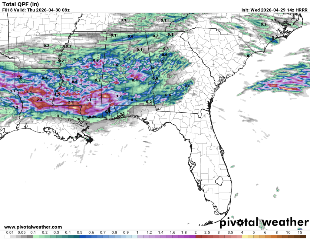
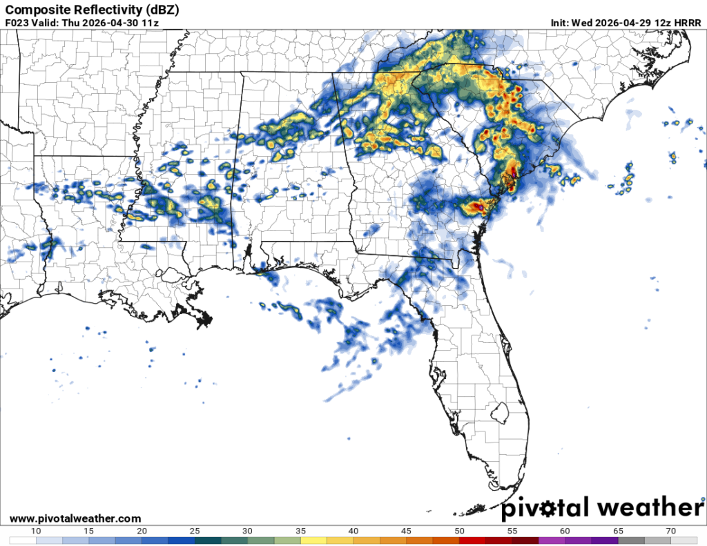
It’s going to be another warm and humid day today as the Gulf moisture pushes in ahead of the front. Highs will be in the upper 80s to around 90 today with winds out of the southwest. Storms will move in by the mid-afternoon with a few severe storms possible around the I-20 to Hwy 98 corridor. The severity of these storms will die down a few hours after sunset, but heavy rain is still expected. This looks mostly like a wind event, but a tornado can’t be ruled out with a few supercells showing on the composite reflectivity below. Afterwards, we’ll see a lot of rain over the next several hours. Rainfall totals range between 1-3.5” so we’ll get plenty over the next 18 hours.

Tomorrow
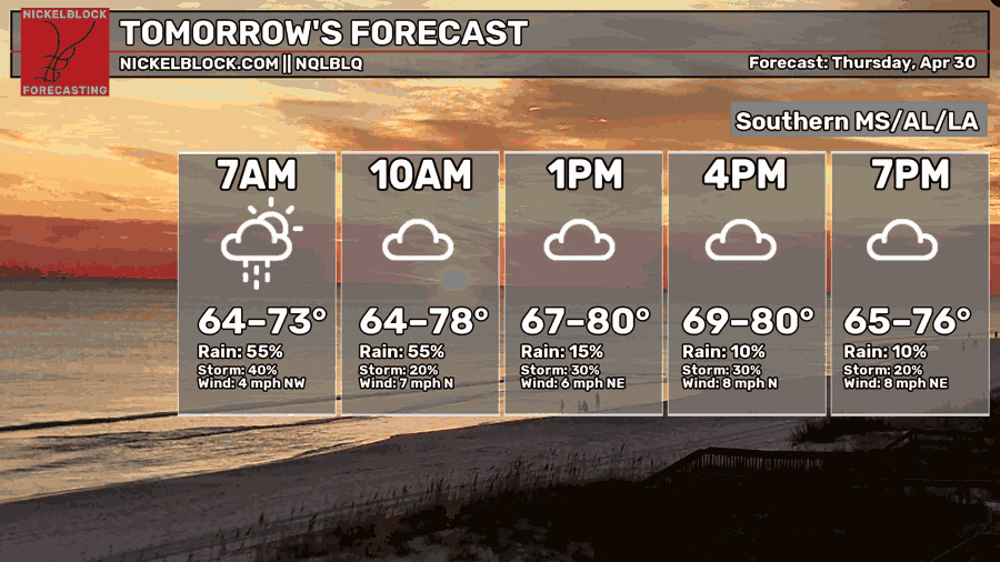
We’ll start off with some lingering scattered showers across the southern part of the state after the main line has run through. Another round of showers is possible in the mid-afternoon to the evening. Otherwise it’ll be mostly cloudy day with a cooler overall feel. Highs will top out around 80 at the warmest with winds shifting to the north signifying the frontal passage. Overnight, we’ll fall into the low to mid 60s.
Friday
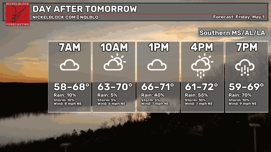
It’s going to be a much cooler than average day, unfortunately that’s also due to the incoming rain. A low pressure system moving in from the western Gulf will bring in one last big rain chance from the early afternoon all the way to Saturday morning. Thankfully this won’t be anything severe, but this is where we’ll get our last big shot of rain for a while. Temperatures will be in the low 70s for the high and the upper 50s for the low.
The Weekend

So we’re starting off pretty soggy in the morning this Saturday, but the good news is that it clears out pretty quickly! We’ll be back to partly cloudy skies and highs in the upper 60s. Yep, you heard that right! It’s going to be much cooler this weekend and near one of the coolest high records. Overnight, we’ll fall into the upper 40s. By Sunday, we’ll have another cool day with highs in the upper 60s to low 70s and a low in the upper 40s. Enjoy it!
The big question is “how long will this last?” Well, the reality is that this is an anomalously cool temperature drop for this time of year, but we have had this happen in the past. A “Canadian blast” of air is moving in, but it won’t hang around for too long as it shifts towards the east into the Atlantic. Afterwards, we’ll slowly warm up as the winds shift and bring in more Gulf moisture by the end of next week.