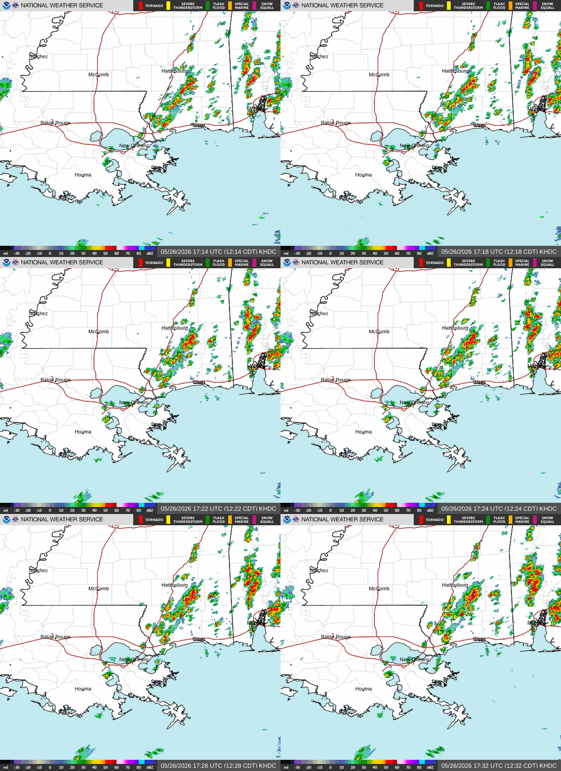
Radar shows scattered thunderstorms, some with heavy rainfall, moving northeast over Perry, Forrest, and Stone counties that may bring localized areas of flash flooding and gusty winds.
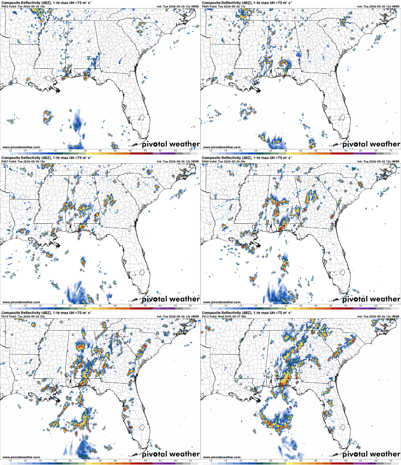
Recent short-range models show scattered showers and thunderstorms continuing throughout the day.
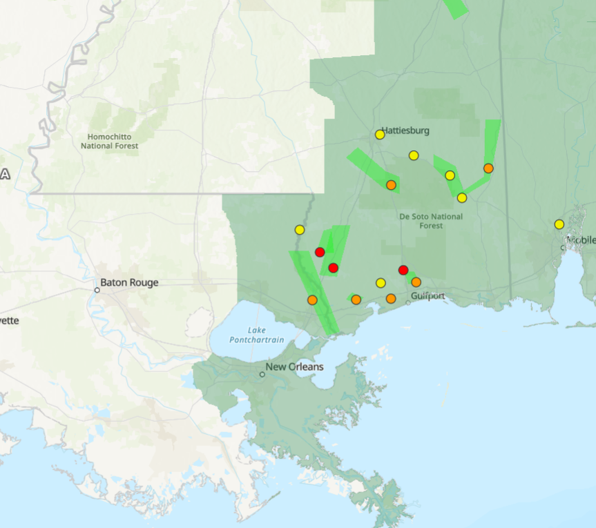
Currently, there is a Slight Risk (Level 2/4) of Excessive Rainfall, meaning there is a risk of isolated significant flash flooding along with river flooding. A Flood Watch remains in effect until midnight for the areas highlighted in green below, generally from the New Orleans metro eastward through the Mississippi Coast.
Due to heavy rainfall over the last few days, several rivers are in minor (orange dots) to moderate (red dots) flood stage. River flooding will continue to be something to watch for today!
Yesterday, a Flash Flood Emergency was issued for Petal and parts of Forrest County, Mississippi, after reports of nearly 6 inches of rain fell in a short period of time, causing rapid flooding. This serves as a reminder that floodwaters are powerful and can overpower your vehicle!


