Today’s Overall Setup
Hey guys! Today is looking like a typical day in June for the United States. The main features to note are two troughs, one over Montana and one over the northeast. The one over Montana will bring the threat of rain and severe weather to the northern Plains and those near the north-central Canadian border. The one over the northeast is bringing a cool east-northeast flow, which is bringing temps to a comfortable upper 70s.
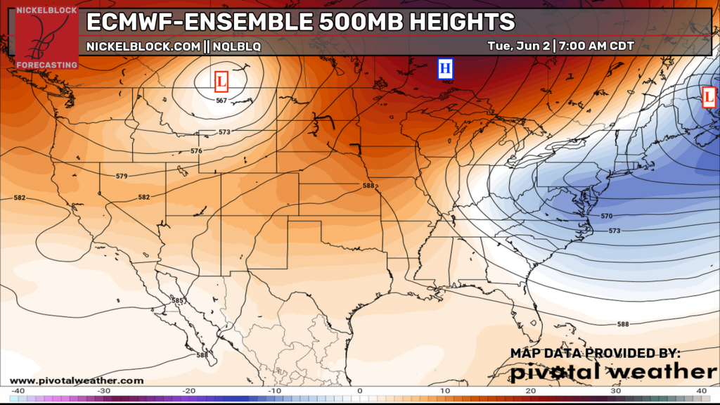
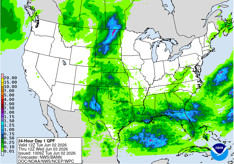
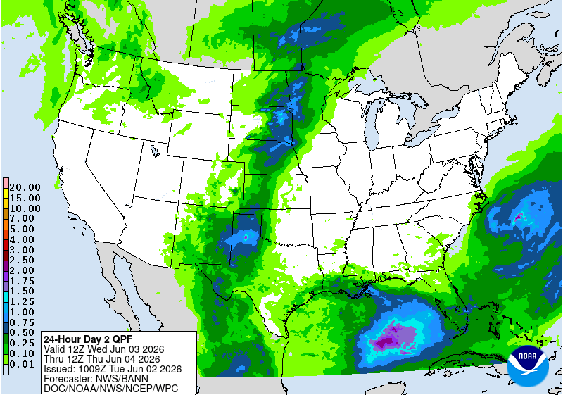
Everywhere else? We’re staying largely dry, aside from some afternoon or evening convection popping up over the Plains and the Southeast, thanks to a cold front strung across the South, allowing daytime heating to trigger thunderstorms as it pleases. Some heavy rain and flash flooding are possible in the Dakotas, eastern New Mexico, and western Texas, so watch out if you live there.
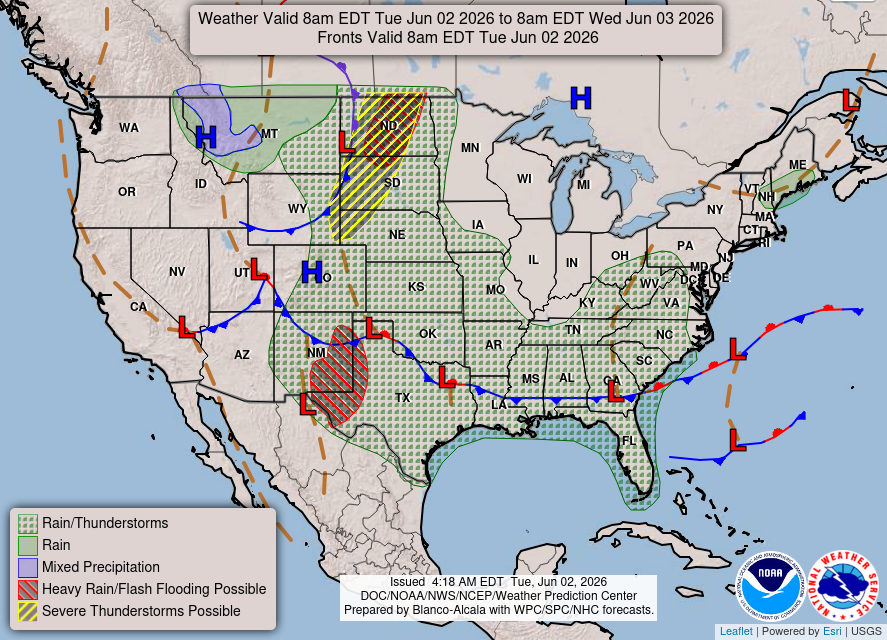
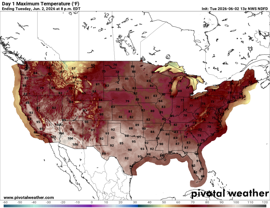
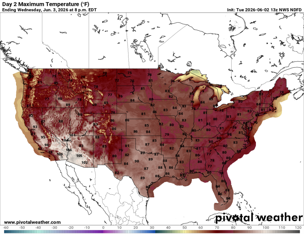
High temperatures for the day are pretty HOT for the south, and it’s certainly humid. Widespread 80s and 90s are expected from Texas to Florida.
Today’s Severe Weather Threat
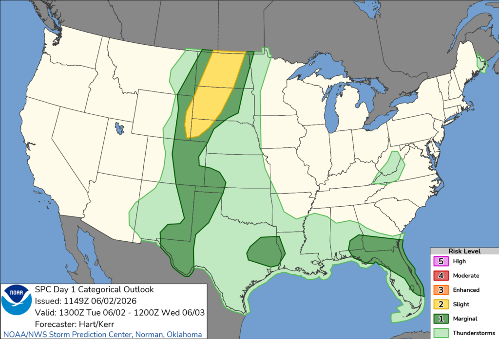
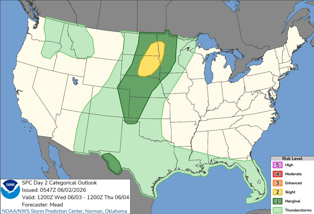
The SPC has issued a Slight (Level 2 out of 5) risk of severe weather for the northern Plains, as well as a long Marginal (1 out of 5) risk moving southward into Colorado and into the southern Plains. There are also two other Marginal risk zones over eastern Texas and over Florida, as some of those afternoon storms I mentioned could become severe and bring some gusty winds.
Watch out for some more intense severe weather in the Slight zone, where there is a 5% risk of tornadoes and a 15% risk of severe wind and hail.
The ingredients are all there in the northern Plains, including a decent amount of CAPE (which measures the instability in the atmosphere), wind shear, and steep lapse rates. The SPC warns that quite a few supercells could form in this region later this afternoon.
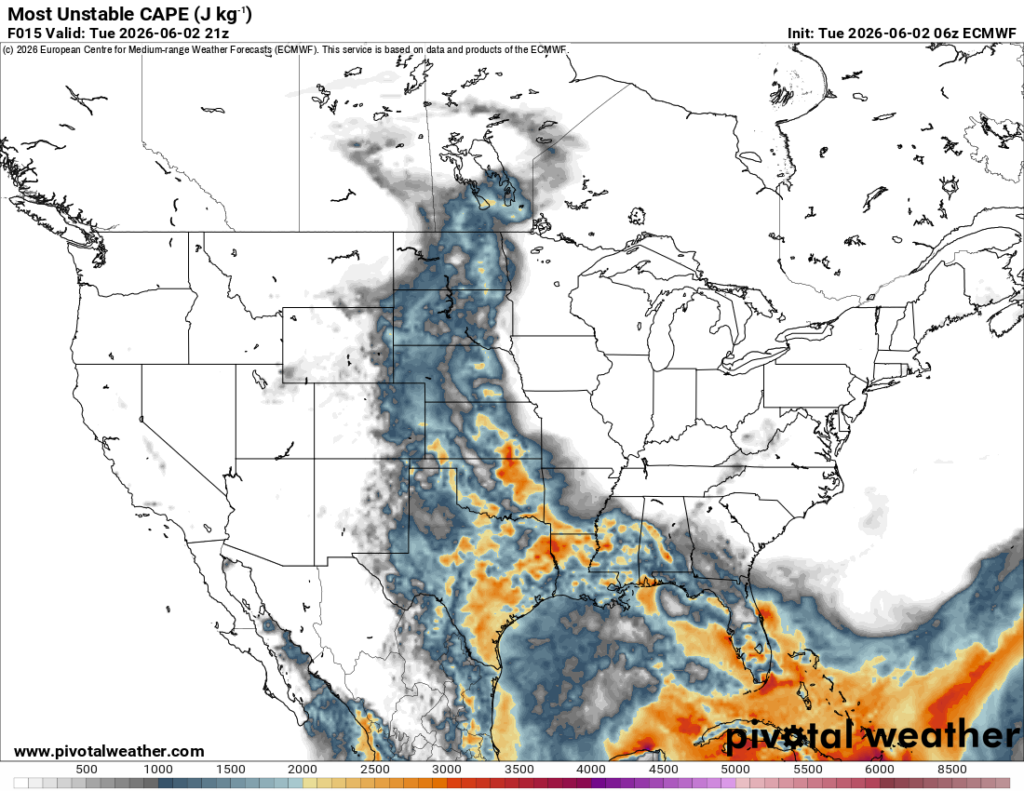
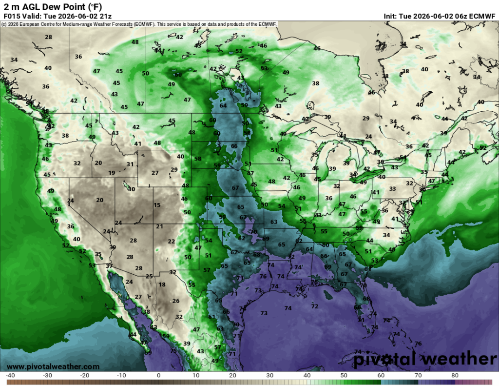
It’s really neat to see how much higher dew points can impact CAPE values. When dew points are elevated, meaning there is more low-level moisture in place, the atmosphere becomes more supportive of convection. That added moisture helps increase instability, giving storms more energy to develop and grow if there is enough lift present.
Tomorrow’s Weather
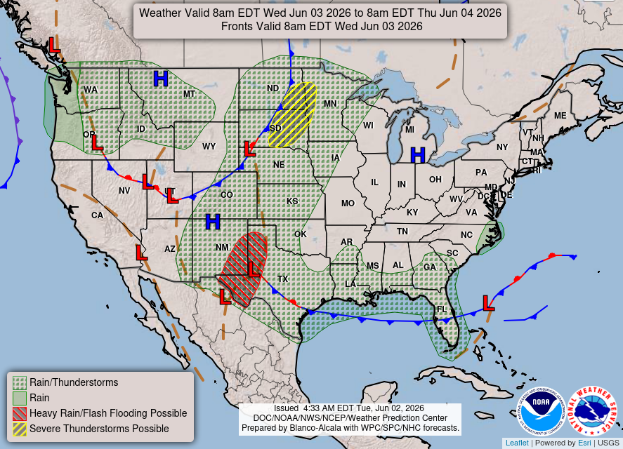
For tomorrow, a pretty similar day in terms of severe weather in the northern Plains and afternoon scattered thunderstorms in the southern Plains and southeast, but this time the cold front will have moved off the Gulf, decreasing the chance of rain for those in the southeast. This should slightly lower the humidity as well, but the southerly flow off the Gulf will not fully let up.
The Pacific Northwest can also see scattered showers or thunderstorms tomorrow as a trough of low pressure parks over the area.
Temperatures tomorrow will be warmer than today, with widespread 70s and 80s across most of the country. Want even warmer temperatures? You can go to the desert southwest, where it’s 106! Maybe not…
There will be yet again another similar severe weather threat for the northern Plains tomorrow. There is currently only a 2% risk of a tornado in the Slight risk zone below, BUT, even though it’s low, there still is the threat and there is a good amount of wind shear in the region. Severe wind and hail are all on the table for those in the Marginal risk as well.
CONUS Weekly Temperature & Precipitation Outlook
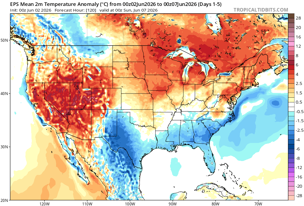
Here’s a look at the EPS modeled temperature anomalies through Sunday. Red indicates above-average temperatures on average for the week, white indicates average temperatures, and blue indicates below-average temperatures.
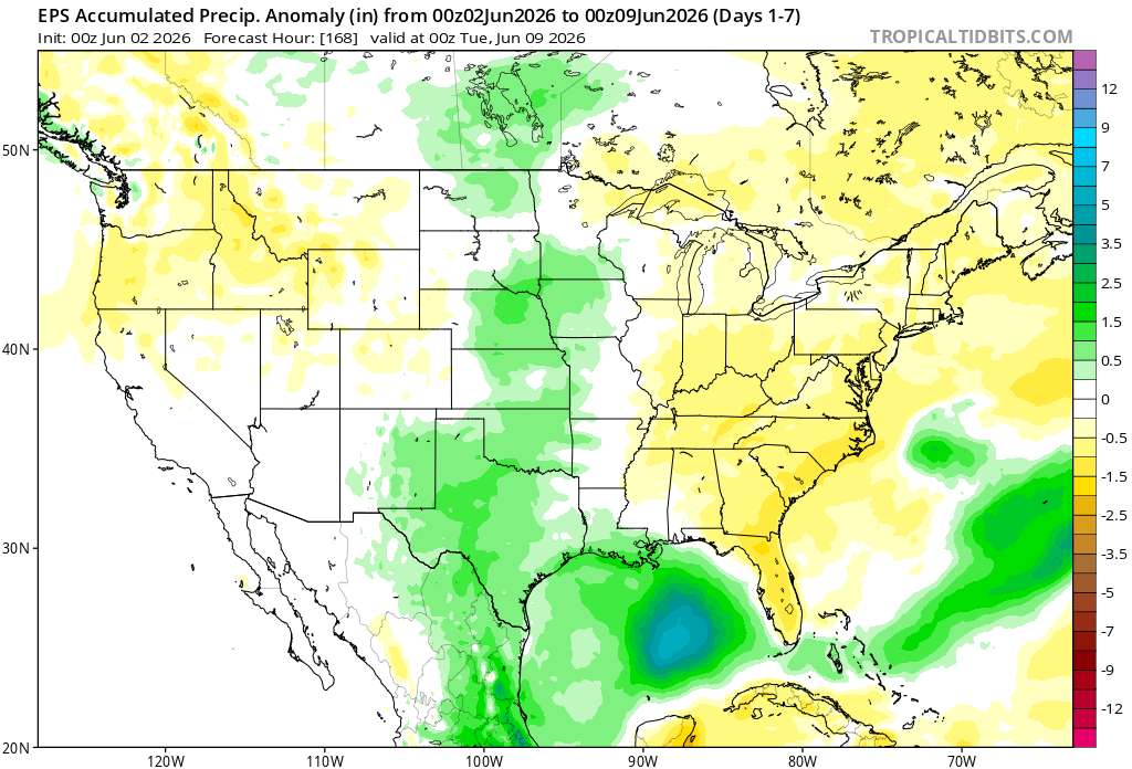
Here’s a look at the EPS modeled precipitation anomalies through next Tuesday. Green indicates above-average precipitation, white indicates average precipitation, and yellow indicates below-average precipitation. Let’s look into the details by region:
Weekly Outlook: Western & Central United States
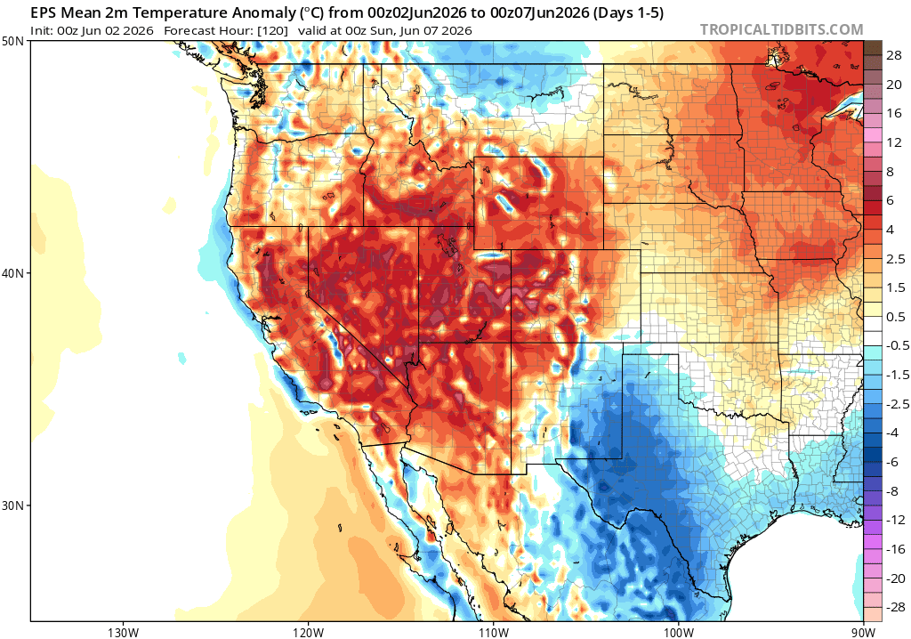
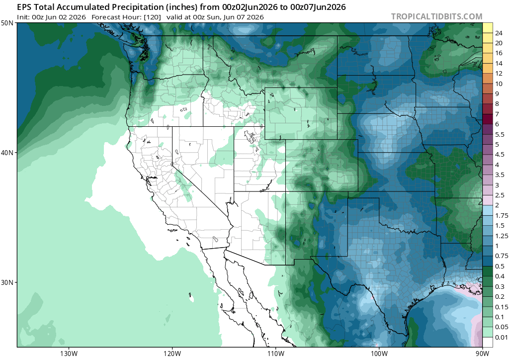
The West is going to be HOT this week, with temperature anomalies running above average over the next 1-5 days. It will also be very dry in the deserts and most of California, thanks to the ridging pattern setting up over the West. We’ll see cooler than average temperatures over Texas and eastern New Mexico, as well as a few shots of rain. We’ll be slightly warmer than average over the Plains, but in between the ridging and troughing, which is the prime area to be for some rain.
Weekly Outlook: Eastern United States
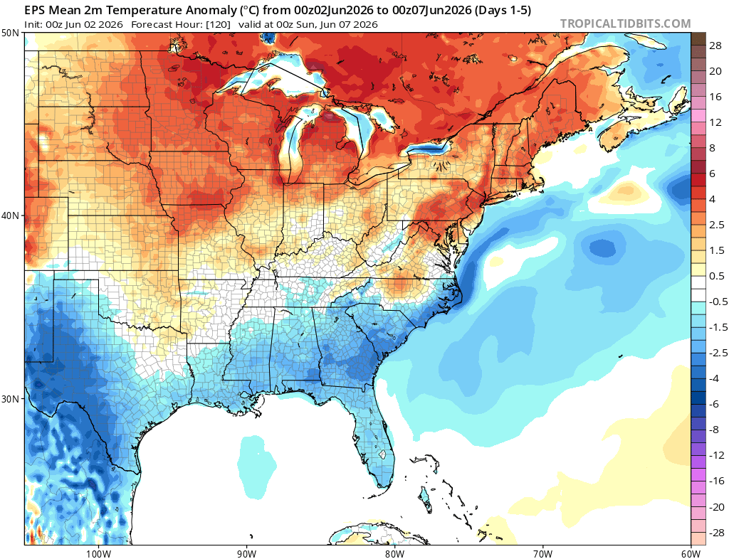
Thanks to a large ridge of high pressure that will park itself over the eastern half of the country, we will see definitely less rain this upcoming week compared to last week. Sinking air will not allow for as much convection in the afternoons, and storm systems should be directed around the high. The wind direction in the southeast U.S will be mainly out of the east, southeast, which will allow for temperatures slightly below average, since they won’t be out of the Gulf. The northern US will be above average for temperatures, feeling more like June.
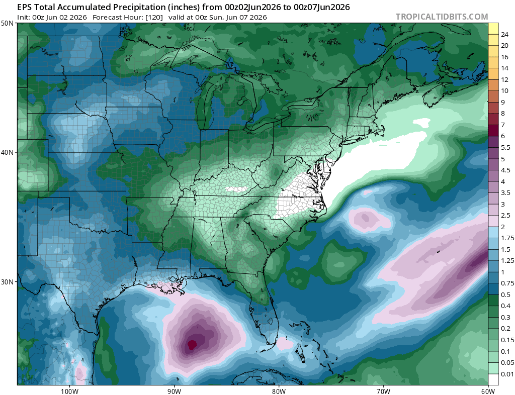
The ensembles are picking up on a LOT of rain this week in the central Gulf, as shown by the deep purple colors above. There will be lots of rain over the water given the extreme moisture content, but currently the NHC is not concerned with any tropical development.
Extended Outlook
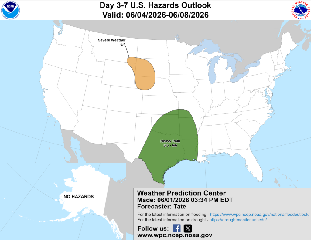
Above is a look at the U.S. Hazards Outlook from NOAA, highlighting areas of more impactful weather to be aware of over the next 3 to 7 days.

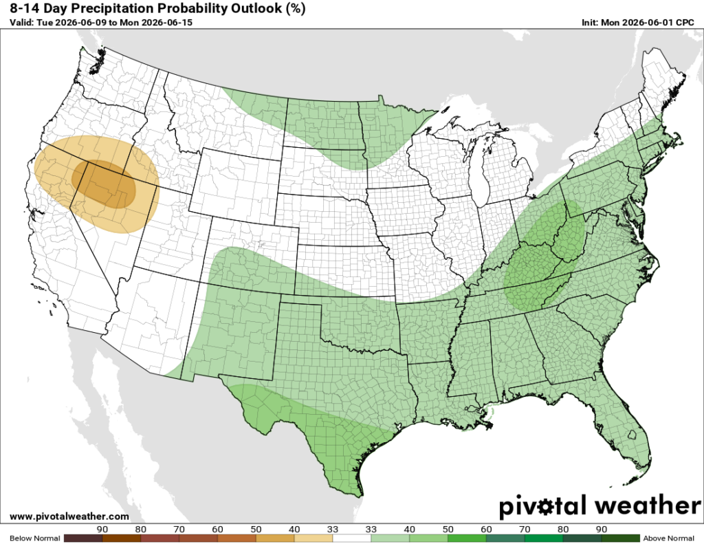
The cooler than average temperatures in the southeast are not here to stay. The 8-14 day temperature outlook shows above average temperatures for ALL of the U.S. We could also see some increased rainfall in the south and east U.S over that time period as well.
Thanks for tuning in to this National Forecast! Tune in to our local, tropical, and regional forecasts to stay updated on the latest!


