The weather is looking pretty normal this week along the gulf coast. For the remainder of this week, temperatures and dew points are looking slightly below normal. This weekend and early next week, a bit more heat will build, but temperatures will remain average to slight above average.

Today
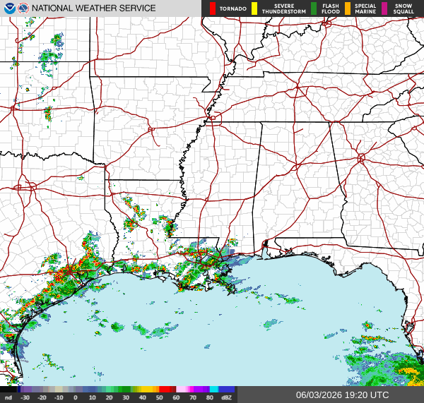
As I’m writing this, some strong storms are firing up in Louisiana, with a smaller patch of storms in the area south of Lumberton, MS. These storms are moving west, but they are moving very slowly. Localized flooding is likely in some places, especially in the regions of very low elevation in Louisiana. If an area near your location usually floods, be on the lookout for some flooding.
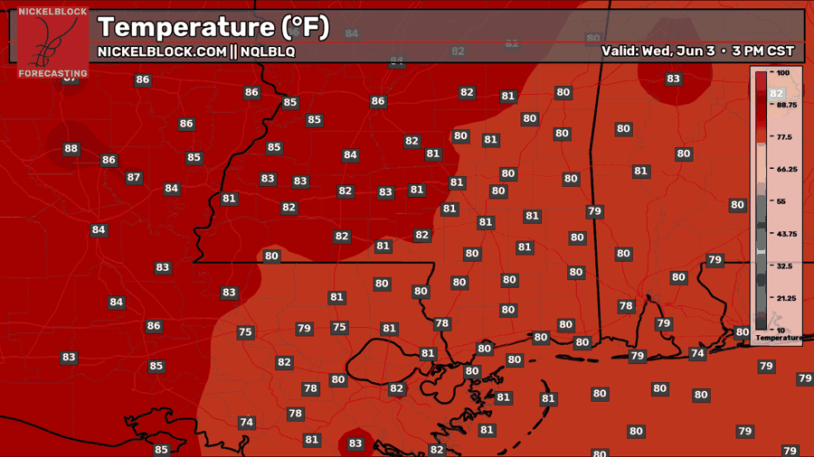
Temperature are currently in the upper 70s-mid 80s across our region, which is decently below normal for this time of year.
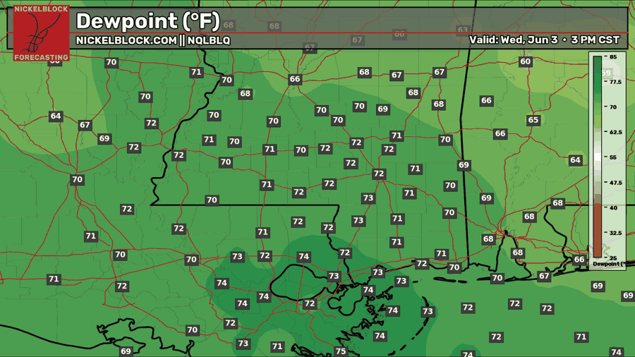
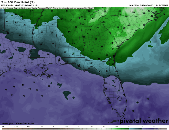
Right now, dew points are generally oppressive, with higher values the further west you go. This explains why we’re getting those strong storms developing over Louisiana. In Alabama, up near Butler, we see some dew points only in the low 60s. This is because a cooler, drier air mass is moving into our area from up north.
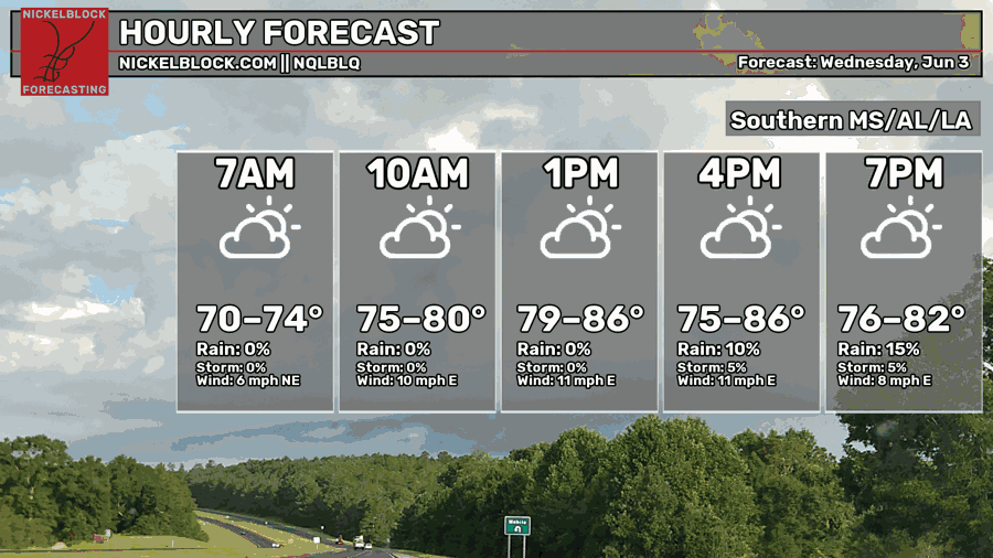
Later tonight, temperatures will range from the mid 70s to the mid 80s. Generally, the chance for rain is low tonight as most of our area east of Biloxi will not see any rain. For the areas west of Biloxi, storms will continue until midnight tonight, then lingering showers may produce even more rain going into the early morning hours of tomorrow.
Totals will generally range from a quarter inch to an inch of rain, however many models agree that some isolated locations could receive up to 2″ of rain.
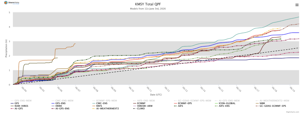
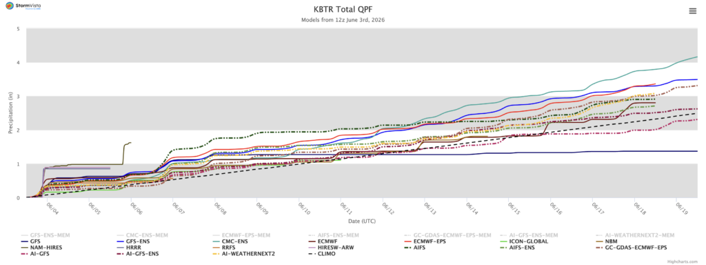
The two images above are spaghetti plots of the cumulative precipitation total for New Orleans and Baton Rouge. Each line represents a different weather models forecasted precipitation total for each location by a certain date (x-axis). While most models show rain totals of less than an inch for tonight, a few high resolution models have totals approaching 2″ in New Orleans.
What this means is that the high resolution models agree that a location in southeastern Louisiana may get 2″ or more of rain tonight.
Tomorrow
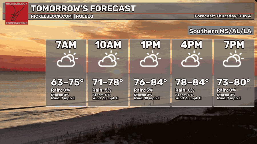
Moving into tomorrow, temperatures will again be below normal, with afternoon highs ranging from the upper 70s to the mid 80s. Temperatures will be warmest in southeastern Louisiana and the southwestern Mississippi. Chances of rain are also very low tomorrow, closely reflecting the big drop in dew points.
Look at that drop!
As an area of high pressure centered over Tennessee continues to develop tonight, re-circulated air from the northern plains and rocky mountains will make its way into our area bringing dew points in the 40s and 50s into our area tomorrow.
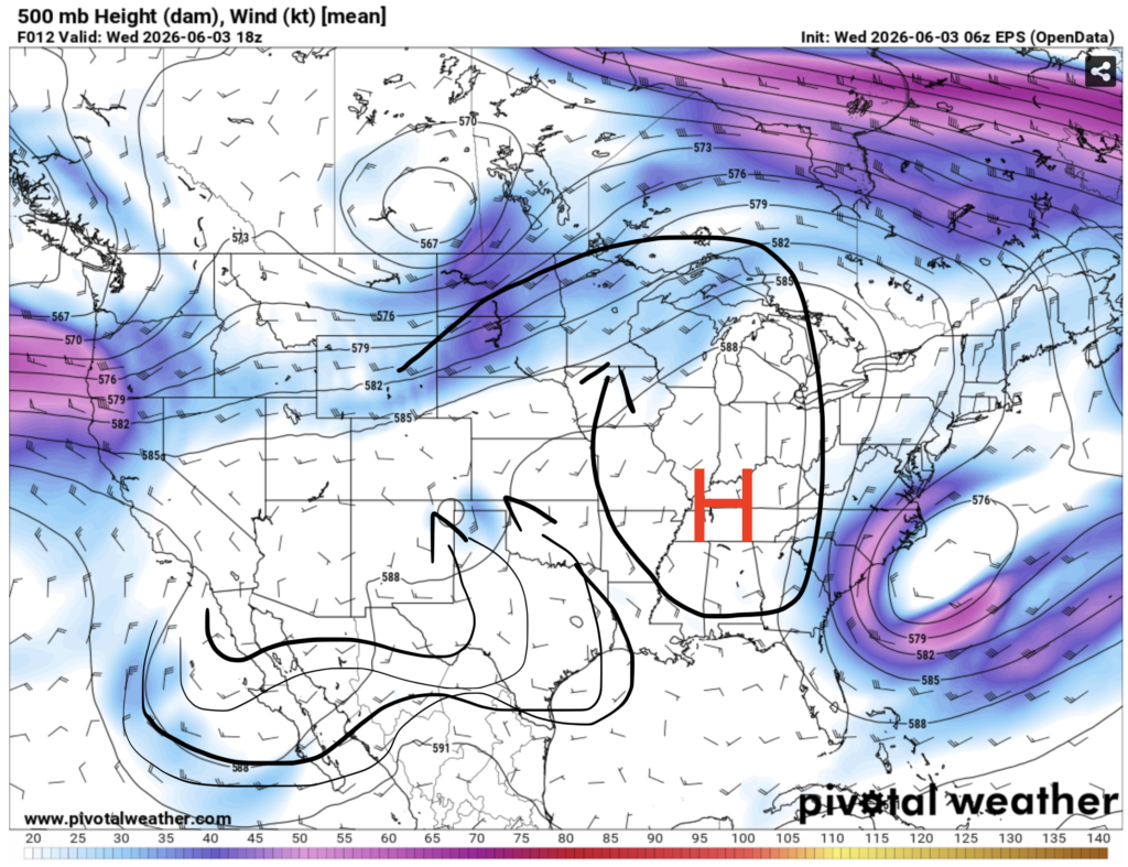
Unfortunately for Louisiana, dew points will stay in the uncomfortable mid 70s for the duration of this week. This can be explained by the above picture. If you look at the lines I drew over Louisiana, you’ll see that the wind is blowing north into Louisiana, bringing humid and warm gulf air with it. The drier and cooler air mass caused by a high pressure center over Tennessee will clash with this air mass, causing lingering storms across Louisiana and Texas tomorrow.

Friday
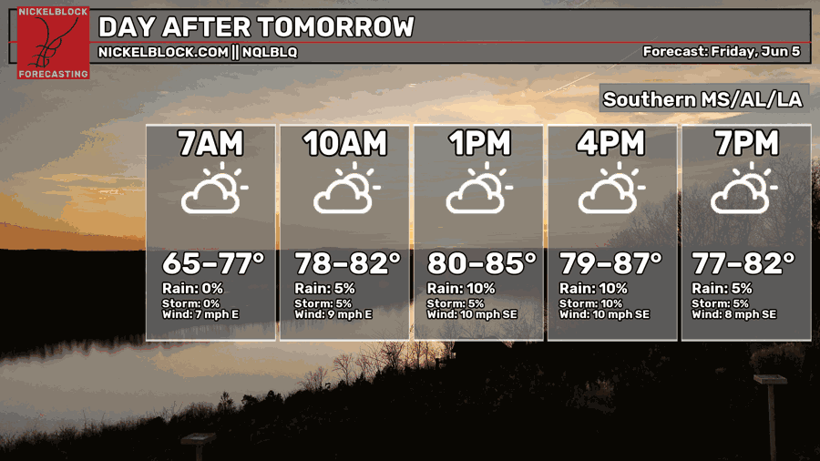
Friday, similar to tomorrow, will see highs that are a bit below normal, ranging from the upper 70s to the mid 80s. Chances of rain are also low for most of our area.
Friday morning into the afternoon may see some showers and storms moving north over the Louisiana delta region reaching the coast of Mississippi. These showers and storms should be gone by the evening.

Extended Outlook
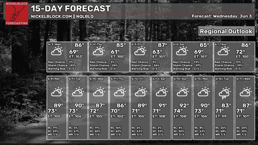
Looking ahead at the next two weeks, the summer heat will continue to build, with highs in the upper 80s and lower 90s. Chances of rain are also generally low each day, suggesting a dry and warm pattern is in store for our region.
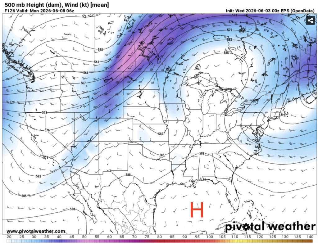
A common pattern I’m seeing over the next two weeks is an area of high pressure in the gulf that extends into the upper midwest, with a trough in the west. This usually leads to dry conditions, as we are far away from the boundary between an area of high pressure and an area of low pressure, which is usually where significant rainfall occurs. This is because areas of high pressure have drier, denser air, which forces the moister, less dense air to rise, creating convection. High pressure also leads to dry conditions since it suppresses vertical motion, a key ingredient in rain formation.
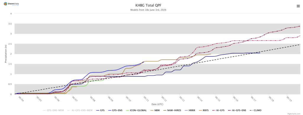
The models are also picking up on this dry pattern. The image above is another spaghetti plot (remember from before?). Most models only predict a total of around 2″ of rain for the next two weeks, mostly from weaker pop up storms.


