A very active weather period continues for the next couple days across the South. The Storm Prediction Center has issued a tornado watch until 5pm. Meanwhile, the Weather Prediction Center has outlined a high risk for excessive rainfall and flash flooding. This is due to the remnants of tropical storm Arthur.
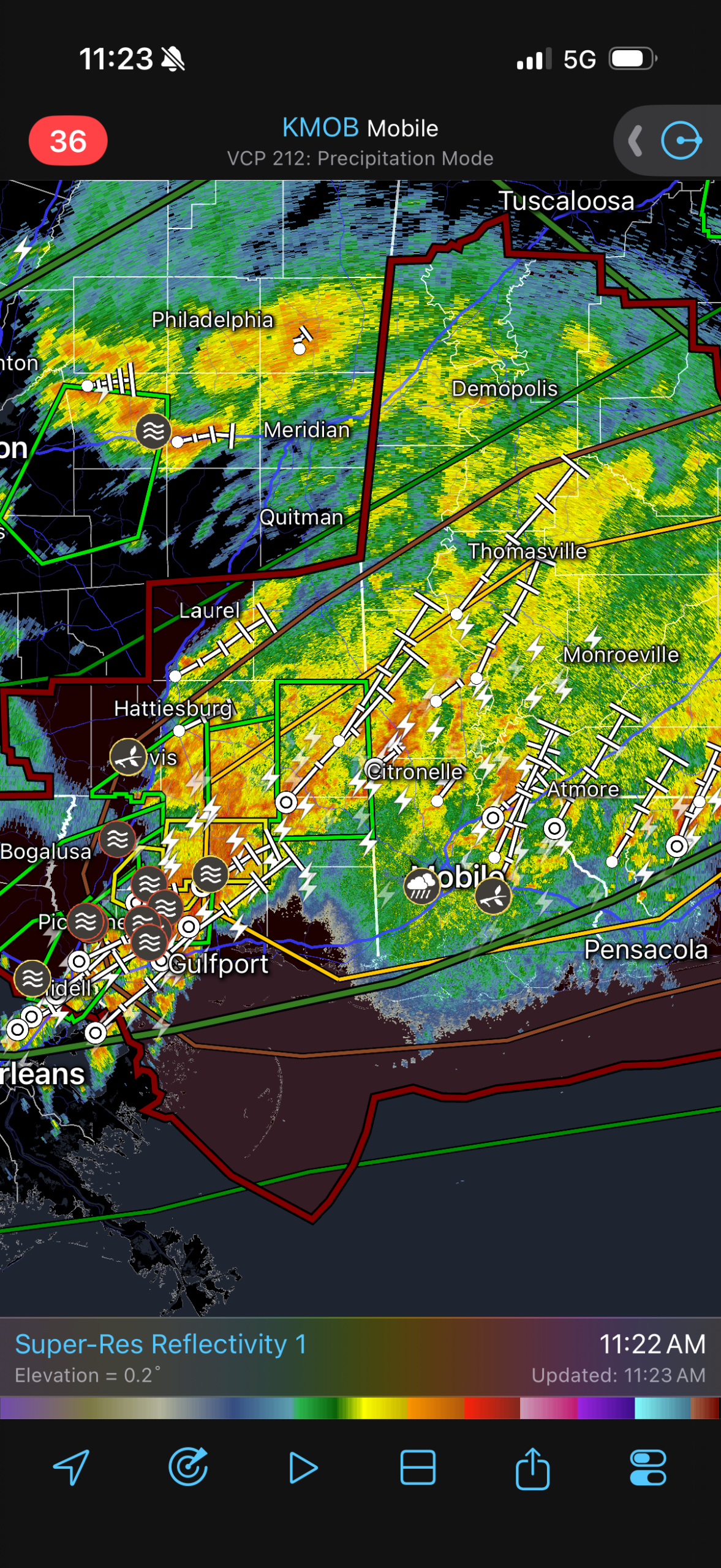
Due to the strong low level shear provided by the cyclone, conditions will be favorable for brief (weak) tornadoes. These tornadoes will be embedded in heavy rain and invisible. Tropical tornadoes are also harder to detect on radar. Make sure to seek shelter as soon as a warning is issued and don’t attempt to see the tornado (you probably won’t be able to).
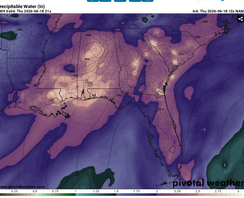
Precipitable water values are as high as they get. This will allow for efficient warm rain fall processes. Several flash flood warnings are in place due to the repeated training of thunderstorms. Make sure to turn around and never drive through flood waters (most flooding deaths occur in vehicles). Flash flooding may reach life threatening levels in some areas.
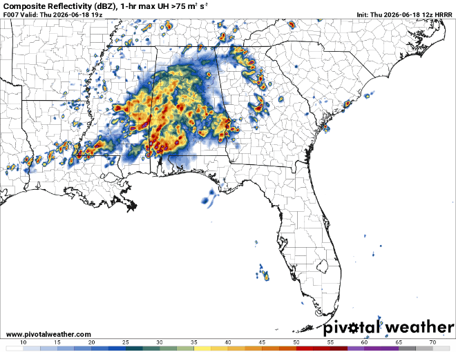
Even as the tropical system exits, a puff of upper level flow and very deep moisture will allow for repeated rounds of convection that will only worsen the flooding issues.
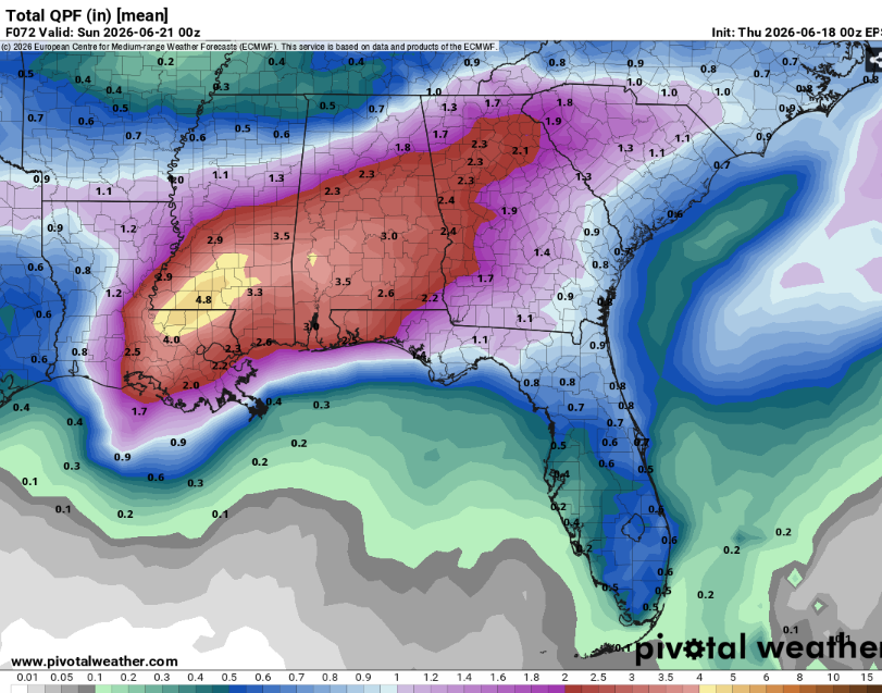
The Euro ensembles indicate widespread areas of greater than three inches of rain and given that this is an ensemble model, there will likely be areas of much higher totals.
Highs will be in the low to mid 80s with mostly cloudy skies and extreme humidity.


