Happy July!
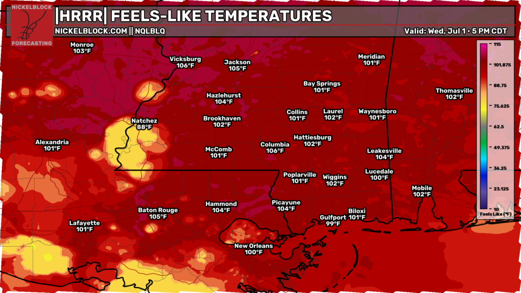
A heat advisory is in effect today for eastern Louisiana and most of Mississippi. High humidity and dangerous heat will bring heat indices up to 110 degrees, and as high as 115 degrees near Jackson, MS. Wear light clothing, take breaks, and drink plenty of water!
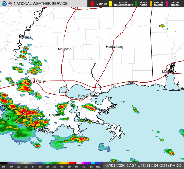
Currently, showers and thunderstorms are ongoing across southern Louisiana, producing gusty winds and frequent lightning.
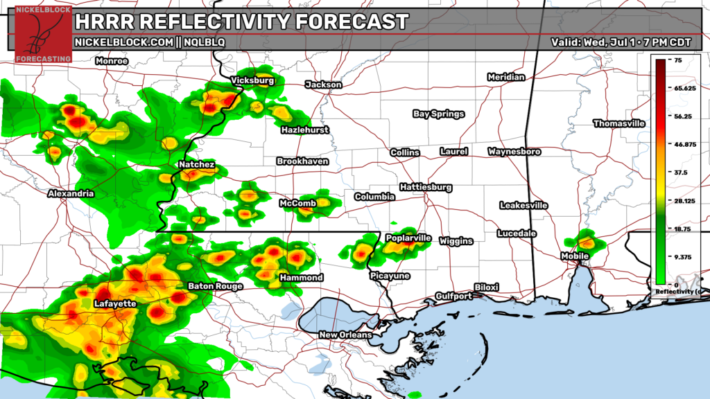
Scattered thunderstorms are expected to develop this afternoon and evening across the region, all while that complex of storms continues moving through southern Louisiana. Some storms could become strong to severe, producing wind gusts over 60 mph, frequent lightning, small hail, and heavy rainfall. And of course, a brief, weak tornado can’t be ruled out.
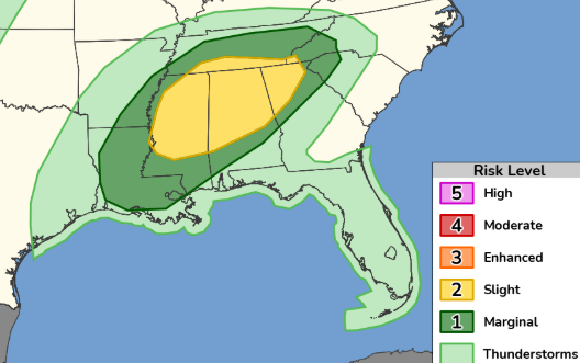
The greatest severe weather threat today is across central Mississippi, especially near and north of Jackson, where pulse thunderstorms may produce winds gust of 60+ mph. The Storm Prediction Center has placed this area under a slight (level 2 out of 5) risk for severe weather.