We are seeing things turn a bit more active, as two areas are highlighted for potential tropical cyclone development over the next 7 days. The National Hurricane Center has identified one area over the eastern Gulf and another over the eastern Atlantic with the potential for development.
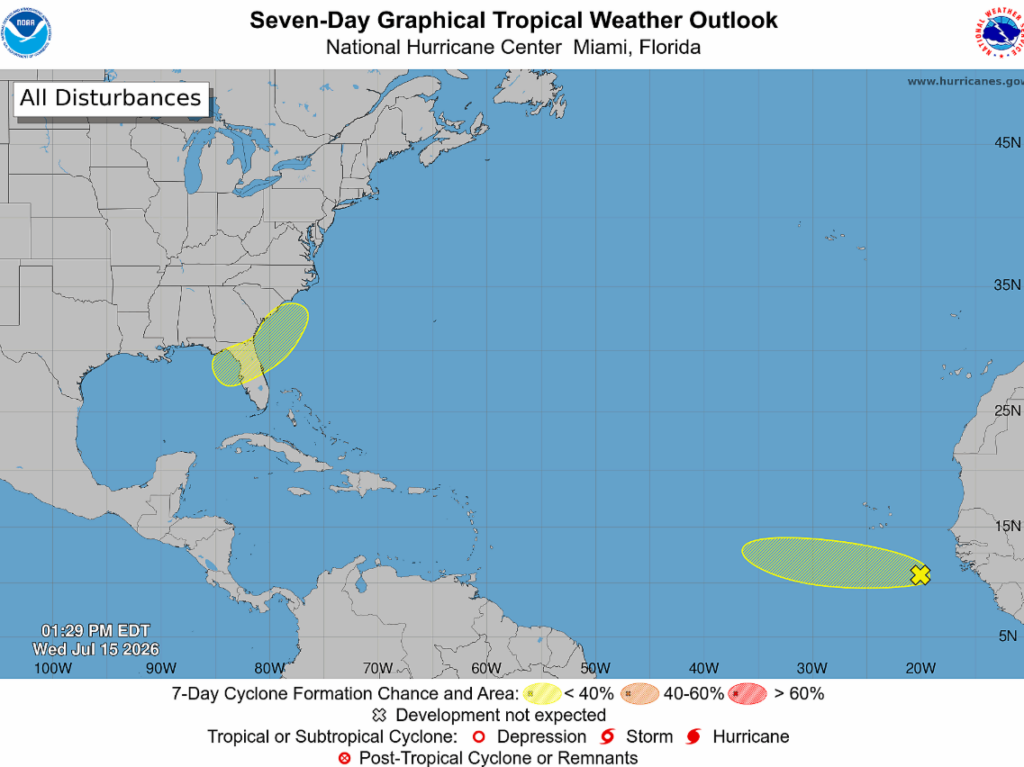
In the eastern Atlantic, a tropical wave has become slightly more organized since yesterday, though likely not for long as it’s moving into an environment with below-normal sea surface temperatures, dry air, and Saharan dust. All of that will act to keep the system weak, so further development is not expected. Hence the low-end 10% chance of development.
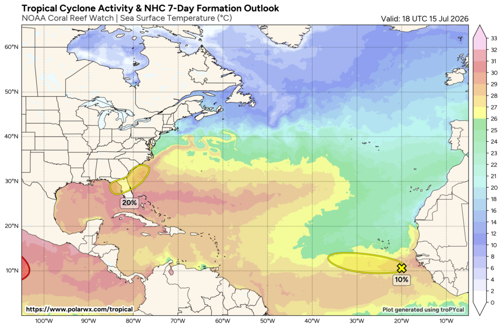
Moving on to something raising a few eyebrows for us in the southeast is a 20% chance of tropical development across the northeastern Gulf over the next 7 days. This weekend, an area of low pressure is forecast to develop before getting scooped up by an upper-level trough and steered northeastward towards Florida.
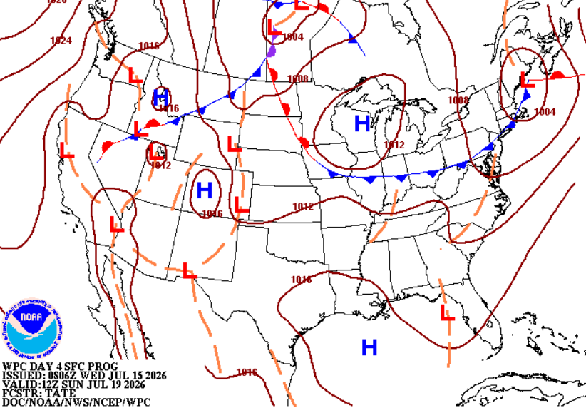
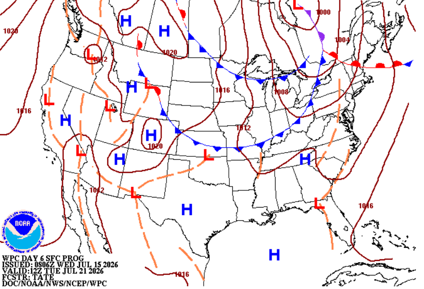
Some gradual development is possible, but due to its limited time over the water, the most likely outcome is heavy rainfall, mainly across Florida, Georgia, and into the Carolinas. This is something to keep a close eye on and check back in on as we get closer to the weekend as it’s still too early to know.
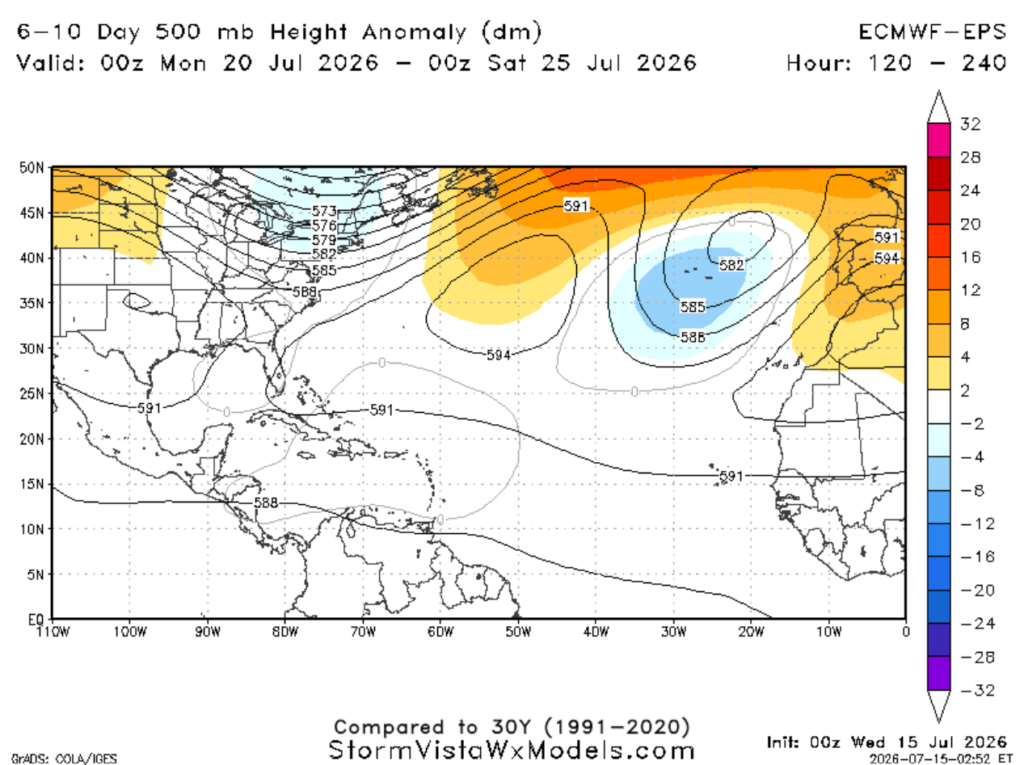
Taking a quick peek into next week… analysis shows a ridge across the western Atlantic. With the clockwise flow around this ridge, any tropical systems coming off Africa would likely curve northward over the open Atlantic rather than threatening those along the Gulf.


