Tonight
As Tropical Storm Bertha pushes northwest, the outer bands will move across the Gulf Coast, bringing showers and thunderstorms in West FL and southern AL, MS, and LA. Localized flash flooding is possible throughout these states. Also, a line of thunderstorms will move into TN during the evening, bringing high winds and possible hail.
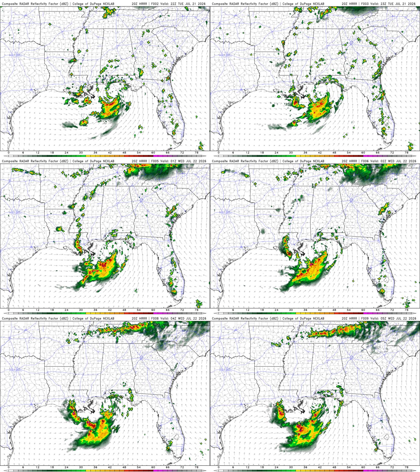
Thunderstorms are forming along the cold front moving through the Midwest, which is why there is potential for severe storms in TN tonight. Northern TN is under a slight risk for severe thunderstorms, while southern TN is under a marginal risk for severe thunderstorms. From the evening into the nighttime hours, TN should expect isolated to scattered severe thunderstorms.
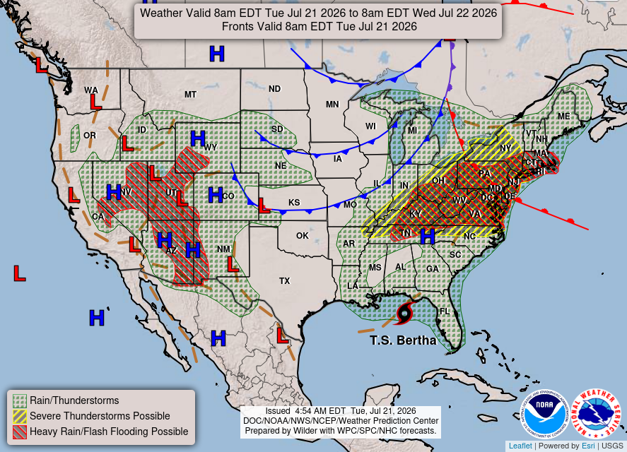
As for Tropical Storm Bertha, the most intense winds will be concentrated over western FL, stretching to southeastern MS.
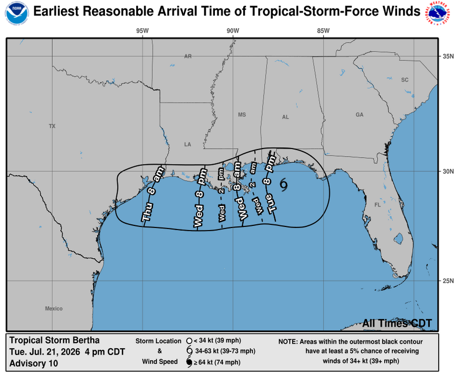
Most of the rainfall will stay just off the coast in the Gulf. Southern LA will receive the most rainfall, with around 1.50 inches, possibly more in localized areas.
Extended Regional Outlook
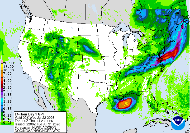
The CPC outlook has our region experiencing above-average temperatures and near-normal to above-average precipitation from July 29th to August 4th.


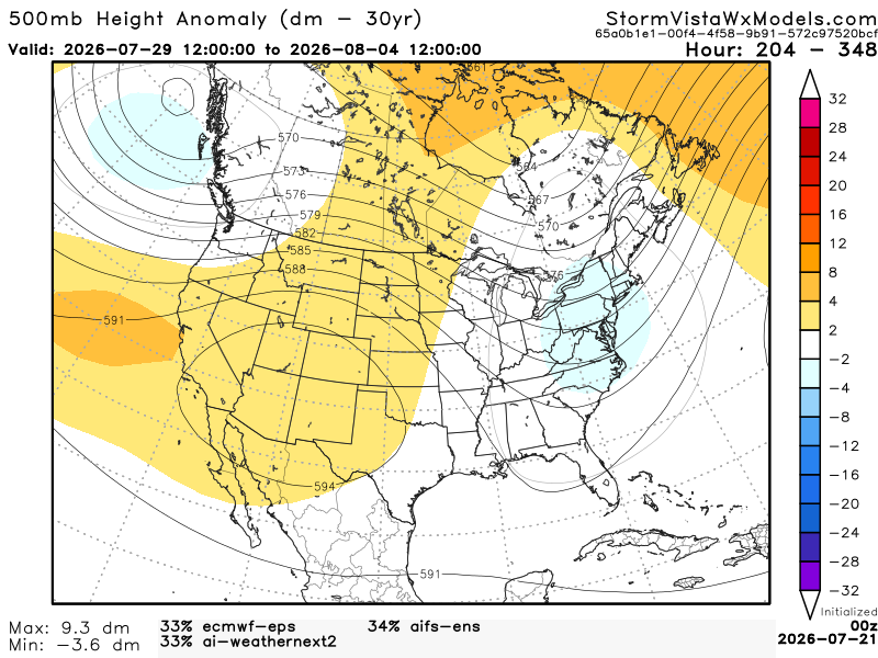
Below, we have 3 of the most accurate models blended into one model. This gives us an idea of the possible outcomes from July 29th (7 am) to August 4th (7 am). Based on this blend of models, I agree with the CPC. There are no anomalies in the south, so this would bring the south near normal precipitation conditions. We will still have warm and humid temperatures with the nearby ridge and regular summer conditions. With the shortwave trough set up over the eastern Gulf near the FL Panhandle, this area could see localized thunderstorms that could potentially be severe.
Today’s Interstate Forecast
I-10: Scattered showers around the FL Panhandle and central LA through the nighttime hours.
I-20: Isolated showers in central AL. Scattered showers and thunderstorms in central MS.
I-49: Scattered showers and thunderstorms in central LA.
I-55: Scattered showers and thunderstorms in central MS.
I-59: Scattered showers and thunderstorms in central MS.
I-65: Isolated showers in central AL. Scattered showers near southern AL.
I-75: Isolated showers and thunderstorms near central and southern FL.
3 Day City Forecast
Houston, TX:
Tonight – Mostly clear. Low of 81 °F.
Wednesday – Very hot, Extreme Heat Warning from 11 am to 8 pm. High of 104 °F. Partly cloudy at night with a slight chance of showers. Low of 84 °F.
Thursday – Sunny. A slight chance of thunderstorms. High of 98 °F. Partly cloudy at night. Low of 82 °F.
Shreveport, LA:
Tonight – Mostly clear. Heat Advisory for the rest of today. Low of 82 °F.
Wednesday – Very hot. High of 100 °F. Clear at night. Low of 76 °F.
Thursday – Very hot. High of 96 °F. Mostly clear at night. Low of 77 °F.
Baton Rouge, LA:
Tonight – Mostly clear with a chance of thunderstorms. Low of 79 °F.
Wednesday – Sunny. A slight chance of thunderstorms. Extreme Heat Warning from 10 am to 8 pm. High of 100 °F. A slight chance of showers and thunderstorms at night. Low of 79 °F.
Thursday – Chance of thunderstorms. High of 94 °F. Partly cloudy at night. Low of 78 °F.
New Orleans, LA:
Tonight – Mostly clear with a chance of thunderstorms. Low of 82 °F. Tropical Storm Warning until further notice.
Wednesday – A chance of thunderstorms. Extreme Heat Warning from 10 am to 8 pm. High of 95 °F. A chance of showers at night. Low of 81 °F.
Thursday – Showers likely and chance of thunderstorms. High of 92 °F. A slight chance of thunderstorms at night. Low of 80 °F.
Jackson, MS:
Tonight – Mostly clear. Extreme Heat Warning until 9 pm. Low of 82 °F.
Wednesday – Mostly sunny. A slight chance of thunderstorms. Extreme Heat Warning from 10 am to 8 pm. High of 98 °F. Partly cloudy at night. A chance of thunderstorms. Low of 76 °F.
Thursday – A chance of thunderstorms. High of 94 °F. Partly cloudy at night. Low of 76 °F.
Birmingham, AL:
Tonight – Increasing clouds as the night progresses. Heat Advisory. Low of 76 °F.
Wednesday – Mostly cloudy. A slight chance of thunderstorms. Heat Advisory until 9 pm. High of 93 °F. A chance of thunderstorms at night. Low of 75 °F.
Thursday – A chance of showers. High of 90 °F. A chance of thunderstorms at night. Low of 73 °F.
Mobile, AL:
Tonight – Slight chance of showers and thunderstorms. Low of 78 °F. Tropical Storm Warning until further notice. Coastal Flood Advisory.
Wednesday – Showers and thunderstorms likely. Coastal Flood Advisory. High of 93 °F. A chance of showers and thunderstorms at night. Low of 79 °F.
Thursday – Showers likely and a chance of thunderstorms. Coastal Flood Advisory until 10 am. High of 92 °F. A slight chance of showers and thunderstorms at night. Low of 77 °F.
Atlanta, GA:
Tonight – Mostly clear. Low of 75 °F.
Wednesday – Party sunny. A chance of thunderstorms. High of 90 °F. A chance of thunderstorms at night. Low of 74 °F.
Thursday – A chance of thunderstorms. High of 88 °F. A chance of showers and thunderstorms at night. Low of 72 °F.
Tallahassee, FL:
Tonight – Partly cloudy. Slight chance of showers. Low of 77 °F.
Wednesday – Chance for thunderstorms. Breezy. High of 90 °F. Slight chance for showers and thunderstorms at night. Low of 76 °F.
Thursday – Slight chance of showers. High of 91 °F. Partly cloudy at night. Low of 74 °F.
3 Day Traveling Forecast
KHOU – Houston: Slight chance of thunderstorms Wednesday night and Thursday during the day. Possible delays at the airport due to lightning.
KSHV – Shreveport: No weather is anticipated for the next three days!
KBTR – Baton Rouge: Slight chance of thunderstorms tonight, Wednesday, and Thursday during the day. Possible delays at the airport due to lightning.
KMSY – New Orleans: Chance of thunderstorms tonight, Wednesday, and Thursday. Possible delays at the airport due to lightning.
KJAN – Jackson: Chance of thunderstorms Wednesday and Thursday during the day. Possible delays at the airport due to lightning.
KBHM – Birmingham: Chance of thunderstorms Wednesday and Thursday night. Possible delays at the airport due to lightning.
KMOB – Mobile: Chance of thunderstorms tonight, Wednesday, and Thursday. Possible delays at the airport due to lightning.
KATL – Atlanta: Chance of thunderstorms tonight, Wednesday, and Thursday. Possible delays at the airport due to lightning.
KTLH – Tallahassee: Chance of thunderstorms Wednesday during the day. Possible delays at the airport due to lightning.


