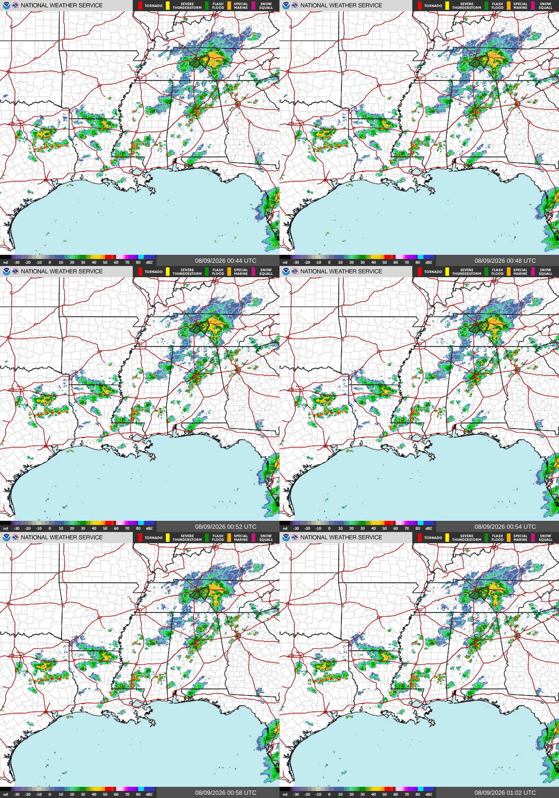
Good evening! As of now (8p CDT), we have a few storms on our radar, with the Birmingham area, the Brookhaven/McComb area, and the Monroe, LA area seeing some scattered thunderstorms tonight. These storms are pretty stationary, so if you haven’t been rained on yet, you’re unlikely to at all tonight. Stormy conditions are expected to stick around for another couple hours but should be gone by around 11 tonight.
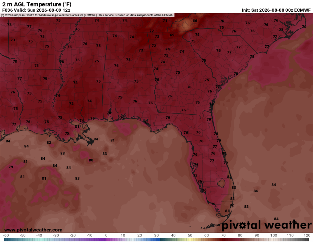
Overnight, the temperatures will continue to cool, eventually bottoming out in the mid 70s for most places at 6 am tomorrow.

Tomorrow
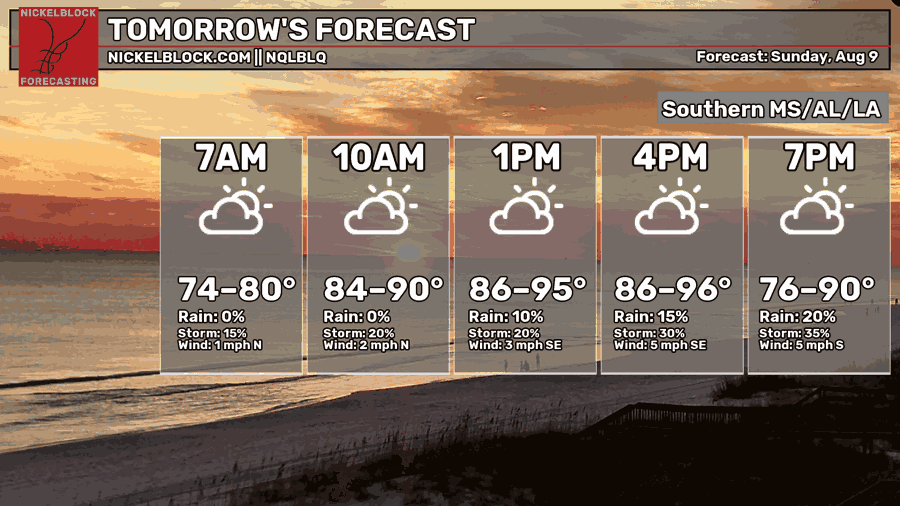
Moving into tomorrow, we’re expecting more hot and muggy conditions, with afternoon high temperatures topping out in the mid 90s for many spots. Morning lows won’t be refreshing at all, only dropping into the mid-upper 70s.
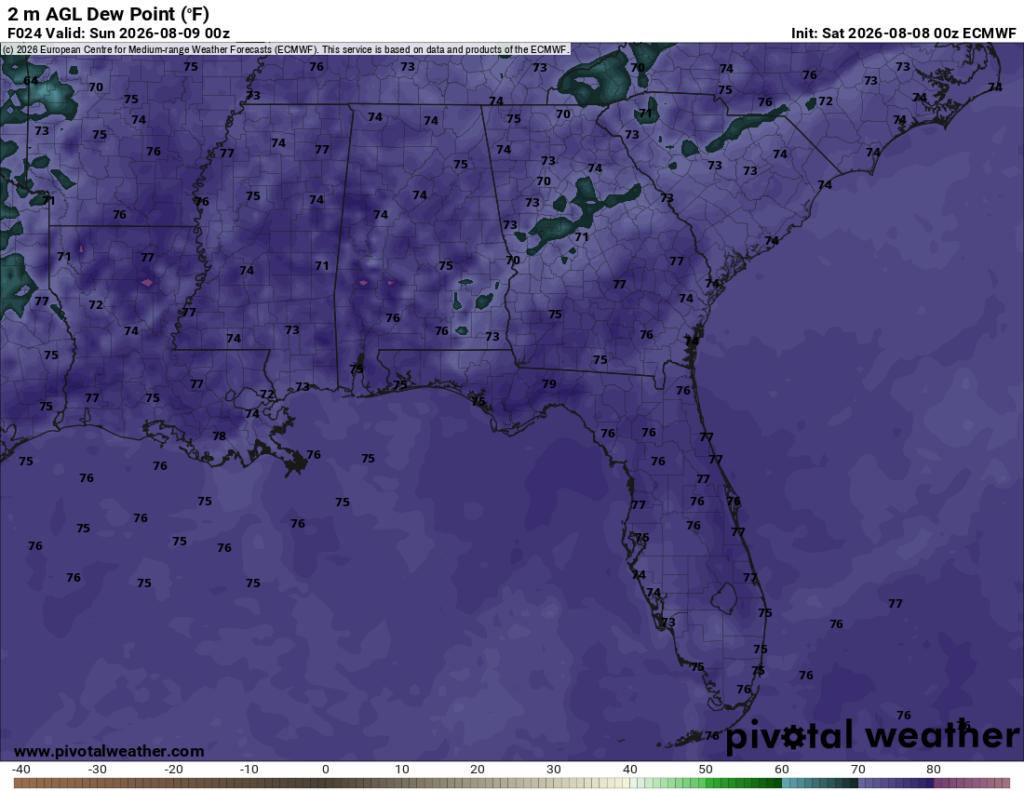
Tomorrow will be quite soupy, with dew point temperatures in the mid-upper 70s for most. These muggy conditions are being caused by a southerly wind coming off of the Gulf of Mexico, which is a result of the southeast being stuck between two ridges.
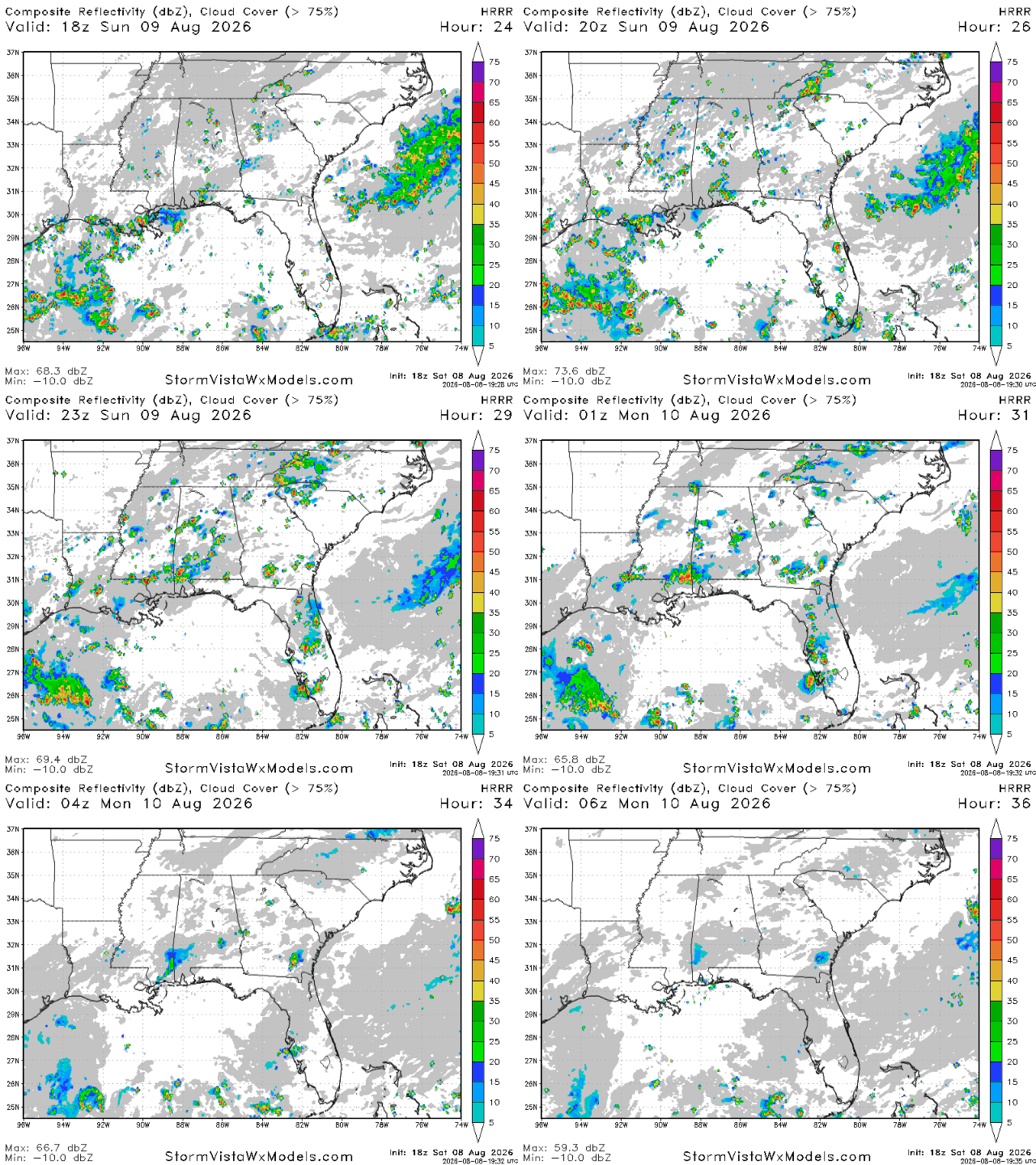
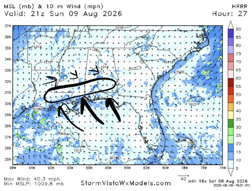
We’re expecting a few sea breeze storms tomorrow afternoon and evening. Storms are likely to fire up in the early afternoon in areas away from the coast, but also not too inland. These hot spot areas are where the southerly sea breeze meets surface wind that is westerly or northwesterly. While pop up storms are difficult to predict before they happen, the HRRR is suggesting that the Hattiesburg area may hit the jackpot for storms tomorrow.
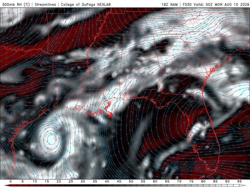
There’s certainly plenty of energy at the surface for storms to eat, but they don’t look to be as potent as they could be tomorrow. This is due to the dryness of mid-level atmosphere. Areas away from the coastline see high relative humidity at the 500 mb pressure level, while areas further north see lower values.
Monday
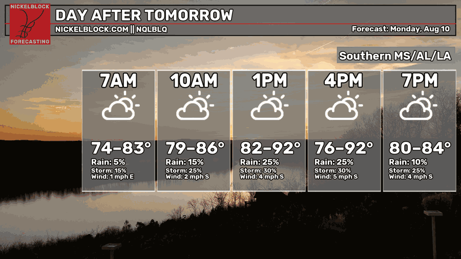
Temperatures are expected to cool down slightly on Monday, with afternoon highs in the lower 90s in some spots. Unfortunately, this cooldown will not come with a reduction in dew point temperatures, which will remain in the mid 70s for most of our area like tomorrow.
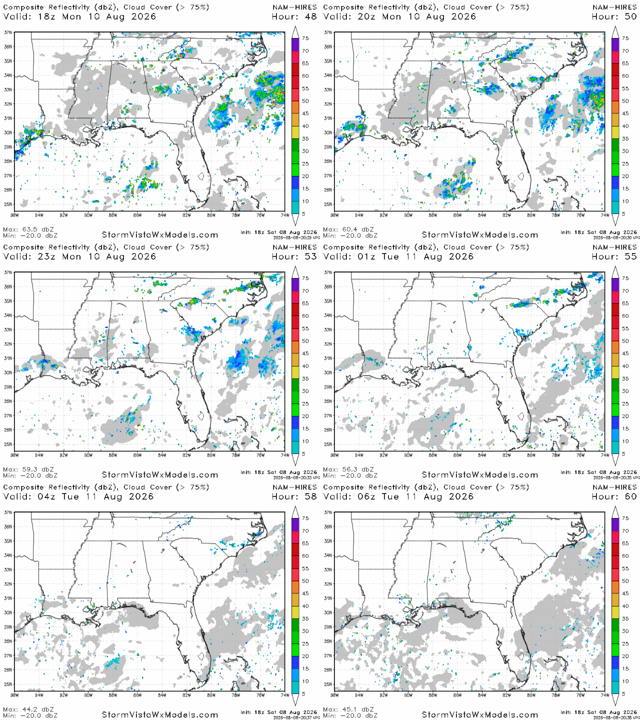
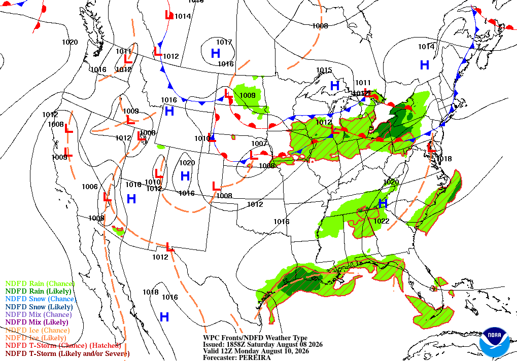
On Monday, there isn’t expected to be much relief from the heat and humidity, as storms look sparse throughout the area. A few showers are possible along the coast due to potential sea breeze storms as well as further north in northern Mississippi, northern Alabama, and the Birmingham area. In between those places, not much is expected.
The humidity won’t be pleasant, but Monday night might be a decent time to spend some time outdoors since you won’t have to worry about storms too much.

Extended Outlook
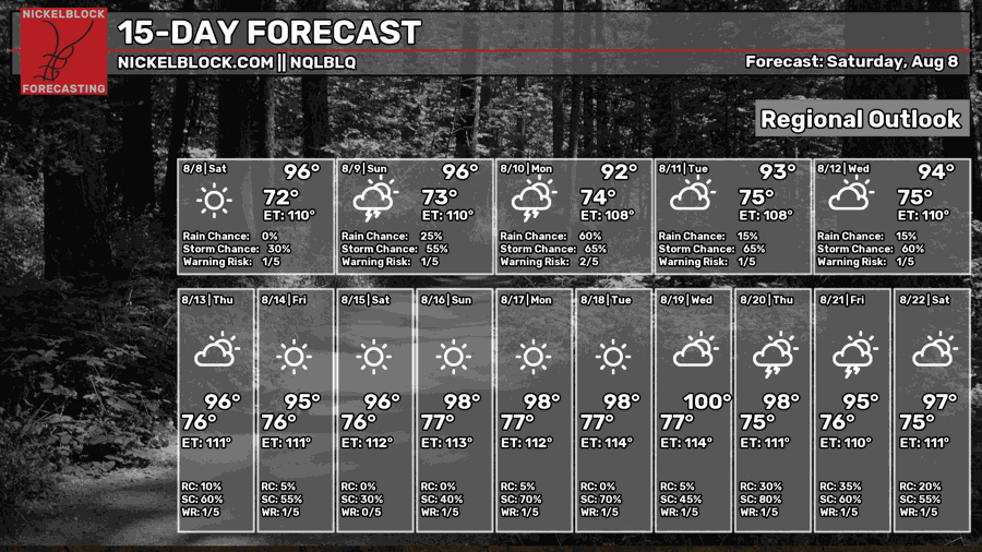
No cooldowns are expected at all during the next two weeks, with nearly everyday being forecasted to see highs in the mid-upper 90s.
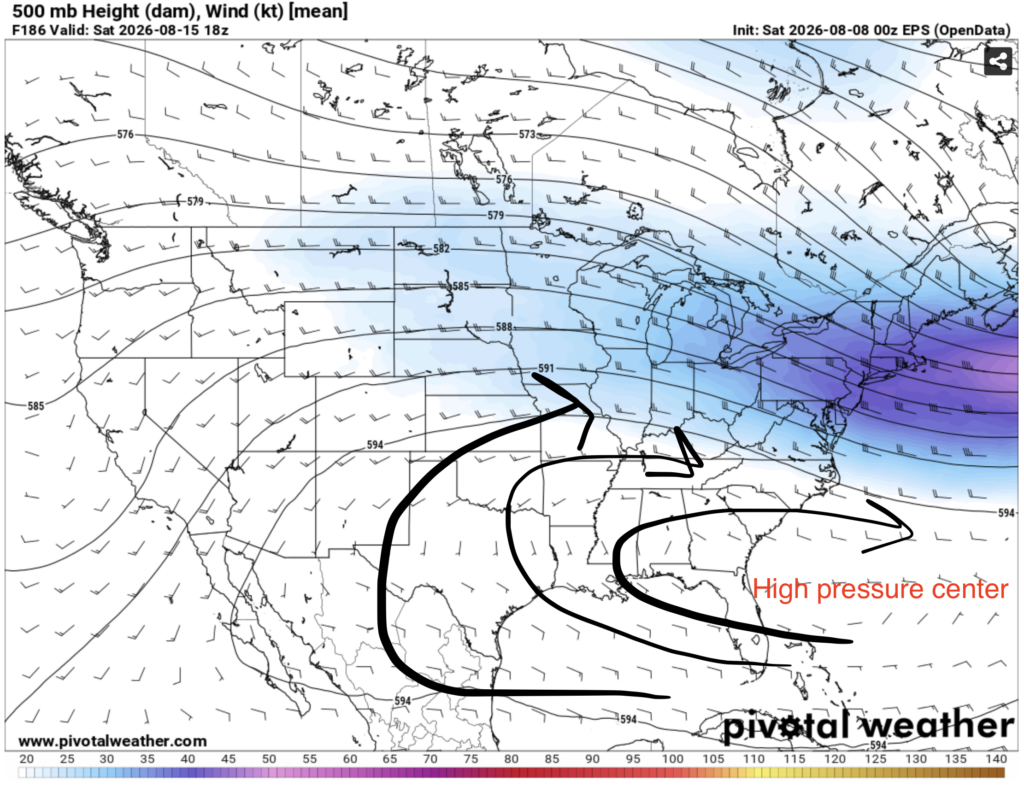
Beginning early next week and lasting until around the 19th, the dominating pattern looks to be a classic setup for heat and high humidity in the southeast. A high pressure center looks to set up over the subtropical Atlantic, which will bring us a constant stream of humid air from the Gulf of Mexico into our region.
During this time period, high temperatures are likely to be well above average, and daily thunderstorms can be expected.
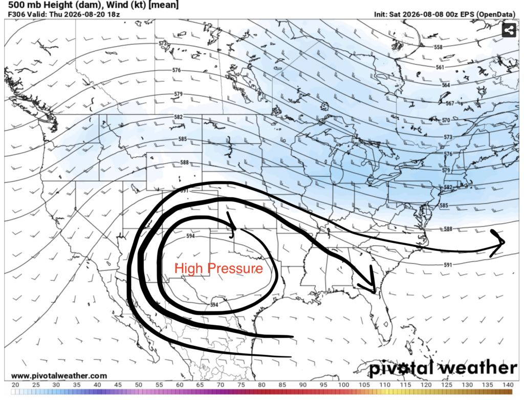
As we get later into the 2 week forecast period, the pattern shifts with ridging moving over to the west, centering itself over Texas. Temperatures are still likely to be hot, but they may be slightly more bearable as the winds in the southeast are now coming out of the northwest.
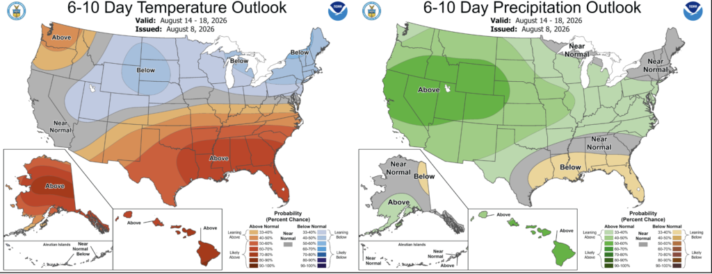
During the August 14-18 period, the NOAA CPC is giving our area a very good chance of seeing above normal temperatures, with slightly below normal precipitation. Out of everywhere in the lower 48, the southeast has the greatest chance of seeing above normal temperatures during this time period.
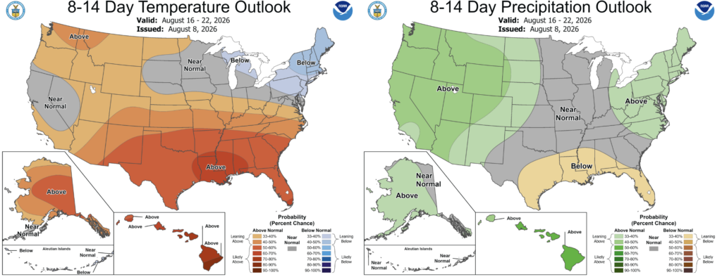
During the August 16-22 period, the NOAA CPC is again giving our area the greatest chance of seeing above normal temperatures out of anywhere in the lower 48. Confidence is a bit lower, but the message is clear.


