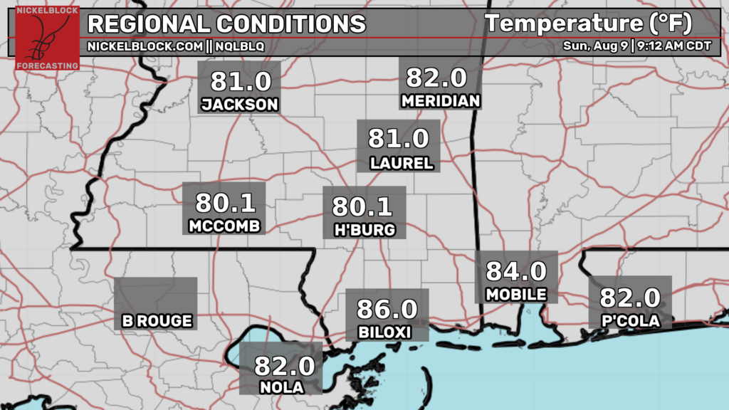
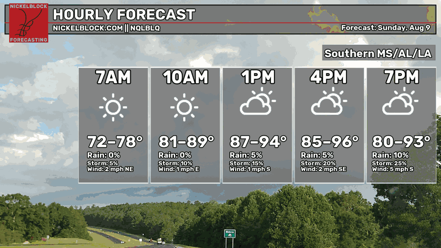
Good morning! As of 9 am CDT, temperatures are in the lower 80s throughout our region. Throughout the day today, temperatures will continue to get hotter, eventually reaching the mid 90s for many by late this afternoon.
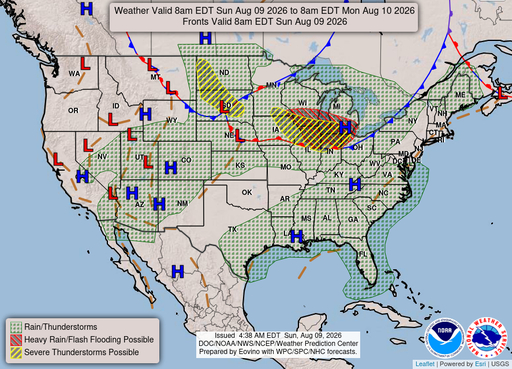
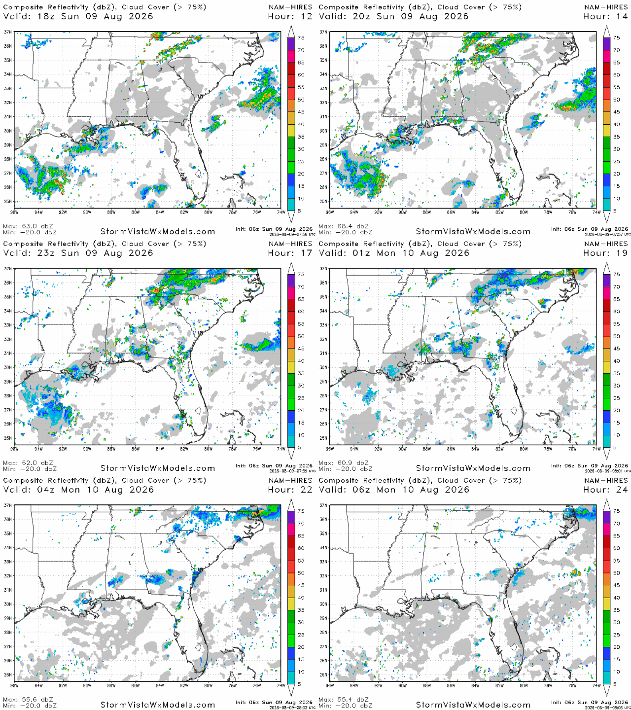
We’re expecting a few sea breeze storms today, mostly in areas a bit closer to the coast. We’re currently sitting under an area of high pressure, so it’s going to be difficult for more robust storms to form as this usually means the mid-level atmosphere is dry, which acts as a “lid” on storm development.
Since yesterday, the potency of the storms for today looks to have gone down slightly. However, some are still expected from New Orleans to Hattiesburg to Montgomery. Storms should begin to fire up today in the mid afternoon, and most storms should be fizzled out by 9 tonight.
Rainfall totals won’t exceed a quarter of an inch, but areas hit directly by storms may see more than that.
Tomorrow
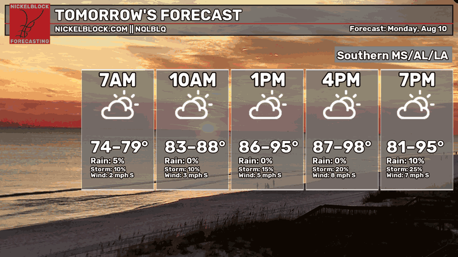
Moving into tomorrow, we’re expecting more above normal temperatures, with afternoon highs expected to get into the mid-upper 90s in most spots. Morning lows won’t be much better, bottoming out only in the mid-upper 70s.
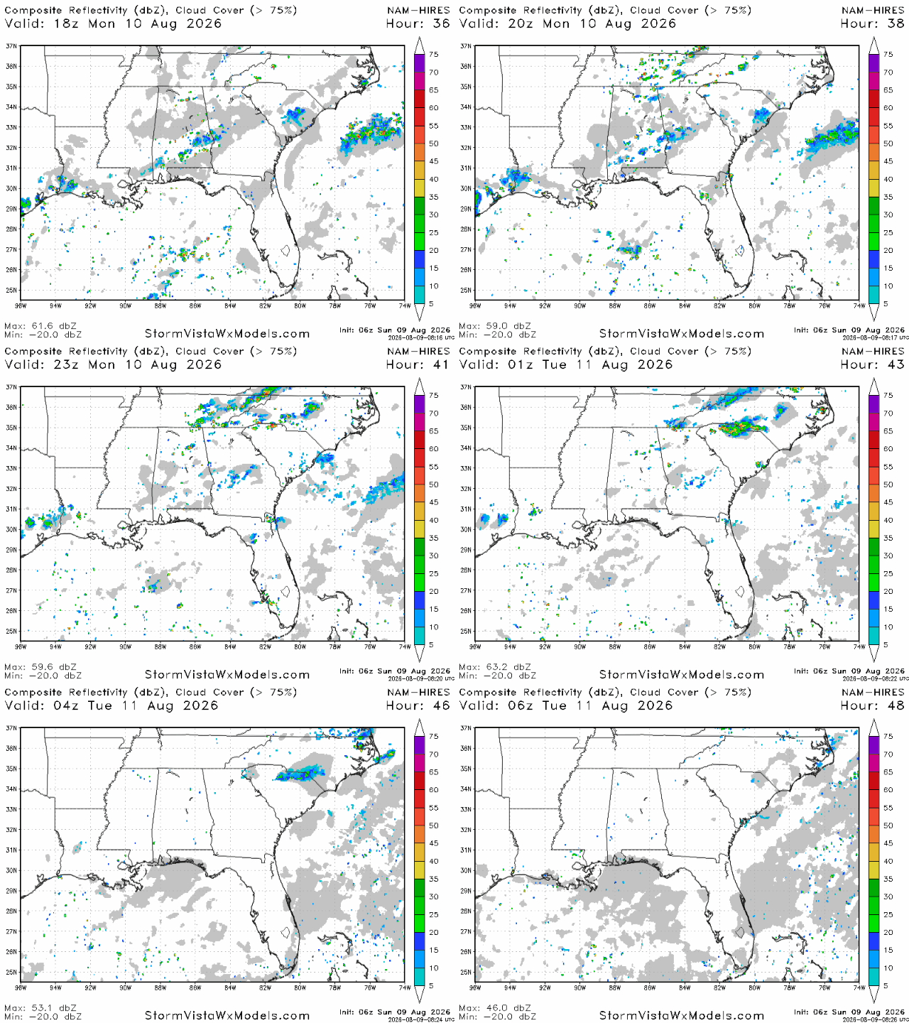
Similar to today, we’re stuck with sea breeze storms and that’s it tomorrow. Storms will be limited to areas relatively close to the coast where the sea breeze will clash with winds coming from a different direction further north. Mid-level dry air will be too much for any thunderstorms further north tomorrow.


