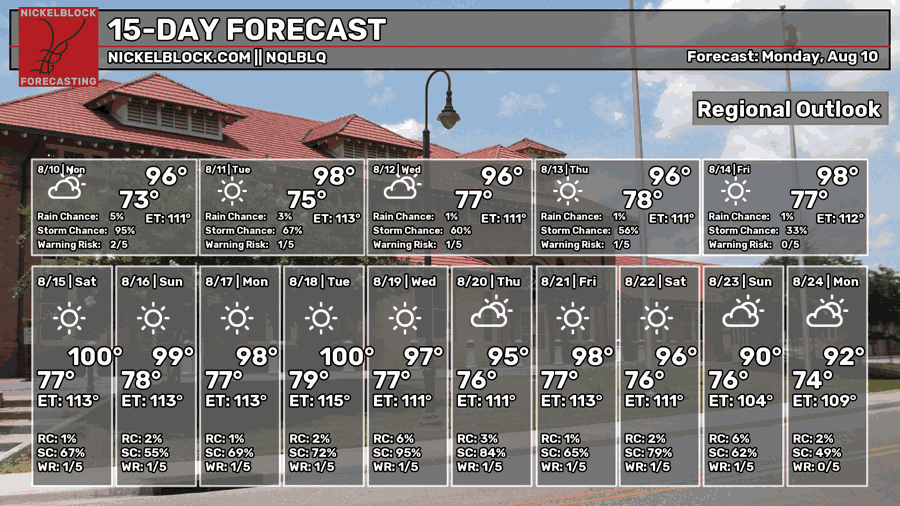
No surprise, it’s going to be hot in August. Unfortunately, rain chances will be pretty low too, so we’re just left with August heat. The heat index is also going to jump a bit into the 100s to around 110 due to the humidity factor as well. Temperatures in the 100s too! Let’s take a look.

Today
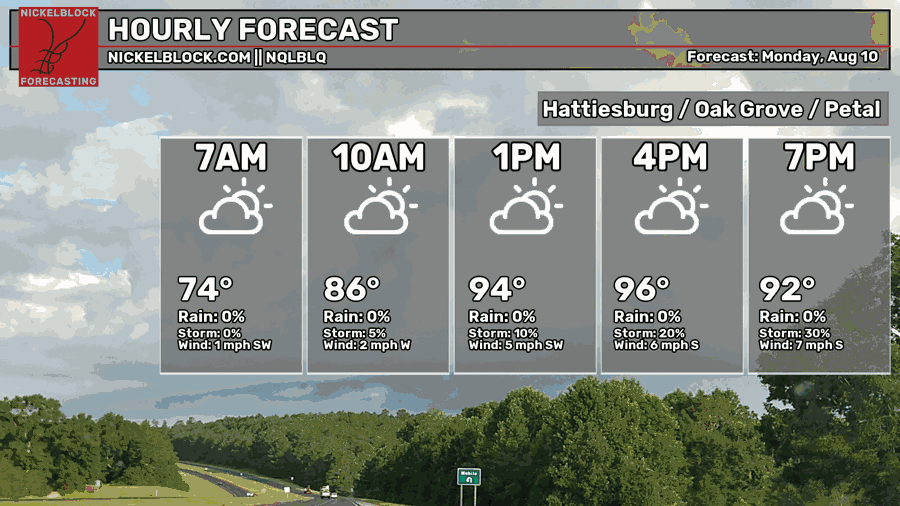
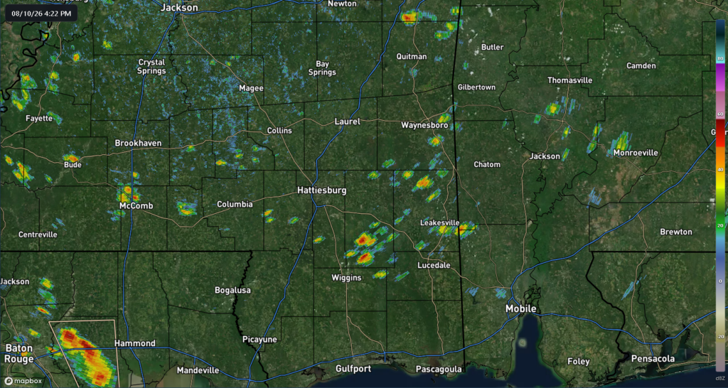
A few storms have already developed across the southern end of the Pine Belt and we can expect a few more to pop up before sunset. They are making their way north in parts of Perry, Greene, and Forrest County. Most of these will be short-lived and provide only a little bit of relief for us. Otherwise, it’s been a mostly sunny day for us with a high in the low to mid 90s. The heat index has already reached the mid 100s today! Afterwards, we can expect a calm night with temperatures in the mid 70s.

Tomorrow
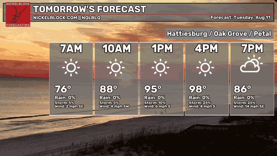
Another hot one is upon us with a high in the mid to upper 90s. I won’t be surprised to see a heat advisory out tomorrow as the heat index reaches the mid 100s again. A few pop-up thunderstorms are possible again, so expect a few across the Coast and the Pine Belt. Overnight, temperatures will fall back into the mid 70s with winds picking up in the evening.
Wednesday
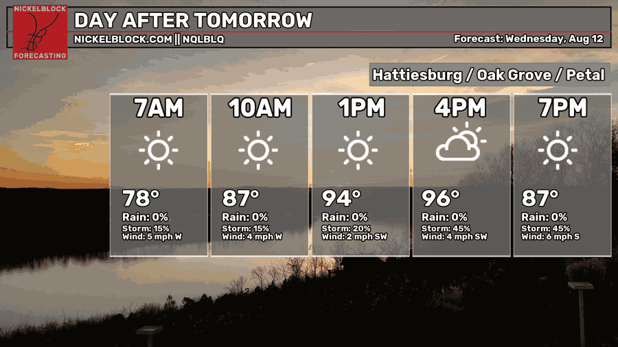
The clouds will cut back a bit and lead us to another hot day on Wednesday. Temperatures will reach the mid to upper 90s with not much rain to speak of. The heat index will once again reach the mid 100s, so stay hydrated out there! Overnight it’ll be another warm one with temperatures in the mid 70s.
Hot End of the Week
Temperatures are going to hit 100 by the end of the week! The humidity stays the same, but that means we’ll likely hit the upper 100s in terms of experienced temperature. This continues into the weekend, so it’ll be scorching hot leading into next week. Not much is changing for us for a little while.
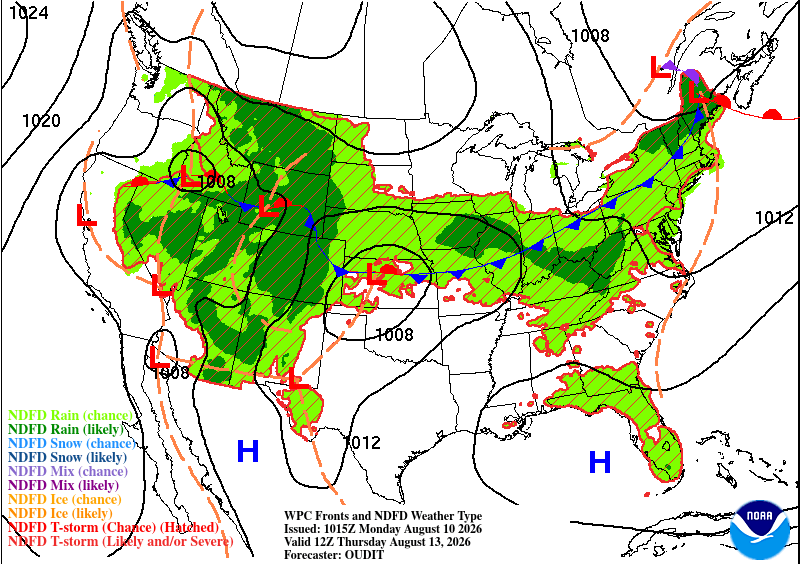
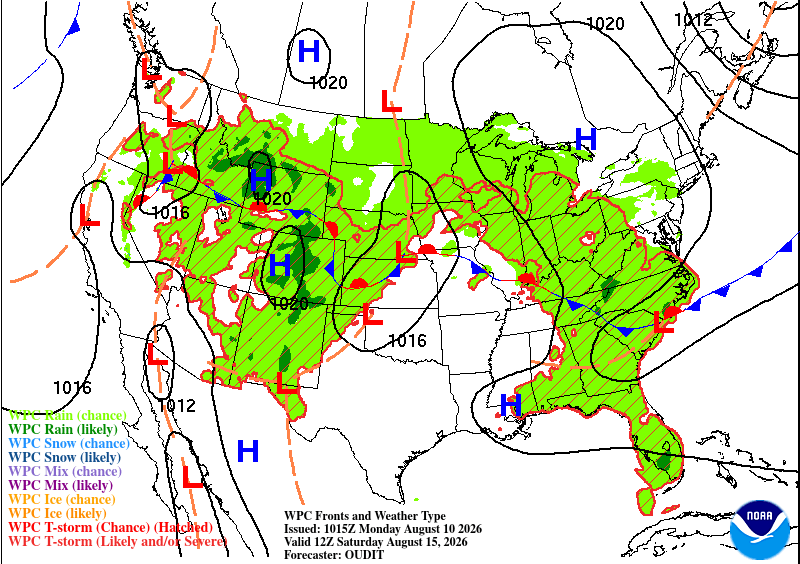
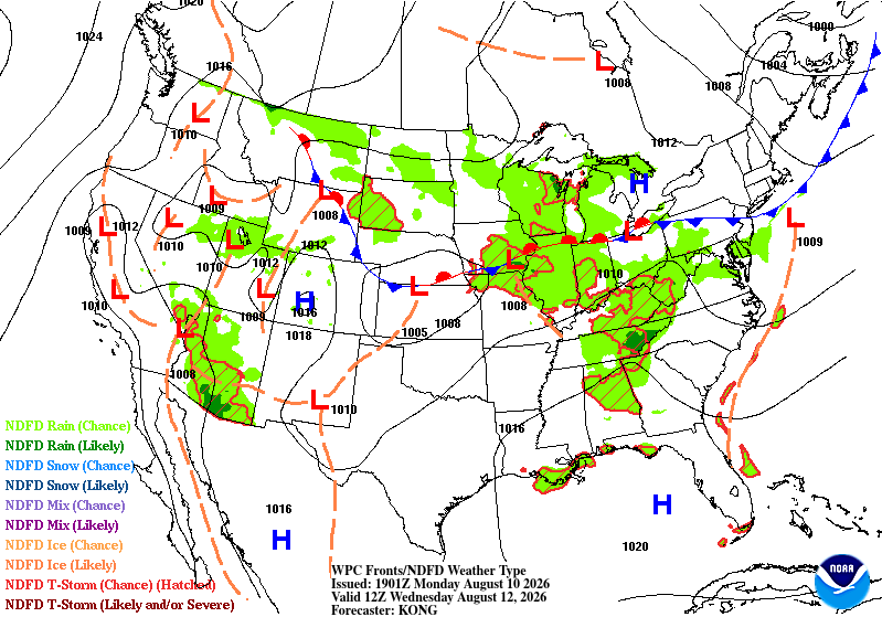
A Bermuda high is morphing towards the Gulf and will hinder the rain chances further by the end of the week. A brief period of dry is possible on Friday which means the heat won’t be as unbearable, but still hot nonetheless. By the weekend, the cold front will sag towards the southern mid-Atlantic bringing a slight chance of rain for us near the coast and in the Pine Belt.