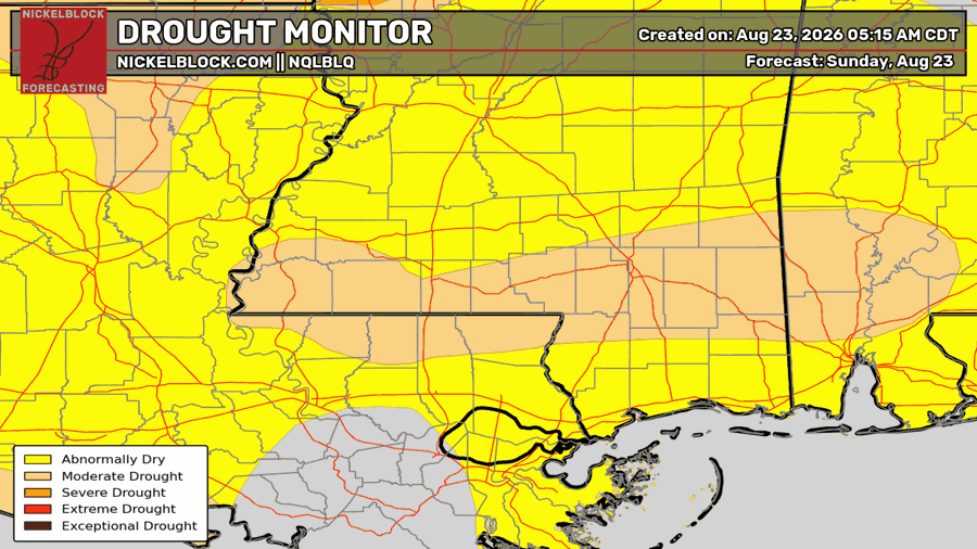
Good morning, everyone! I hope you all have a great Tuesday. This morning we had some shower activity to our north and west, but most of our region is largely dry. For those wanting some rain to come, you probably won’t see any today, but tomorrow and Thursday give you another chance to see some.
The Setup
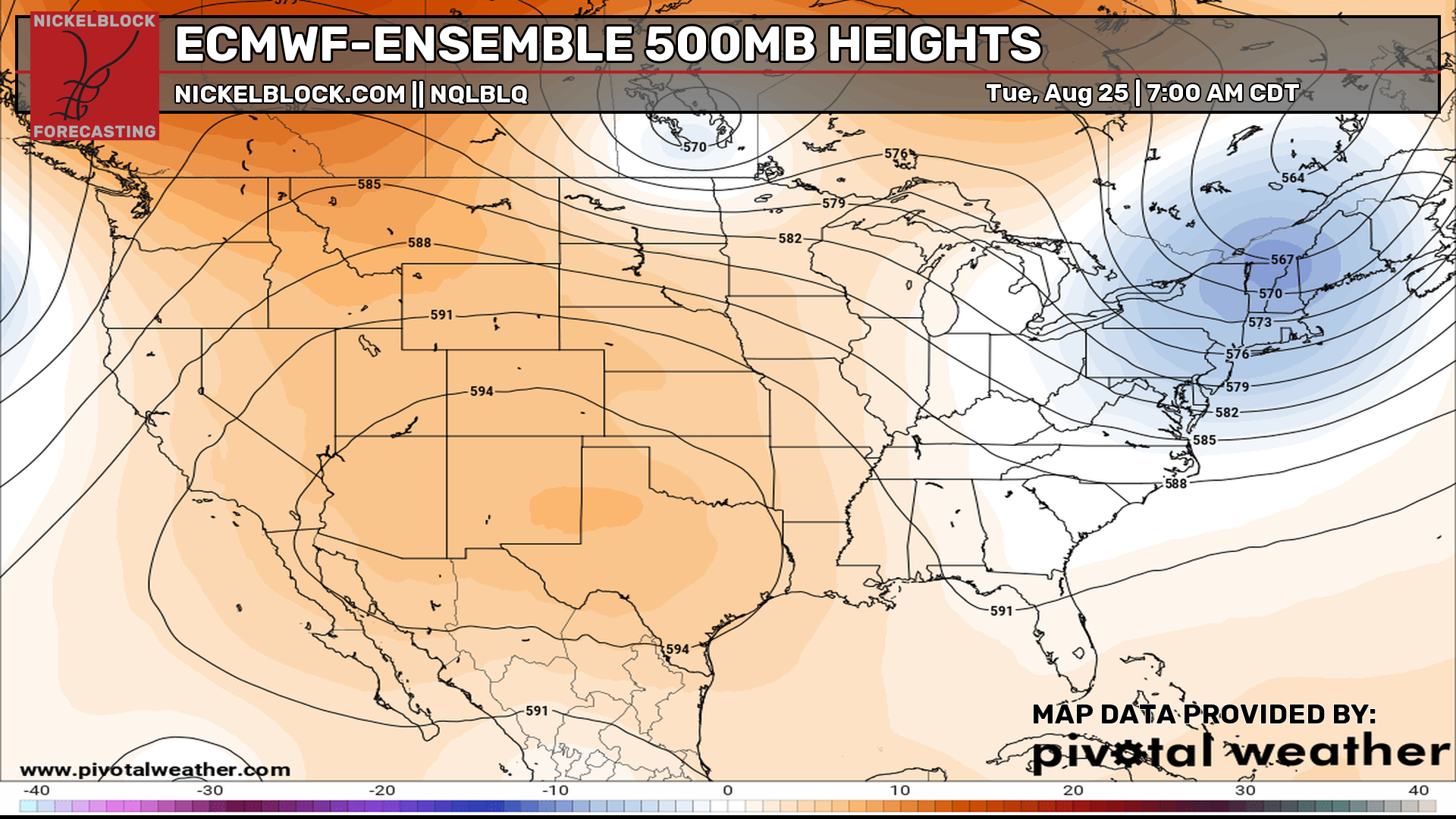
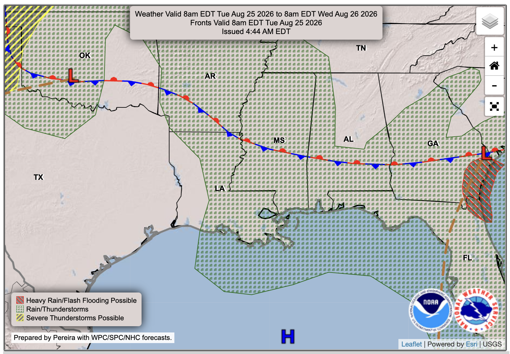
We currently have that large ridge over the west and sneaking into our region, allowing for temperatures to continue to be above normal for the time being. We are on the east side of the ridge, so any rain or storms are coming from the north or northwest, including the broken-up MCS that only those far south saw, and even the spotty showers today. A front is stalled over central MS and the mid-south. This will interact with more moisture and develop a nearby low-pressure system tomorrow, which will bring more shower or thunderstorm coverage and possibly severe winds.

Today’s Forecast
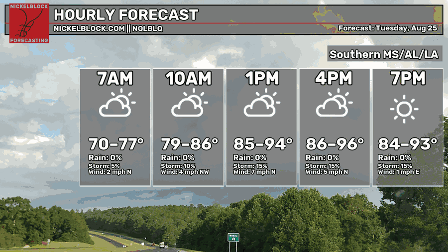
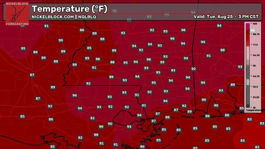
As for today, that shower complex we saw to our northwest this morning has dissipated as it interacted with dry air, and we’ll see mostly sunny skies for the rest of today. A few isolated showers or thunderstorms are possible, but there’s only a 20 percent chance of seeing them. As of this post, 2PM, there are a few cells popping up over Slidell and New Orleans. Temperatures are still in the mid-90s, with the humidity making it feel like 100+. Tonight, temperatures will dip into the mid-70s. Stay safe out there.

Tomorrow’s Forecast: Wednesday, August 26th
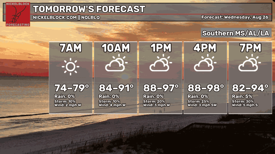
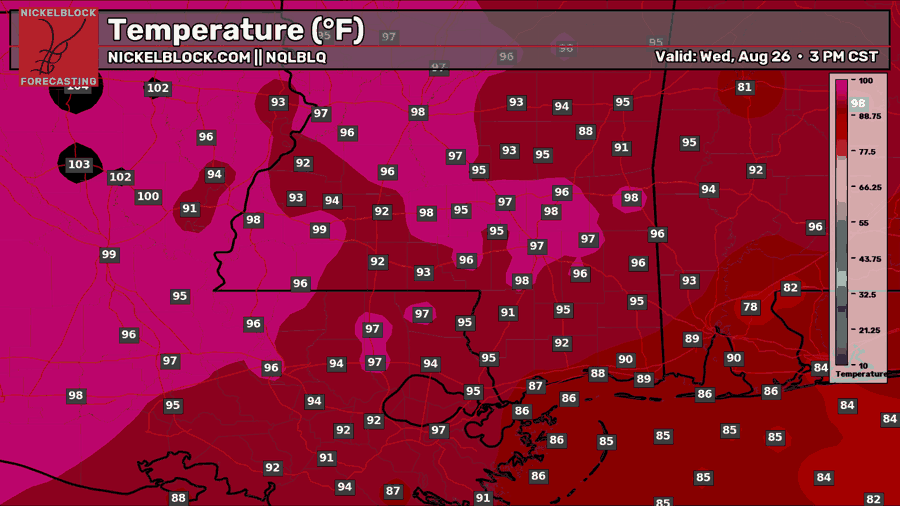
For tomorrow, Wednesday, it looks like most of the day will stay dry, but as we get into the afternoon and evening, a few storms will try to pop up before a line of storms makes its way in from the northwest. The SPC currently has a Marginal (level 1 out of 5) risk of severe weather, mainly for severe wind gusts near Jackson and points northwest. You can see the HRRR picking up a bowing segment along that line late tomorrow after sunset, but we will see if that line reaches far south or not.
Thursday’s Forecast: August 27th
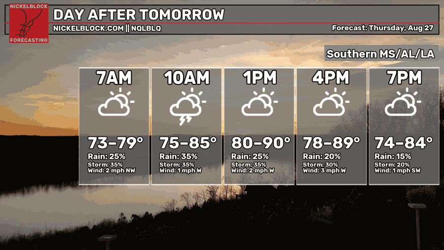
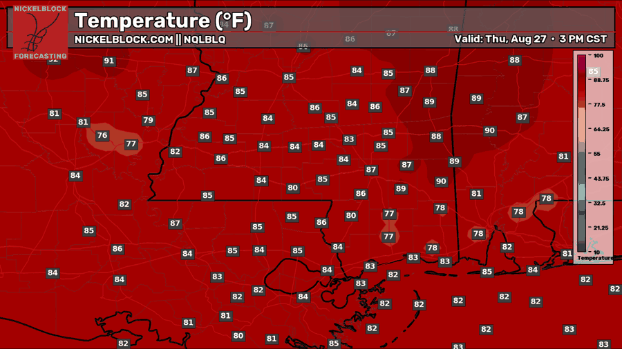
Thursday is a similar story, but the SPC does not have any severe risk outlined for our region. Showers and thunderstorms are possible throughout the day, hit-or-miss, since we are right near the stationary front, yet again. Flash flooding is possible again in areas where there are heavy downpours. This day could feature more coverage, as the front looks like it will squeeze out any remaining moisture as it starts to move away.
Extended Local Outlook
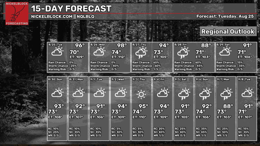
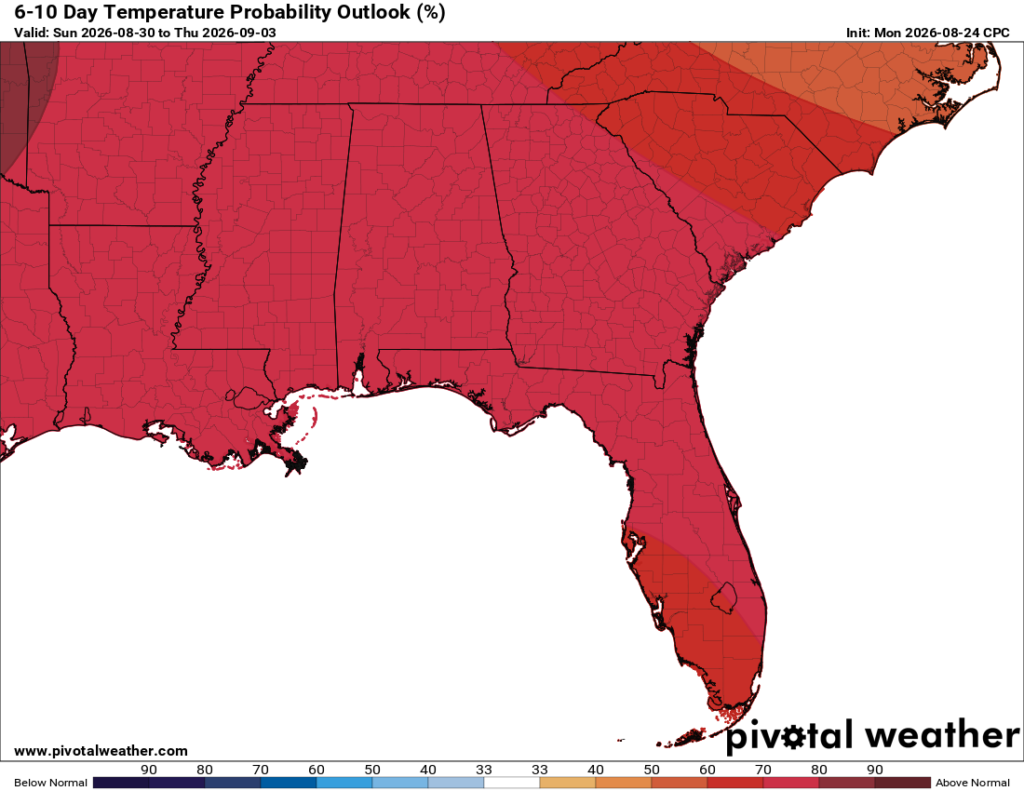
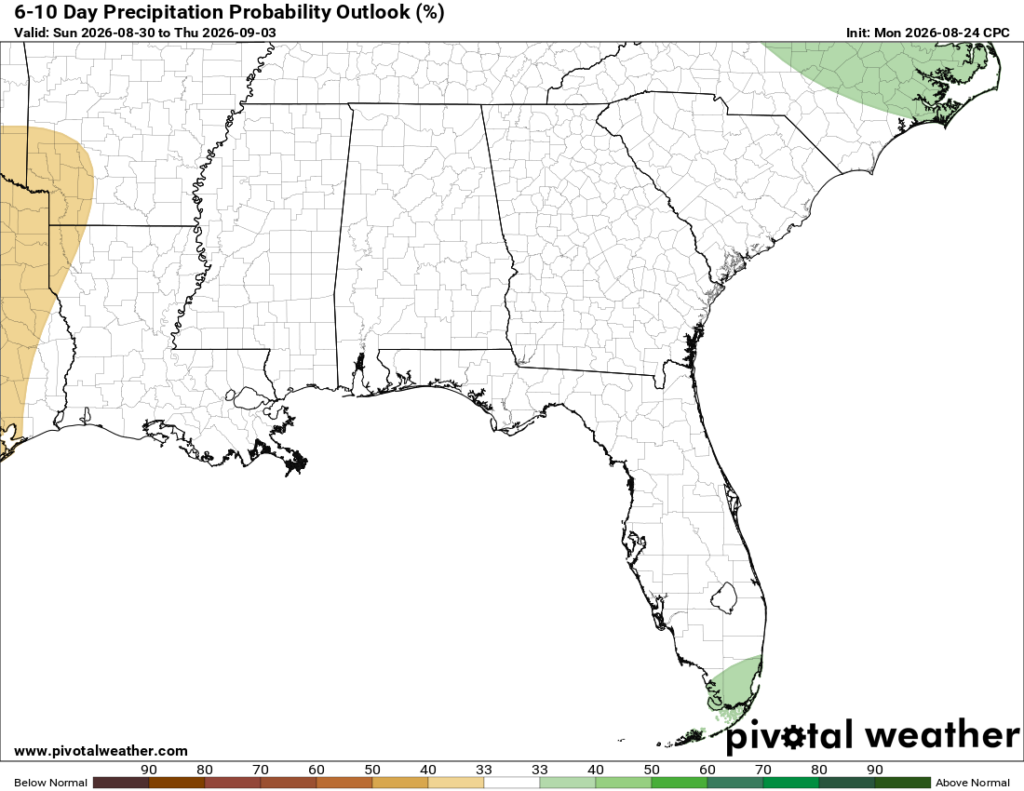
Looking ahead, we will keep around that daily afternoon thunderstorm chance into at least the weekend, but it doesn’t look like there will be any huge rainmakers for the time being. The 6-10 day outlook from the CPC shows near-normal precipitation and above normal temperatures. To be honest, much of the same. We are in a worsening drought in many locations, so we really could use some rain, which you all already know!