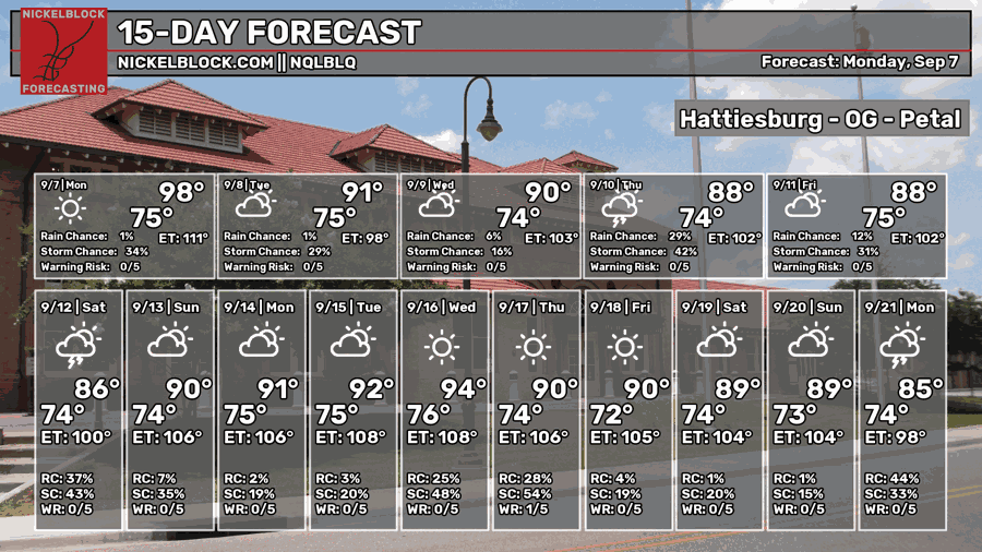
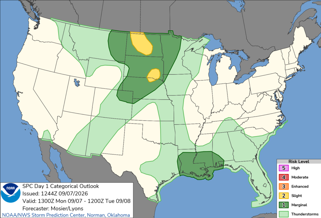
The Summer pattern is holding on as long as it can at this point.We’re stuck with hot and humid weather for the next several days and it doesn’t look like anything’s going to change that for a while. We do have a Marginal (1/5) risk for severe weather today as any sort of storm has the potential for downbursts if it develops well enough. We’ll also see less humid conditions by mid-week dropping the “feels-like” temperature which means not as unbearable heat for now!

Today
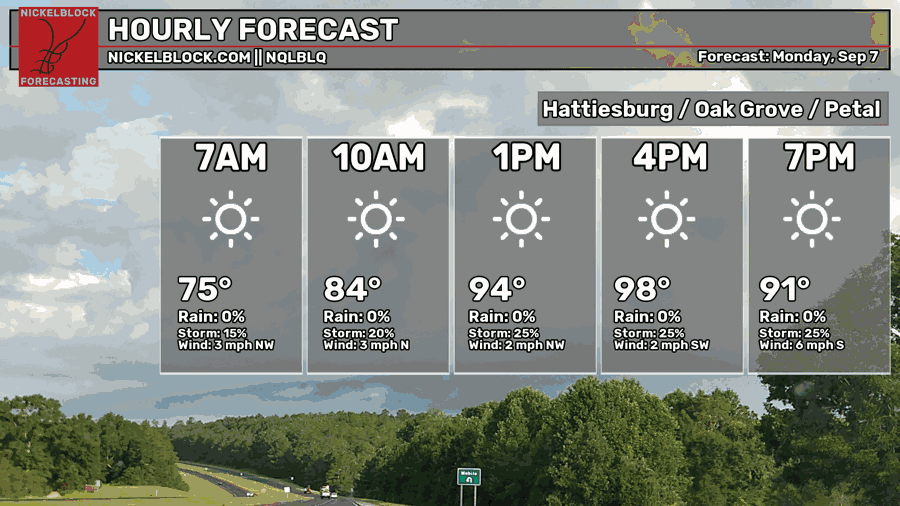
Labor Day’s going to be a very hot one and temperatures are hitting the mid to upper 90s today. The NWS in Jackson has placed a Heat Advisory over much of the southern portion of its county warning area. We’re under the “enhanced” risk which means that the heat index will feel like 105-110 during peak hours. If you’re out, stay near or have water on you!
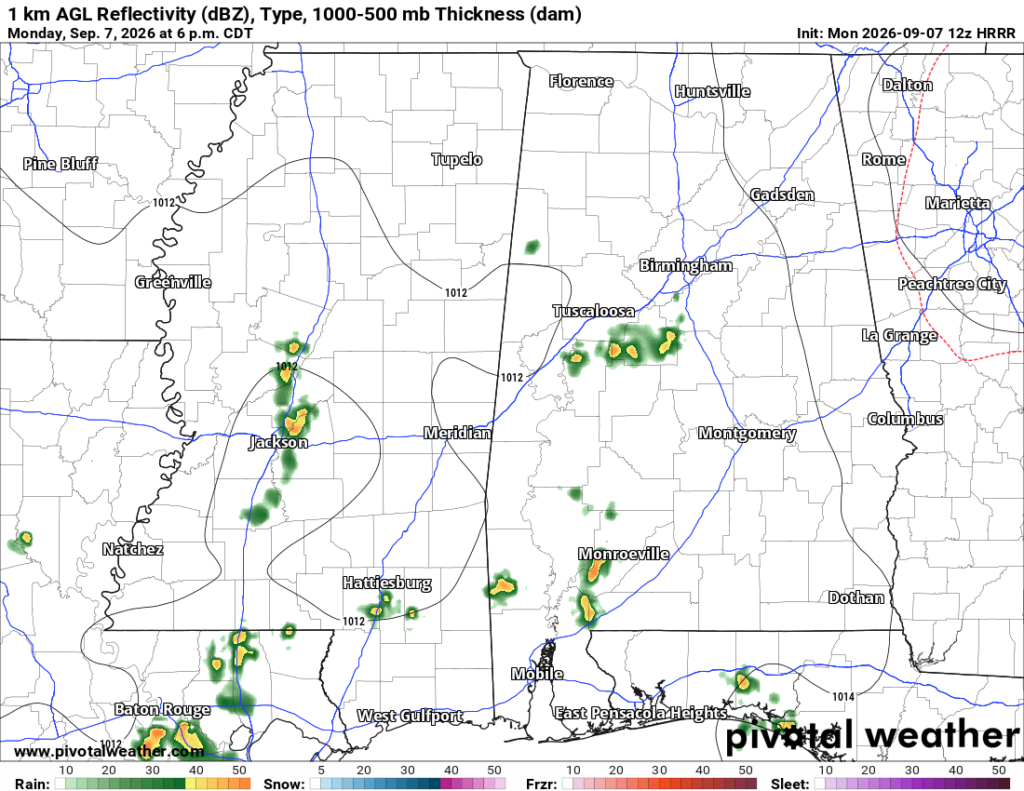
By the mid-afternoon, some pop-up thunderstorms will develop and the Storm Prediction Center has placed a Marginal (1/5) risk over us for severe weather. They’re expecting these pop-up storms to develop quickly which means that downbursts and gust fronts are imminent. Flash flooding, heavy rain and gusty winds are all possible with these storms. After the storms have dissipated around the evening, we’ll go back to our usual humid night with temperatures in the low to mid 70s.

Tomorrow
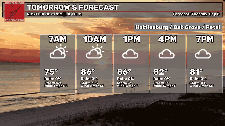
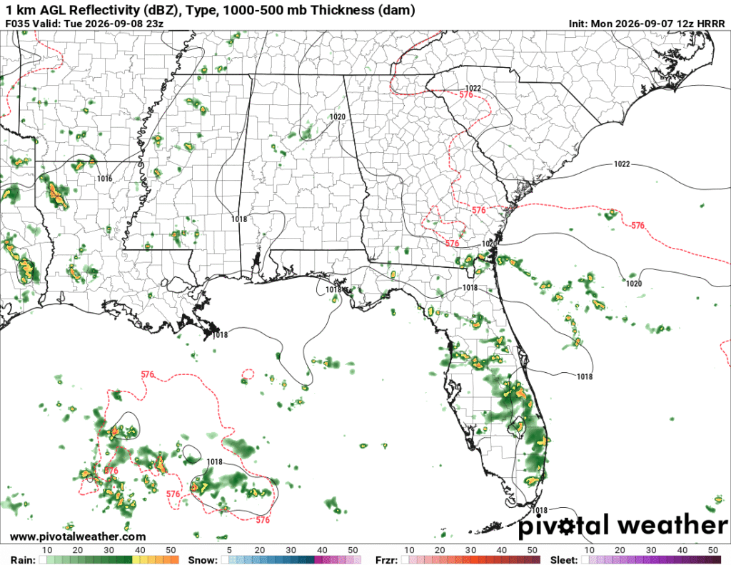
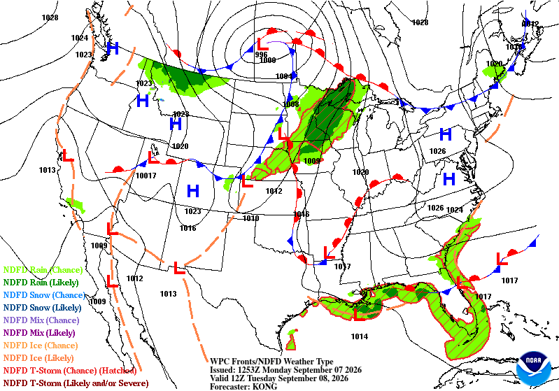
As we slide back into a 4-day work week, we’re going to see some slight relief from the overwhelming heat. The graphic above I believe is a bit of an anomaly, but the HRRR model also shows a bit of an anomaly on their side. Between two fronts is the potential for a cluster of thunderstorms in the late afternoon. Each refresh has decreased the likelihood of a small “outbreak” so it looks like this is turning into less and less of a chance. Temperatures will reach the low 90s with the heat index sitting just below 100. Lows will be in the mid 70s.
Wednesday
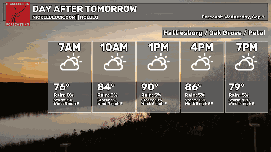
The NQLBLQ model is showing a quick warm-up in the early afternoon with temperatures reaching the low 90s. Since there is a little less humidity than what we usually deal with, it’ll be somewhat easier to heat the surface. Rain chances are closer to the coast this time as the front will inhibit storm development further inland. We still may see a few pop-up thunderstorms in the afternoon, though. Overnight, temperatures will fall back into the low to mid 70s.
End of the Week
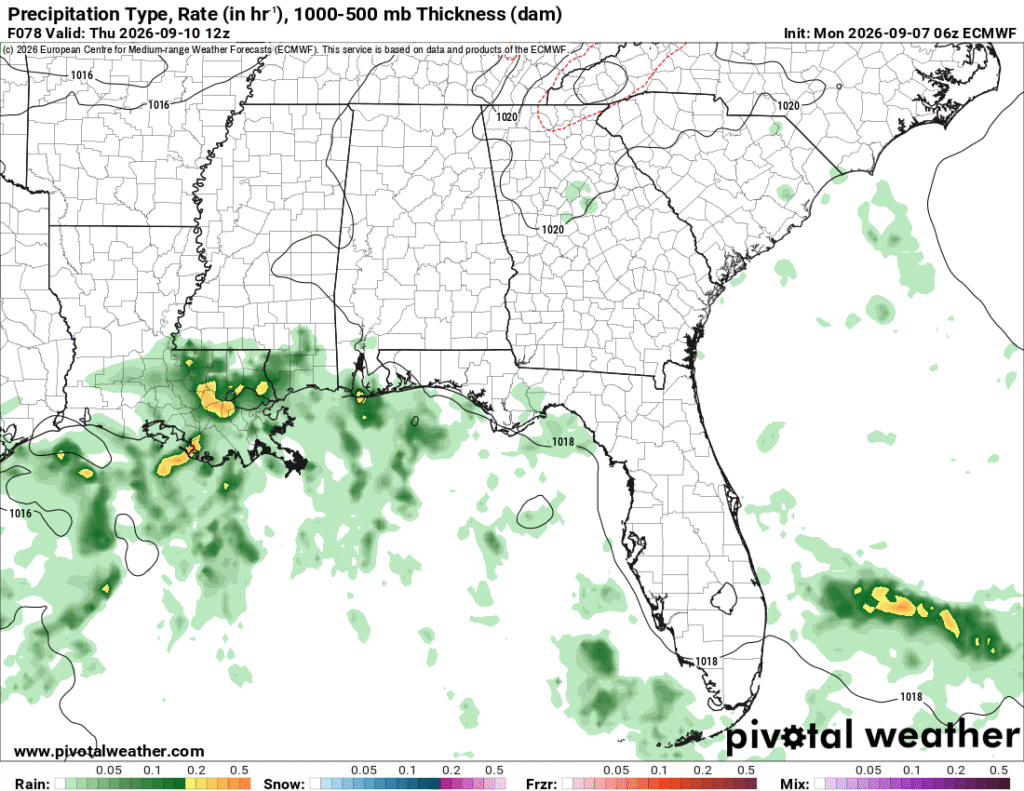
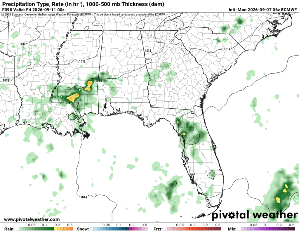
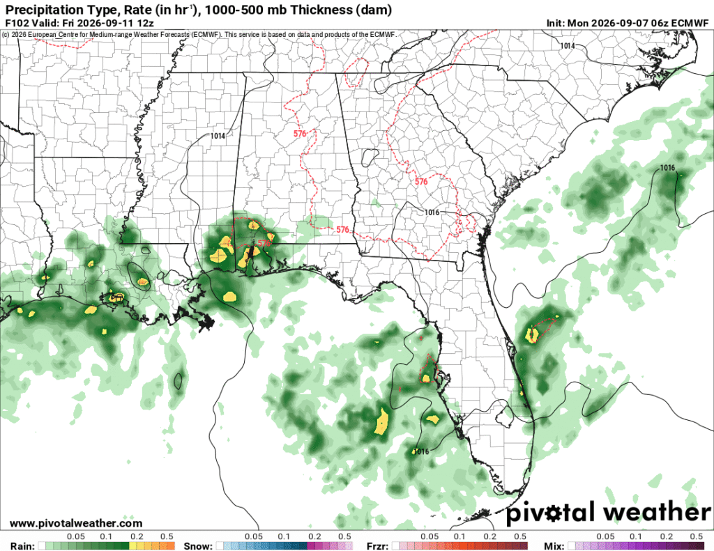
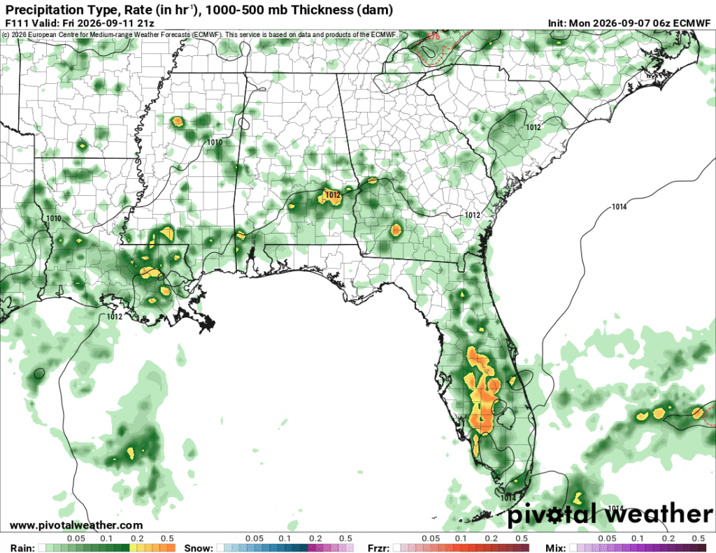
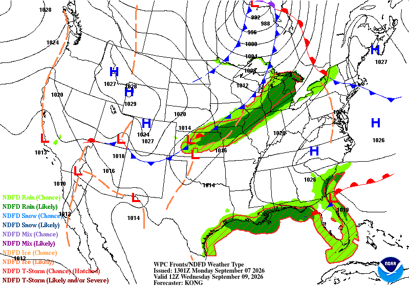
As the front stalls around the coastline, there is enough moisture around the coast to bring some possible rain on Thursday morning and into the evening hours. Depending on how much cloud cover we have, temperatures could max out in the upper 80s instead of the 90s. The humidity will still be a factor, however. Friday will be a similar story with more moisture flowing after the offshore winds move in and onshore winds move moisture further inland.