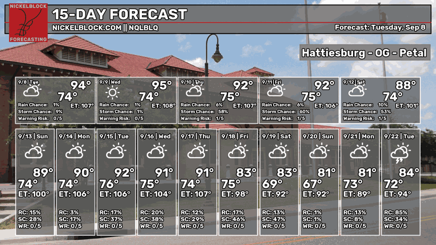
The heat has dialed back a bit today, and the pattern will remain the same for a little while. A front at the coastline will help drive moisture into the Gulf Coast region and bring some much needed rain to our area! This looks to persist through the weekend, so if you have plans to go outdoors, be ready for an afternoon shower.

Today’s Setup
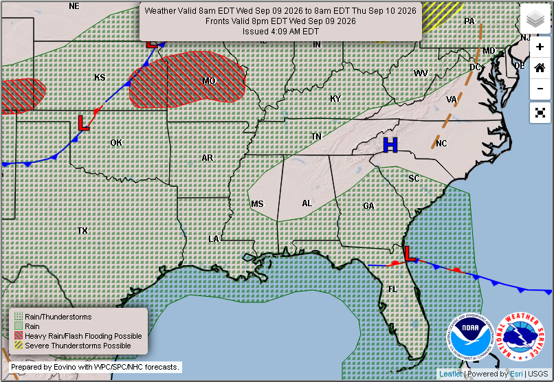

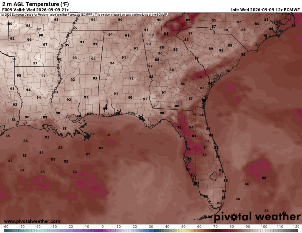
A broad area of high pressure is over the Appalachians and a stationary front is over the northeastern Gulf. The front will stave off most of the rain for anyone away from the coast. It’s a pretty dry and hot day, but not oppressive for most of us on the coast or the Pine Belt. The high has reached the low to mid 90s with the heat index in the low 100s. Overnight, we’ll go back into the low to mid 70s.


Tomorrow
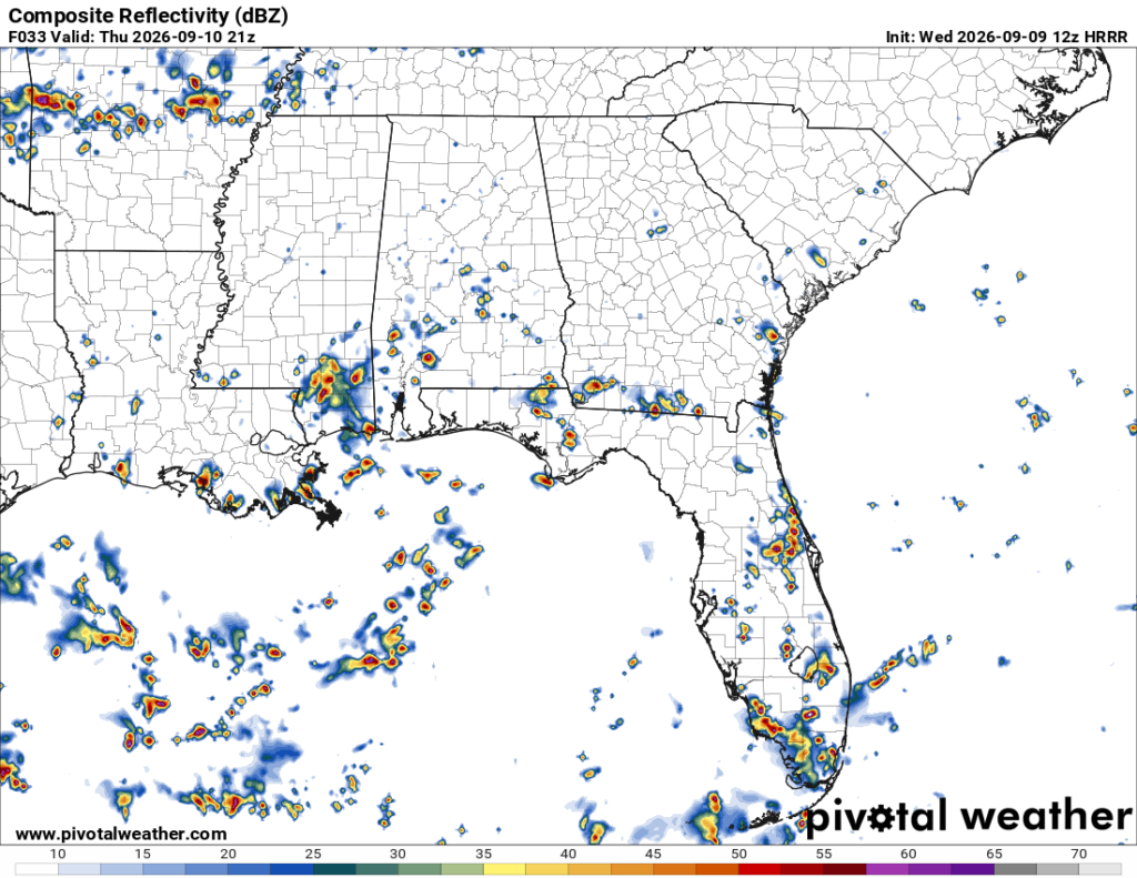
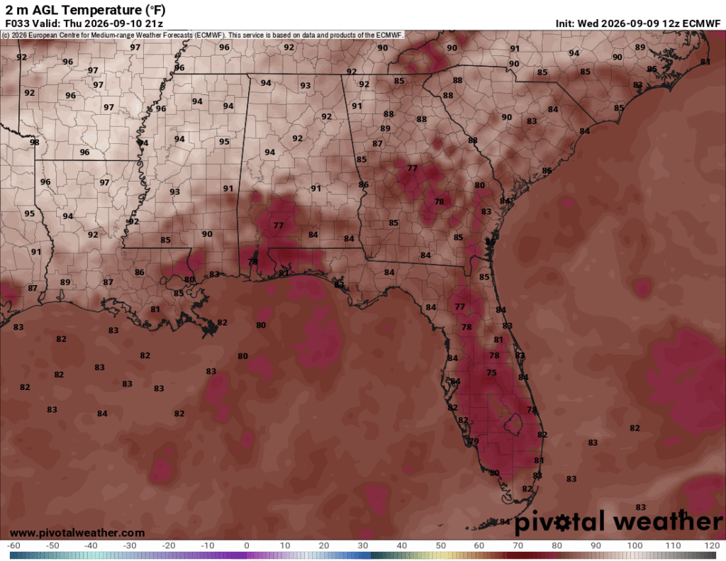
A broad low is moving in the northern Gulf bringing more rain and thunderstorms on Thursday afternoon. Be prepared for some heavy rainfall and possible flash flooding! The HRRR model is suggesting a cluster of cells developing around the central Pine Belt and across much of the southern portions of MS/AL/LA. Temperatures will reach the low 90s as the clouds move in by the middle of the day. The rain looks to move out before midnight and low temperatures will fall back into the low to mid 70s again.
Friday
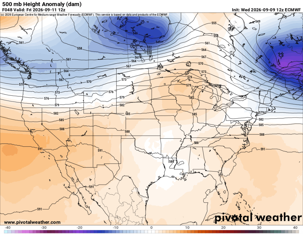
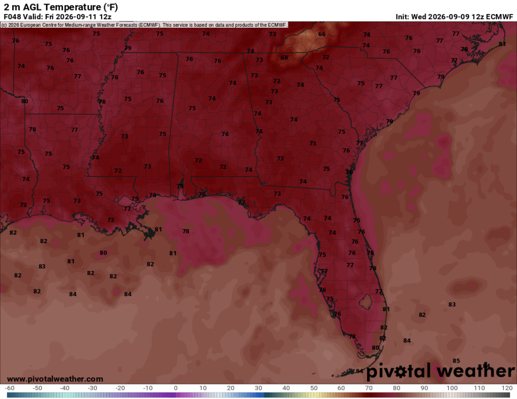
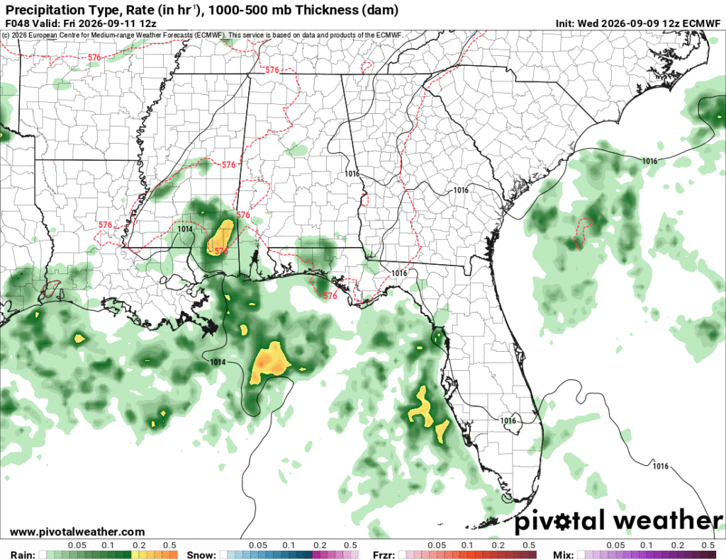
Some rain showers will move in early Friday morning around the coastline and possibly into the Pine Belt. This will keep temperatures down a bit and reducing high temperatures to the upper 80s to around 90 for much of us on the southern end of the state. More rain is likely in the afternoon with the southern winds pushing the sea breeze further inland. For most of us, the rain will move out by the early evening, so the Friday night football game should be clear. For those a bit further north, more rain is possible into the evening hours. The low will drop to the low 70s overnight.

This Weekend
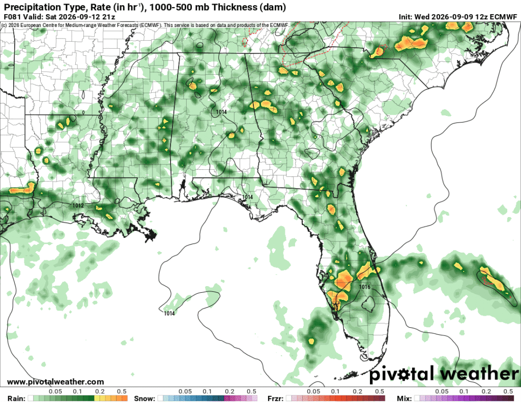
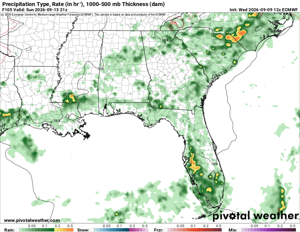
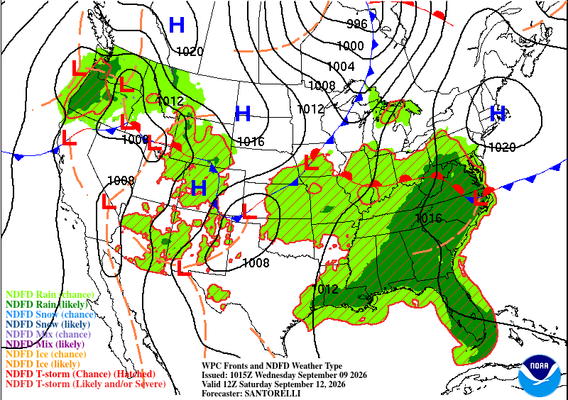
The weekend starts off with scattered rain and thunderstorms on Saturday. Bring your umbrella since it’s going to rain on and off during the afternoon! Temperatures will likely hover around the mid-80s to around 90. Saturday will be pretty damp, and we may even see some early Sunday showers as well. More will develop and move in Sunday afternoon, so bring your raincoat with you if you’re coming out of church in the mid-afternoon.