The Setup
Happy hump day! The forecast remains the same as yesterday’s, with humidity and moisture increasing in our area before this weekend’s rainmaker moves in. You should have already felt the humidity increase as the day went on today. Hopefully you didn’t take the low humidity for granted though, since it won’t decrease again until early next week.
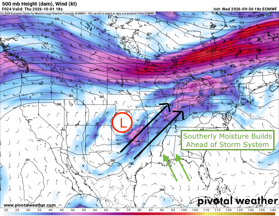
Southerly flow is pulling this moisture from the Gulf around the ridge of high pressure over the southeast and towards the low pressure and strong dip in the jet stream over the central U.S. A very large area of the country is under a flash flood threat tomorrow as the storm system squeezes out a significant amount of tropical energy from Hurricane Polo as well as from the Gulf, now that it’s moving east and tapping into that energy source that we know and love.
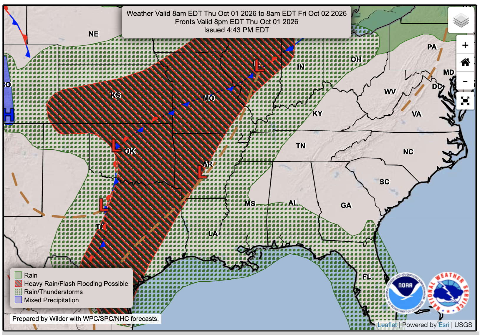

Tomorrow’s Forecast: Thursday, October 1st 🎃
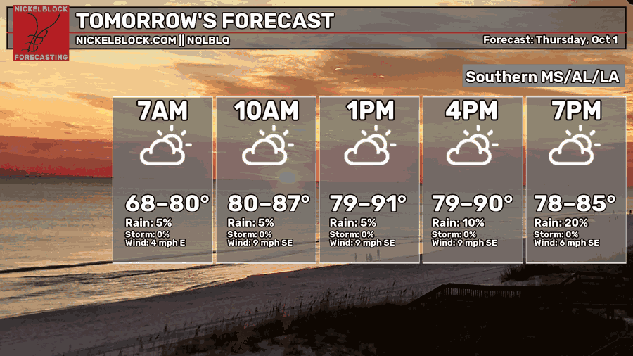
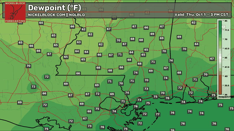
Clouds are building out ahead of the weekend, so expect increased cloud coverage throughout the day tomorrow. High’s will reach near 90 for most areas, and dewpoints will sit in the upper 60s and lower 70s, which will make it feel muggy and like 100 degrees. Some scattered showers will push from the Gulf, starting early the further south you go, and making it’s way to our northern areas by the afternoon, winding down by the evening. These will be scattered showers, with a small chance of thunder and lightning within some of them.

Friday’s Forecast: October 2nd
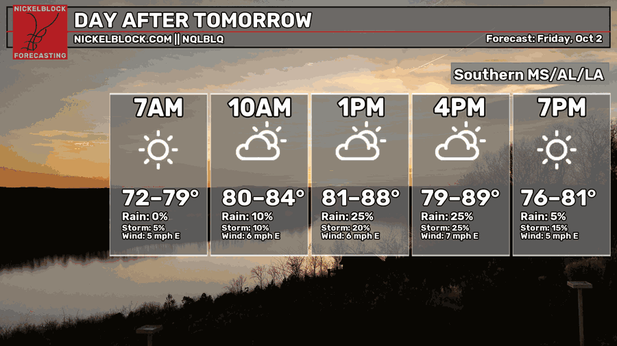
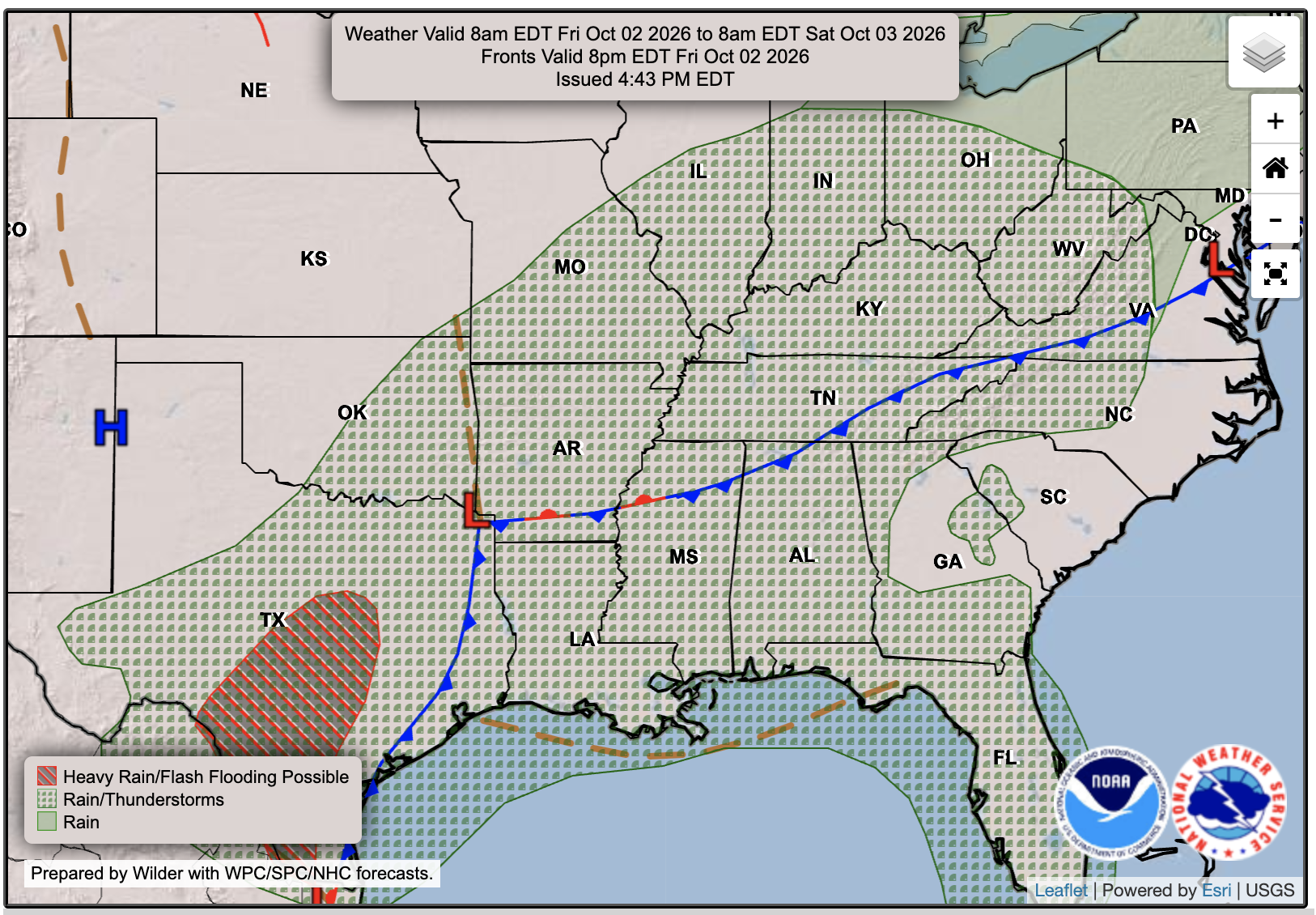
Humidity and clouds build even more on Friday, with temperatures down by a few degrees, in the upper 80s, due to the cloud cover. As the low pressure and associated fronts move even closer to our area, some more showers and storms will be possible throughout the day, though we’re saving most of the rain that we will see for Saturday and Sunday. This day does seem wetter than Thursday, so ensure you are prepared for some more numerous showers and storms. The WPC has placed our area under a level 1 out of 5 risk of excessive rainfall/flash flooding for Friday.
Weekend & Extended Local Outlook
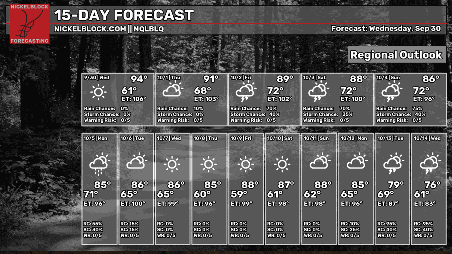
The big rainmaker moves in by Saturday and Sunday, brining potentially multiple inches of rain and possibly some flooding. The WPC has placed us under a level 2 out of 5 threat of flash flooding on Saturday and Sunday, with the potential for an increased threat level definetly out of the question as we get closer. The WPC is predicting 2-4 inches for most of our region, but some models show even higher totals up to 8 inches in some areas possible, depending on where most of the banding sets up. My thoughts are that the further south you are, the higher the rain total you will see, and those close to the coast could very well see those 4 + inches totals. Temperatures will also be brought down to the mid-80s for the weekend and next week.
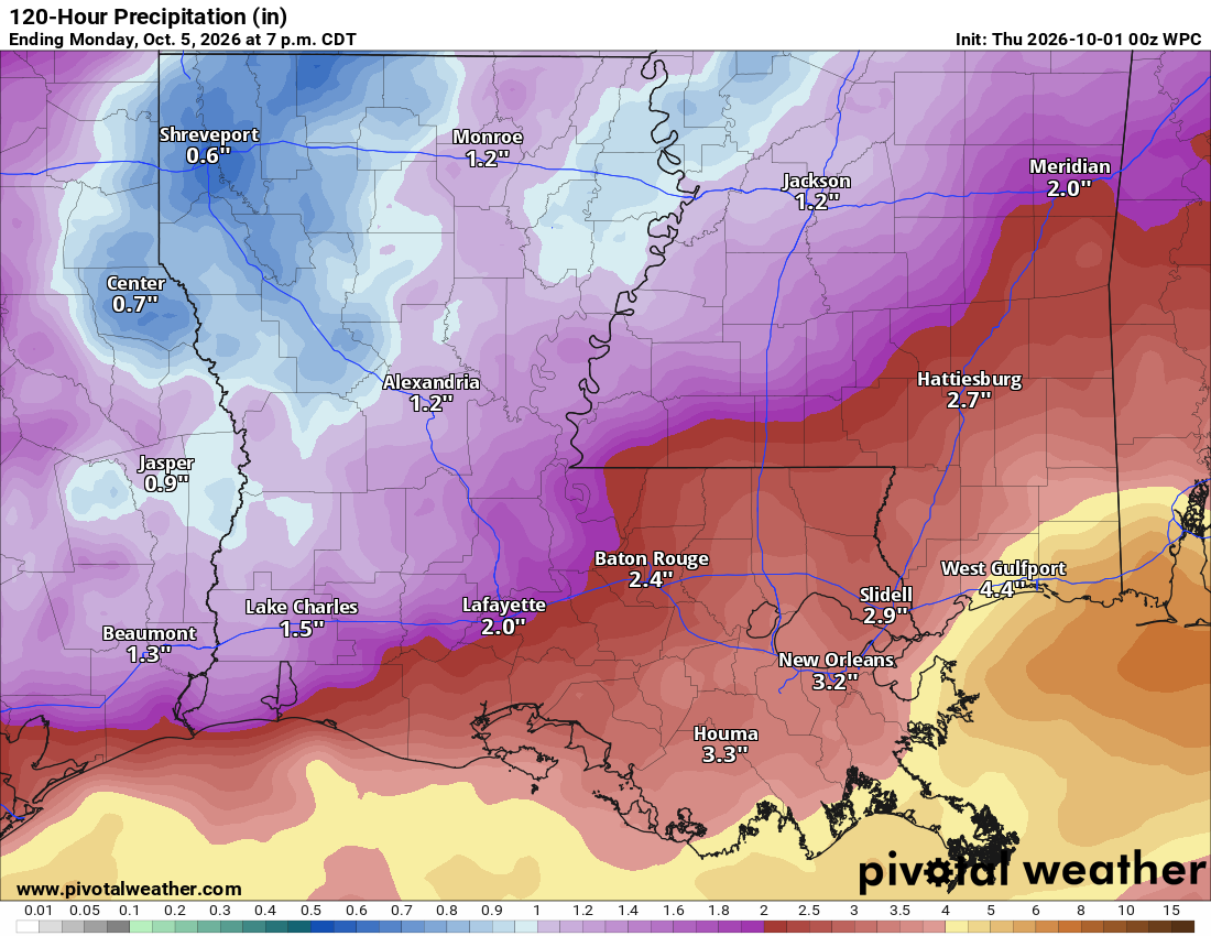
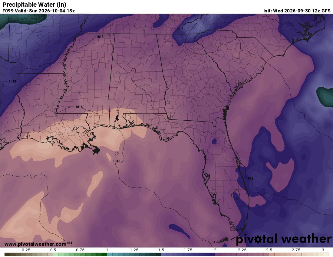
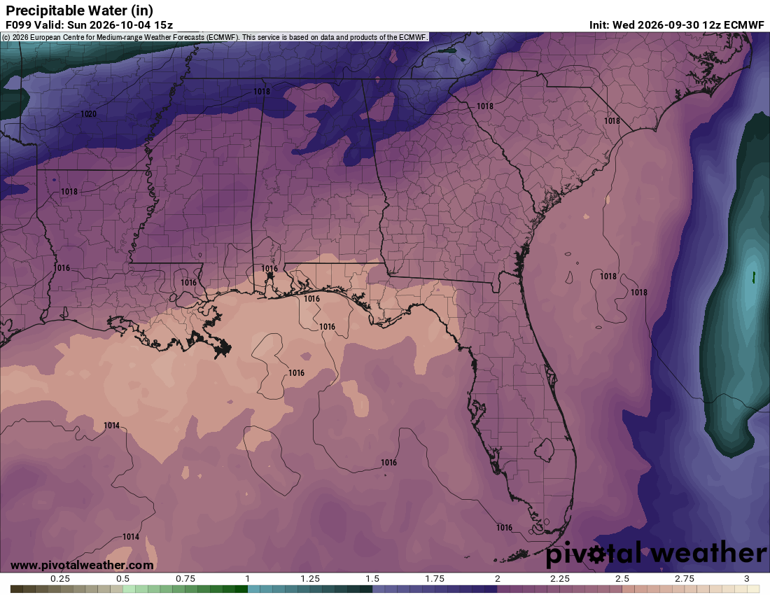
Below is a look at the modeled precipitable water for Sunday, which gives us an idea of how much moisture will be available in the atmosphere. While these models are useful for looking at the overall large-scale pattern, they aren’t always the best with the finer details.
It’s important to note the differences between the models, though, like in the example below. The GFS shows the bulk of the available moisture over our area and farther inland, while the Euro keeps most of it just offshore and closer to the coast. That small difference could mean the difference between some areas seeing 1–3 inches of rain and others potentially seeing 5–8 inches. We’ll keep you updated as we get closer!