Depending on your location, there is a 60% chance it is already raining. For everyone not living in Louisiana, you may catch some light rain here and there tonight. The system that brought rain to a good chunk of Texas is sagging into the Gulf tonight and will “spray” the central Gulf Coast with some light rain.
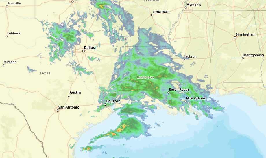
The light rain probably won’t amount to much, but it will offer some help to some places in desperate need of water.
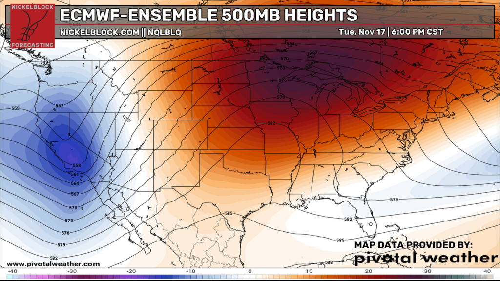
But we dry things out just as fast as the rain showed up. Ridging takes back over across Missouri and deflects any incoming systems to the north and around us.
In fact, it looks dry all the way through this Saturday on the Deterministic model guidance. And on the Ensembles, it isn’t much better. Below is a map of “percent of normal rainfall” blended across five of the best ensemble models.
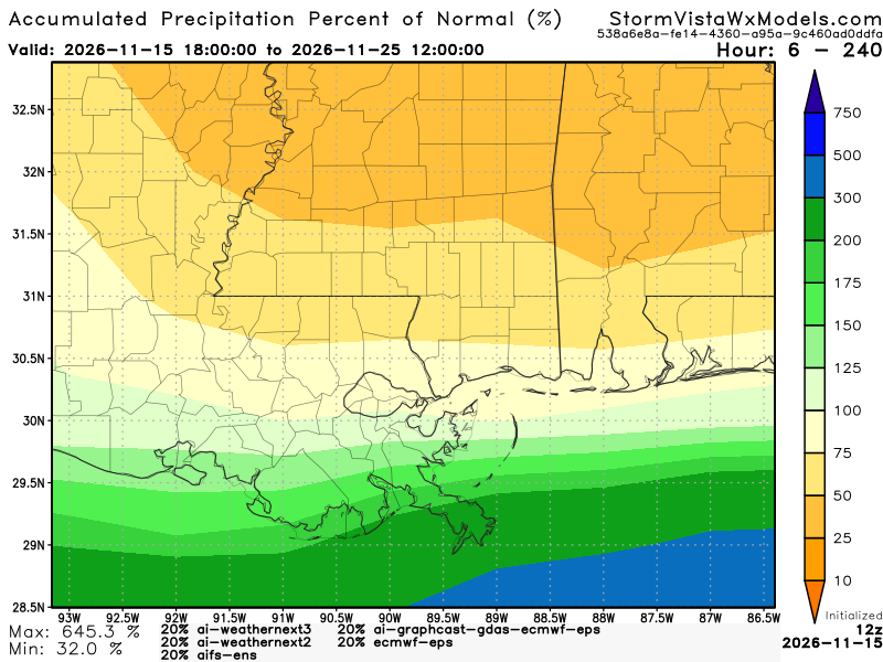
The blend shows – at most – about 50% of normal or less for most of the area. And most of the rain is set to fall tonight in those areas.
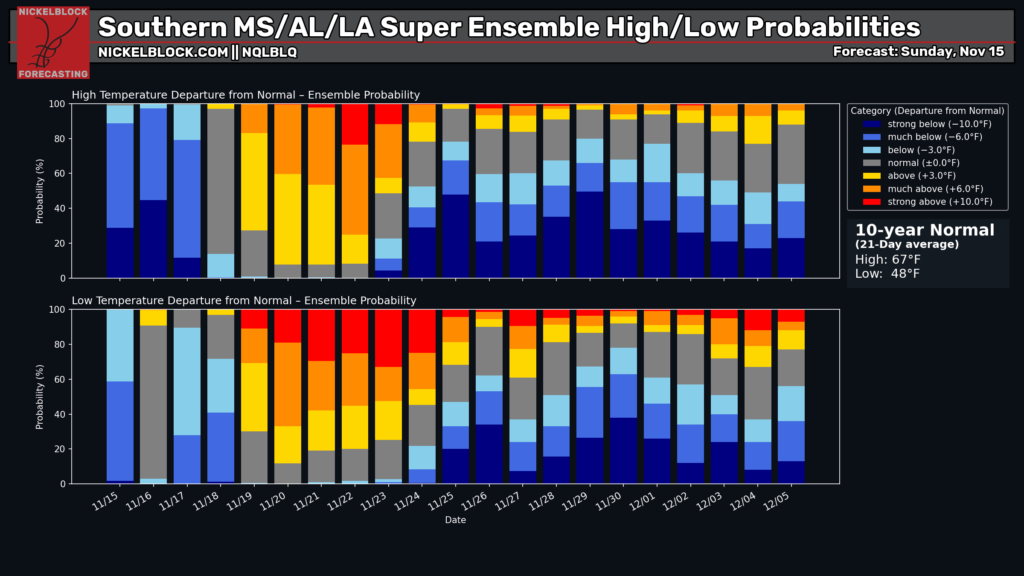
Taking an early look at Thanksgiving weekend temperature anomalies for the area, we will be (regionally) about normal. In the “Record Books” it may end up being “cooler than normal” but I doubt anyone is going to feel the difference.
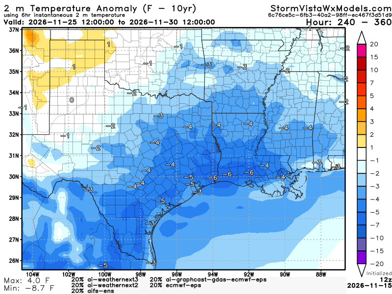
So while this map looks blue, don’t expect it to feel terribly cold.

MONDAY
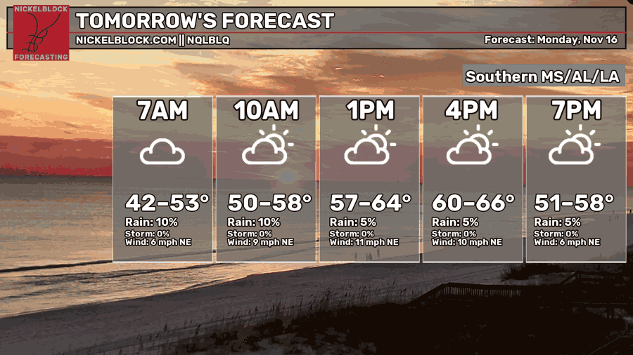
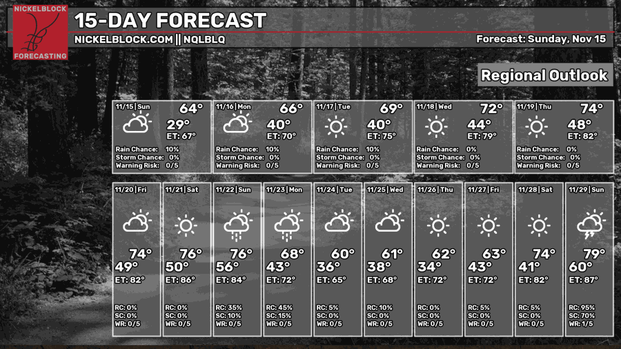
Tomorrow will be a bit chilly, but keep in mind the average high for this time of year is about 69F and the average low is about 50F.
The clouds will be with us in the morning but should clear as we head into the afternoon.

TUESDAY
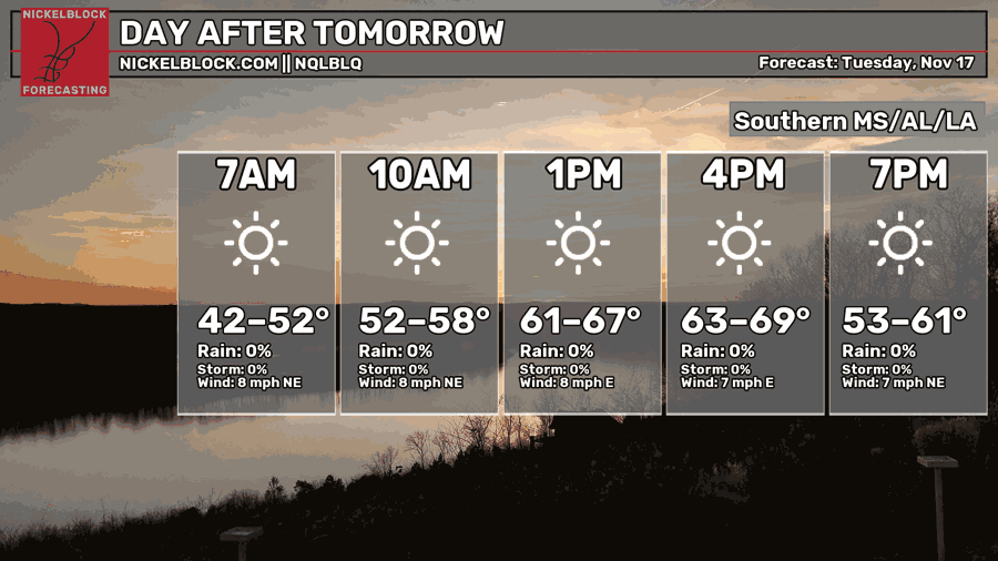
Plenty of sunshine on Tuesday. Once we get out of the clouds and this system moves out, the high pressure that builds in should squash any meaningful cloud cover.
That said, the high pressure that builds in isn’t a “tropical” high pressure. So it will still feel like Autumn. Overnight lows Tuesday morning will be below normal, but our highs should park us back to where we should be this time of year.
EXTENDED OUTLOOK
Not much extra to talk about here. After high pressure takes back over, most of the fronts that slide through the Lower 48 will mostly give us a bit of a miss.
Now! That said! I think as we get closer to Thanksgiving a system will have enough “mustard” to slide a cold front all the way south and into our area. But, if you’re looking for rain, this may not be the Cold front for you.
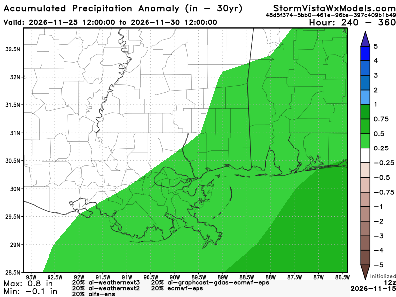
Notice that the week of Thanksgiving the “difference from normal” for precip is +0.25″ on the high side with most folks about normal.
And normal for this time of year? About 0.10″ per day. So, you figure, this is saying, “The area has a chance for between about a half-an-inch of rain and up to about an inch.”
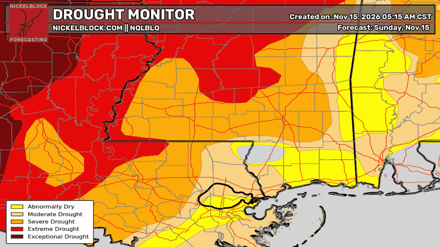
And that will be nice. But it certainly isn’t the amount of rain that we need to help us with the drought.
Which, speaking of, is getting worse.
Looking at the 15-day outlook I think the NQLBLQ AI-Weather Helper we have that helps compute the forecast here is a bit too cold for Thanksgiving morning. But we will watch it.
Beyond that, looking at the local temperature probabilities, you can see more blue showing up than red. So maybe this stretch of cooler weather will try to stick around into December.