Happy Friday the 13th! It’s been a cool, Fall day and it finally feels like Autumn! The rest of the weekend will sure feel the same as that cold front pushes further towards the coast. A small chance of rain is possible Sunday night into Monday, but otherwise it’s looking pretty dry for the rest of the week.


Tonight
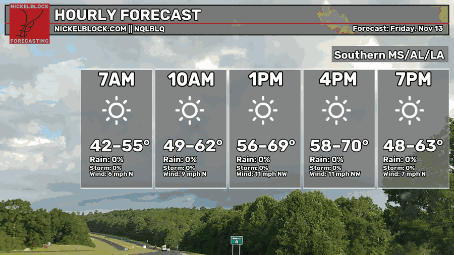
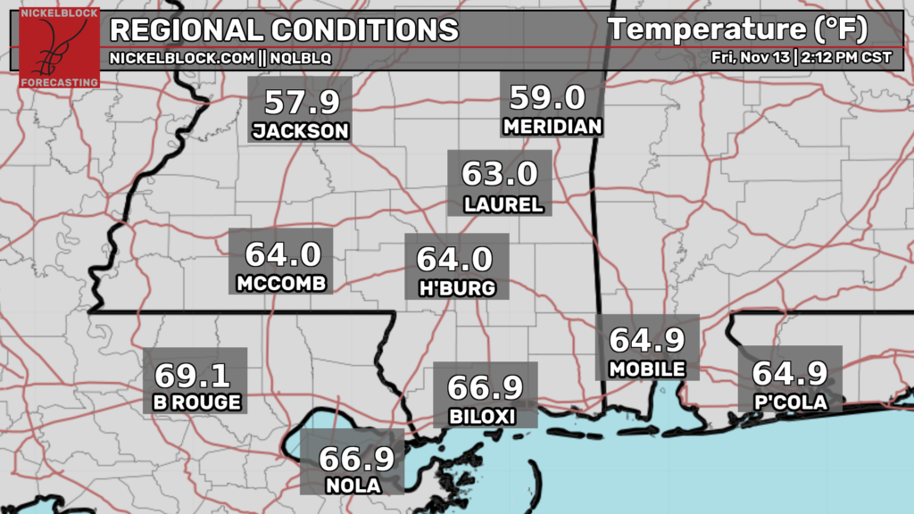
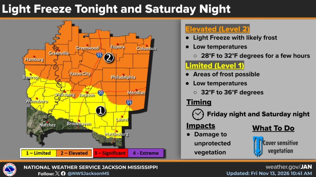
Most of us have been feeling the cooler temperatures just under 70. As the sun goes down, it’ll cool off significantly and some areas may even see freezing temperatures! Areas around I-20 will likely hit the freezing point with some of us seeing a little frost further south. Bring your sensitive plants indoors!

Tomorrow
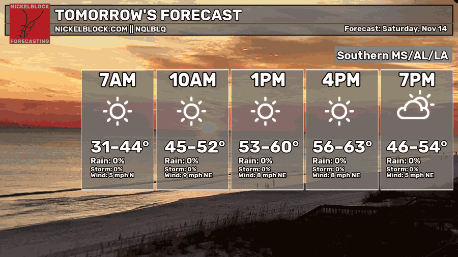
We’ll start of a little chilly in the morning tomorrow with lows in the low to mid 30s. We won’t see many clouds as the cold front will keep them away! Temperatures will just reach above the 60 mark with winds out of the northeast around 5-10mph. I’d recommend a jacket during the day as it’ll be just cool enough to wear long sleeves! Overnight, temperatures will reach the upper 30s, so frost won’t be an issue.
Sunday
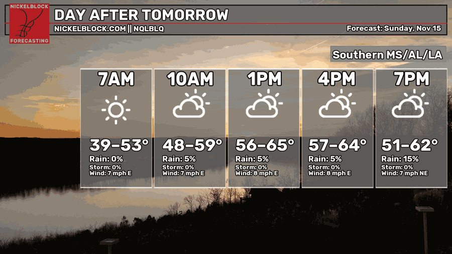
As a storm system to our west moves in towards Texas and Louisiana, we can expect some upper level clouds during the day on Sunday. Temperatures will hover around the upper 50s to low 60s across the area with winds out of the east and northeast. Overnight, a few areas in southeastern Louisiana and southeastern Mississippi will see some of the leftover rain from the incoming system. Lows will be in the upper 30s again.
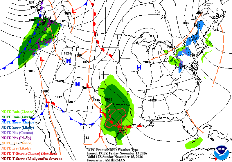
Rain on Monday?
It looks like the whole system just peters out by Monday morning. A few stray showers are possible, but it looks like it’ll dry out before the afternoon hours. The other side of that is the incoming front as it’ll bring us gusty winds up to 25mph! Temperatures will be in the low 60s with mostly cloudy skies.
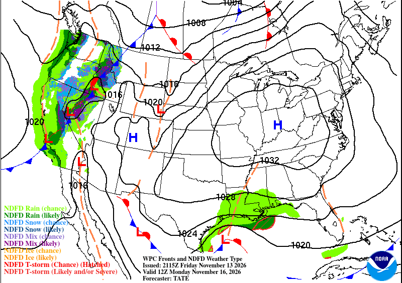
General Warming Trend Next Week
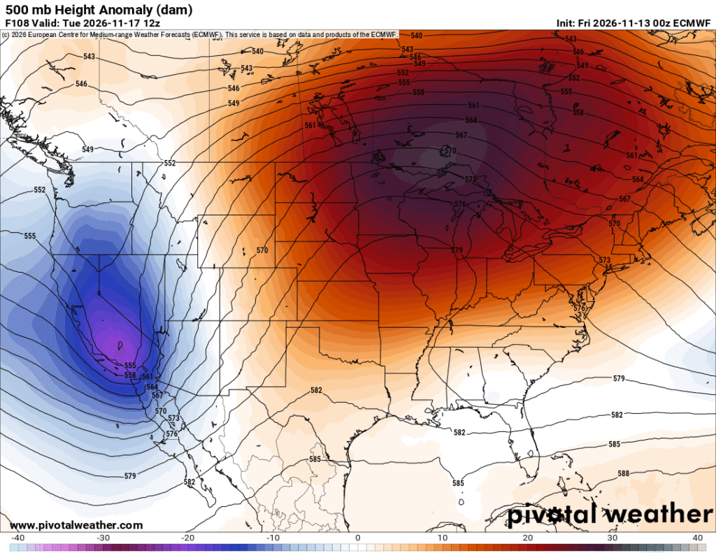
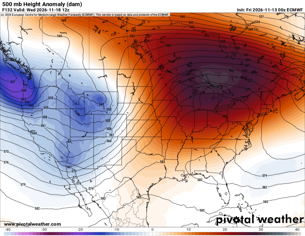
The overnight rain will soon be replaced by a large high pressure dome next week as the lower and upper levels both combine their efforts to dry everything out again. The upper levels show a building ridge that moves across the Plains and into the eastern US by Wednesday. This will leave us high and dry with our temperatures climbing to the mid 70s by midweek and will stay there by the end of the week. Lows will also climb from the low 40s to low 50s by Friday.
Extended Forecast
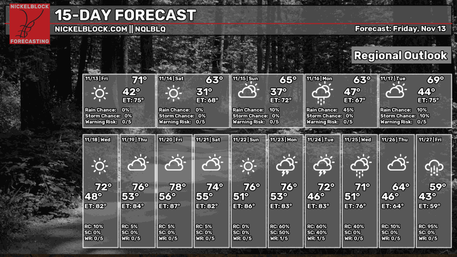
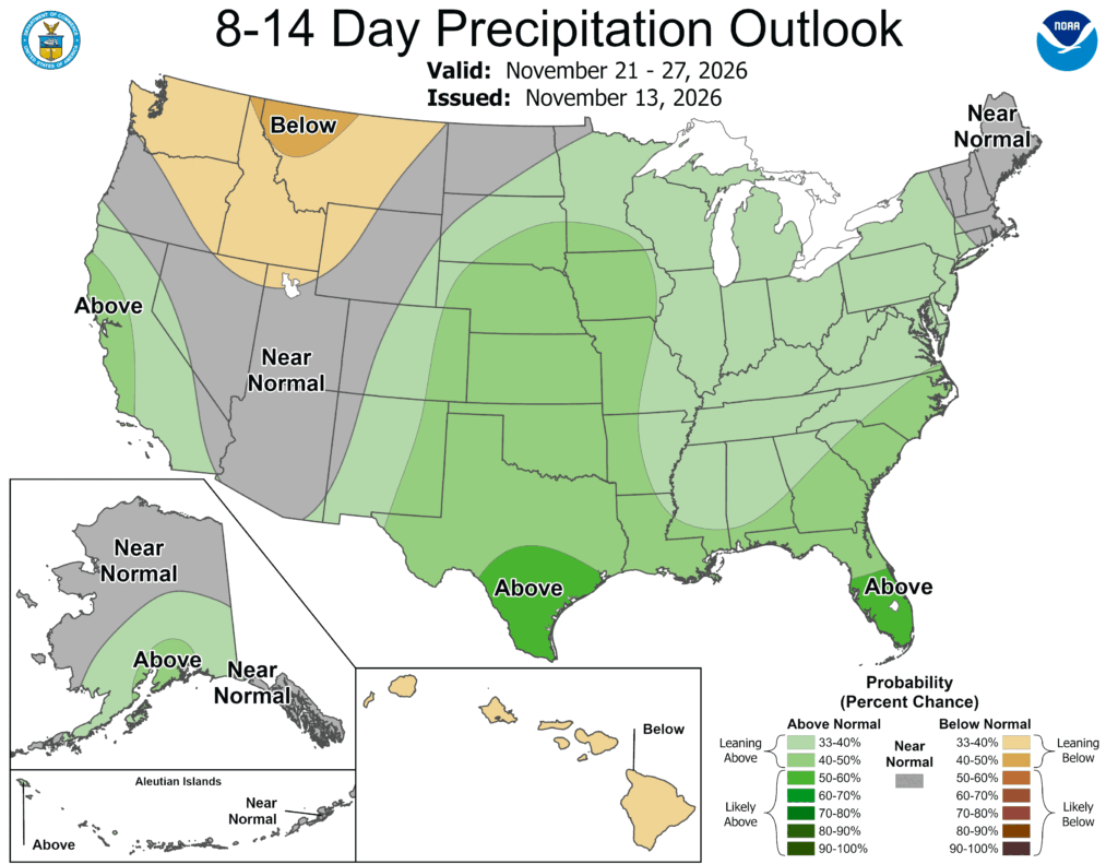
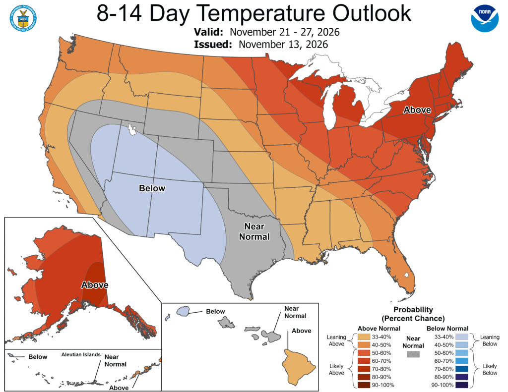
Looking at the extended forecast, we notice that precipitation coincides with that “hump” in the upper atmosphere from next week. We can expect a little bit of rain by mid-week Thanksgiving week as a closed trough and a weaker trough move through the southeast around that time. I don’t know if they’ll be drought busters just yet, but they have to work through a strong surface high to the east to get the rain to us.


