Howdy!
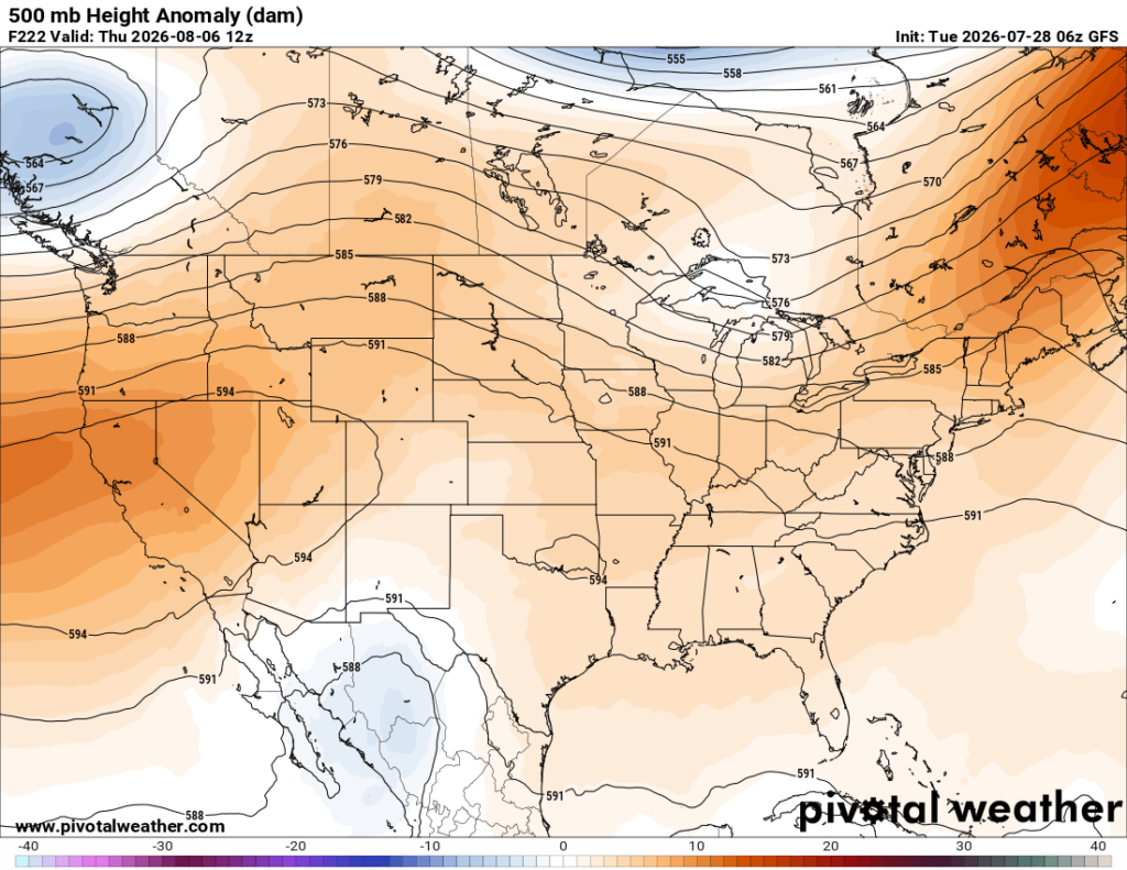
Chances of rain will increase throughout the week into the weekend, with greatest chance being on Sunday. By late next week, ridging will move back into the region. It will be very hot for the rest of the week, so make sure to stay cool!

TODAY/TONIGHT
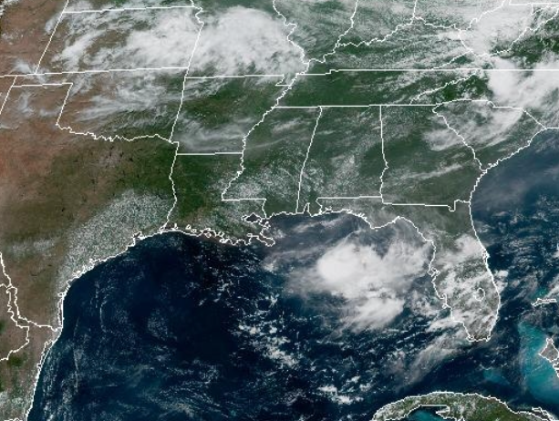
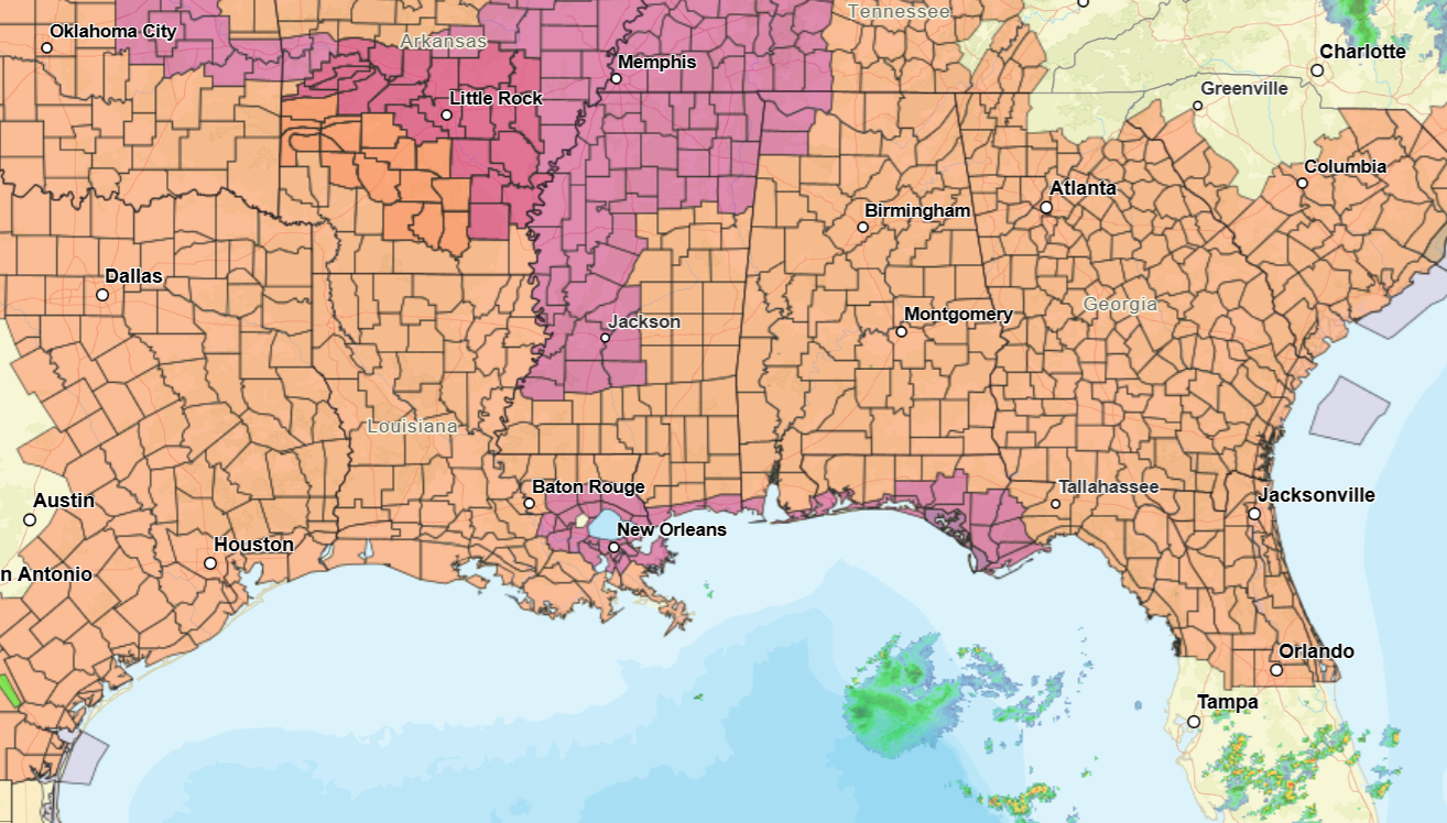
Currently (around 12pm CST), there is not much of anything going on in the region. Little to no cloud coverage and no rain for anyone. A bunch of heat advisories and extreme heat warnings are in effect!
Today is looking to be a very hot day, highs reaching in the 100s and heat index values a bit higher than that. Also, the humidity will not help in the slightest with how it will feel as dewpoints will be well into the 70s. Not much of a chance to see any rain today, maybe an isolated shower or thunderstorm is possible.
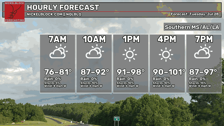
The main mechanism for any convection today is a sea breeze and daytime heating. If storms do develop, we could expect some locally strong wind gusts and some downpours.
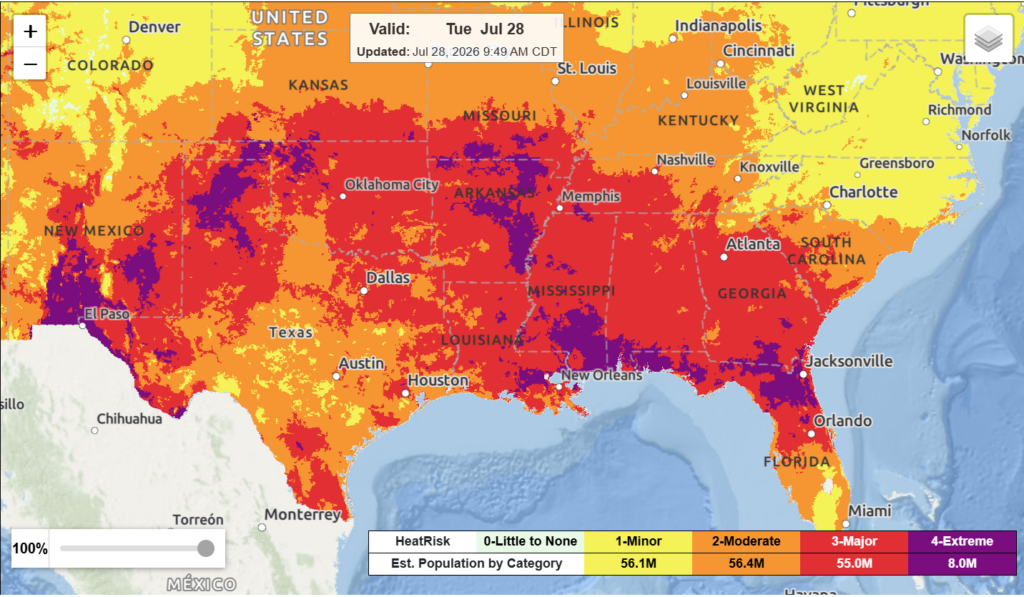
Today, a good amount of the region is under major to extreme heat risk, meaning that health issues related to heat are very possible. When you are outside today, make sure to drink plenty of water and try to stay as cool as you can.
TOMORROW
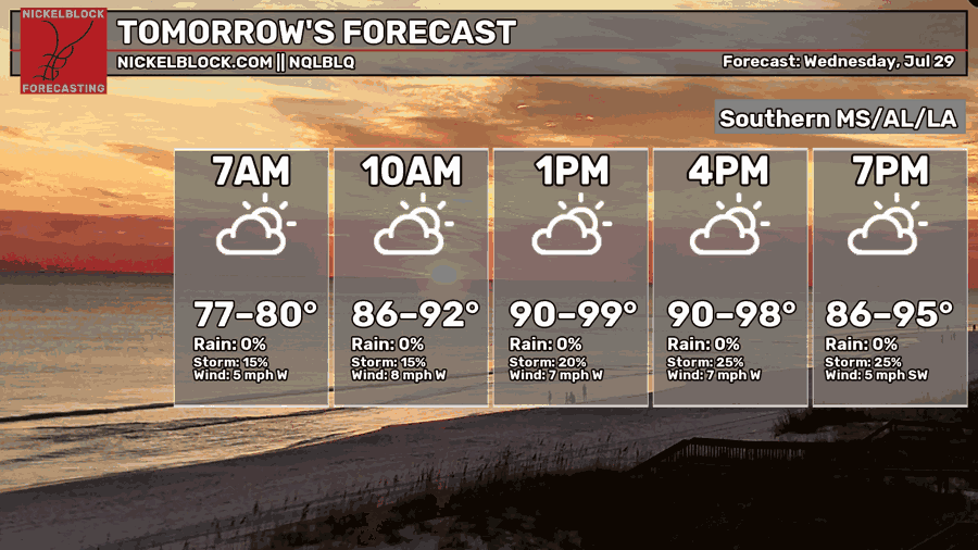
Tomorrow is going to be another hot day for much of the region. Chances of precipitation increase slightly as a weak frontal boundary moves to impact the region, a contradiction to what the graphic says below in terms of percentages. This will make temperatures slightly lower than today, but the heat is still here to stay and heat index values will still reach above 100.
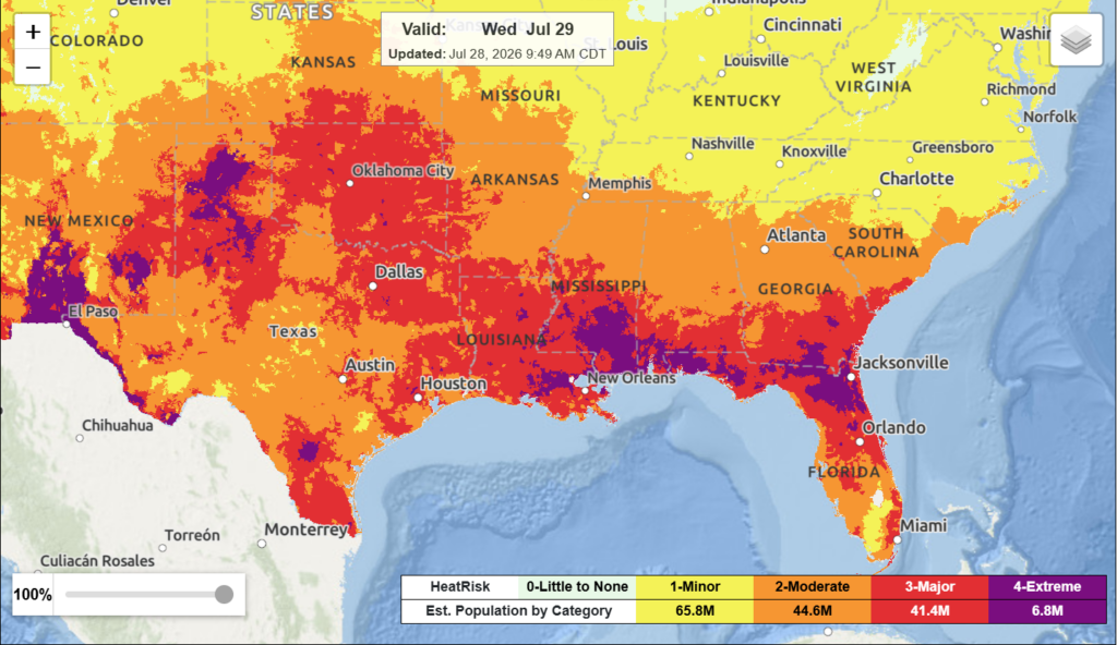
The region is still much under the major to extreme heat risk. Once again, please take care of yourself when outside. Maybe go swimming so you can stay cool if you are able to.
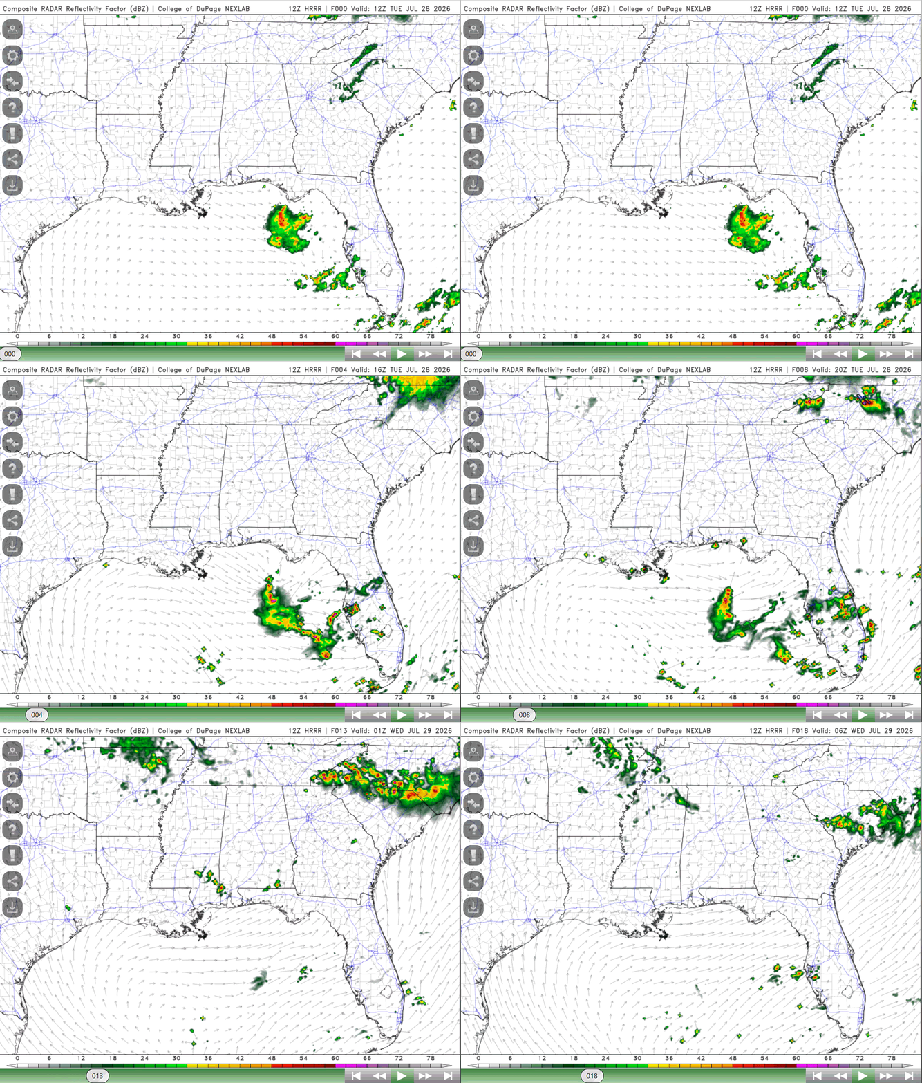
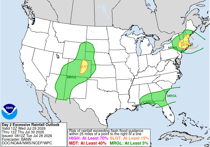
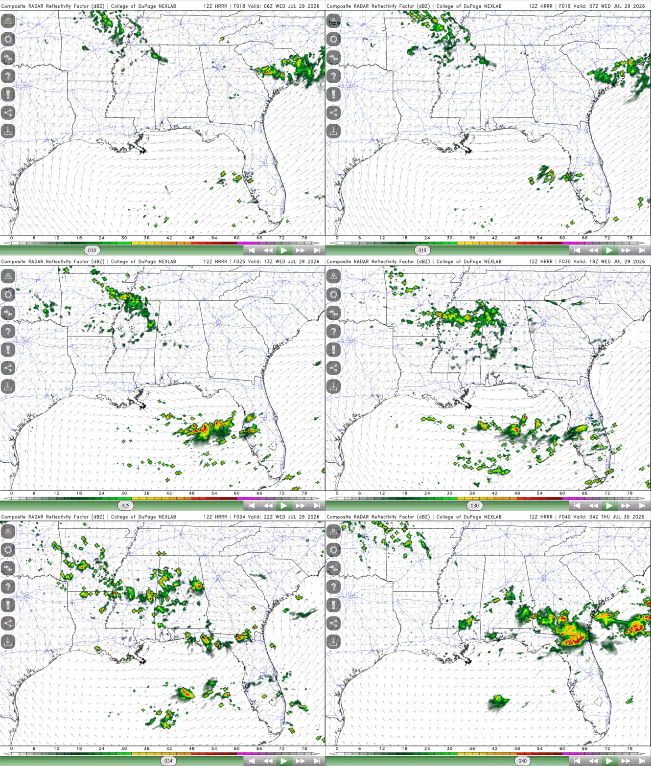
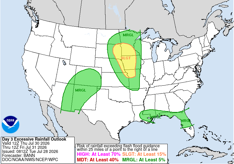
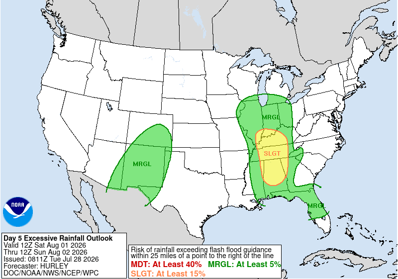
There is a bit of a risk for excessive rainfall in parts of Alabama. Moisture paired with the stalled boundary over the region, a chance for a sea breeze, and upper-level shortwaves will trigger showers and thunderstorms tomorrow through the rest of the week, greatest chance being in the eastern parts of the region tomorrow.
The HRRR model below shows when rain is expected to impact the region. Scattered showers and thunderstorms are possible, with thunderstorms having the chance to produce some locally strong wind gusts and lightning.

THURSDAY
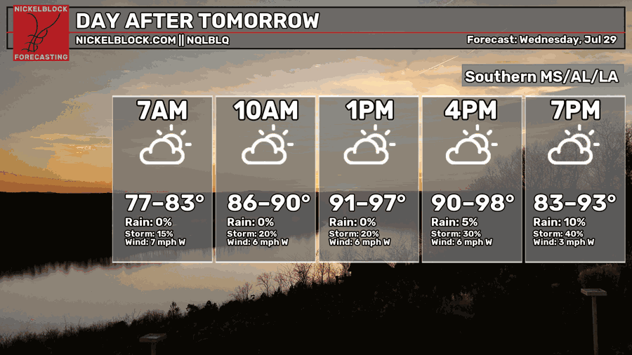
Chances of rain increase going into Thursday as that boundary triggers lift, moisture is present, and there will be plenty of instability through daytime heating and with the front. Numerous showers and thunderstorms are possible, starting in the morning.
Upper-level shortwaves will also move over the region triggering lift as well, increasing the coverage of any rain. Coastal regions have the greatest chance to see heavier rain and thunderstorms, frequent lightning is possible with some stronger wind gusts.
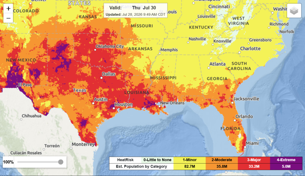
It will still be a hot day, though not as hot as it has been, a lot of areas just below the heat advisory threshold. Still, much of the region is under the moderate, major, and extreme heat risk. Despite the increased cloud coverage and rain, the heat will still be a concern.

EXTENDED OUTLOOK
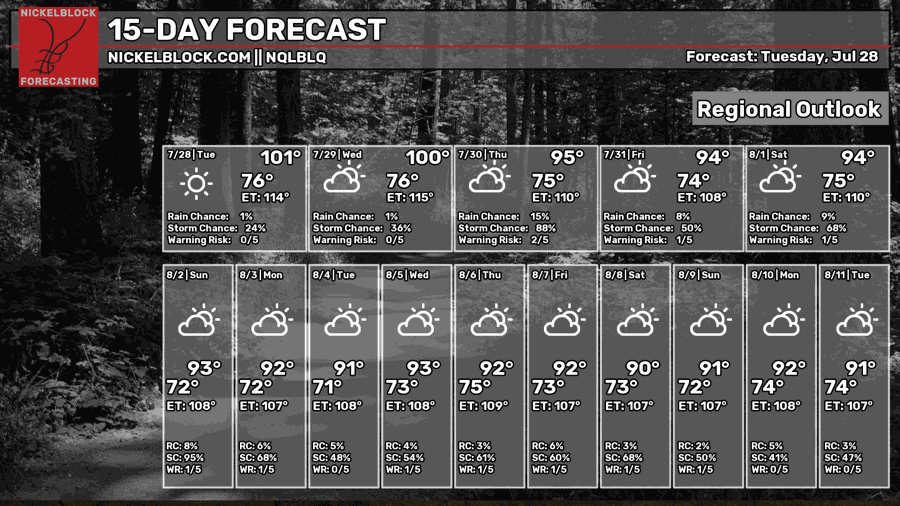
This weekend is looking to be pretty wet. On Friday, a cold front will approach the area, triggering more widepread rain coverage. By the weekend, this front will have stalled over the region and some upper-level disturbances will also impact the region. Numerous to widepread rain coverage is expected for the weekend, showers and thunderstorms very much possible.
Main risk with some of the stronger storms is gusty winds, lightning, and some locally heavy rain. This rain will keep temperatures slightly cooler than they have been, so a little bit of relief this weekend with that. Saturday-Sunday, excessive rainfall is possible in the region, northern parts of Alabama being under the slight risk category.
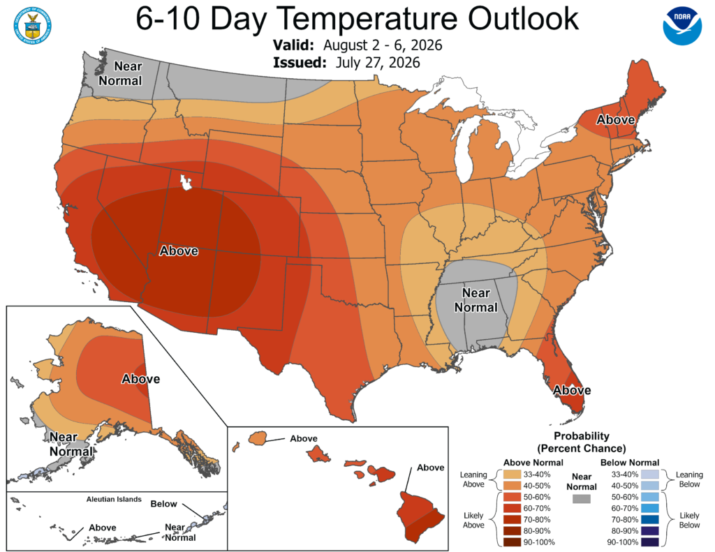
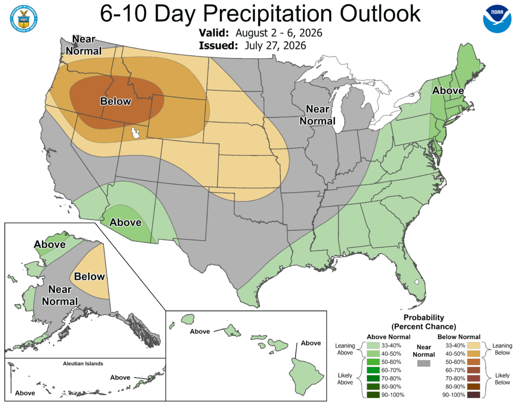
The trough that will be impacting the region through the weekend is anticipated to keep conditions a little cooler with a bit of an unsettled pattern into early next week. If this will persist, temperatures will remain near normal for a good portion of the region in the next 6-10 days. Precipitation trends will remain slightly above the average.
Looking ahead, upper-level ridging will move back into the region by the end of next week and will stick around for a bit. This will likely decrease chances of rain from what they have been recently.
For now, make sure to stay cool when outside and keep dry this weekend! Thanks, and make sure to watch my video forecast below!


