Yesterday was quite hot and muggy with temperatures reaching the mid 80s and a some cumulus clouds in the sky and it made it almost look like summer was here! Well, we’re nearing it considering how soon it usually happens in the South, but we’ll soon get a few days of relief at the beginning of this coming week.

Looking at the surface analysis, we have a long low pressure system that is stalling over the coastal south. This will keep showers and thunderstorms riding the stationary front over the next 24 hours as it slowly moves further south towards the coast.
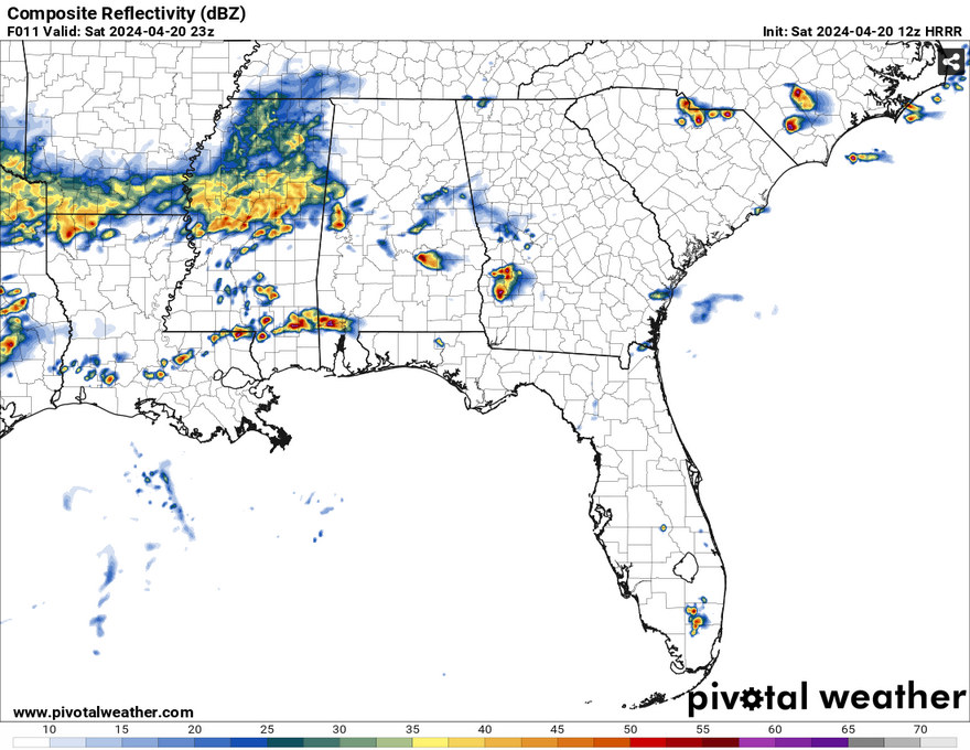
The early afternoon should be fairly clear for much of south Mississippi, but we’ll see a thin line of cells start to develop over the Pinebelt, mainly to the south as we get closer to the evening. The SPC does have us under a marginal risk for severe thunderstorms, and it looks like the storms developing this evening are the main reason. While these don’t look to be anything crazy, there is always a chance for hail, high winds, and flash flooding. This looks to be the main window for the severe weather as it will begin to wane after dark.

Overnight into Sunday, we’ll see a steady amount of rain coming in. If you’re getting ready for church or work in the morning, you’ll probably need an umbrella since this system doesn’t look to get outta here until around noon.
Right behind the system is a fresh breeze of cool, dry air. Temperatures will even out during the day and only reach the 60s as the cold front pulls in. Even at night we’ll see temperatures drop into the 40s for a couple of nights as the ridge builds over the south. Overall, the start of the week will be a nice fresh start.
[wpcode id=”41179″]
Regional Day-to-Day Forecast
Today – Scattered showers and thunderstorms, then showers likely and possibly a thunderstorm in the afternoon. Mostly cloudy, with a high near 80. Northeast wind 5 to 10 mph. Chance of precipitation is 60%. New rainfall amounts between a quarter and half of an inch possible.
Tonight – Showers and thunderstorms likely. Mostly cloudy, with a low in the low 50s. North northeast wind around 5 mph. Chance of precipitation is 70%. New precipitation amounts between a half and three quarters of an inch possible.
Sunday – Showers likely, mainly before noon. Mostly cloudy, with a high in the low 60s. North northeast wind 5 to 15 mph, with gusts as high as 25 mph. Chance of precipitation is 70%. New precipitation amounts between a quarter and half of an inch possible.
Sunday Night – Partly cloudy, with a low in the mid 40s. North wind 5 to 10 mph.
Monday – Sunny, with a high near 70. North wind 5 to 10 mph, with gusts as high as 20 mph.
Monday Night – Patchy fog in the early morning. Otherwise, mostly clear, with a low around 42. North wind around 5 mph becoming calm in the evening.
Tuesday – Sunny, with a high in the mid 70s. Light and variable wind becoming south 5 to 10 mph in the morning.
Tuesday Night – Mostly clear, with a low in the low 50s. South wind around 5 mph becoming west after midnight.
Wednesday – Sunny, with a high in the low 80s. Calm wind becoming north around 5 mph in the afternoon.
Wednesday Night – Mostly clear, with a low in the mid 50s.
Thursday – Mostly sunny, with a high in the low 80s.
Thursday Night – Partly cloudy, with a low in the upper 50s.
Friday – Partly sunny, with a high in the mid 80s.
[wpcode id=”41149″]


