Howdy!
For the next few days, temperatures are pretty average, highs in the mid to upper 80s, and moisture returns to all of the region by late this weekend going into next week. Heat will return for next week with highs in the lower 90s and dewpoints also creep back up, so expect the heat index to increase as the week progresses. Look out for the chance of rain Saturday!

TODAY/TONIGHT
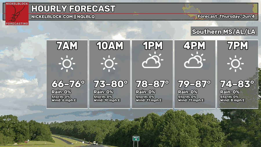
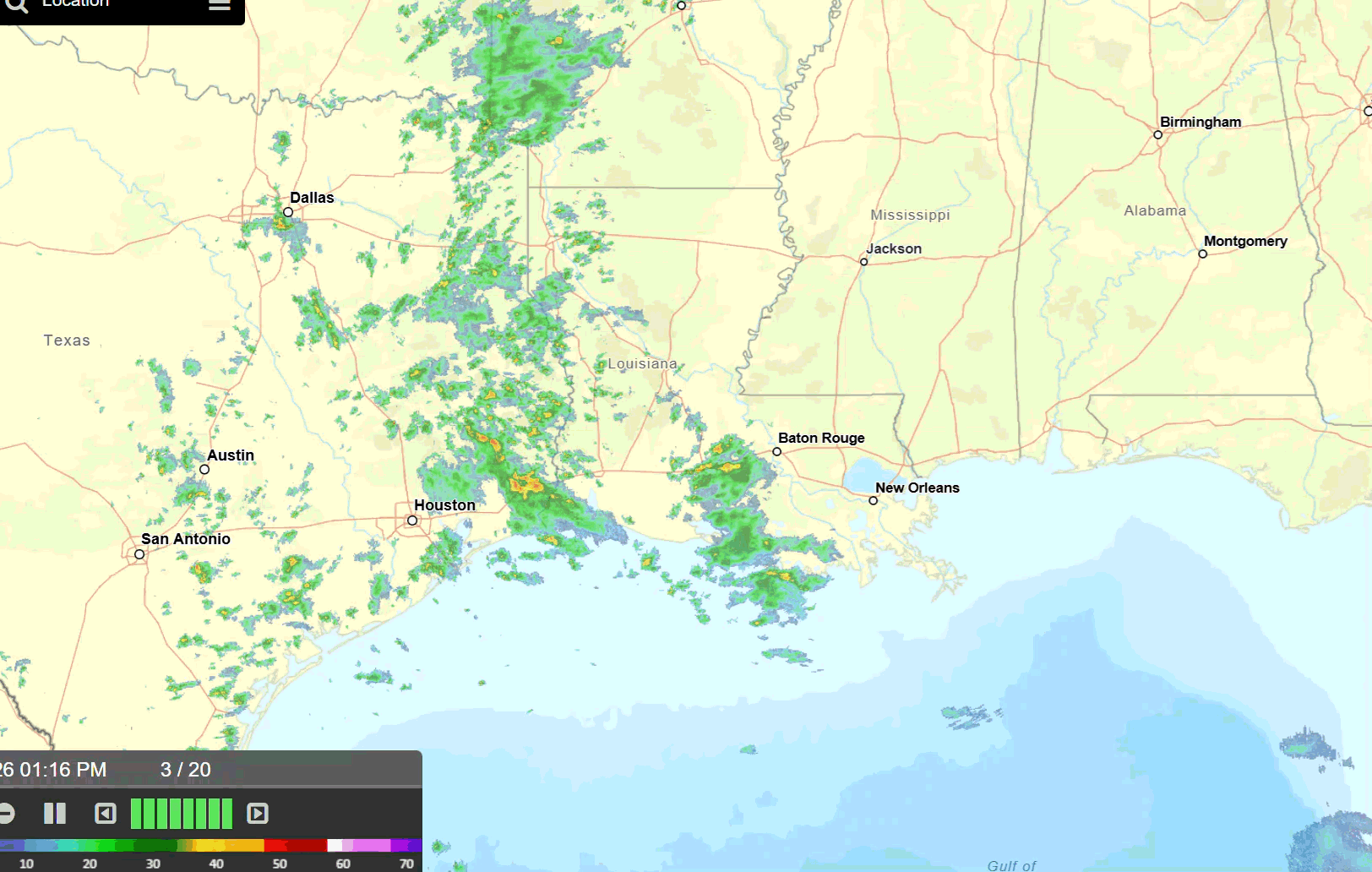
Currently, temperatures in the region are in the lower 80s, warming up to the upper 80s as the day progresses, and the sun will show for a lot of the region (especially in Mississippi and Alabama). Moisture is present in Louisiana which is aiding the rain that much of southern Louisiana is getting, currently out near Lafayette and Opelousas (see radar below).
A ridge of high pressure to the east is keeping things pretty dry and stable for Mississippi and Alabama which will last into the weekend. Once this ridge moves out of the region, gulf moisture returns and so do chances of rain.
Total rainfall rates from today into tonight can range from as little as 0.05 inches to more than an inch of rain. Greatest accumulation is in central to southern Louisiana along the gulf.
TOMORROW
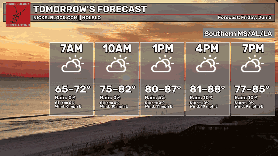
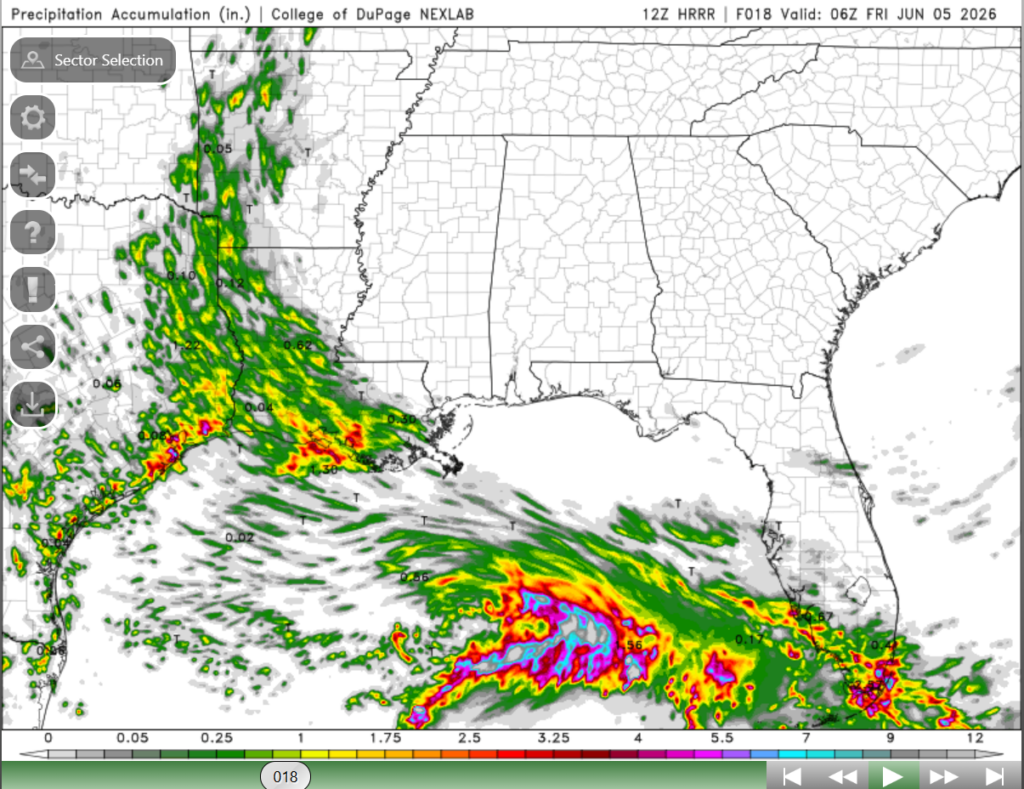
Temperatures will be similar to what they are today, highs in the upper 80s and generally lower dewpoints to the east. Things are a bit interesting in the gulf, tomorrow we will see a low form along a stationary front, which will trigger rain along the gulf coasts of Louisiana and Mississippi.
This low will bring in lots of moisture into the region. We can see this more clearly below in the PWAT Anomaly model. This compares the amount of moisture in the atmosphere currently to what is normal for this time of year. We can see that the greens indicate higher moisture amounts than normal.

In other words, expect rain tomorrow along the coast of Mississippi and Louisiana! None of these storms will be “organized” and feature typical severe weather as there is not enough wind shear to support that, but they have the chance to be slow moving and produce a good amount of rainfall. Plus the risk for lightning and some gusty wind. Greatest chances of rain are through the day and into the evening, decreasing throughout the night.

SATURDAY
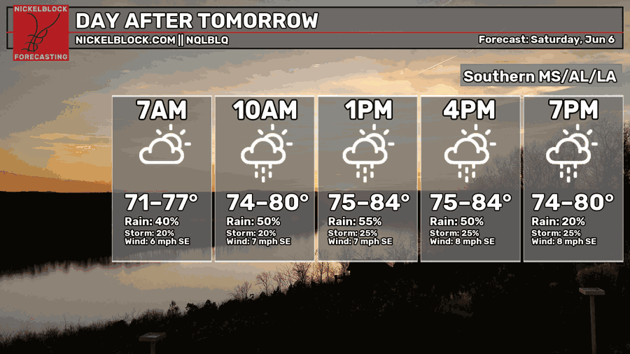
Get excited! Temperatures will be below average, highs in the mid 80s for the region, but rain returns along with some stickier conditions. It is pretty clear that we will have more than enough moisture in the region that will support those showers and weak thunderstorms to develop.
None of these storms will be severe or strong as the atmosphere will not have the sufficient amount of instability and lift. Below, we can see that there is still ridging over the region, limiting the amount of ascent in the region, which is typically called subsidence.
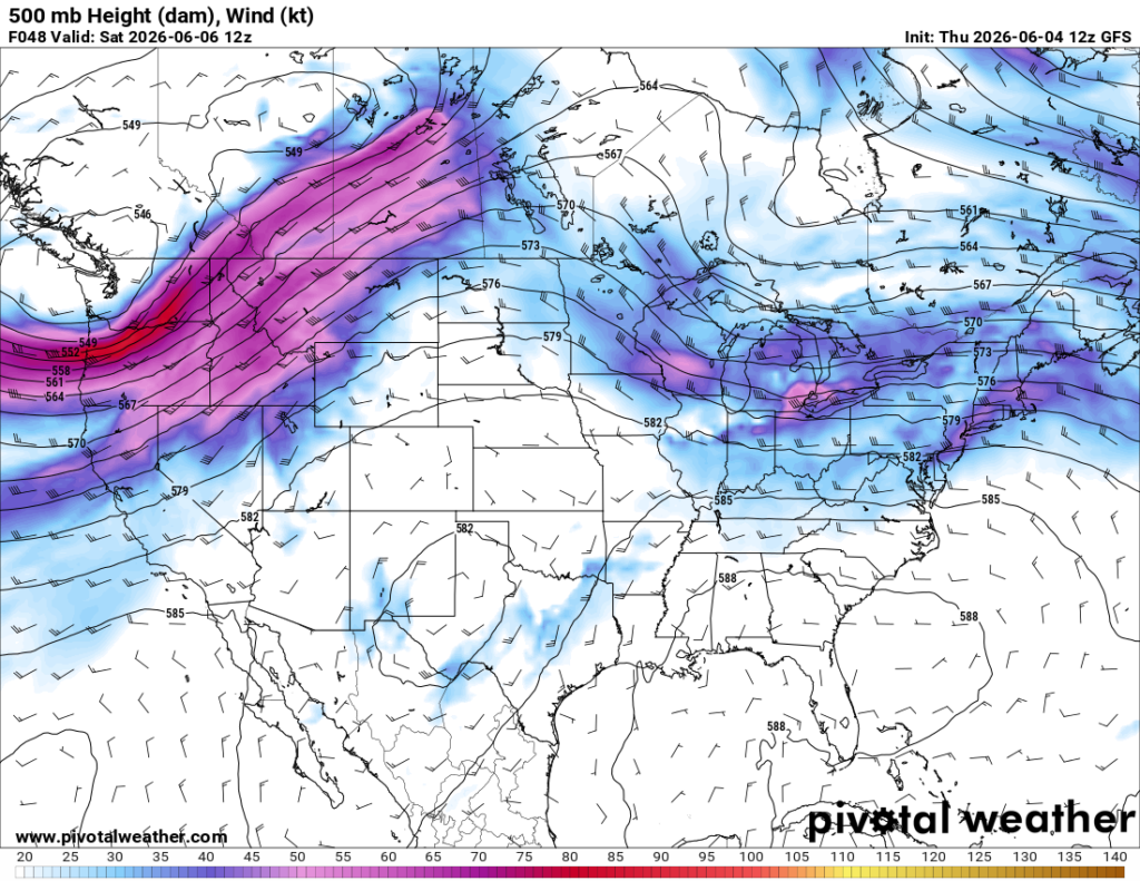
Subsidence means the broad descent of air in a region, so in other words sinking air. A lot of the times, this suppresses development of severe storms and is important in discussing tropical weather! Either way, it will be wet for much of the region on Saturday, so carry that umbrella with you.
Some areas could see localized flooding as some of these showers can be heavier slow moving. Several rounds of showers are expected throughout the day, greatest amounts stretching between central Mississippi and Louisiana, Alabama having the least chance of rain.

EXTENDED OUTLOOK
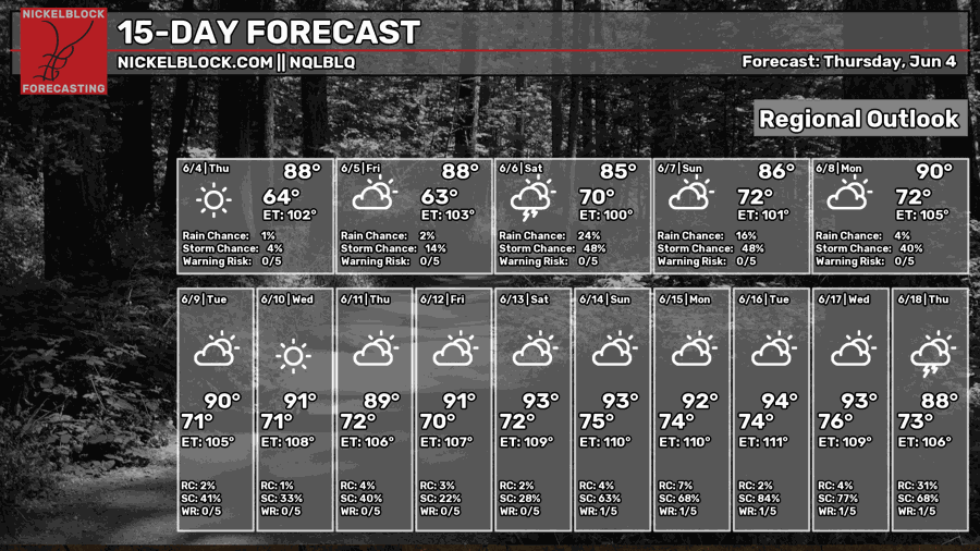
Looking ahead at the next two weeks, it will progressively get hotter, highs reaching the low 90s and lows not dipping below 70. We are looking at a more typical summer-like pattern, with those afternoon showers possible for each day.
The pattern you typically see for the summer is a high-pressure ridge over the area, keeping conditions drier and warmer. When looking at the model, I noticed a pattern change a little less than two weeks out, showing a trough extending into our area for Monday into Tuesday that week.
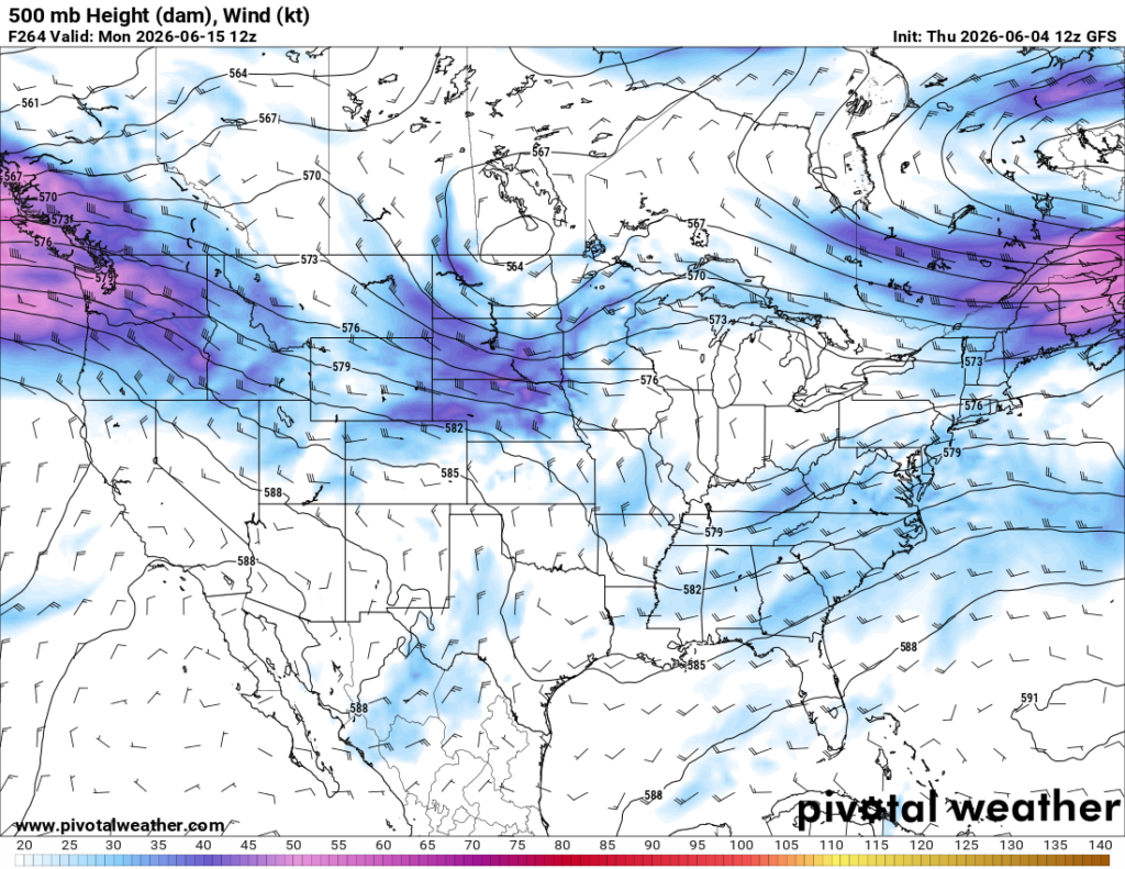
I am interested in how this will play out and what that will mean for our region but looking at it, I can predict some stronger thunderstorm chances. Overall, summer returns for the coming two weeks!


