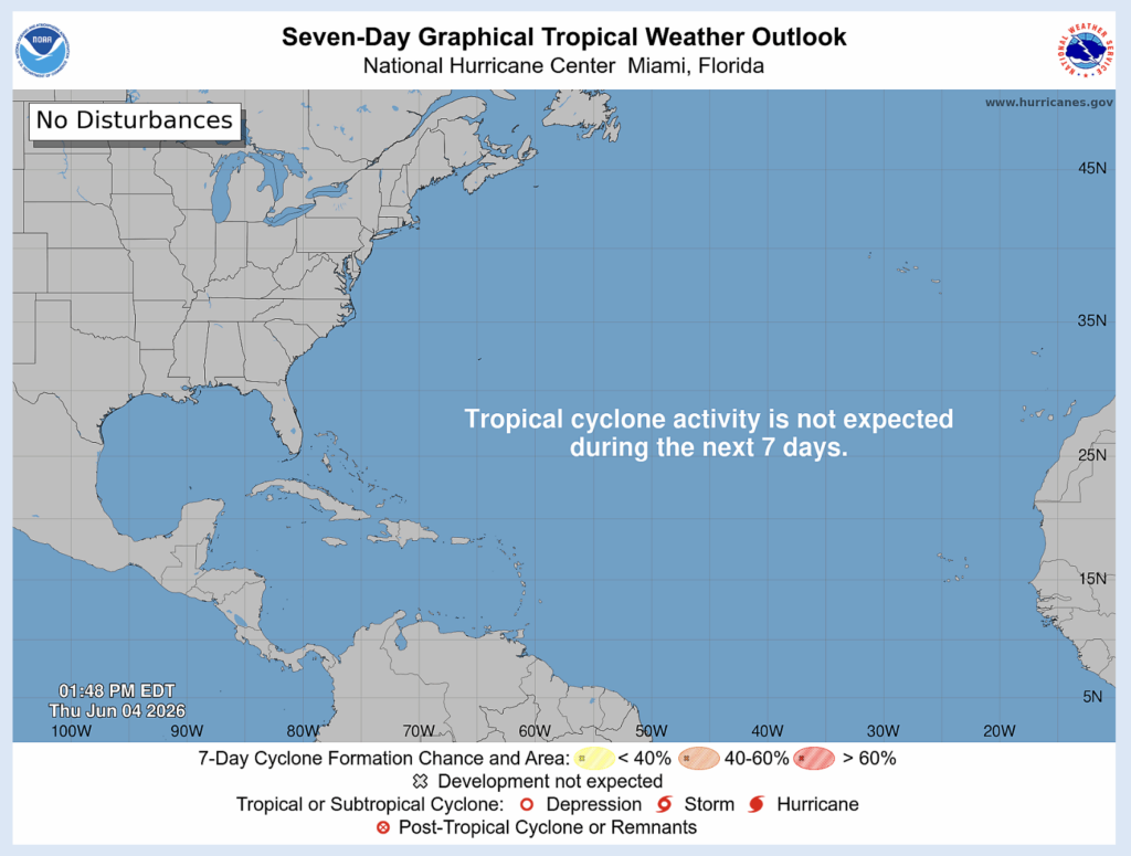
We are halfway through the first week of hurricane season. Right now, we have no disturbances or expected activity for the next week.
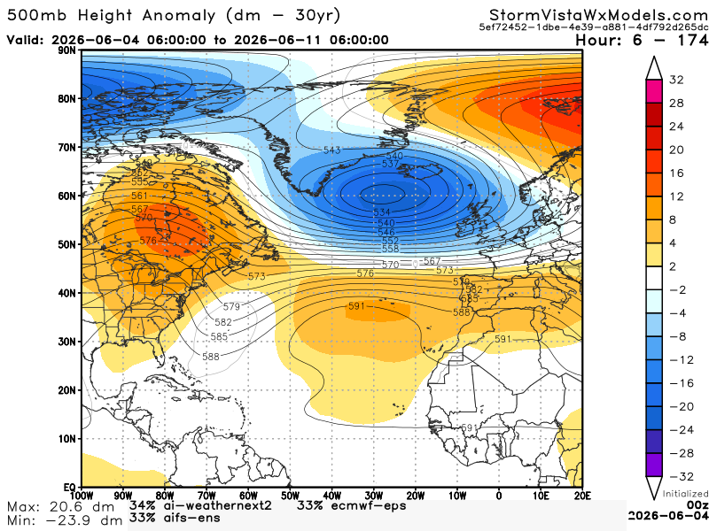
Here we have a 500mb height anomaly model blend over the span of a week. Height anomalies are a tool we use to identify troughs and ridges. We see a ridge stretching from the South to Canada and a trough in the Atlantic near the East Coast. This would suggest a hard time for development in the Atlantic. The Gulf suggests something different.
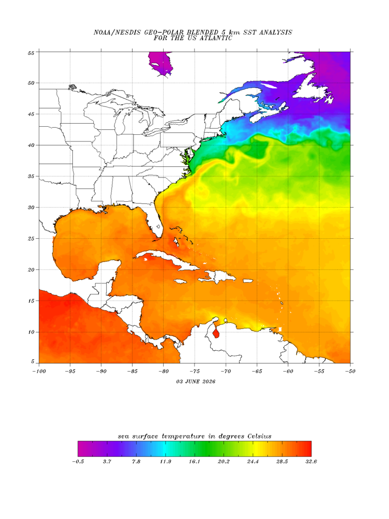
Here we have sea surface temperatures in the Atlantic and the Gulf. Right now, the Gulf has waters warm enough to support development. Now, let’s take a look at whether we have wind shear or not.
Here we have a model showing wind from June 4th to June 11th. Red is the most wind shear, which is what we are seeing a lot of in the Gulf right now. Not until the middle of June do we start to see the wind shear calm down.
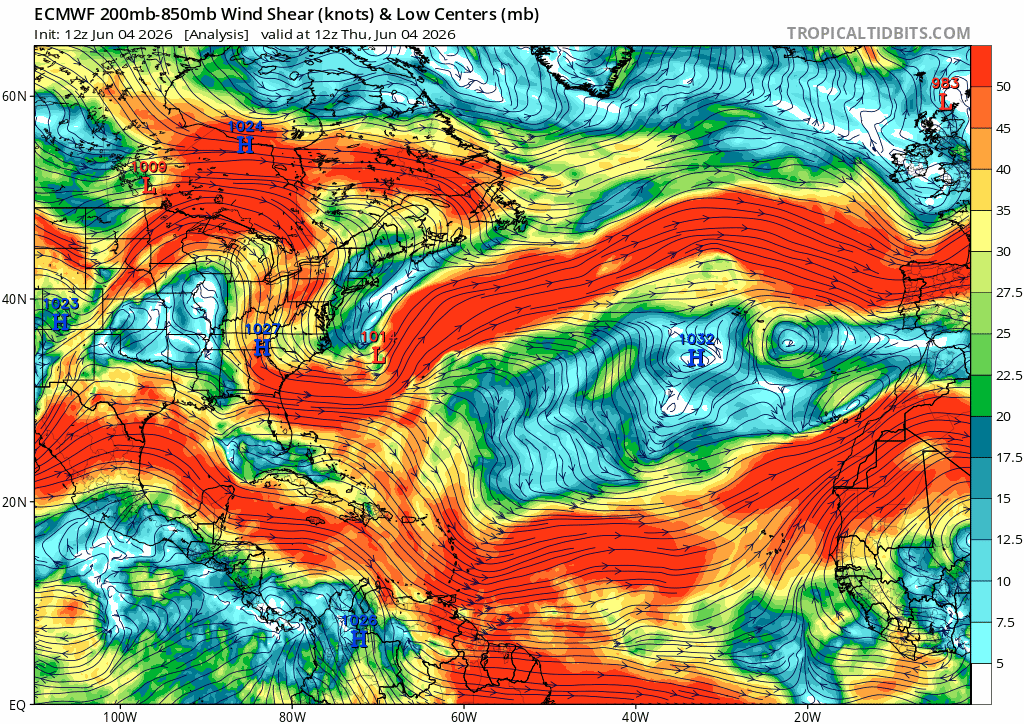
This wind shear will prevent development and/ or weaken development.


