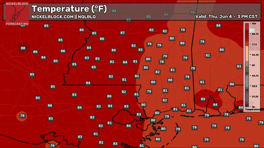
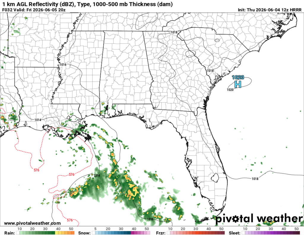
As I’m writing this, temperatures are in the pleasant low-mid 80s with mostly mostly clear skies. Dew points are suspiciously low for a June day on the gulf coast. Most of our region is rain free except for south central Louisiana, where storms west of Lafayette are moving towards the northwest.
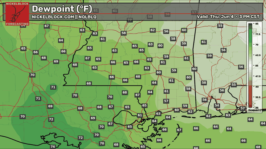
The area of high pressure that was moving into our region from the north yesterday has moved into the eastern portion of our area, bringing sunny skies, pleasantly warm temperatures, and drier air. It looks like the gradient between humid gulf air and drier continental air has set up over southwestern Mississippi and northeastern Louisiana.

This gradient explains why Louisiana and eastern Texas are experiencing stormy conditions, while everywhere else is dry. The humidity over Louisiana is giving those storms plenty of fuel to fire up and drop some rain.
And this can be explained by the surface wind direction in our region. Wind coming off of the gulf is transporting humid air into Louisiana and Texas, which is unlike the rest of our region.
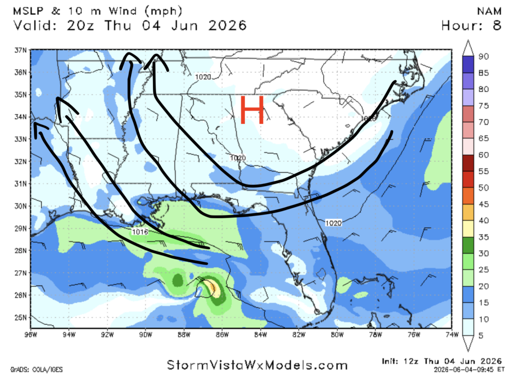
Further east in Alabama and the Florida panhandle, the surface wind is coming from the southeast, but that air is simply being re-circulated from the north. This is because winds flow clockwise around areas of high pressure, such as the one currently situated near the GA/TN/NC intersection.
Overall, my forecast from yesterday seems to be panning out well.
Tomorrow
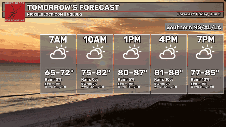
Moving into tomorrow, afternoon high temperatures will range from the low 80s to the upper 80s. Morning lows will be in the mid to upper 60s. Chances of rain are low for our region.
The area has the greatest chance to see rain tomorrow is the Louisiana delta region and the Mississippi coast. Some scattered storms and showers will move into the area in the morning and will be pretty much done by the evening.
I noted the possibility for rain in this region yesterday, but since then the chance of rain and rainfall totals have decreased slightly.
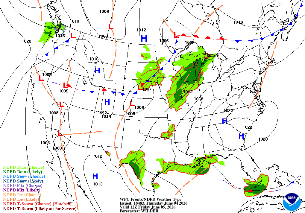
In the above mentioned region, there is now only a chance of rain, as opposed to rain being “likely”, which is what the climate prediction center was predicting yesterday.
Extended Outlook
Not much has changed with the extended outlook since yesterday.
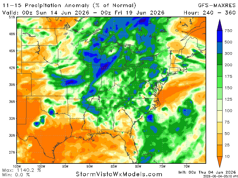
Throughout the next two weeks, a pattern that involves a ridge building over our region looks likely. This means temperatures might be slightly above normal and precipitation below normal. The GFS-MAXRES suggests precipitation will be below normal along the gulf coast.
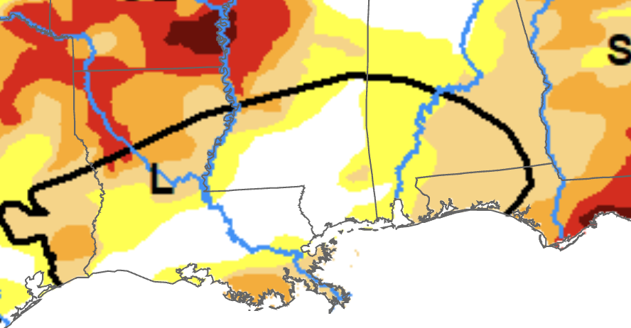
Today, a new drought monitor update was released. It shows drought has been completely wiped away in southwest Mississippi and most of south central and eastern Louisiana. Most of southern Alabama and the Florida panhandle has seen a 1 category improvement in drought since last week.
While this is good news overall, the warm and dry pattern we could experience over the next couple of weeks may lead to a resurgence in drought.


