Now that everyone is back to work, the weather is also set to get a little goofy as we move through later this week. Models continue to hint as an area of low pressure swinging around our ridge of high pressure (the thing making the weather so nice lately) and into the Gulf.
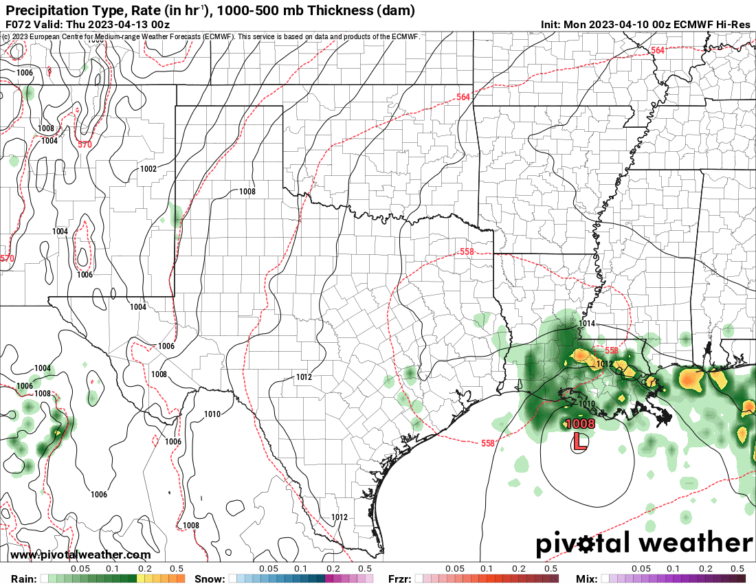

The low then skirts northward across the area with some rain by later this week on Wednesday, Thursday and Friday. Then the next cold front tries to swing by as we move through this upcoming weekend.
That low in the Gulf will likely mean some coastal flooding in the bayous of Louisiana and may even some localized inland flooding from rainfall for coastal Louisiana and coastal Mississippi. The threat farther inland will be scattered showers and storms with some gusty wind and lightning.
Then, as the next system approaches, the atmosphere is going to be a bit wonky as the low exits. Not in a “bad” way, necessarily, just in a less-easily-forecastable way. There will likely be some lingering dry air in place, and some sinking air, too. That means storms that develop will be a bit more clustered and scattered. And they are less likely to fire up and move along the front. We may see a few MCS events develop with some brief heavy rain and gusty wind.
But trying to nail down those at more than five or six days out is an exercise in futility.
AG FORECAST

Here is a look at the Ag Forecast
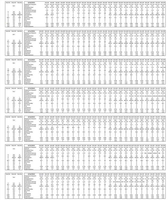
For a full-size image of the Ag Forecast: CLICK HERE
REGIONAL DAY TO DAY FORECAST
Today: Partly sunny. Highs around 70. Northeast winds around 10 mph.
Tonight: Mostly cloudy. Lows in the mid 50s. Northeast winds 5 to 10 mph.
Tuesday: Partly sunny. Highs in the mid 70s. East winds around 10 mph with gusts up to 20 mph.
Tuesday Night: Partly cloudy. Lows in the mid 50s.
Wednesday: Partly sunny. A slight chance of showers and thunderstorms in the afternoon. Highs in the mid 70s. Chance of rain 20 percent.
Wednesday Night: Mostly cloudy with a chance of showers with a slight chance of thunderstorms. Lows in the upper 50s. Chance of rain 50 percent.
Thursday: Showers likely. A slight chance of thunderstorms in the morning, then a chance of thunderstorms in the afternoon. Highs in the mid 70s. Chance of rain 60 percent.
Thursday Night: Partly cloudy. A slight chance of showers in the evening. Lows around 60. Chance of rain 20 percent.
Friday: Mostly sunny. Highs in the lower 80s.
Friday Night: Mostly clear in the evening, then becoming partly cloudy. Lows in the lower 60s.
Saturday: Partly sunny with a chance of showers. A slight chance of thunderstorms in the morning, then a chance of thunderstorms in the afternoon. Highs in the lower 80s. Chance of rain 40 percent.


