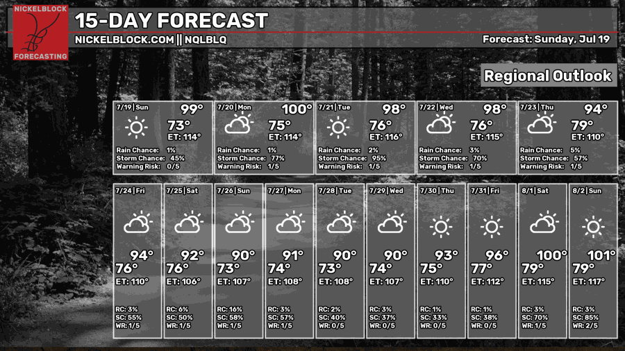
We have two things to keep in mind for our area: the extreme heat and Tropical Depression Two.
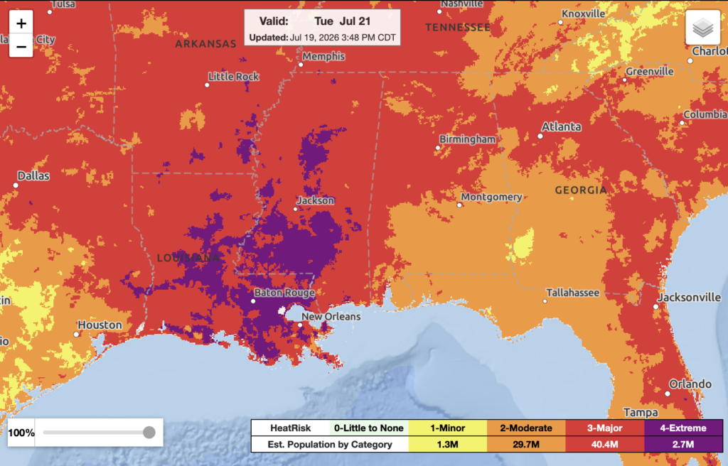
The heat is only going to get worse as we progress into the next week. Heat index values will be closer to 108–112, possibly higher in localized areas.
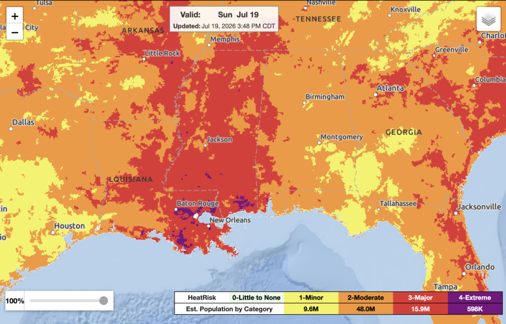
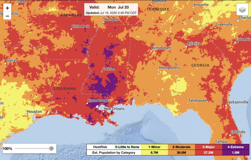
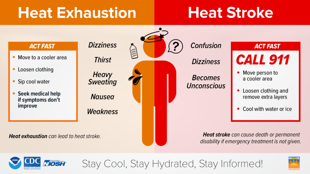
With extremely hot and humid weather, heat illness could happen since your body’s ability to cool itself will be more challenging. Below are some indicators of heat-related illness and how to act:
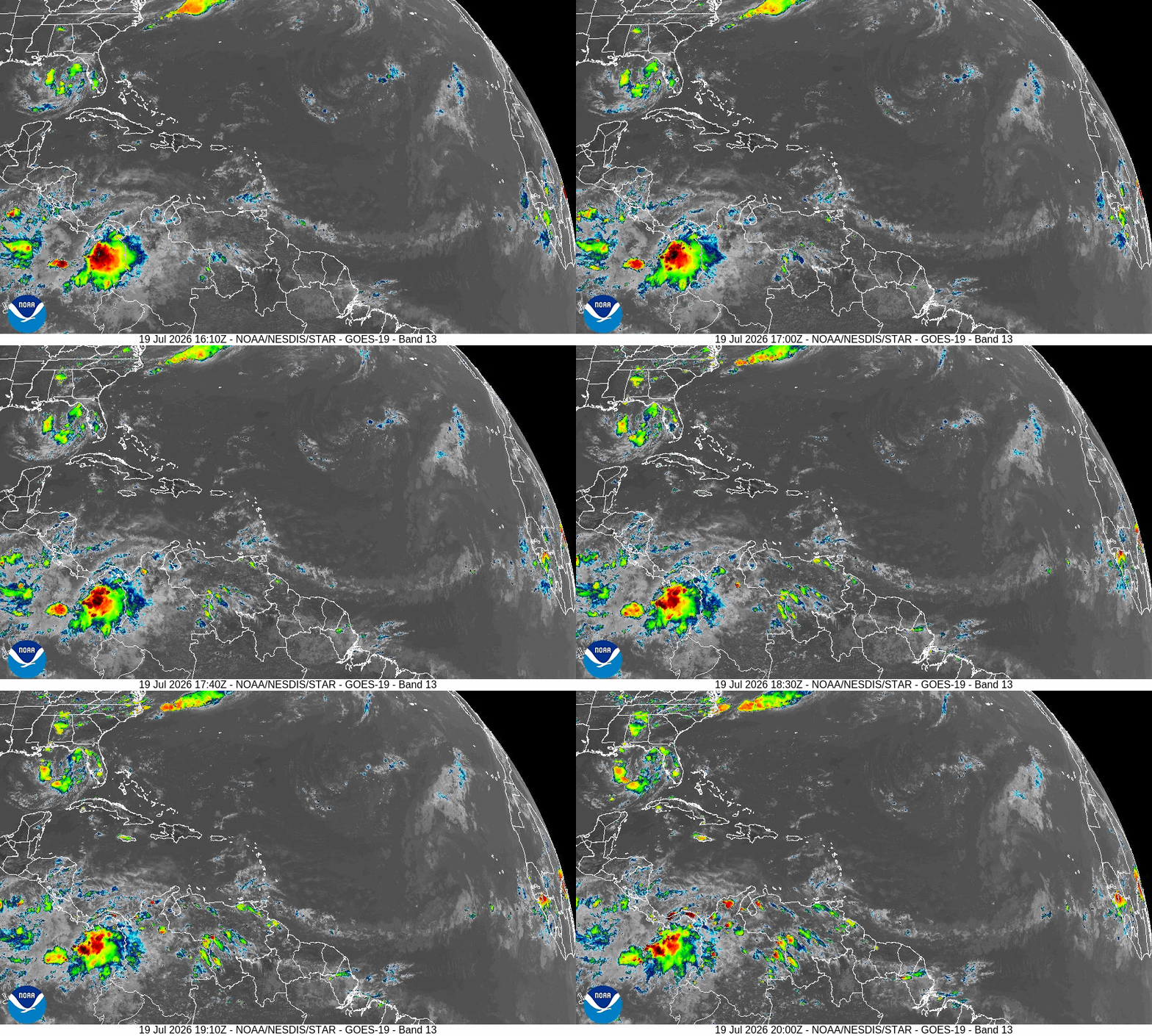
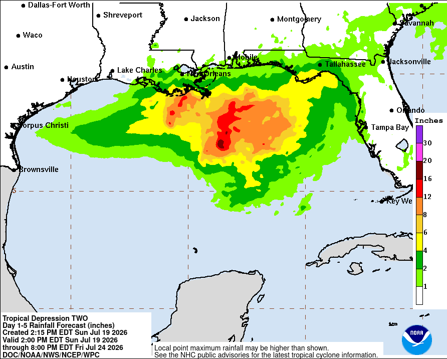
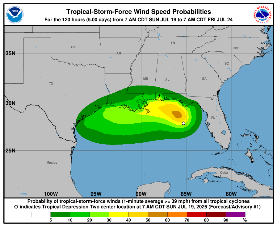
Tropical Depression Two is expected to strengthen into a tropical storm by late Monday. Our area should remain vigilant over the next few days. The biggest concerns are life-threatening rip currents, high surf, rough seas, local heavy rainfall, and tropical storm force winds, especially near the coast.

Today
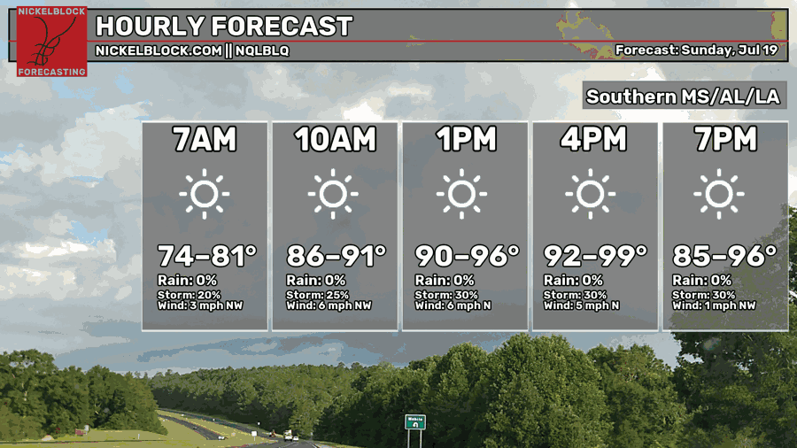
Very warm temperatures in the upper 90s around late evening. The chance of storms remains steady around 30% throughout today. Calm winds are coming out of the north-northwest.
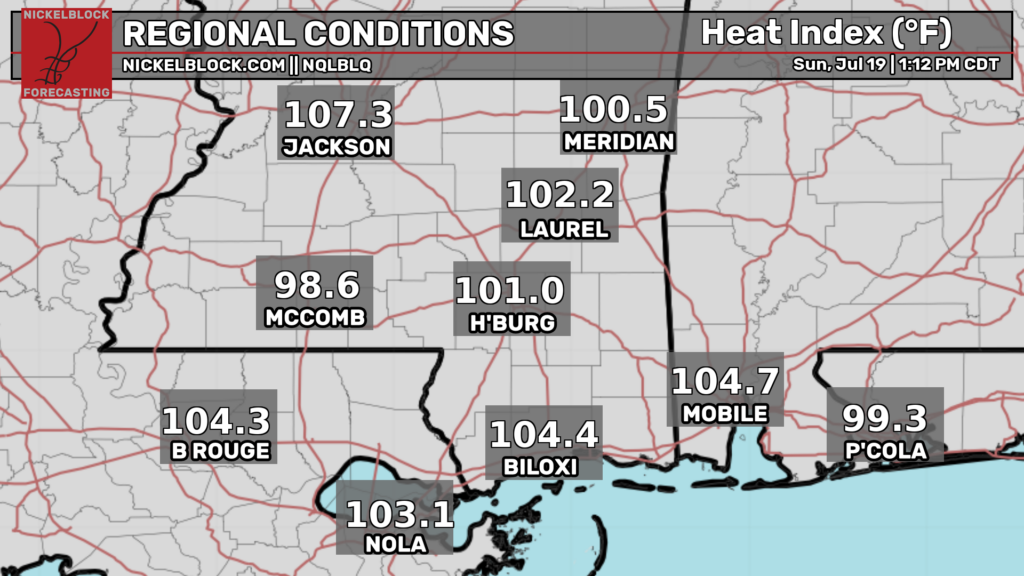
Heat indices are still increasing today. Right now, almost our entire area feels like the temperatures are in the triple digits! MS and eastern LA are currently under a Heat Advisory, meaning temperatures and high humidity may cause heat illnesses. Make sure you drink plenty of fluids, stay in an air-conditioned room, stay out of the sun, and be sure to check up on relatives and neighbors.
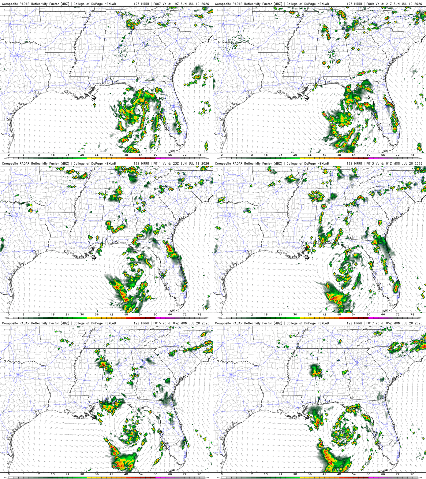
Scattered showers and thunderstorms are moving into our area from the northeast in the late afternoon/evening. The heavy rain would be concentrated in southern AL and near the MS/ AL border. During the afternoon, expect isolated showers mostly in southern AL and southern MS.
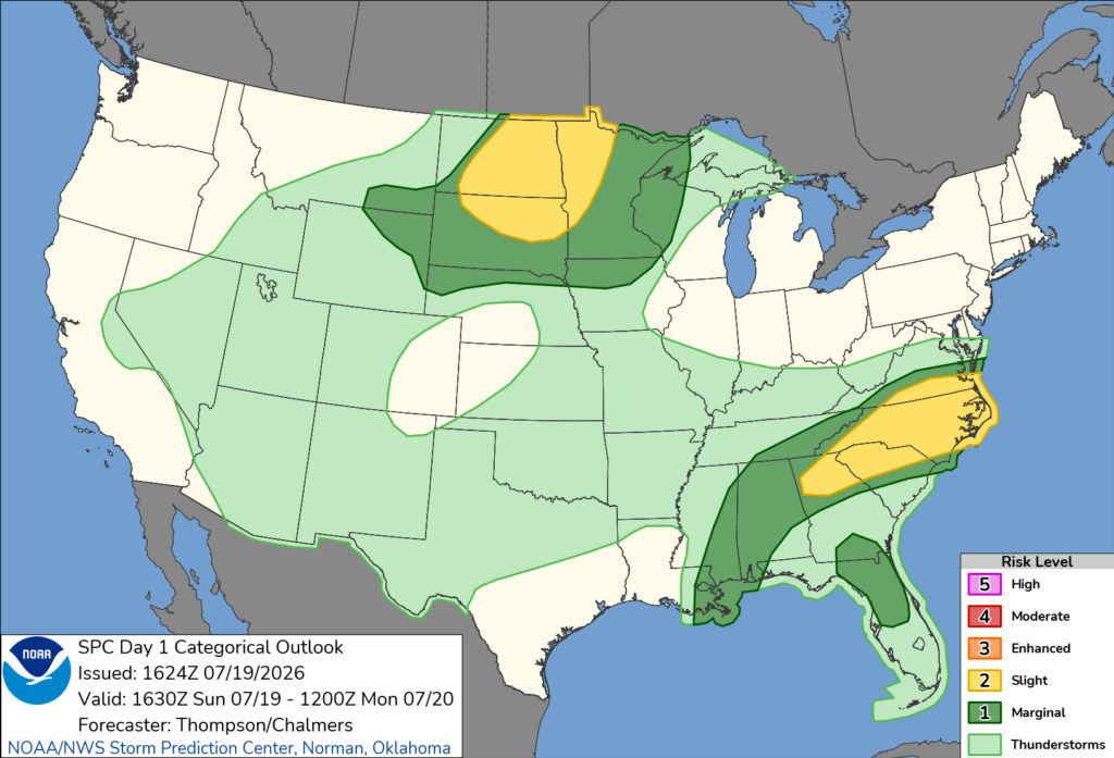
SPC has our area under a marginal risk for severe weather. The main concerns would be gusty winds and isolated flash flooding.
Tomorrow
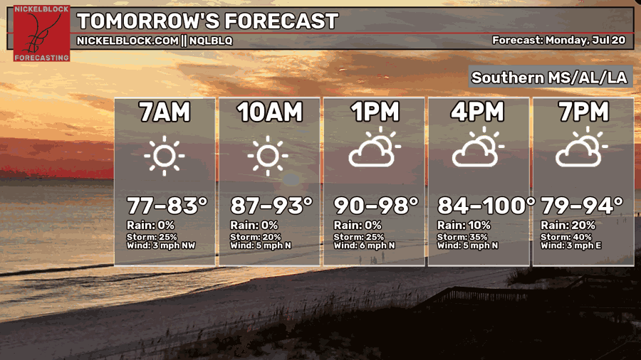
Similar conditions to today. Very warm with temperatures in the upper 90s, maybe higher in localized areas. The chance of showers and thunderstorms will increase later in the day around the late afternoon/ evening. Calm winds are mostly coming out of the north.
Again, make sure you drink plenty of fluids, stay in an air-conditioned room, stay out of the sun, and be sure to check up on relatives and neighbors because temperatures will remain high going into this week.
Scattered showers and thunderstorms are possible, moving in from the northeast during the late afternoon/ evening hours in areas of southern MS and southern LA. Isolated to scattered showers and thunderstorms are possible in southern AL during afternoon/ late afternoon hours. Isolated flash flooding is possible. Starting around 7 pm tomorrow till 7 pm Tuesday, some of our area can see > 1.50 inches of rain.
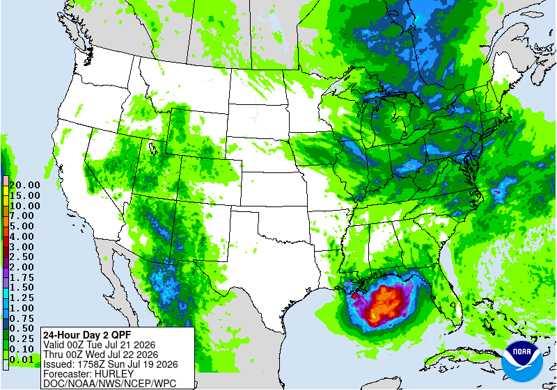

Tuesday
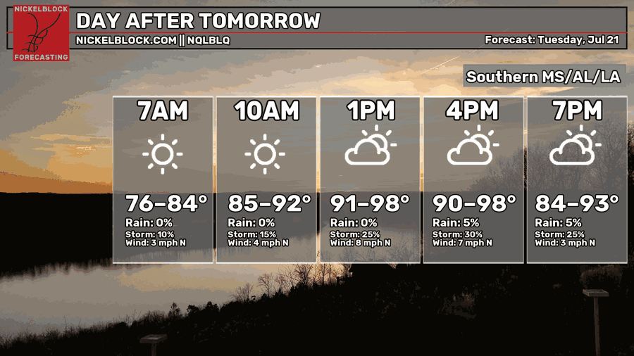
Again, looking similar to the past 2 days with temperatures in the upper 90s. The chance of showers and thunderstorms will increase later in the day, around late afternoon. Relatively calm winds are mostly coming out of the north.
With Tropical Depression Two out in the Gulf, the path is currently still up in the air. Again, the biggest concerns are life-threatening rip currents, high surf, rough seas, local heavy rainfall, and tropical storm force winds, especially near the coast.

Extended Forecast
The CPC outlook had our area experiencing above-average temperatures and near- to slightly above-normal precipitation.


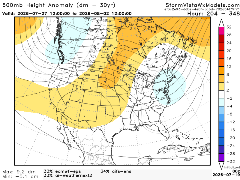
This 500mb height anomaly model has a blend of the 3 most accurate models over the past 7 days. The model runs from July 27, 7 am to August 2, 7 am. Based on the blend, I would agree with the CPC. In the area where there is a positive anomaly (Texas and New Mexico), the temperatures will be much warmer and drier. Our area should expect slightly warmer temperatures, but not so dry. With the shortwave trough near Western FL, that area will see more showers and thunderstorms. For our area, we can expect our usual thunderstorms during the afternoon and evening hours.