Howdy!
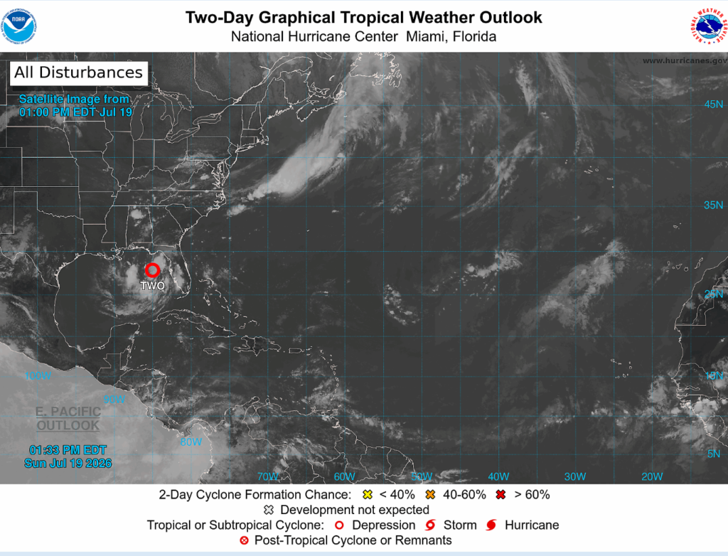
After a quiet period and nothing to really pay attention to in the Atlantic, we now have Tropical Depression Two (upgraded during the time I have been working on this post) in the northeastern gulf. Max sustained winds of 25kts (30 mph) and moving north-northwest at 1 mph (very slow moving). It was previously just a broad area of low pressure that had disorganized convection associated with it, but has since been able to become better organized.
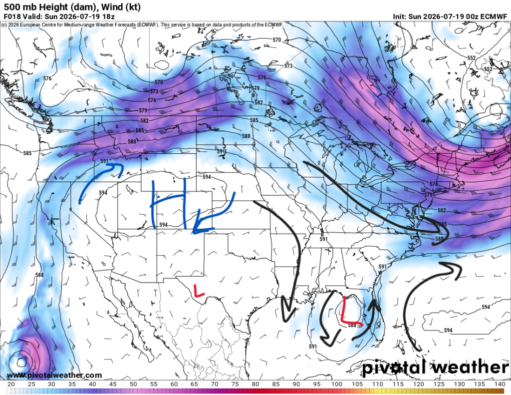
A high pressure ridge located ot the west and a subtropical ridge located to the east is what will drive where/how much this system will develop.
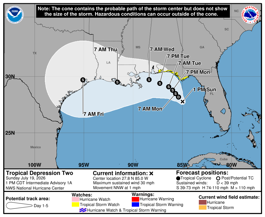
The National Hurricane Center has denoted the probable paths below in the cone, and then to the right is tropical tidbits possible paths. A lot of the paths indicate the tropical depression to go near/over the gulf coast along Florida, Alabama, Mississippi, and Louisiana (our region).
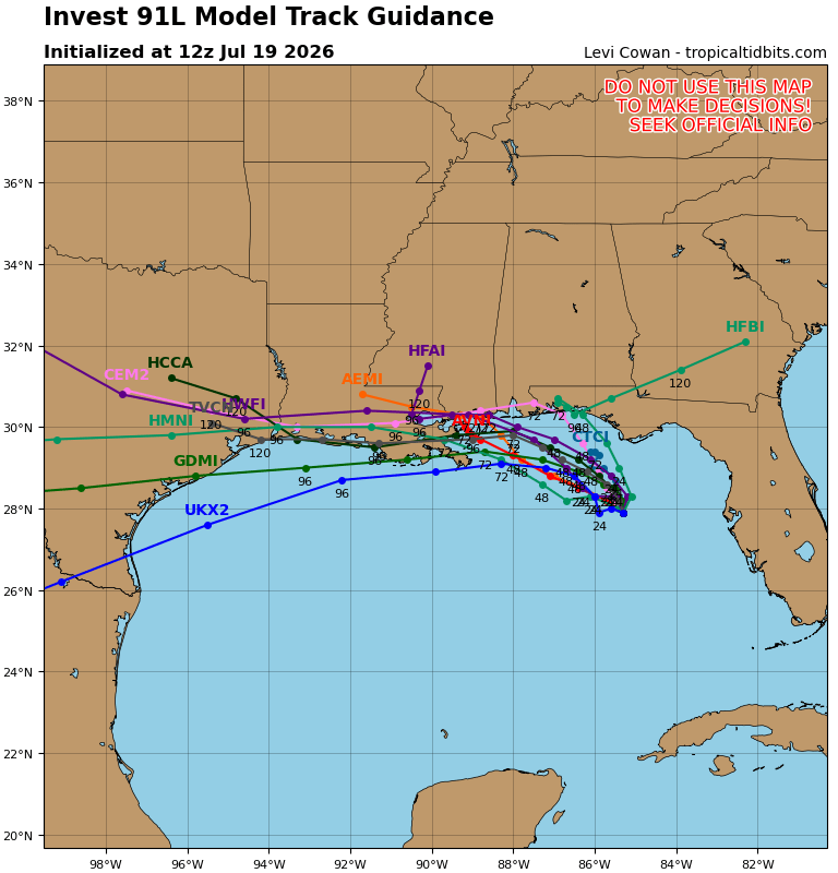
The system will likely develop further into a tropical storm later tonight by early tomorrow as it heads through the gulf, feeding off the warm, moist waters. What can be expected from this system is heavy rain in our region, causing some areas to possibly flood. Strong winds and frequent lightning are also guarenteed.
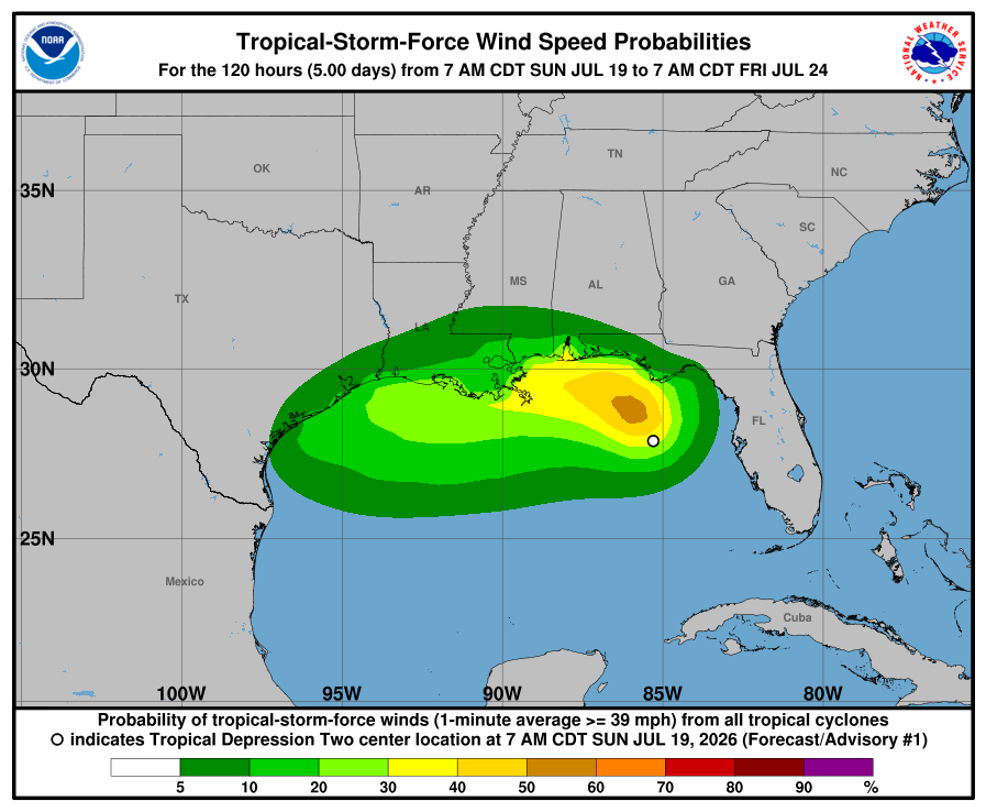
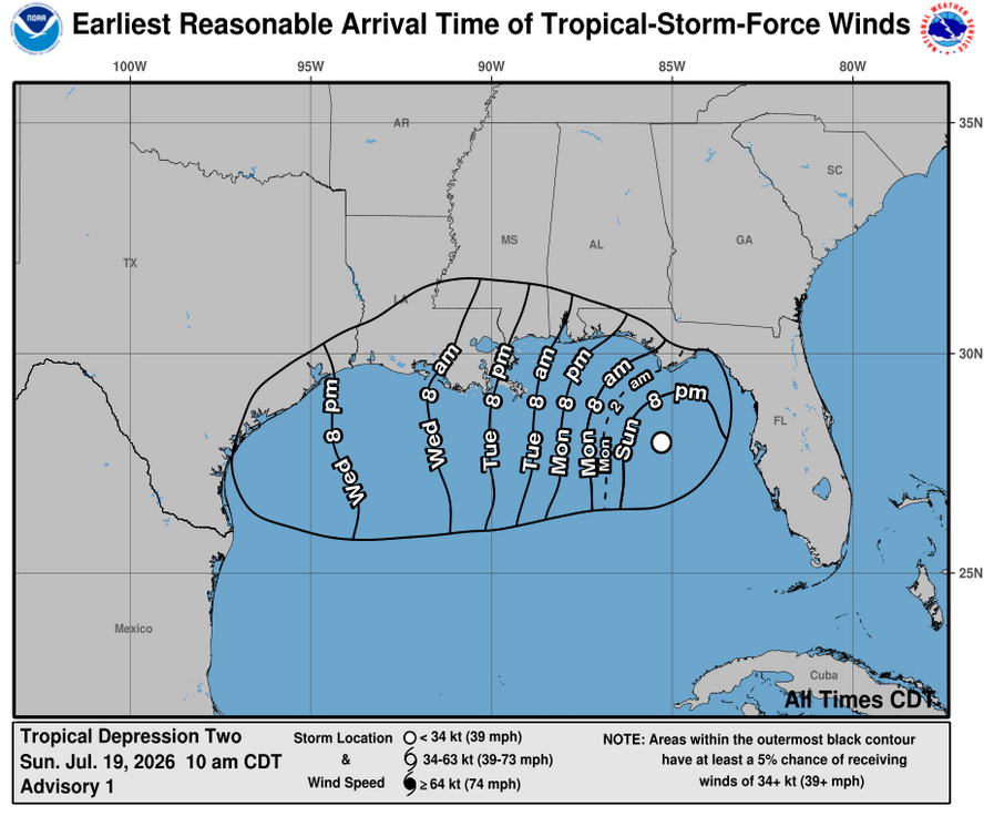
The strongest winds for the region will be along the coast, timing varying when the storm will impact the area. It is looking like Tuesday will be the main impact day through Wednesday.
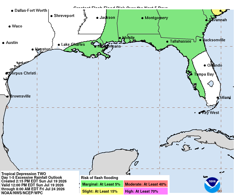
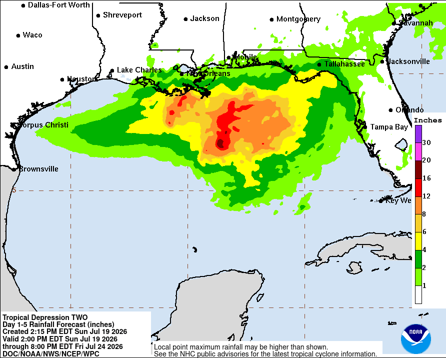
Excessive rainfall is possible, days 1-5 under a marginal risk. Heavy rain will likely occur in areas very near/along the coast as the tropical disturbance moves closer. 2-4 inches of rain is expected, localized areas may experience more than that. I enourage you to keep up to date with this tropical disturbance and see how it will impact you and when. Maybe have a plan just in case it does start flooding. It is vitally important to keep safe and to keep aware!