Things continue to look good through the rest of this week with a brief shot for some rain tonight as a weak front passes through.
It looks like we may see a few showers and storms sneak across the area. Any storms will be below severe limits and – at worst – will feature some brief heavy rain, rumbles of thunder and small hail.
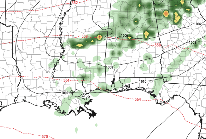
Any rain will zip through the area and should be clearing most of us by sunrise. There isn’t much “cold” air behind this front, so any change in temperature will be minimal. We may drop the dewpoint a few degrees, making it feel a bit more pleasant.
Then, as we move through the weekend and into next week, we will see another shot for storms. And the potential for severe weather. The CIPS Analogs continue to show a risk for severe weather across the region on the 28th. But it also continues to show the risk a bit more north of our area specifically.
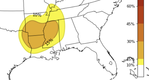
The Storm Prediction Center has even outlined part of the region with a risk for severe weather. But the bulk of that risk is to our north, as well.
So, for nwo, it is something worth monitoring, but nothing I am overly concerned about for our area. This continues to look like a ‘north of us’ problem.
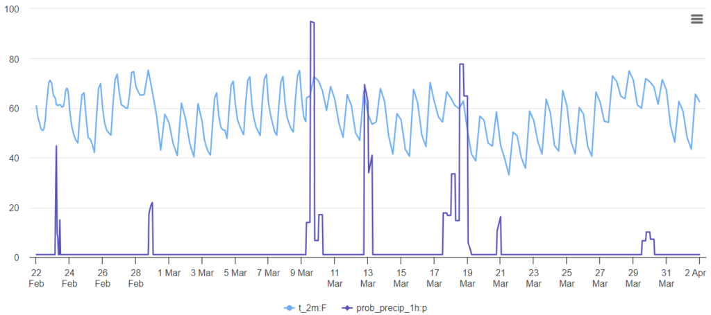
Beyond the next few days, it looks like we will continue to ride the rollercoaster as we move into and through March. No big shots of cold on the horizon from model guidance,
I know a lot of folks are getting interested in planting, but I think if you do decide to put seeds in the ground, be wary that it is still a bit early to guarantee no more frosts and no more freezes.
REGIONAL DAY TO DAY FORECAST
Thursday: Mostly sunny. Highs in the mid 70s. South winds 15 to 20 mph with gusts up to 35 mph.
Thursday Night: Mostly cloudy. A slight chance of showers after midnight. Lows in the upper 50s. Southwest winds 10 to 15 mph with gusts up to 30 mph. Chance of rain 20 percent.
Friday: Sunny. Highs in the lower 70s. Northwest winds 10 to 15 mph with gusts up to 25 mph.
Friday Night: Clear, cooler with lows in the mid 40s. Northwest winds 5 to 10 mph.
Saturday: Sunny. Highs in the lower 70s.
Saturday Night: Clear. Lows in the lower 40s.
Sunday: Sunny. Highs in the mid 70s.
Sunday Night: Mostly clear. Lows around 50.
Monday: Mostly sunny. Highs in the mid 70s.
Monday Night: Partly cloudy in the evening, then becoming mostly cloudy. Lows in the upper 50s.
Tuesday: Partly sunny. Highs in the upper 70s.
Tuesday Night: Mostly cloudy. Lows in the mid 60s.
Wednesday: Mostly cloudy with a 20 percent chance of showers. Highs around 80.


