We will get a bit of a reinforcing shot of cooler, drier air today. That should lead to some breezy conditions throughout the day today. But given the recent rain, it won’t raise the wildfire risk. Tonight, clear skies and high pressure behind this cold front may lead to temperatures dropping to the 30s in some spots with most folks settling around 40F.
We should get another shot of cooler, drier air tomorrow, too. That should set us up for temperatures around 55F to 60F for highs with overnight lows in the 30s for Tuesday, Wednesday and Thursday.
By Friday, the ridge shifts to the east and we get back into a southerly flow. And then we start pooling warm, Gulf of Mexico air across the area on Friday and Saturday.
Then the next cold front arrives. This one may bring a another shot for some storms. The Euro computer weather model is showing a cold front with a line of storms moving from west to east across the region on Saturday evening and into the overnight hours, finally clearing the area by early Sunday morning.
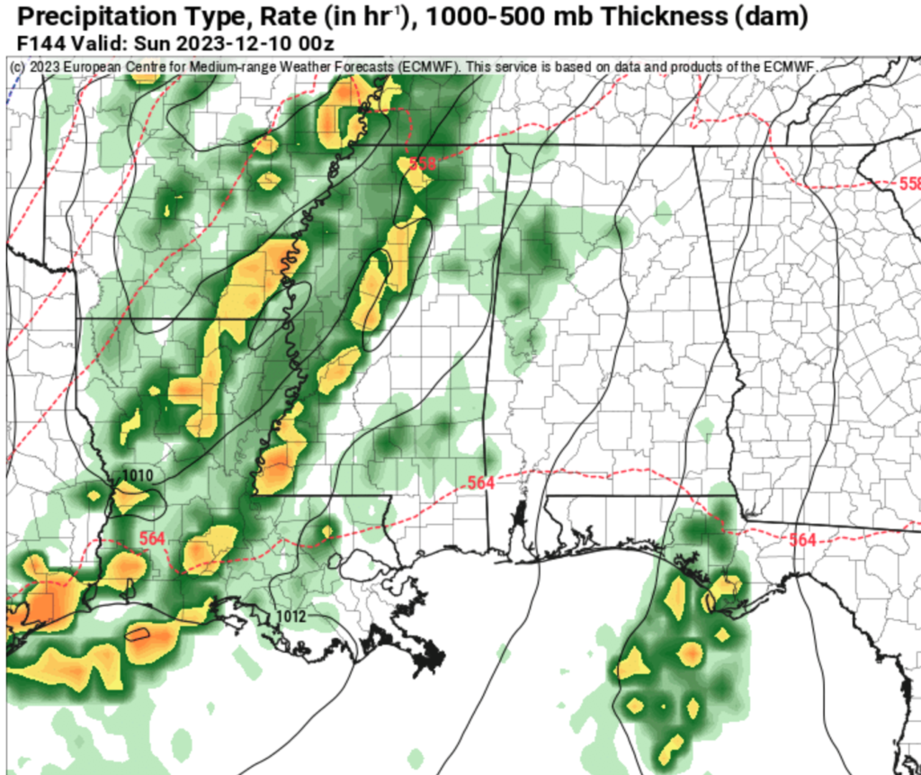
The GFS computer weather model (the American model) shows basically the same thing.
The only difference between the two models is what the atmosphere will look like aloft. The Euro is a bit quicker and has a more favorable environment for severe weather while the GFS is a bit slower and the environment is slightly less favorable. Both feature rain and storms, though. And both suggest Saturday evening as a start time.
Then things dry out, clear out and cool down again after the front kicks through.
[wpcode id=”41149″]
REGIONAL DAY TO DAY FORECAST
Monday: Partly sunny. Highs in the upper 60s. West winds 5 to 10 mph, becoming northwest in the afternoon.
Monday Night: Mostly cloudy. Cooler with lows around 40. Northwest winds around 5 mph.
Tuesday: Partly sunny. Highs in the mid 60s. Northwest winds around 5 mph.
Tuesday Night: Partly cloudy in the evening, then becoming mostly clear. Lows around 40. Northwest winds around 5 mph.
Wednesday: Sunny. Highs in the upper 50s.
Wednesday Night: Mostly clear. Lows in the mid 30s.
Thursday: Mostly sunny. Highs in the lower 60s.
Thursday Night: Partly cloudy. Lows in the lower 40s.
Friday: Sunny. Highs around 70.
Friday Night: Mostly clear. Lows in the lower 50s.
Saturday: Partly sunny with storms possible by evening. Highs in the lower 70s. Chance of rain 40 percent.
Saturday Night: Showers and storms possible. Temperatures hold in the 60s. Chance of rain 60 percent.
Sunday: A slight chance of thunderstorms in the morning. Then clearing and cooler with highs around 60. Chance of rain 40 percent.


